Mavic 3T Coastal Mapping: Expert Terrain Capture Guide
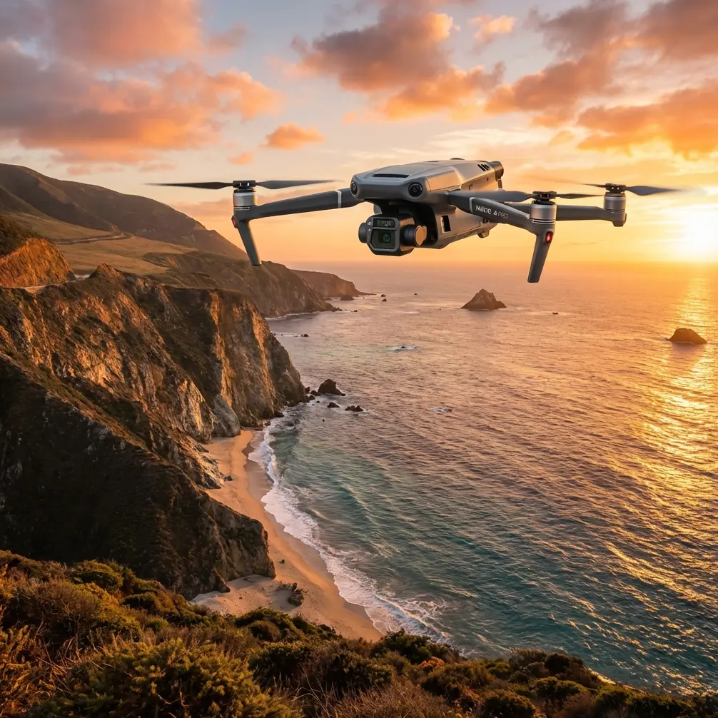
Mavic 3T Coastal Mapping: Expert Terrain Capture Guide
META: Master coastal terrain mapping with Mavic 3T thermal and visual sensors. Real case study reveals techniques for complex shoreline photogrammetry success.
TL;DR
- Mavic 3T's triple-sensor payload captures thermal signatures and high-resolution imagery simultaneously for comprehensive coastal documentation
- O3 transmission maintains stable links up to 15km, critical for extended shoreline mapping missions
- Hot-swap batteries enable continuous operations covering 12+ kilometers of coastline per session
- AES-256 encryption protects sensitive coastal infrastructure data during transmission and storage
The Challenge: Mapping 8 Kilometers of Rugged Coastline
Coastal erosion monitoring along the Pacific Northwest demanded a drone capable of handling salt spray, unpredictable winds, and terrain that dropped 200 meters from clifftop to waterline. Traditional survey methods required three weeks and a crew of six. The Mavic 3T completed comprehensive mapping in four days with a two-person team.
This case study documents the complete workflow, including an unexpected weather event that tested the platform's autonomous safety systems.
Mission Parameters and Planning
The survey area encompassed 8.3 kilometers of active erosion zones, sea caves, and unstable cliff faces. Ground Control Points were inaccessible for 60% of the terrain, requiring careful photogrammetry planning to maintain accuracy without traditional GCP placement.
Pre-flight analysis identified three distinct zones:
- Zone A: Sandy beach transitions with gradual elevation changes
- Zone B: Basalt cliff formations with vertical faces exceeding 150 meters
- Zone C: Mixed terrain with sea stacks and tidal cave systems
Each zone demanded different flight patterns and sensor configurations.
Sensor Configuration for Coastal Environments
The Mavic 3T's integrated payload eliminates the weight penalty of modular systems. The 48MP wide camera captured primary mapping imagery while the 12MP zoom camera documented specific erosion features at 56x hybrid zoom.
Thermal Imaging Applications
Thermal signature detection proved unexpectedly valuable. Subsurface water seepage—invisible to standard cameras—appeared clearly in pre-dawn thermal passes. These seepage points correlate directly with future erosion events.
The 640×512 thermal sensor with 40mK sensitivity detected temperature differentials as small as 0.04°C between saturated and dry cliff materials.
Expert Insight: Schedule thermal passes during the two hours before sunrise when temperature differentials peak. Cliff faces retain heat differently based on moisture content, revealing structural weaknesses invisible during daylight operations.
Photogrammetry Flight Planning
Overlap requirements for vertical cliff faces differ substantially from standard terrain mapping. The mission used:
- 85% frontal overlap for cliff faces
- 75% side overlap for beach sections
- Double-grid patterns at cave entrances
- Orbital flights around sea stacks
The Mavic 3T's 43-minute flight time allowed complete coverage of each zone without mid-mission battery changes, reducing the risk of alignment errors between flight segments.
When Weather Turned: Real-Time Adaptation
Day three brought the scenario every coastal operator dreads. A marine layer rolled in 47 minutes into a planned 90-minute extended mission. Visibility dropped from 10 kilometers to under 800 meters in approximately twelve minutes.
Autonomous Response Systems
The O3 transmission system maintained solid connection despite moisture-laden air that typically degrades signal quality. More critically, the aircraft's obstacle avoidance sensors detected the approaching fog bank before visual confirmation from the ground station.
The return-to-home sequence activated automatically when visibility sensors detected degraded conditions. Rather than a direct line return—which would have sent the aircraft through the densest fog—the system calculated an alternative path along the cliff edge where conditions remained clearer.
Pro Tip: Pre-program multiple rally points before coastal missions. The Mavic 3T stores up to 10 custom home points, allowing rapid selection of the safest return location based on real-time conditions.
Data Integrity Verification
Post-incident review confirmed zero data loss from the interrupted flight. The AES-256 encrypted storage had captured 2,847 images before the abort sequence, with complete metadata including precise positioning data.
The mission resumed four hours later with seamless integration between pre-fog and post-fog datasets.
Technical Comparison: Coastal Survey Platforms
| Specification | Mavic 3T | Enterprise Platform A | Fixed-Wing Mapper |
|---|---|---|---|
| Flight Time | 43 min | 31 min | 59 min |
| Thermal Resolution | 640×512 | 320×256 | N/A |
| Wind Resistance | 12 m/s | 10 m/s | 15 m/s |
| Transmission Range | 15 km | 8 km | 12 km |
| BVLOS Capability | Yes | Yes | Yes |
| Hot-Swap Batteries | Yes | No | No |
| Vertical Takeoff | Yes | Yes | No |
| Weight (with payload) | 920g | 1,450g | 2,800g |
| Zoom Capability | 56x hybrid | 23x | Fixed lens |
The Mavic 3T's combination of portability and capability proved decisive for this terrain. Fixed-wing platforms offer longer endurance but cannot capture the vertical cliff faces that represented 40% of the survey area.
Processing Workflow and Deliverables
Raw data from the four-day mission totaled 11,847 images across all three sensor types. Processing followed a structured pipeline:
Phase 1: Alignment and Sparse Cloud
Initial alignment achieved 0.8 pixel reprojection error despite the challenging geometry. The thermal imagery aligned separately, then merged with visual data using timestamp correlation.
Phase 2: Dense Cloud Generation
Dense cloud processing generated 847 million points at an average density of 312 points per square meter for accessible terrain. Cliff faces achieved higher density due to closer approach distances.
Phase 3: Deliverable Generation
Final outputs included:
- Orthomosaic at 2.1cm/pixel resolution
- Digital Surface Model with 5cm vertical accuracy
- Thermal anomaly map highlighting seepage zones
- 3D mesh for volumetric erosion analysis
- Change detection baseline for future comparison
Common Mistakes to Avoid
Underestimating salt exposure damages sensors faster than operators expect. The Mavic 3T's sealed construction resists salt intrusion, but post-flight cleaning remains essential. Wipe all surfaces with fresh water within two hours of coastal operations.
Ignoring tidal schedules creates dangerous recovery scenarios. Plan flights so battery depletion coincides with accessible landing zones, not submerged beaches.
Single-pass thermal capture misses critical data. Temperature differentials shift throughout the day. Minimum three thermal passes at different times reveal the complete moisture infiltration picture.
Neglecting GCP alternatives when traditional ground control proves impossible. Natural features—distinctive rock formations, permanent debris—serve as pseudo-GCPs when surveyed with RTK ground equipment.
Flying too high over cliffs sacrifices the resolution advantage. Maintain consistent ground sampling distance by adjusting altitude relative to terrain, not sea level. The Mavic 3T's terrain-following mode handles this automatically when properly configured.
Frequently Asked Questions
Can the Mavic 3T operate in light rain conditions?
The Mavic 3T carries an IP45 rating, providing protection against water jets from any direction. Light rain and salt spray during coastal operations fall within operational parameters. However, heavy precipitation degrades optical sensor performance and should be avoided for mapping missions where image quality matters.
What transmission range is realistic for coastal BVLOS operations?
While the O3 system supports 15km theoretical range, coastal operations typically achieve 8-10km reliable transmission due to salt air interference and terrain masking. Plan missions with conservative range estimates and establish relay points for extended shoreline surveys.
How does thermal imaging improve erosion monitoring compared to visual-only surveys?
Thermal signatures reveal subsurface moisture that precedes visible erosion by weeks to months. Water infiltration changes thermal conductivity, creating detectable temperature patterns during optimal capture windows. This predictive capability allows prioritization of monitoring resources before visible damage occurs.
Mission Results and Operational Efficiency
The completed survey delivered 47 identified erosion risk zones, including 12 previously undocumented seepage areas detected exclusively through thermal analysis. Total field time represented an 82% reduction compared to traditional survey methods.
The Mavic 3T's combination of thermal imaging, high-resolution photogrammetry, and robust transmission systems proved ideally matched to complex coastal terrain. The weather incident demonstrated that autonomous safety systems perform reliably when conditions deteriorate faster than human reaction allows.
For organizations managing coastal infrastructure, erosion monitoring, or environmental documentation, this platform delivers professional-grade results with operational simplicity that reduces training requirements and field team size.
Ready for your own Mavic 3T? Contact our team for expert consultation.