Mavic 3T Coastline Capture at Altitude: A Field Tutorial
Mavic 3T Coastline Capture at Altitude: A Field Tutorial That Actually Holds Up
META: Expert tutorial for using the Mavic 3T on high-altitude coastal missions, covering thermal signature control, photogrammetry workflow, O3 transmission, GCP strategy, batteries, and secure operations.
High coastal work exposes every weakness in a drone workflow. Wind shear builds fast near cliffs. Salt haze eats contrast. Bright water confuses exposure. And when you are trying to capture actionable data rather than pretty footage, small mistakes compound into unusable outputs.
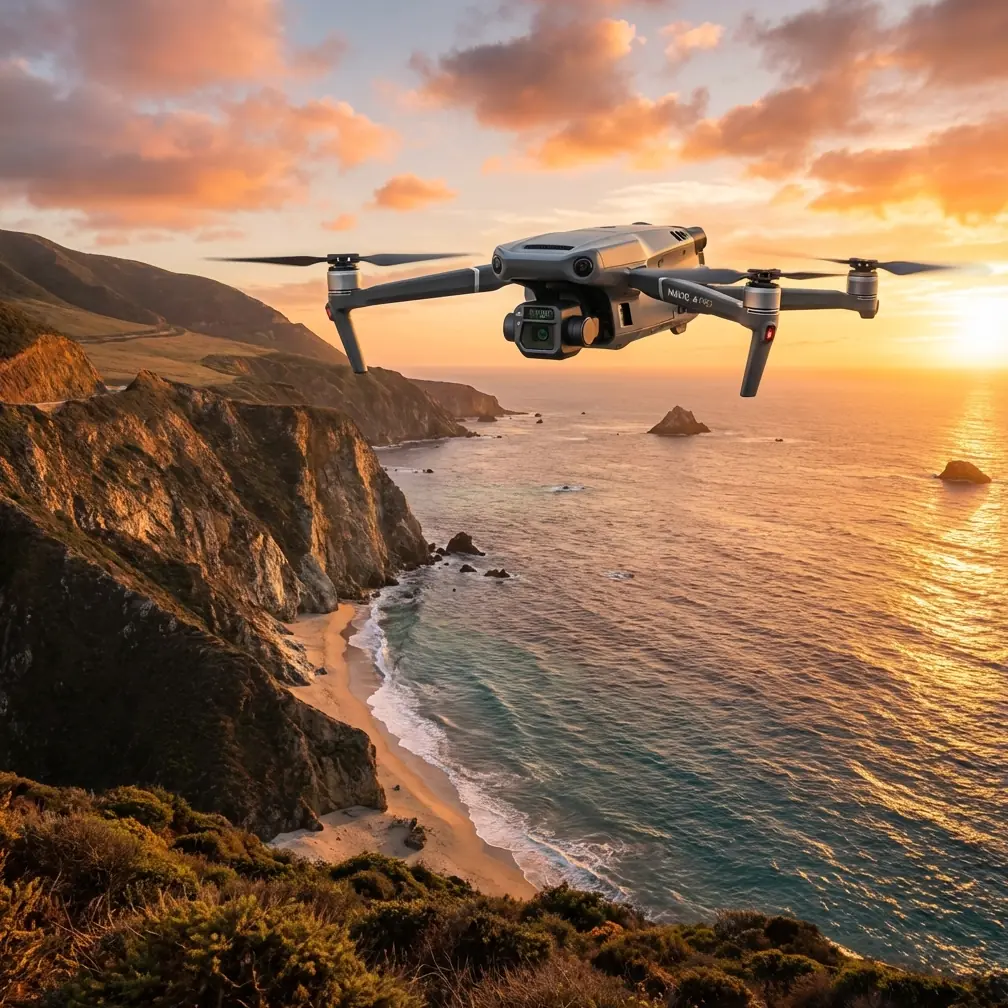
That is exactly where the DJI Mavic 3T earns its place.
This is not a generic overview of the platform. If your mission is capturing coastlines from elevated launch points, the Mavic 3T brings a very specific mix of strengths: a compact airframe that can be deployed quickly, a thermal payload that helps separate surface conditions invisible to the eye, and a transmission stack built for working at awkward distances where line of sight can be visually clear but operationally fragile. Add disciplined battery rotation, sound photogrammetry habits, and the right accessory choices, and the aircraft becomes far more than a simple inspection drone.
I have used this class of system in the exact kind of environment where brochures stop being useful. Here is how I would set up a Mavic 3T mission for coastline capture at altitude, and why each decision matters.
Start with the mission, not the camera
The first mistake pilots make on coastal jobs is treating the flight like a visual capture exercise. It usually is not. A real coastal mission tends to combine at least three objectives:
- documenting erosion or cliff-face changes
- checking thermal anomalies in structures, rock seams, or search areas
- building a mapped dataset that can be compared over time
The Mavic 3T is valuable because it can support all three in one deployment. That matters when weather windows are short and access points are narrow. If you are parked above a sea wall or standing on a ridgeline with crosswind building, fewer launch cycles means less operational risk.
The thermal side deserves special attention. A coastline does not behave thermally like inland terrain. Wet rock, dry sand, pooled water, concrete, vegetation, and metal infrastructure all shed or retain heat differently. That means thermal signature interpretation is only useful if you understand the timing of the flight. Dawn and late evening often produce the best separation for anomalies because solar loading has not yet flattened the scene or is beginning to release from surfaces unevenly.
If your aim is to detect water ingress in coastal structures, hidden voids, stranded persons, or temperature differences along rock formations, timing matters as much as sensor quality.
Why altitude changes the workflow
Launching from high ground above a shoreline sounds easy. In practice, it creates its own trap.
Pilots assume that because they are physically elevated, they will get cleaner signal, better visibility, and easier coverage. Sometimes that is true. But the radio environment near cliffs and headlands can be unpredictable. Reflections off rock faces and interrupted terrain contours can create moments where a clean path on paper becomes less stable in the air.
This is where the Mavic 3T’s O3 transmission system becomes operationally meaningful rather than just a spec-sheet talking point. O3 gives you a more resilient video and control link in places where terrain shape can otherwise make the mission feel unstable. On a coastal run, that stability buys you more than convenience. It lets you hold framing over a target, assess wave interaction around structures, and avoid premature repositioning that can ruin mapping consistency.
Transmission reliability also matters for team communication. If you are flying from a clifftop with a visual observer set back from the edge, both of you need confidence that the aircraft is doing exactly what the controller shows. Hesitation in that loop creates bad decisions.
Build the flight around light and surface reflectivity
Water is the most deceptive background in drone imaging. It blows out fast, tricks metering, and often reduces edge definition near the shoreline. The result is a scene that looks dramatic to the eye and mediocre in the dataset.
For visible imagery, I recommend treating the sea as a contaminant in your exposure decisions unless the mission specifically targets the water surface. Expose for the landform or built structure you need to analyze. If you expose for the water, cliff texture and man-made detail often suffer.
At altitude, haze adds another layer. Salt in the air lowers contrast, especially when you are shooting obliquely across long stretches of coast. The practical answer is not simply “fly lower.” Often you cannot. Instead:
- schedule for cleaner atmospheric windows
- avoid mid-day glare when possible
- plan mapping passes with consistent overlap rather than improvising pretty angles
That last point is where many Mavic 3T operators leave value on the table. If the mission may become a measurement task later, collect with photogrammetry in mind from the start.
A workable photogrammetry setup for coastal terrain
The Mavic 3T is not only for thermal interpretation. Used correctly, it can contribute to coastal photogrammetry workflows that support change detection and planning.
The challenge with coastlines is that they contain repeating textures, moving water boundaries, and vertical relief. Software can struggle when the scene includes too much dynamic edge movement or not enough fixed control.
That is why GCP placement matters so much here.
A lot of pilots place Ground Control Points where it is convenient instead of where the terrain needs them. On a cliff-backed shoreline, that usually produces stronger accuracy inland than at the actual edge. The fix is to distribute GCPs so the software sees control across elevation changes and near the transition zones that matter most. Even a modest network of clearly visible points can dramatically improve model confidence if the spacing reflects the terrain rather than the parking area.
Operationally, two details make a difference:
- put control near elevation breaks, not just flat staging areas
- avoid relying on wet sand zones where the shoreline shifts between passes
This is not academic. If your client later compares datasets over months to track erosion or structural movement, weak control at the edge can hide the very changes they care about.
Use thermal with discipline, not curiosity
The Mavic 3T’s thermal capability is one of its biggest advantages on a coastline mission, but it is also the easiest feature to misuse.
Everything on the coast creates thermal contrast for some reason. Sun-warmed stone, metal rails, foam on retreating waves, saturated timber, and shaded cavities can all look “interesting.” Interesting is not the same as useful.
The right approach is to define what anomaly matters before launch. Are you looking for heat leakage in a coastal facility? Temperature variation indicating water ingress? Human detection in a search corridor? Uneven drying patterns on a slope? Once that question is set, thermal interpretation becomes far more disciplined.
One practical example: if you are surveying a sea wall or cliff stabilization system, thermal imagery can help isolate moisture patterns that are less obvious in standard RGB capture. But if you fly too late in the day after prolonged direct sun, surface heating may overwhelm the subtle differences you need. The sensor did not fail; the mission timing did.
That distinction separates field craft from gadget enthusiasm.
The accessory that changed my coastal workflow
One third-party upgrade I now treat as standard for this kind of mission is a high-visibility landing pad with weighted edge anchors from a specialist drone field-gear supplier. It sounds minor. It is not.
On elevated coastal sites, launch surfaces are often gravel, scrub, dust, or uneven stone. Rotor wash lifts debris, and the Mavic 3T does not benefit from ingesting grit or salt-laden particles during takeoff and landing. A stable, visible pad creates a cleaner departure point, improves landing repeatability when fatigue creeps in, and gives the crew a defined sterile zone in cramped staging areas.
I have also had good results pairing that with a third-party sun hood for the controller screen. Again, not glamorous. But when glare bounces off sea and cloud at the same time, a hood can be the difference between seeing a thermal edge properly and guessing.
Accessories should not turn into clutter. These two earn their place because they solve real coastal problems.
Battery management is not a side issue here
High-altitude launches over coastlines tempt people into longer out-and-back legs because the view feels open and the route looks simple. That mindset creates battery risk.
Wind over cliffs is rarely steady. It stacks, curls, and shifts with terrain. The outbound leg may feel efficient while the return takes significantly more power. Build your reserve around the return against deteriorating conditions, not around the easy first half of the mission.
This is where hot-swap batteries change the rhythm of work. If your team has a clean rotation process, you can land, replace, relaunch, and maintain continuity while conditions are still favorable. That is especially useful when light is changing quickly and you need both RGB and thermal passes in the same operational window.
A disciplined battery cycle also protects data quality. Tired pilots make sloppy overlap decisions. Rushed last-battery flights produce holes in datasets. Keep the aircraft ready, but keep the crew sharper than the machine.
Security and chain of custody matter more than many pilots admit
Coastal missions are often tied to infrastructure, environmental monitoring, or sensitive locations. In those contexts, secure handling of imagery is not optional.
The Mavic 3T’s support for AES-256 is more relevant than people sometimes realize. If you are collecting inspection imagery around ports, utility corridors, protected shoreline assets, or incident scenes, strong data protection supports chain-of-custody discipline from the moment of capture. That will not fix poor operator habits, but it gives you a stronger base for handling sensitive material responsibly.
Security also extends to transmission behavior and crew procedure. Do not normalize ad hoc file sharing in the field. Do not dump mixed project files onto untracked devices. A clean workflow is part of professional UAV practice, especially when thermal imagery can reveal more than casual observers expect.
What about BVLOS thinking?
Even when you are not conducting a BVLOS operation, coastline work benefits from BVLOS-style planning.
Why? Because the environment punishes assumptions. Terrain obscures. Weather shifts abruptly. Human access is limited. Recovery options narrow fast.
Borrow the planning discipline even if your mission remains within standard visual constraints:
- define emergency diversion zones before launch
- note areas where cliff geometry may degrade situational awareness
- assign observer positions for real visibility, not convenience
- establish hard return triggers tied to wind and battery state
This mindset reduces improvisation. That is usually where incidents begin.
A practical field sequence for the Mavic 3T
If I were running a high-altitude coastline capture mission with the Mavic 3T tomorrow, my field sequence would look like this:
- Arrive early enough to study wind behavior on site, not just in the forecast.
- Select a launch point that protects takeoff and landing from debris and rotor wash.
- Set out GCPs where the terrain changes, especially near cliff edges or structural transitions.
- Run the RGB mapping pass first if glare and weather support it.
- Follow with thermal capture in the time window most likely to reveal the target anomaly.
- Rotate batteries cleanly rather than stretching a single sortie too far.
- Review a small sample in field conditions before breaking down.
- Log any environmental changes that might affect later comparisons.
That workflow sounds simple because it should be. Good field operations are usually plain on paper and demanding in practice.
If you are refining your own Mavic 3T coastal workflow and want a second set of eyes on mission planning, this quick WhatsApp chat link is a straightforward way to compare notes before you head into the field.
The bigger takeaway
The Mavic 3T is at its best when the mission needs compact deployment, multi-sensor awareness, and dependable link performance in terrain that turns ordinary flights into messy ones. Coastal operations from high ground are exactly that kind of test.
What makes the aircraft effective is not just the thermal payload or the O3 transmission system on their own. It is the combination of those capabilities with disciplined GCP planning, battery rotation, secure data handling through AES-256, and field accessories that solve real launch-site problems. Those details do not make for flashy marketing copy. They do make for better data and safer flights.
And that is the real measure of a professional setup. Not whether the footage looks dramatic on a bright day, but whether the aircraft helps you come back with data you can trust when the environment is working against you.
Ready for your own Mavic 3T? Contact our team for expert consultation.