Capturing Coastlines with the Mavic 3T: A Field Report
Capturing Coastlines with the Mavic 3T: A Field Report from Difficult Terrain
META: Specialist field report on using the DJI Mavic 3T for coastline missions in complex terrain, covering thermal signature work, O3 transmission, battery strategy, photogrammetry limits, and practical flight planning.
I’ve spent enough time around cliffs, salt spray, broken headlands, and tidal flats to know that coastal flying punishes sloppy assumptions. A site that looks simple on a map can become a signal trap, a wind tunnel, or a lighting nightmare the moment the aircraft lifts off. That is exactly where the Mavic 3T earns its keep.
This is not a generic drone overview. It is a field-minded look at how the Mavic 3T behaves when the job is to document coastlines in uneven terrain, where rock faces block line of sight, wet surfaces distort visual texture, and environmental change can hide in plain sight. If your work involves environmental monitoring, infrastructure checks near shore, erosion tracking, or thermal signature review around coastal assets, the aircraft’s design choices matter in ways that only become obvious on site.
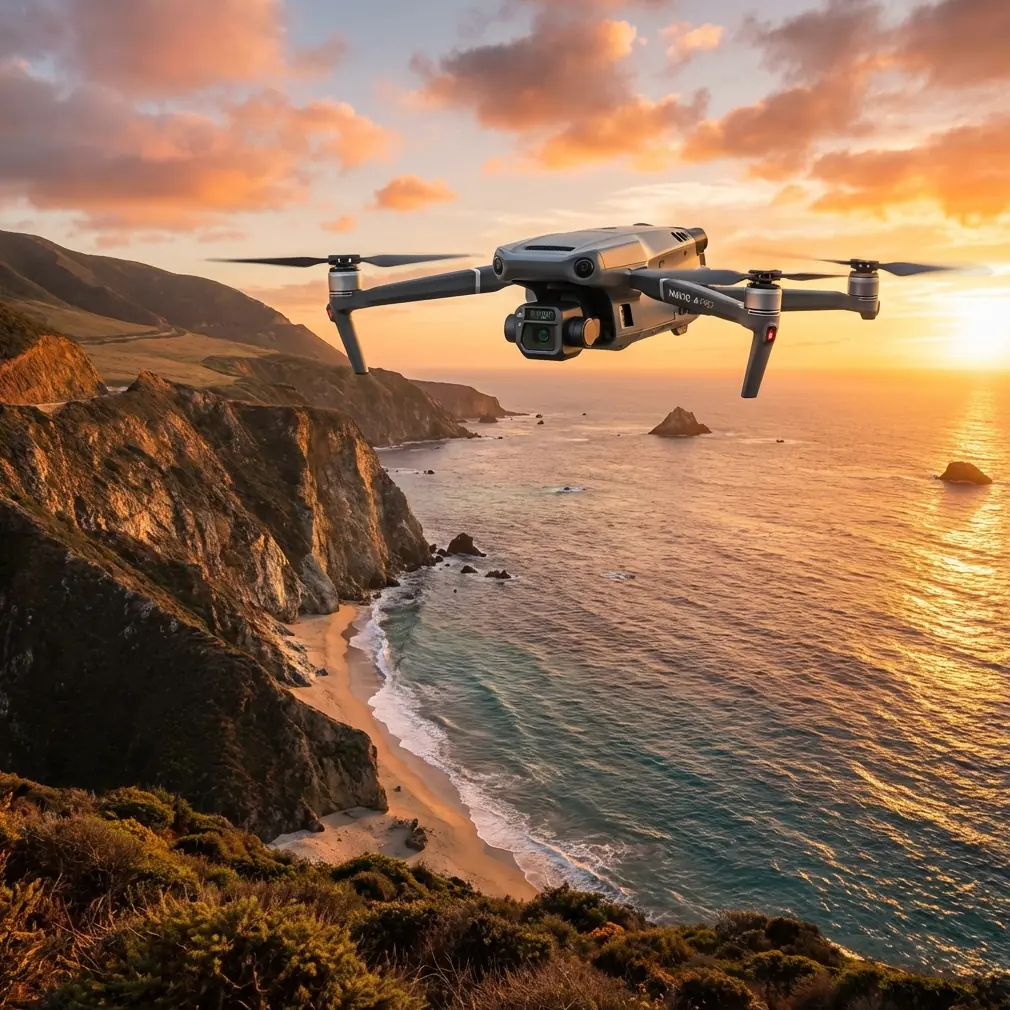
Why the Mavic 3T makes sense on the coast
The Mavic 3T sits in an unusual sweet spot. It is compact enough to deploy from narrow staging areas, yet it carries the sensing mix needed for more than simple visual capture. That matters on the shoreline because a single mission often has competing objectives. You may need visible imagery for documentation, thermal data for anomaly detection, and fast turnaround because weather windows close quickly.
The aircraft’s thermal capability changes the conversation immediately. Along coastlines, standard RGB imagery can miss what the eye expects to see. Wet rocks, reflective water, haze, and low-angle sun flatten detail. Thermal signature data gives you another layer. In civilian work, that can help identify moisture patterns in coastal structures, heat anomalies on rooftops or utility assets near shore, and environmental contrasts during dawn or late-day surveys. The point is not that thermal replaces visible imaging. It doesn’t. The point is that on a coastline, thermal often reveals operationally useful differences when the visible scene is visually messy.
Then there is transmission reliability. DJI’s O3 transmission system is one of those specifications people mention quickly and then forget to interpret. On the coast, it deserves real attention. Headlands, sea walls, and cut-in coves interrupt clean signal paths. When flying around complex terrain, stable transmission is not a convenience. It affects whether you can safely maintain situational awareness as the aircraft moves across rock contours and elevation changes. O3 helps maintain image feed quality and control confidence in conditions where terrain geometry, not just distance, is your limiting factor.
Security also deserves a practical note. Coastal data collection often involves sensitive commercial sites: ports, energy infrastructure, marine construction zones, protected restoration areas, or private shoreline assets. AES-256 encryption is not a line-item to skim past. It has operational significance because the footage and telemetry from these flights can be commercially sensitive even when the mission itself is entirely civilian. If your workflow includes external stakeholders, consultants, or regulated site owners, secure transmission and data handling should be part of mission planning from the start.
The first trap: assuming coastlines are good photogrammetry environments
They are not. At least, not by default.
Many operators come to coastal mapping with a photogrammetry mindset shaped by fields, roads, or rooftops. The coastline is different. Water surfaces shift, glint, and refuse to provide stable matching points. Wet sand changes reflectivity by the minute. Jagged slopes create shadow bands. Vegetation on dunes can move enough to reduce reconstruction consistency. Add tide movement and your orthomosaic timeline becomes unforgiving.
That does not mean photogrammetry is off the table. It means you need stronger control discipline. If the objective is measurable shoreline change, erosion documentation, or asset context mapping, GCPs become much more than a quality checkbox. They are your anchor against a scene where large portions of the frame are unstable or low-texture. On a beach or rocky shelf, carefully placed GCPs can rescue alignment quality when water edges and reflective zones would otherwise weaken the model.
Operationally, this changes how I plan Mavic 3T sorties. I don’t treat the whole coastal zone as one equal mapping surface. I split it mentally into reconstruction-friendly and reconstruction-hostile regions. Dry upper beach, path networks, retaining walls, access roads, and built structures generally cooperate. Intertidal zones, water margins, and reflective rock shelves do not. The Mavic 3T is effective here when you use it selectively and avoid pretending every square meter deserves the same capture logic.
Thermal on the coast: useful, but timing is everything
Thermal payloads attract excitement, but they also punish poor timing. Coastal environments exaggerate that problem.
Water moderates temperature. Wind strips surface heat. Sun exposure changes quickly with cliff shadow and cloud movement. If your thermal mission is aimed at detecting abnormal heat patterns in buildings, utilities, or industrial coastal infrastructure, the time of day can decide whether your imagery tells a clear story or a misleading one.
For example, a retaining structure exposed to direct afternoon sun can hold enough surface warmth to mask subtle anomalies. Fly again near dawn and the contrast may be cleaner. The Mavic 3T gives you the sensor layer, but the operator still has to understand the site’s heat behavior. That is where field experience matters more than feature sheets.
This is also why I rarely separate thermal planning from terrain planning. A cliff-backed site may create abrupt thermal zones simply because one section remains shaded while another has been sunlit for hours. When readers ask whether the Mavic 3T “works well” for thermal signature capture along a coastline, my answer is yes, provided the mission objective is defined tightly and the timing is chosen for the site rather than for crew convenience.
A battery management habit that saves real missions
Here is the battery tip I wish more pilots learned before they fly a windy coast.
Do not launch your freshest battery into the longest outbound leg if it is still cold from the case, especially on a dawn mission. Give it a short, close-in working segment first, or allow proper temperature stabilization before the demanding leg. Cold batteries can look fine on paper and then sag harder than expected under coastal wind load when the aircraft is farthest from your recovery point.
That risk is amplified near cliffs and open water because the return path often climbs, fights headwind, or forces a wider route to maintain safer terrain clearance. A battery that behaves normally inland can feel noticeably weaker in that scenario.
The Mavic 3T workflow benefits from disciplined battery rotation, and hot-swap batteries are one of those practical realities every field team values, even if people use different language for it. Fast replacement between flights keeps the mission moving while light, tide, and weather remain usable. But speed is only helpful if rotation logic is sound. My own field rule is simple: mark batteries by actual performance behavior, not just cycle count. One pack may repeatedly finish with stronger reserve in gusty conditions. Another may show earlier voltage drop after sitting exposed to cool sea air. Label them, track them, and assign them deliberately.
For long coastal documentation days, I also avoid burning battery on unnecessary hover review at the takeoff point. Review enough to validate capture, then land, swap, and move. The coast is a place where teams lose productive minutes without noticing. Wind increases. tide advances. glare worsens. A battery strategy is not just about endurance. It is about preserving the mission sequence.
Signal and terrain: why O3 matters more than headline range
People love maximum-range discussions, but coastline operations usually fail for more ordinary reasons. You fly around a protruding rock face. The aircraft slips behind a ridge. A harbor wall interferes with your clean signal corridor. Suddenly, “range” was never the real issue.
O3 transmission matters because it improves resilience in these non-ideal geometries. When flying coastal assets or environmental corridors, I plan around likely signal interruption points before takeoff. The Mavic 3T’s transmission system gives more confidence when you need to work laterally along uneven shorelines rather than simply pushing straight outward over open ground.
This has operational significance for teams considering expanded workflows, including complex observer-supported operations or future BVLOS planning where regulations allow it under proper authorization. I am not suggesting shortcuts. I am saying that communication reliability, terrain reading, and route design become foundational much earlier than many teams expect. Even in standard visual operations, the discipline required for coastal flying resembles the mindset of more advanced mission planning.
Building a coastline workflow around the aircraft’s strengths
The Mavic 3T is strongest when you stop treating it as a single-purpose camera platform. On difficult coastlines, I use it as a rapid decision tool first and a documentation tool second.
A typical sequence might look like this:
- Conduct a quick visual and thermal pass to understand surface conditions, wind behavior near terrain, and potential problem zones.
- Identify where photogrammetry is actually worth attempting and where it is likely to produce weak reconstruction because of water movement or low texture.
- Set or verify GCP visibility in stable land areas if measurement accuracy matters.
- Run targeted capture patterns for the areas that support reliable outputs.
- Finish with thermal review when environmental conditions favor contrast.
That workflow saves time because it respects the site instead of imposing a rigid mapping script onto it.
One more practical point: coastal missions often involve stakeholders who are not drone specialists. Engineers, environmental consultants, site supervisors, and land managers want interpretable results, not aviation jargon. The Mavic 3T helps here because it can produce layered evidence from one deployment. If I can show a visible image of a revetment, match it with a thermal view suggesting moisture intrusion or heat anomaly, and place it within a broader site model built with GCP support, the conversation becomes faster and less abstract.
Data handling and trust on commercial shoreline projects
This is where secure workflows matter more than many operators admit. The Mavic 3T’s AES-256 capability has real value on projects involving industrial waterfronts, private resorts, energy sites, or environmental restoration programs under restricted review. You may be collecting perfectly ordinary civilian data, but the site owner still expects confidentiality and procedural discipline.
Trust is built through little things: controlled access to image sets, clear chain-of-custody for deliverables, and documented flight planning. The aircraft supports that professional standard, but the team has to carry it through. If you need to compare notes on a specialized shoreline workflow, one practical way to start is to message a field specialist here.
Where the Mavic 3T is excellent, and where you should stay realistic
For coastline work in complex terrain, the Mavic 3T is excellent at rapid deployment, mixed-sensor inspection, and targeted documentation. It is particularly strong when the mission needs thermal signature insight without moving to a much larger platform. It is also well suited to jobs where terrain complexity makes portability a serious advantage. Carrying a larger system across loose rock, dune access paths, or narrow cliff approaches is not always sensible.
Still, realism matters. If your project depends on flawless wide-area coastal photogrammetry across large reflective water margins, no compact aircraft can simply wish away the physics of the scene. If the wind is unstable at multiple elevations, launch timing and route design remain more important than sensor wish lists. If the client wants repeatable comparative data, your GCP discipline and mission consistency will influence quality more than marketing terminology ever could.
That is the right way to judge the Mavic 3T on the coast. Not as a miracle tool, but as a very capable aircraft whose thermal payload, O3 transmission, secure data handling, and field-friendly battery workflow line up unusually well with the realities of difficult shoreline operations.
From my perspective, that is why it keeps making sense for these missions. The aircraft handles the practical friction points that consume real field time: awkward access, changing light, mixed sensing needs, and compressed weather windows. On a coastline, those details are not side notes. They are the mission.
Ready for your own Mavic 3T? Contact our team for expert consultation.