How I Use the Mavic 3T to Capture Mountain Coastlines Withou
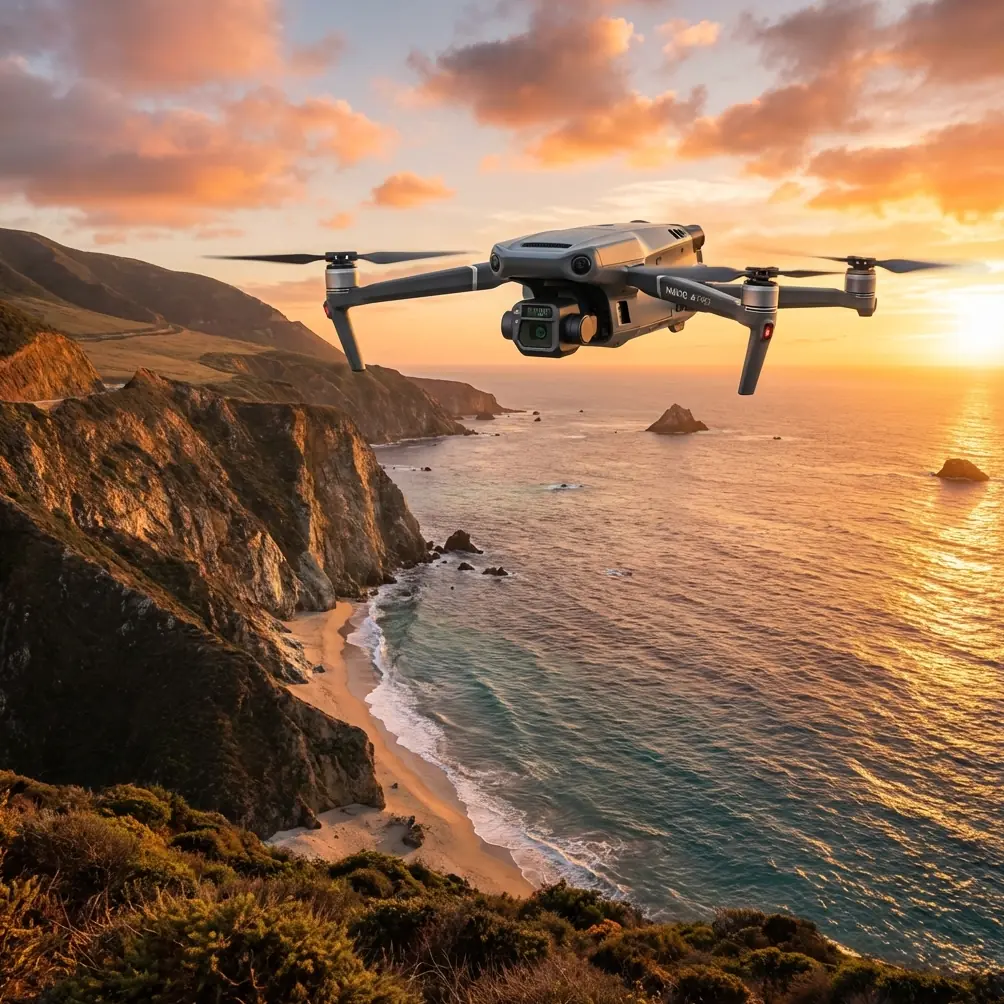
How I Use the Mavic 3T to Capture Mountain Coastlines Without Losing Data or Control
META: Expert field tips for flying the Mavic 3T along mountain coastlines, covering thermal workflows, O3 transmission, EMI antenna handling, photogrammetry discipline, and mission planning.
Mountain coastlines are where a drone pilot’s habits get exposed.
You have cliffs that throw wind back at you. Salt haze that softens contrast. Sharp temperature shifts between rock, water, and vegetation. Signal reflections that can make a stable link feel unreliable for a few seconds at exactly the wrong moment. If you are flying the Mavic 3T in this environment, the aircraft is capable enough to deliver excellent results, but only if the operator understands how the landscape changes the job.
I want to focus on the Mavic 3T specifically, not as a generic drone review, but as a working tool for coastline capture in mountainous terrain. That means thermal signature interpretation, visible imaging discipline, photogrammetry setup, and the very practical issue most brochures skip: what to do when electromagnetic interference starts creeping into your link budget and the aircraft is halfway down a ridgeline.
Why mountain coastlines are unusually demanding for the Mavic 3T
The Mavic 3T is often discussed in terms of thermal payload utility, inspection flexibility, and quick deployment. All of that matters here. But coastal mountain work adds a layer of complexity because the terrain is constantly changing the aircraft’s relationship to the controller, the sun angle, and the background temperature.
On a flat industrial site, the thermal scene is comparatively legible. Along a mountain coast, thermal contrast can collapse fast. Wet rock can retain heat differently from dry stone. Shaded crevices may look anomalous when they are merely insulated from solar gain. Sea spray and humidity can reduce image crispness at the exact time you need fine edge separation.
This is also where the Mavic 3T’s transmission system matters more than people admit. O3 transmission gives you a robust starting point, but a mountain face and open water can create a messy RF environment. Rock can block line of sight, while metallic structures such as handrails, towers, cable routes, and rooftops near coastal facilities can add multipath behavior. The result is not always a total signal loss. More often, it is a subtle drop in stability, a momentary hesitation in feed quality, or inconsistent control feel.
Those minor disruptions are enough to ruin a careful mapping run or force a thermal reacquisition pass.
Start with the mission objective, not the scenery
The biggest mistake I see is pilots treating a dramatic coastline as a cinematic opportunity first and a data environment second. With the Mavic 3T, your workflow should begin by deciding which of these jobs you are actually doing:
- thermal inspection of slopes, retaining walls, rooftops, or vegetation stress
- orthomosaic capture for photogrammetry
- 3D shoreline and cliff documentation
- search-style visual scanning for civilian safety or site management
- progress tracking for infrastructure, resorts, roads, or coastal stabilization works
Each objective drives a different flight geometry.
If I am building photogrammetry deliverables, I care about overlap discipline, repeatable altitude, camera angle consistency, and whether I need GCP support. If I am working with thermal signature analysis, I care more about timing, emissivity assumptions, reflected energy, and whether the sun has already contaminated the scene.
The Mavic 3T can do both, but not equally well in a single pass. Trying to combine every output into one flight usually degrades all of them.
Thermal work: read the coastline like a heat system
The thermal camera on the Mavic 3T is most useful along mountain coasts when the operator understands what is generating the contrast.
Rock faces heated by low-angle sunlight may continue radiating well after the visible image suggests uniformity. Water surfaces can appear deceptively calm thermally while the shoreline edge reveals seepage, drainage paths, or infrastructure anomalies. Vegetation on steep coastal slopes often shows mixed signatures because root moisture, shadowing, and wind exposure vary over just a few meters.
That means your flight timing matters more than your post-processing skill.
I generally prefer early morning or a controlled late-day window depending on the inspection target. For slope drainage, retaining features, and hidden moisture pathways, you want a thermal environment where background loading is not overwhelming the subtle differences. Midday often gives you attractive visible imagery but poorer thermal discrimination.
The phrase “thermal signature” gets used loosely. In practice, it is not a single hotspot or cool patch. It is a pattern shaped by material, geometry, moisture, and time. The Mavic 3T helps because it lets you cross-check thermal anomalies against the visible scene immediately, which is essential on irregular coastlines where false positives are common.
For photogrammetry, consistency beats improvisation
The Mavic 3T is not usually the first aircraft people name for pure high-volume mapping, yet in constrained coastal terrain it can still be very effective when the mission is planned properly.
The challenge is that mountain coastlines tempt pilots to manually adapt every few seconds. That works for reconnaissance. It works poorly for photogrammetry.
If you need usable outputs, keep your variables under control:
- maintain steady speed through each leg
- keep overlap conservative near elevation changes
- avoid aggressive yaw corrections mid-line
- separate nadir collection from oblique collection
- use GCPs where accuracy actually matters
GCP discipline becomes more valuable when cliffs and stepped terrain are involved. A dataset can look visually complete and still be weak in elevation reliability if the terrain changes outpace your planning assumptions. Even a handful of carefully placed control points can help anchor the model where GNSS-only data would drift.
The raw references behind this article come from aircraft design material, not drone marketing, and they are a useful reminder of something field operators often forget: fluid, angle, and motion relationships matter when systems are under changing conditions. One example cited a transfer flow of 44.22 × 10⁻⁴ m³/s, equivalent to 15,920 L/h, during steady climb calculations. Another figure in the same source showed 234 × 10⁻⁴ m³/s = 84 L/h in a different operating context. I am not bringing those numbers into a Mavic 3T article to compare fuel systems directly. I am using them because they illustrate an operational truth: once a platform changes attitude, the internal behavior of a system changes too. In drone work, that same thinking applies to battery planning, image consistency, cooling behavior, and pilot expectations during climbs along steep terrain.
On a mountain coast, climbing and descending legs are not just navigational choices. They affect how stable your capture rhythm remains.
Handling electromagnetic interference with antenna adjustment
This is the part pilots usually learn the hard way.
When you fly along a mountain coastline, EMI does not always announce itself dramatically. Sometimes the aircraft is fine over the beach, then your feed gets unstable as soon as you slide laterally beneath a ridgeline or pass near a communications mast, utility corridor, or coastal building cluster.
The worst response is panic input.
The better response starts with antenna awareness. With O3 transmission, orientation still matters. If I see signal quality degrade, I first check whether I have effectively pointed the controller antennas poorly relative to the aircraft’s position. Pilots get so focused on the screen that they forget the physical geometry of the link. A small adjustment in controller angle can clean up the connection without altering the aircraft path.
My process is simple:
- Stop making unnecessary control changes.
- Re-establish clean controller orientation toward the aircraft.
- Step laterally a few meters if terrain or nearby structures are causing localized reflection.
- Gain altitude only if it improves line of sight and remains safe for the mission.
- If the aircraft is moving behind terrain, turn the route before the link gets worse.
Open water can trick pilots into thinking RF conditions must be ideal. They are not always. Water can contribute to reflection effects, while cliff geometry can partially shield the aircraft. In these moments, antenna adjustment is not cosmetic. It is operationally significant because it preserves control confidence and protects the continuity of your dataset.
If you are building repeatable procedures for coastal jobs and want a second opinion on link management or mission design, I sometimes share field workflow notes directly through this Mavic 3T operations chat.
Use hot-swap battery logic even when the aircraft does not literally “hot swap”
People throw around the term hot-swap batteries because it suggests uninterrupted operations. What matters in real mountain coastline work is not the label. It is the mindset.
You should structure battery rotations so that aircraft downtime does not force bad decisions in the air. That means:
- pre-labeling packs by cycle health and mission role
- assigning one pack set to exploratory scouting and another to data capture
- landing before the battery becomes a psychological constraint
- staging the next launch so the break between flights does not wreck lighting consistency
Along a mountain coast, return legs can cost more energy than expected because wind near ridges is rarely symmetrical. The outbound segment may feel cheap. The return, especially with a climb back to a safer recovery point, may not be.
This again connects to the reference material’s attitude-based calculations. In the source, a 30° angle appears in the treatment of changing system behavior under steady climb. Different aircraft, different system, same field lesson: angle changes workload. For Mavic 3T operators, that means battery reserve should be planned around terrain geometry, not just horizontal distance on the map.
AES-256 matters when the job includes sensitive infrastructure
Coastal mountain work is not always remote wilderness. It may involve resorts, pipelines, utility assets, roads, marine facilities, communication sites, or erosion-control structures. In those environments, image security matters.
AES-256 support is not the reason most crews choose the Mavic 3T, but it becomes valuable when your captured data includes infrastructure layouts, thermal anomalies, or progress records that should not move loosely through unmanaged workflows. The drone is only one part of a responsible operation. The rest is how the footage is handled, stored, transferred, and documented after landing.
If your client cares about operational confidentiality, build that into the process from the start rather than trying to patch it later.
BVLOS thinking without pretending every mission is BVLOS
BVLOS gets mentioned constantly, often without operational nuance. Most coastal mountain jobs with the Mavic 3T will still be flown within the local visual and regulatory framework applicable to the crew. Even so, BVLOS thinking can improve VLOS operations.
By that I mean:
- route planning with communication contingencies
- terrain-based signal awareness
- predefined decision points
- segmented mission architecture
- recovery options if visibility changes
Mountain coastlines create pseudo-BVLOS problems even in legal VLOS conditions because ridges, trees, and structures can interrupt the simplicity of a straight visual relationship. A professional operator plans for those complications before takeoff.
Practical capture sequence I recommend
For a mixed coastline mission, I usually break the Mavic 3T workflow into four blocks:
1. Recon pass
A short visual scan to assess wind, glare, bird activity, and RF behavior. No hero shots. Just intelligence gathering.
2. Primary visible capture
This is where I collect the cleanest data for mapping or documentation before changing light or fatigue starts to interfere.
3. Thermal pass
A separate run with thermal priorities in mind. Different speed, different angle choices, different interpretation criteria.
4. Detail pass
Targeted obliques, structural edges, erosion points, drainage traces, or vegetation anomalies identified during the earlier flights.
This sequence prevents the common problem of contaminating a precise data mission with improvisation.
What the Mavic 3T does especially well here
For mountain coastline work, the Mavic 3T’s real strength is not that it does everything perfectly. It is that it lets a disciplined operator move between visible and thermal decision-making fast enough to stay useful in a complex environment.
That matters when the coastline is changing by the minute. Clouds shift. Water glare changes. Wind pushes upslope. Rock faces move in and out of shadow. A slower or less flexible workflow misses the window.
If you treat the aircraft as a compact field instrument rather than a flying camera, it becomes far more valuable. The thermal view helps you read hidden conditions. The visible payload supports documentation and modeling. O3 transmission gives you a strong operational link, provided you manage controller orientation intelligently when EMI starts to show up. And careful battery rotation protects you from the false confidence that comes from a short easy outbound leg over water.
That is how I would approach the Mavic 3T for capturing coastlines in mountain terrain: not as a scenic flight, but as a structured data mission shaped by terrain, heat, signal geometry, and timing.
Ready for your own Mavic 3T? Contact our team for expert consultation.