Mavic 3T on Dusty Construction Sites: A Specialist’s
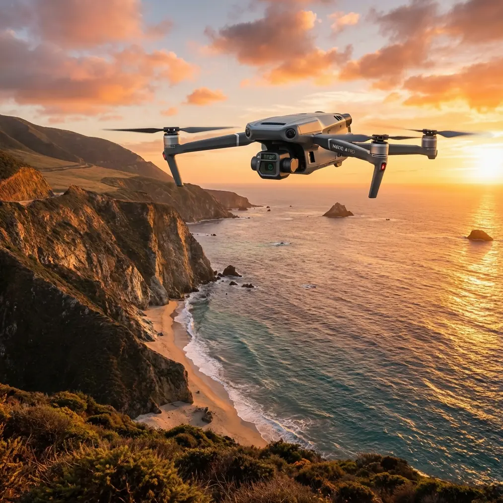
Mavic 3T on Dusty Construction Sites: A Specialist’s Technical Review of Flight Altitude, Control Stability, and Data Reliability
META: Expert review of using the Mavic 3T on dusty construction sites, with practical altitude guidance, thermal workflow insight, transmission considerations, and stability lessons drawn from aircraft design validation principles.
Dust changes everything.
On a clean site, the Mavic 3T is a fast and forgiving platform for thermal scans, progress documentation, roof checks, stockpile review, and short-interval inspection work. On a dusty construction site, the same aircraft becomes part camera system, part environmental sensor, part risk management tool. The pilot who treats dust as a minor inconvenience usually ends up with softer imagery, weaker thermal contrast near ground level, more unstable framing during low passes, and a surprisingly high number of reflights.
I’ve seen operators focus almost entirely on sensor specs when the bigger issue is mission geometry. With the Mavic 3T, the most useful performance decision on dusty sites is often not which camera to select first, but how high to fly the aircraft above the active work zone so the data remains stable, repeatable, and worth using later.
That is where this review starts.
Why altitude matters more than most Mavic 3T operators expect
The usual instinct on construction work is to fly lower for “more detail.” In dust, that logic breaks down quickly. Rotor wash can interact with loose particulates. Heavy equipment creates moving haze layers. Freshly disturbed soil throws up fine material that sits in the lowest part of the air mass. Thermal readings near those layers can become less trustworthy, and visual imagery can lose edge definition just enough to reduce confidence in photogrammetry outputs.
For Mavic 3T missions over active earthmoving areas, I usually recommend treating altitude as a dust-separation buffer first and a resolution variable second. In practical terms, many site teams get better operational results by flying higher than they initially planned, then tightening overlap and slowing ground speed to preserve mapping quality.
For general progress capture and thermal overview on an active dusty site, a strong working band is often around 35 to 60 meters above ground level. That range is high enough to get above much of the densest near-surface particulate movement, yet still low enough for the Mavic 3T to deliver actionable visual and thermal context. If haul trucks, crushers, or grading operations are producing visible suspended dust plumes, stepping upward toward 60 to 80 meters can improve frame consistency and reduce the false confidence that comes from close but dirty imagery.
This is not a universal number. It is a field rule shaped by visibility, wind direction, material type, and whether the objective is thermal signature detection, photogrammetry, or live remote coordination.
Still, one principle holds: on dusty sites, the “lowest safe altitude” is often not the “best data altitude.”
What classical aircraft validation tells us about drone work in dust
The source material behind this article comes from Chinese civil aircraft design manuals rather than drone marketing literature, and that is useful. It shifts the conversation from features to verification.
One source discusses design validation for controllability and stability across all flight states, including the need to demonstrate longitudinal control during changes in thrust, speed, flap deployment, flap retraction, and speed-brake operation. It also specifies a single-hand control force threshold of 222 N in those validation conditions. The Mavic 3T is obviously not a crewed transport aircraft with flaps and autobrakes, but the engineering idea still matters: aircraft performance is not judged in one steady-state condition. It is judged through transitions.
That matters on dusty construction sites because most poor drone data is created during transitions, not cruise. The unstable moment is the climb out of the staging area into a warmer dust layer. Or the deceleration over a spoil pile. Or the lateral repositioning near a concrete pour while the aircraft moves from clean air into suspended particulate. If you only think about the Mavic 3T as stable in level flight, you miss where errors begin.
The same reference also highlights validation of landing performance using a target approach speed of 1.3 Vso and a flight path angle of -3°, with stopping distance assessed under different braking configurations. Again, the direct aircraft mechanics differ from a multirotor. The operational lesson does not: approach geometry and stopping behavior are engineered, not improvised. For Mavic 3T work around dust, that translates into disciplined low-speed approaches to launch and recovery points, especially if the pad is near disturbed soil. Pilots who descend steeply into their own dust cloud often contaminate lenses, raise ingestion risk, and start the next sortie with compromised optics.
The big takeaway is simple. Stability is not just a comfort issue. It determines whether your thermal evidence, progress records, and 3D outputs can be trusted.
The Mavic 3T’s strongest fit on construction sites
The Mavic 3T earns its place on construction work because it combines fast deployment with sensor flexibility. The thermal camera helps flag heat anomalies in temporary electrical installations, HVAC elements, curing irregularities, equipment zones, and occupied temporary structures. The visual payload supports progress records, façade checks, roof observations, and site-wide context. For teams working with photogrammetry, the platform is not a pure mapping specialist in the way larger survey UAVs are, but it is often good enough for frequent site snapshots when the mission is built carefully.
Dust changes how those strengths should be used.
Thermal signature work
Thermal signature quality on a dusty site depends heavily on timing and air cleanliness. Fine suspended dust can interfere with scene clarity and flatten subtle temperature differences, especially near recently disturbed ground. If the site goal is to compare warm mechanical equipment, overloaded temporary power components, or heat leakage around modular structures, don’t rush the flight just because the aircraft is ready. Wait for a cleaner interval or shift altitude to get above the worst of the particulate layer.
Photogrammetry and GCP discipline
If the mission includes photogrammetry, GCP placement becomes more valuable, not less. Dust reduces the margin for visual ambiguity in tie points and ground features. I recommend high-contrast, securely fixed GCPs placed away from active vehicle churn where possible. On sites with repetitive surfaces, exposed soil, and moving machinery, image overlap should be conservative. The operator trying to squeeze productivity by reducing overlap often discovers later that the site had plenty of images but not enough dependable geometry.
O3 transmission in operational reality
O3 transmission is a real operational advantage on construction sites with changing lines of sight, tall structures, and moving interference sources. Yet dust-heavy jobs often involve steel framing, containers, generators, temporary offices, and concrete masses that are more likely to disrupt link quality than the open-space test conditions people imagine. A stable downlink is not just about viewing the screen. It affects pilot confidence, path smoothness, and whether a thermal observation gets documented properly before the aircraft has to reposition.
If the site coordination team needs a live review workflow during the mission, I usually tell them to define observation points in advance rather than asking the pilot to improvise while orbiting in a dust plume. Better transmission helps; better mission structure helps more.
A practical altitude model for dusty construction capture
For Mavic 3T operators who want a usable field model, here is the framework I use.
1. Site-wide progress capture
Use 50 to 70 meters AGL as a dependable starting band.
This usually clears the worst local dust while preserving enough context for weekly or daily documentation. It also reduces the visual chaos caused by moving vehicles dominating the frame.
2. Thermal overview of active zones
Use 40 to 60 meters AGL first, then adjust based on plume height and thermal objective.
If the target is a broad thermal signature rather than a tiny hot spot, stepping slightly higher often produces cleaner, more interpretable thermal scenes.
3. Roof, upper façade, or elevated asset checks
Match altitude to structure height, but avoid flying directly through dust channels formed by wind against building edges.
A slightly offset orbit at moderate standoff distance often delivers better imagery than a tight low pass.
4. Mapping with GCP support
Fly high enough to stay above dust concentration zones, then increase overlap and maintain consistent speed.
When the ground is actively being cut, filled, or compacted, reflights caused by poor image quality cost more time than the extra minutes spent flying a cleaner line.
5. Recovery and relaunch
Do not descend aggressively into loose soil or aggregate zones.
Use a pad or elevated landing surface where practical. A clean recovery preserves payload quality for the next battery cycle.
Material thinking belongs in drone operations too
The second source document is about high-temperature alloys, welding behavior, heat treatment, and forming. At first glance, that seems far removed from a Mavic 3T article. It is not.
One of the specific details in that source is that certain alloy products show good weldability and can be joined by processes such as argon arc welding, spot welding, seam welding, and brazing. Another detail is the reference to heat-treatment windows such as 1015 to 1090°C and process temperatures around 1160 ± 20°C, along with notes about oxide scale removal and surface treatment after thermal processing.
Why should a construction drone operator care? Because these are reminders that structural reliability always comes from process control, surface condition, and post-process verification. Dusty sites are hard on every exposed system: hinges, motors, gimbal interfaces, airframe joints, landing surfaces, and battery contacts. You do not need to know the metallurgy of the Mavic 3T to understand the engineering principle. Fine contamination plus repeated thermal cycling plus rushed field handling eventually shows up in small mechanical inconsistencies.
On this platform, those inconsistencies usually appear first as:
- slight gimbal behavior changes,
- more frequent cleaning needs on optical surfaces,
- imperfect battery seating habits caused by hurried swaps,
- and reduced confidence in repeated data capture angles.
That is why hot-swap battery rhythm matters operationally even on a compact mission profile. The Mavic 3T may let teams move quickly between sorties, but if battery changes happen in airborne dust with no shielded workflow, you are solving one productivity problem by creating a maintenance one.
AES-256 and BVLOS discussions need context
Construction buyers sometimes ask about AES-256 and BVLOS as if they are standalone value points. They are not. They are mission design issues.
AES-256 matters if imagery, thermal observations, and site progress records are commercially sensitive. On active industrial and infrastructure projects, encrypted handling supports internal risk management. But encryption does not rescue poor field discipline. If image sets are inconsistent because the aircraft was flown too low in dust, secure transmission just preserves flawed data more safely.
BVLOS is similar. On large linear or multi-zone construction programs, there is understandable interest in extending operational range or reducing repositioning time. The Mavic 3T can be part of those conversations, but dusty environments punish weak standardization. Before any team thinks about stretching mission envelopes, they should first prove they can repeat a clean VLOS capture profile with consistent altitude, launch hygiene, GCP logic, and post-flight cleaning.
If your site team is building that workflow and wants a practical setup discussion, send the mission outline through this construction drone planning channel and include the site dimensions, dust sources, and whether thermal or photogrammetry is the main output.
What experienced operators do differently with the Mavic 3T in dust
The best pilots on dusty sites are rarely the flashiest. They are the most methodical.
They watch the dust before they power on.
They choose takeoff points upwind when possible.
They use altitude to escape the dirtiest air instead of fighting through it.
They slow transitions over active zones.
They don’t force thermal interpretation from contaminated low-level passes.
They know when a second clean flight is faster than hours of defending weak data later.
The Mavic 3T rewards that discipline. It is fast to deploy, versatile enough for mixed capture tasks, and capable of producing high-value construction intelligence when the flight profile respects site conditions. On dusty projects, the smartest move is often counterintuitive: go a little higher, stabilize the mission, and let cleaner data carry the workload.
That approach aligns with the oldest and most durable lesson in aircraft validation: performance only matters when it remains controllable through changing conditions.
For dusty construction capture, that is where the Mavic 3T proves its value.
Ready for your own Mavic 3T? Contact our team for expert consultation.