Mavic 3T in Mountain Construction Work: A Technical Review
Mavic 3T in Mountain Construction Work: A Technical Review Grounded in Signal Integrity and Mission Timing
META: Expert review of the Mavic 3T for mountain construction site capture, with practical insight on thermal workflow, transmission reliability, mission timing, and accessory choices that matter in steep terrain.
By Dr. Lisa Wang
Mountain construction sites expose a drone’s weak points quickly. Elevation changes break line of sight. Wind pushes small aircraft off predictable tracks. Crews need thermal awareness, visual documentation, and dependable data transfer without wasting narrow weather windows. That is why the Mavic 3T is interesting not just as a compact thermal platform, but as a system whose real value depends on how well its sensors, links, power setup, and field workflow behave under pressure.
Most reviews stop at the headline features. For construction teams working on mountain roads, retaining walls, cable routes, slope stabilization, or remote utility pads, that is not enough. The useful question is simpler: can the aircraft deliver repeatable, time-aligned site intelligence when terrain and schedule are both working against you?
The answer is often yes, but only if you think about the Mavic 3T the same way aircraft designers think about avionics architecture: as a chain of signal handling, update timing, and physical interconnection. Two ideas from classic avionics design are especially relevant here. First, the network has to preserve signal integrity at every connection point, including the main path and the branch points. Second, not every kind of information should be updated at the same rate. Those principles sound abstract until you are standing on a mountain bench trying to capture a thermal hotspot, a progress orthomosaic, and a safe return route before fog rolls in.
Why the Mavic 3T suits mountain construction better than its size suggests
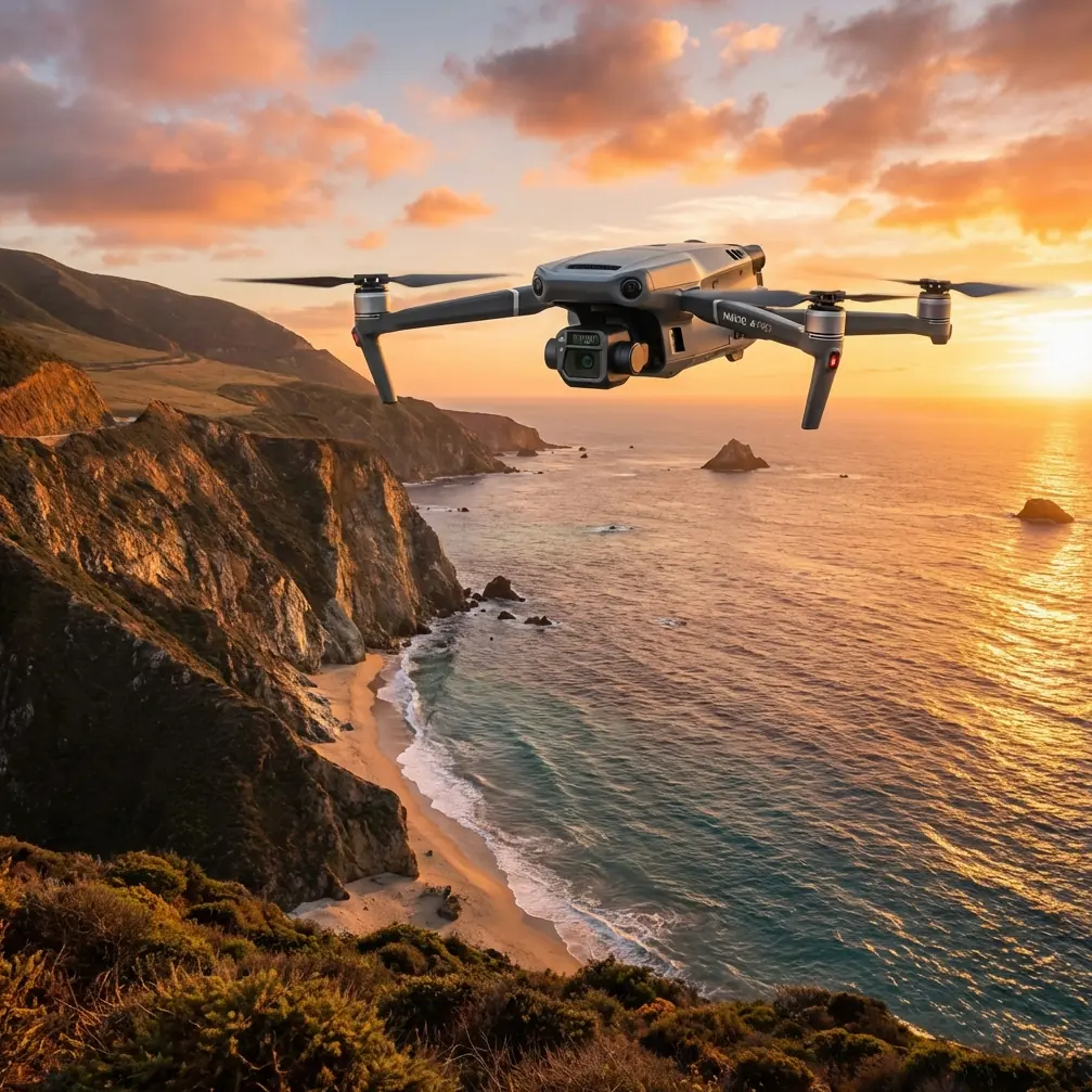
The Mavic 3T sits in an unusual position. It is portable enough for a survey lead or site superintendent to carry uphill with minimal support gear, yet it offers a thermal signature layer that can reveal issues a standard RGB mapping drone will miss. On mountain construction projects, that matters in very practical ways.
A thermal pass at dawn can identify moisture-retaining zones in a slope cut, detect uneven curing patterns in recently placed material, or reveal overheating electrical components in temporary site infrastructure. Later in the day, the visual camera workflow supports progress capture, haul road monitoring, and photogrammetry for earthwork tracking.
That dual-role capability is useful because mountain projects rarely allow separate flights for every department. The geotechnical team, site manager, and safety coordinator often need different data from the same launch window. A compact drone that can feed those needs in one field session has real operational value.
The hidden issue: transmission reliability is not just a spec-sheet concern
In steep terrain, transmission quality becomes a project variable. Ridges, cut slopes, concrete plant structures, and temporary steel installations all create multipath reflection and intermittent obstruction. This is where the avionics concept of preserving signal integrity at every endpoint becomes surprisingly relevant.
One of the source references describes bus-network design with a strict requirement: signal integrity must be maintained at any termination point, including both the main bus and short branch connections. Translate that into mountain drone work and the lesson is clear. The weakest point in your field chain is often not the aircraft itself, but the little link segments around it: controller antenna orientation, external display cable quality, third-party monitor mounts, and even the way data is offloaded from the controller after landing.
Construction teams tend to focus on aircraft range, but the more useful focus is continuity. O3 transmission is valuable not because it sounds advanced, but because continuity of image and control link is what preserves confidence during terrain-masked sections of a route. A broken or degraded feed in the middle of a slope inspection can force an early return or create gaps in the thermal record that later make comparison difficult.
This is also why I recommend treating accessories carefully. On one mountain road project, a third-party high-brightness tablet mount with vibration damping improved field usability more than expected. The stock viewing setup was workable, but under bright alpine light and with heavy winter gloves, the larger display made thermal anomalies easier to verify in real time and reduced pilot input errors. That did not change the aircraft’s transmission system, yet it improved the integrity of the human-machine link. In real operations, that matters.
Timing matters more than many pilots realize
The second reference point from the avionics material is even more useful. It explains that different data types should move on different iteration cycles, with a “large cycle” for slower updates and a “small cycle” for fast updates. It gives a concrete example: when N = 6, one large cycle can be divided into 64 small cycles, allowing different information to be transmitted 1, 2, 4, up to 64 times within that larger frame.
That concept maps neatly onto Mavic 3T mountain missions.
Not every data layer needs the same refresh rhythm. Your piloting awareness inputs need fast updating: aircraft position, obstacle awareness, terrain relation, battery state, and live thermal image interpretation. By contrast, high-level project tasks such as periodic progress stills, waypoint milestone checks, and GCP confirmation operate on a slower cycle.
The crews that get the most from the Mavic 3T are usually doing this instinctively, even if they never call it scheduling theory. They divide one mission into nested loops:
- very fast control and situational awareness decisions
- moderate-rate framing and overlap checks for photogrammetry
- slower task-level decisions about area completion and documentation priorities
When you separate those update layers mentally, mountain flying gets cleaner. You stop overloading the pilot with every objective at once.
For example, if your team is capturing a haul road switchback and adjacent retaining work, you may run a small-cycle mindset for flight safety and thermal scanning in the shadowed areas, while using a larger-cycle plan for orthomosaic coverage checkpoints every few legs of the route. The result is less cockpit noise and better consistency.
Thermal signature work in the mountains: where the Mavic 3T earns its keep
Thermal imaging on a mountain construction site is rarely about dramatic hot spots. The best use cases are subtler.
A Mavic 3T can help identify differential temperature patterns in drainage corridors after a cold night, which may indicate unexpected water movement behind temporary stabilization works. It can reveal heat leakage from site cabins or generator housings placed near sensitive slopes. It can also support inspection of electrical junction points serving pumps, crushers, or communications equipment on elevated pads where walking access is poor.
The operational significance is this: thermal data gives early indications of conditions that ordinary RGB imagery may not show until they become obvious, expensive, or disruptive.
But thermal work in mountain terrain is unforgiving if you do not manage timing and environmental consistency. Shade migration across slopes changes signatures quickly. Wind can cool exposed surfaces unevenly. A thermal mission flown too late in the morning may blur the difference between moisture, material density, and simple solar loading.
That is why I advise construction teams to lock thermal collection into a repeatable time band and build the rest of the mission around it. If the thermal objective is primary, fly that first. RGB mapping can follow. Trying to reverse the sequence often degrades the one dataset that is hardest to reproduce.
Photogrammetry, GCPs, and steep ground truth
The Mavic 3T is not only a thermal tool. For mountain construction capture, it becomes more valuable when paired with disciplined photogrammetry practice. The terrain itself creates the trap: steep surfaces can look well documented on-screen while still producing weak reconstruction in processing.
Ground control points matter here, especially when the site includes bench cuts, elevation jumps, and long narrow corridors. GCP placement should reflect vertical relief, not just horizontal spread. Teams that place control only on accessible flat areas often end up with a deceptively neat dataset that drifts where they need accuracy most: on the slope face, crest line, or drainage channel.
Operationally, the Mavic 3T works best when thermal and mapping outputs are treated as complementary rather than separate products. The RGB model provides measurement context. The thermal layer helps explain why a certain area deserves follow-up. A warm patch on its own is interesting; a warm patch tied precisely to a reconstructed slope segment or structure joint is actionable.
Power management and hot-swap thinking in narrow weather windows
Hot-swap batteries are not just a convenience topic in mountain work. They are a planning concept.
You may not literally hot-swap in the sense used on larger persistent systems, but the field mindset should be similar: keep aircraft turnaround short, keep role transitions clean, and never let battery handling become the reason you miss the one calm period of the day. In mountain environments, wind often increases sharply after mid-morning. A 20-minute delay on the ground can turn a productive second sortie into a canceled one.
Battery rotation discipline, pre-labeled packs, and a protected staging area matter more than people expect. When your first flight is a thermal pass and the second is a structured photogrammetry route, the transfer between them should feel procedural, not improvised.
Data security and stakeholder trust
Construction documentation often includes sensitive site layouts, progress data, contractor sequencing, and infrastructure details. While this is not a military concern, it is still commercially sensitive. That is where secure handling practices and features associated with protected transmission and storage, including workflows aligned with AES-256 expectations, matter to project owners.
In practice, the significance is not theoretical encryption jargon. It is trust. Owners want to know who can access site imagery, when it is exported, and how it is shared between the field team and office. If your mountain project is part of a utility, transport, or energy corridor, that question appears early.
The Mavic 3T becomes a stronger platform when the data path around it is controlled just as carefully as the aircraft itself. Again, that echoes the avionics principle from the source material: the branch points matter. Signal handling and message handling do not stop at the airframe.
BVLOS talk versus mountain reality
BVLOS is one of those terms that gets thrown around too loosely. In mountain construction, the practical challenge is not ambition. It is terrain geometry. Even when a route length seems modest on paper, ridges and cuts can break visibility or degrade confidence quickly.
So rather than stretching the concept, smart teams use the Mavic 3T to build disciplined segmented workflows. Launch from points that preserve the healthiest transmission corridor. Break long alignments into manageable sections. Use prior terrain knowledge and observer placement where regulations and site rules allow. The goal is not to force a theoretical maximum-distance mission. The goal is clean, defensible capture.
That is especially true when thermal interpretation is part of the job. The pilot needs bandwidth to interpret changing signatures, not just maintain control.
A practical field setup that improves results
For mountain construction capture, I like a simple stack:
- Mavic 3T as the primary aircraft
- clearly planned dawn or early-morning thermal segment
- follow-on RGB capture for photogrammetry
- carefully distributed GCPs across elevation changes
- a third-party high-brightness monitor mount for better image interpretation in sun
- disciplined battery rotation and immediate data offload
- a documented handoff process for site managers and processing staff
If your team needs help refining that setup for steep terrain operations, a direct field workflow discussion usually saves more time than another generic checklist. You can reach us here for practical configuration advice: message our mountain site drone team.
Final assessment
The Mavic 3T is not magic, and mountain construction sites do not forgive sloppy workflows. What makes this aircraft valuable is the way its compact thermal and visual capabilities can be organized into a disciplined mission structure.
The source avionics references point to two truths that apply surprisingly well here. First, reliable outcomes depend on preserving integrity across every connection point, not just the main system core. Second, mixed-priority information must be scheduled intelligently rather than treated as one uniform stream. The example of 64 small cycles inside one large cycle is not just an aerospace abstraction. It mirrors how successful drone teams separate immediate flight awareness from slower documentation tasks.
That is the right way to judge the Mavic 3T for mountain construction. Not by isolated specs, but by whether it helps your crew capture thermal signature, visual evidence, and site geometry in a synchronized, repeatable way when access is difficult and time is short.
Ready for your own Mavic 3T? Contact our team for expert consultation.