Mavic 3T in Remote Fields: A Specialist’s Field Report
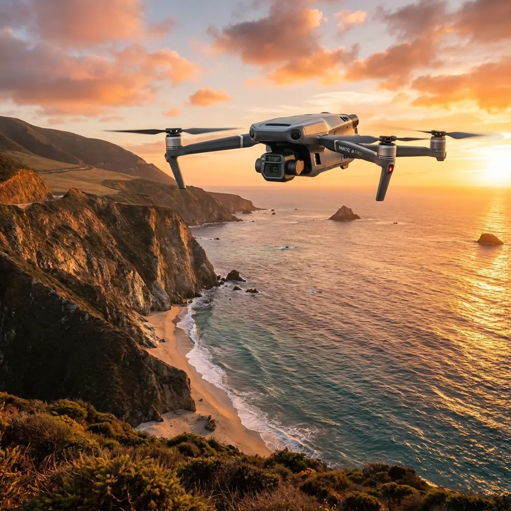
Mavic 3T in Remote Fields: A Specialist’s Field Report on What Actually Matters
META: A field-tested look at using the DJI Mavic 3T for remote agricultural and land survey work, with practical insights on thermal signature capture, pre-flight cleaning, testability, reliability, and why broader low-altitude logistics trends matter.
I’ve spent enough mornings in remote fields to know that the most important part of a drone mission often happens before takeoff.
Not the flight plan. Not the waypoint grid. Not even the sensor settings.
It’s the quiet two-minute inspection when you wipe down the vision sensors, check the lens window for dust and moisture residue, and make sure the aircraft is reading the world clearly before you ask it to do real work. For a platform like the Mavic 3T, that small habit has outsized value. In remote agricultural and land-management environments, where one mission may need to combine thermal signature review, visual confirmation, and mapping-grade image collection in the same sortie, a dirty sensor stack can create bad decisions faster than most operators realize.
This matters more now because the role of small and medium UAVs is changing. Recent industry news out of China highlights DJI’s release of two heavy-payload drones designed for future large-load transport scenarios, tied directly to the expansion of the low-altitude economy. That headline is not really about replacing a Mavic 3T with a larger aircraft. It signals something else: the operating environment around field drones is becoming more mature, more layered, and more integrated with real economic workflows. As larger transport drones move goods and support broader infrastructure, compact aircraft like the Mavic 3T become even more valuable as the eyes of that low-altitude system—especially in remote fields where fast inspection still beats guesswork.
For readers focused on capturing fields with the Mavic 3T, that shift has practical consequences.
The Mavic 3T’s role is getting sharper, not smaller
When people hear about large-load UAVs, they sometimes assume compact mission aircraft become less relevant. In field operations, the opposite is often true.
A heavy-lift aircraft may eventually move inputs, tools, or emergency supplies across wide rural zones. The Mavic 3T, by contrast, answers a different question: what exactly is happening on the ground right now? That distinction is why the Mavic 3T remains so useful for remote acreage, orchards, utility corridors crossing farmland, drainage assessment, and thermal screening of assets and crop-adjacent infrastructure.
Its value comes from fast deployment and layered sensing. The thermal payload gives you a way to isolate anomalies that the naked eye misses. The visual camera helps confirm whether that anomaly is a heat-stressed pump, standing water affecting soil temperature, an irrigation leak line, livestock congregation, or simply a sun-warmed rock patch at the edge of a row. If you’re building orthomosaics or documenting field conditions over time, photogrammetry workflows can then turn those observations into a consistent record.
That is where the Mavic 3T earns its keep in remote field work: not by doing one thing spectacularly, but by compressing detection, verification, and documentation into one flight window.
Why a cleaning step belongs in every field SOP
The “pre-flight cleaning step” sounds mundane. It isn’t.
Remote field environments are hostile to precision sensing. Dust from access roads settles on optics. Pollen films over sensor windows. Fine moisture residue from dawn operations can cling to glass. Fertilizer and chemical drift in agricultural zones can leave a barely visible haze. Even when the aircraft still flies normally, contaminated surfaces can reduce the trustworthiness of obstacle sensing, visual clarity, and thermal interpretation.
I advise operators to build cleaning into the written pre-flight checklist, not leave it to memory. Before powering up:
- inspect the thermal and visible camera windows
- inspect forward, rear, upward, and downward sensing surfaces
- remove loose dust first
- use appropriate lens-safe cleaning materials
- verify no streaking remains in angled light
The operational significance is straightforward. A Mavic 3T used over remote fields often flies low enough and close enough to terrain, tree lines, poles, and irrigation structures that reliable sensing is part of the risk envelope. If the aircraft’s safety features are expected to work well, the inputs feeding those features must be clean. This is not cosmetic maintenance. It is mission assurance.
Reliability is not abstract; it is workflow design
One of the more useful reference points for understanding professional UAV operations comes from a classic aircraft design manual section on avionics systems. It emphasizes that testability should be reviewed on schedule during system design reviews, including system design review, preliminary design review, and critical design review. It also notes that proving built-in test hardware and software requires more than lab results; it calls for analysis of production test outcomes and field maintenance activity.
That may sound far removed from a Mavic 3T flying over soybean plots or remote utility easements. It isn’t.
The principle is the same: don’t judge a field aircraft only by the specification sheet. Judge it by how testable and supportable it is in real operations.
For a remote-field team, that translates into a few practical standards:
1. Treat repeatable checks as part of operational readiness
A professional Mavic 3T program should have a short but consistent health-check routine before and after missions. Sensor cleanliness is one part. Gimbal response, thermal calibration status, storage media health, battery condition, and transmission stability are others.
The avionics handbook’s focus on fault detection and fault isolation time is particularly relevant here. In plain language, if something goes wrong in the field, how quickly can you identify the issue and separate aircraft fault from environmental interference, workflow error, or payload contamination? Teams that answer this quickly lose less daylight and produce more usable data.
2. Field maintenance feedback matters
The handbook explicitly points beyond production testing toward “field system maintenance activity” analysis. That is exactly how good Mavic 3T operations improve. If one farm, one region, or one season keeps producing the same issue—dust intrusion, thermal haze during midday, weak visibility under pollen load, recurring compass concerns after vehicle transport—you don’t just solve it once. You modify the SOP.
That is where experience becomes a system instead of a story.
3. Built-in intelligence is only useful if crews know what they’re looking at
The reference discusses BIT, or built-in test, hardware and software. On a modern UAV platform, the spirit of that idea lives in system status alerts, pre-flight diagnostics, sensor warnings, calibration prompts, and maintenance records. Crews working in remote areas should be trained to interpret these indicators with discipline. Too many avoidable field losses start with someone dismissing a warning because the aircraft “still looked fine.”
Weight always shows up somewhere, even on a compact field aircraft
Another reference source, from an aircraft design manual on weight balance and control, dives into material density and sandwich-panel structures, including honeycomb core data and values such as 1.65 to 1.73 for a specific aramid paper honeycomb core range, alongside density figures that scale significantly with material choices. On the surface, this seems disconnected from a Mavic 3T mission over fields.
But it points to a basic engineering truth that every operator should respect: airborne capability is inseparable from mass efficiency.
You do not need to know the internals of the Mavic 3T’s composite structure to feel the consequences of that design logic. The aircraft’s usefulness in remote work depends on an airframe that balances durability, transportability, thermal payload integration, and flight endurance. Every gram in structure, every compromise in material selection, affects how much mission performance survives once wind, heat, and repeated deployment enter the picture.
Operationally, this matters in three ways.
First, compact aircraft only stay practical in remote fields if crews can hand-carry them, deploy quickly, and move between launch points without turning every mission into a logistics exercise.
Second, payload-and-structure efficiency influences endurance margins. In rural work, those margins are what separate “captured enough to decide” from “need another battery cycle.”
Third, durable lightweight structures support data consistency. A field drone that travels constantly in trucks, utility vehicles, and backpacks takes abuse. Airframe integrity, gimbal stability, and payload alignment are not glamorous topics, but they shape whether your photogrammetry outputs hold together and whether your thermal comparisons remain trustworthy over time.
Thermal signature capture: stop chasing pretty images
A lot of Mavic 3T content online focuses on thermal images that look dramatic. That is not the same as thermal data that helps a field decision.
In remote fields, thermal signature interpretation only becomes useful when it is tied to time of day, weather history, surface condition, and mission purpose. Are you looking for irrigation non-uniformity? Animal location? Equipment stress? Wet ground? Solar loading on structures? Compaction patterns affecting moisture retention? Each target has a different thermal behavior window.
The Mavic 3T is strong because it lets you scan wide enough to spot patterns and then verify locally with the visible camera. But operators still need discipline. A thermal anomaly without visual context is often just a question mark with a color palette.
For field capture, I typically recommend teams define the anomaly class before takeoff. In other words, say what would count as meaningful before the drone is in the air. That sounds simple, but it changes how people fly. They stop collecting random heat maps and start collecting decision-grade evidence.
Photogrammetry, GCPs, and when “good enough” is not good enough
Readers interested in capturing fields often combine thermal flights with mapping runs. The Mavic 3T can contribute to that workflow, but expectations must be matched to method.
If your goal is broad visual documentation of field condition, drainage paths, access roads, or crop-edge encroachment, basic photogrammetric capture may be enough. If your goal is repeatable measurement, boundary documentation, or integration with agronomy and engineering records, you should be thinking carefully about control.
That is where GCPs still matter. Even with excellent flight automation and stable image collection, ground control points help anchor the map to reality. In remote areas, where terrain references may be sparse and the consequences of alignment drift can accumulate over repeated surveys, GCP use can be the difference between a helpful image product and a defensible site record.
This is also why I separate “inspection flights” from “mapping flights” in planning. The Mavic 3T can do both, but trying to improvise both objectives in a single rushed sortie usually weakens each one. Better to decide whether the mission is primarily anomaly detection, asset confirmation, or spatial record creation.
Transmission, security, and remote confidence
Remote fields expose another truth: signal confidence shapes operator behavior.
Strong transmission performance such as O3-class capability is not just a comfort feature. In rural operations, especially around uneven terrain, shelterbelts, and long field edges, stable video and telemetry reduce hesitation and help crews maintain cleaner decision loops. When feed quality degrades, pilots become conservative in the wrong moments and reckless in others. Good transmission tends to make operations smoother, calmer, and more precise.
The same goes for data handling. If you are capturing sensitive farm layouts, infrastructure conditions, or recurring operational routes, secure handling matters. AES-256 discussions sometimes get treated as an IT checkbox, but for commercial field operators it has a practical dimension: clients increasingly care where imagery goes, how it is stored, and who can access it.
These are not abstract procurement points anymore. They affect whether a drone program is trusted enough to become routine.
The bigger low-altitude economy will change what “field drone work” looks like
Let’s circle back to the recent DJI heavy-payload release news. The article’s core claim is that as a new generation of large-load transport drones expands, the low-altitude economy will serve industries and public livelihood across a broader space and at a higher level.
For Mavic 3T operators, the takeaway is not “buy bigger aircraft.” It is “prepare for more connected workflows.”
A remote field mission today may look like a standalone inspection. In the near future, it may become one layer in a coordinated system: compact thermal scouting, targeted mapping, logistics support from heavier UAVs, and centralized reporting across dispersed sites. That makes data quality, testability, maintenance discipline, and standard operating procedures more valuable than ever.
If your team wants to discuss how to structure a practical field workflow, this direct WhatsApp line is the easiest place to start: message Dr. Lisa Wang’s team here.
What experienced Mavic 3T crews do differently
After enough field days, the patterns become obvious.
Good crews do not rush setup because the aircraft is “small.” They clean optics before every mission. They separate thermal scouting from measurement tasks unless the plan clearly supports both. They record recurring field faults and update SOPs. They treat diagnostics and system warnings as operational data, not interruptions. They understand that lightweight airframe engineering is not trivia; it is the reason the aircraft remains useful after long transport, repeated deployment, and changing weather. And they recognize that the growth of larger UAV ecosystems does not diminish the Mavic 3T. It defines its niche more clearly.
That niche is clarity at the edge of uncertainty.
In remote fields, that is exactly what you need.
Ready for your own Mavic 3T? Contact our team for expert consultation.