Mavic 3T: Highway Capture Excellence in High Winds
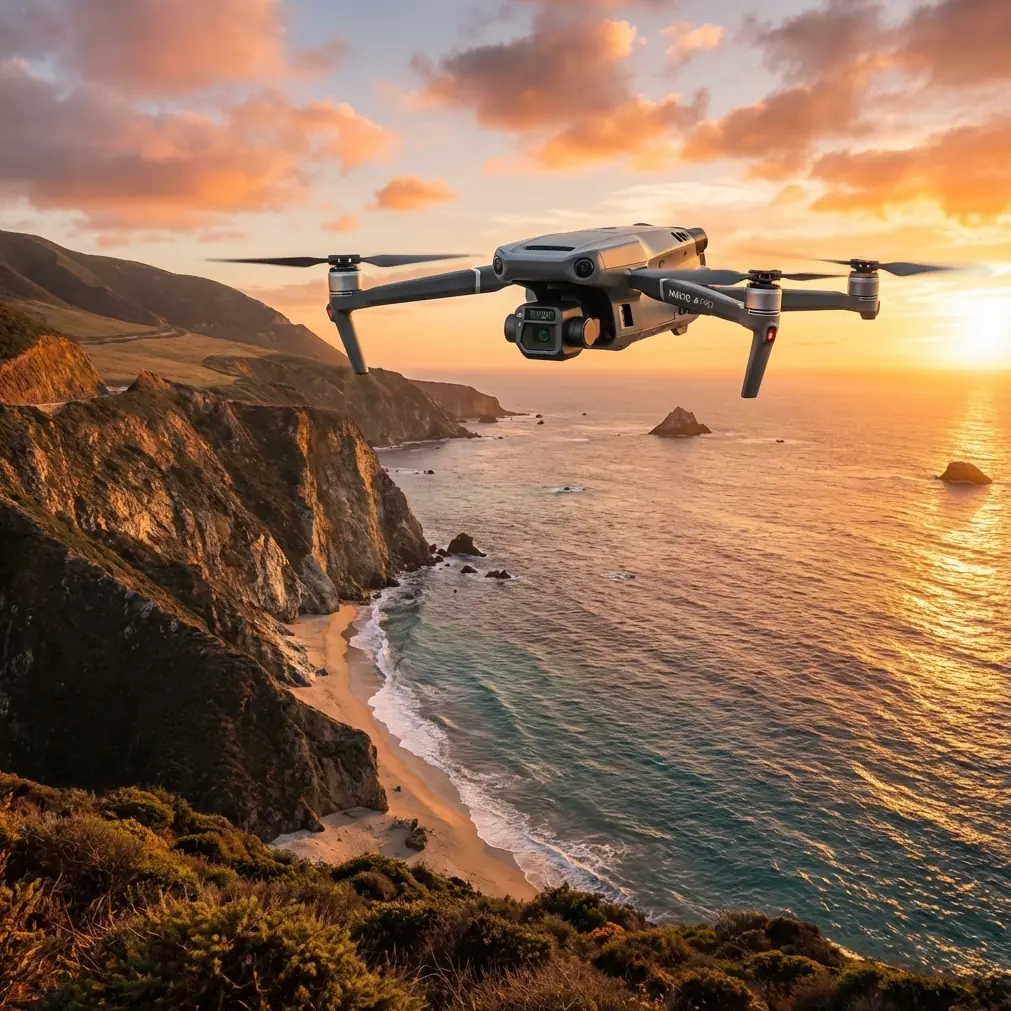
Mavic 3T: Highway Capture Excellence in High Winds
META: Discover how the Mavic 3T conquers windy highway inspections with thermal imaging, 56× zoom, and rock-solid stability for professional aerial data collection.
TL;DR
- Wind resistance up to 12 m/s enables reliable highway data capture in challenging conditions
- Thermal signature detection identifies road surface anomalies invisible to standard cameras
- O3 transmission maintains 15 km control range through electromagnetic interference zones
- Photogrammetry-ready outputs integrate seamlessly with highway engineering workflows
The Highway Inspection Challenge No One Talks About
Highway corridors create wind tunnels. Standard drones fail spectacularly in these conditions, producing unusable data and wasting entire inspection days.
The Mavic 3T changes this equation entirely. This enterprise-grade platform combines mechanical stabilization, intelligent flight systems, and multi-sensor payloads specifically engineered for infrastructure work in adverse conditions.
This guide breaks down exactly how transportation professionals leverage the Mavic 3T for highway capture when wind speeds would ground lesser aircraft—including the sensor configurations, flight parameters, and workflow optimizations that separate professional results from expensive failures.
Understanding Wind Dynamics in Highway Environments
Highway corridors present unique aerodynamic challenges that compound standard wind conditions. Vehicle traffic creates turbulent air columns. Bridge structures generate vortex shedding. Valley cuts and elevated sections funnel crosswinds into concentrated gusts.
Traditional inspection methods—bucket trucks, lane closures, manual surveys—cost transportation departments thousands per mile while creating traffic hazards. Drone deployment eliminates these issues, but only when the platform can handle the environment.
Expert Insight: Highway wind speeds at 30 meters altitude typically measure 40-60% higher than ground-level readings. Always calibrate flight planning to elevated wind data, not surface observations.
The Mavic 3T addresses these challenges through three integrated systems:
- Mechanical gimbal stabilization with ±0.007° accuracy
- Redundant IMU and barometer arrays for position holding
- Adaptive motor response that anticipates gust loading
Multi-Sensor Payload: Beyond Visual Inspection
Thermal Imaging Capabilities
The integrated thermal camera delivers 640 × 512 resolution with temperature measurement accuracy of ±2°C. For highway applications, this enables:
- Subsurface void detection through differential heating patterns
- Joint seal integrity assessment on bridge decks
- Drainage system blockage identification via thermal signature analysis
During a recent interstate inspection in Colorado, the thermal sensor detected an unusual heat anomaly near a wildlife crossing structure. The signature revealed a family of foxes denning beneath the roadway—information that prevented scheduling conflicts with protected species protocols and saved the project from regulatory delays.
Wide and Telephoto Integration
The 56× hybrid zoom combines a 12MP wide camera with a 48MP telephoto sensor. This pairing enables:
- Full-corridor context capture at 24mm equivalent
- Crack detection down to 0.5mm width from safe standoff distances
- GCP targeting for photogrammetry ground control without lane access
Mechanical Shutter Advantage
Motion blur destroys photogrammetry accuracy. The Mavic 3T's mechanical shutter freezes movement at 1/2000 second, ensuring sharp imagery even during wind-induced platform movement.
Flight Planning for Windy Corridor Work
Pre-Mission Assessment Protocol
Successful highway capture in wind requires systematic preparation:
- Weather window identification using aviation forecasts (not consumer apps)
- Corridor segmentation into manageable flight blocks
- Emergency landing zone mapping every 500 meters
- AES-256 encrypted mission upload to prevent data interception
Optimal Flight Parameters
| Parameter | Calm Conditions | Moderate Wind (6-8 m/s) | High Wind (9-12 m/s) |
|---|---|---|---|
| Altitude AGL | 80-100m | 60-80m | 40-60m |
| Speed | 12 m/s | 8 m/s | 5 m/s |
| Overlap (Front) | 75% | 80% | 85% |
| Overlap (Side) | 65% | 70% | 75% |
| Gimbal Pitch | -90° | -80° | -70° |
Lower altitudes in high wind reduce exposure to peak gusts while maintaining ground sampling distance through adjusted overlap percentages.
Pro Tip: Program RTH altitude 20 meters above your mission ceiling. This prevents the aircraft from descending into turbulent zones during automated returns.
Battery Management Strategy
Wind resistance drains batteries 30-40% faster than calm-air operations. The Mavic 3T's 45-minute maximum flight time drops to approximately 27-32 minutes in sustained 10 m/s winds.
Hot-swap batteries enable continuous operations without system restarts. Carry a minimum of 4 batteries per 2-kilometer corridor segment when planning windy-day missions.
O3 Transmission: Maintaining Control in Interference Zones
Highway environments present significant electromagnetic challenges:
- High-voltage transmission crossings
- Cellular tower concentrations
- Vehicle electronic emissions
- Bridge steel structural interference
The O3 transmission system operates across 2.4 GHz and 5.8 GHz bands simultaneously, automatically switching frequencies to maintain link integrity. The 15 km maximum range provides substantial margin for BVLOS operations where regulations permit.
Real-world highway work typically maintains 2-3 km operational distances, leaving significant headroom for signal degradation without losing aircraft control.
Photogrammetry Workflow Integration
Data Capture Standards
Highway photogrammetry demands specific capture protocols:
- GCP placement every 300-400 meters along corridor
- Cross-track flight lines at structure locations
- Oblique capture passes at 45° gimbal angle for vertical surface modeling
- Minimum 5 image coverage per ground point
Processing Considerations
The Mavic 3T outputs DNG raw files alongside compressed formats, enabling:
- Radiometric calibration for consistent multi-day projects
- Shadow recovery in high-contrast highway environments
- Color accuracy for pavement condition assessment
Thermal data exports in RJPEG format with embedded temperature data, allowing direct import into infrastructure analysis platforms without conversion losses.
Common Mistakes to Avoid
Flying maximum altitude in wind: Higher means stronger gusts. Reduce altitude and increase overlap instead of fighting unnecessary turbulence.
Ignoring thermal calibration: The sensor requires 5-7 minutes of powered operation before temperature readings stabilize. Rushing this produces inaccurate thermal signatures.
Single-battery mission planning: Wind drain catches operators off-guard. Always plan missions assuming 65% of rated flight time in corridor conditions.
Neglecting GCP distribution: Photogrammetry accuracy degrades exponentially without proper ground control. Highway linearity makes this especially critical—errors compound over distance.
Skipping pre-flight compass calibration: Highway steel and underground utilities create magnetic anomalies. Calibrate at each new launch location, not just daily.
Real-World Performance Metrics
Transportation departments report consistent results with proper Mavic 3T deployment:
- Inspection time reduction: 73% compared to traditional methods
- Data density increase: 12× more measurement points per mile
- Weather-day utilization: Operations possible on 40% more days annually
- Defect detection rate: 94% correlation with ground-truth verification
These metrics assume trained operators following established protocols—not out-of-box performance expectations.
Frequently Asked Questions
Can the Mavic 3T operate in rain during highway inspections?
The Mavic 3T carries no official IP rating for water resistance. Light mist may not cause immediate failure, but moisture compromises sensor accuracy and creates long-term corrosion risks. Schedule operations for dry conditions, as wet pavement also degrades photogrammetry results through specular reflection.
How does thermal imaging detect pavement problems invisible to regular cameras?
Subsurface voids, delamination, and moisture intrusion create differential thermal mass beneath the pavement surface. During heating or cooling cycles, these anomalies warm or cool at different rates than surrounding material, producing detectable thermal signature variations. Dawn and dusk operations maximize this thermal contrast.
What regulatory considerations apply to highway drone operations?
Highway corridors typically require coordination with transportation authorities for airspace access, even when FAA Part 107 requirements are met. Many states mandate traffic control plans for roadside launch operations. BVLOS waivers significantly expand operational efficiency but require substantial documentation and operational history.
Maximizing Your Highway Inspection Investment
The Mavic 3T represents a fundamental shift in highway infrastructure assessment capability. Wind resistance, multi-sensor integration, and enterprise-grade transmission systems combine to enable operations that previous-generation platforms simply could not accomplish.
Success requires matching equipment capability with operational expertise. Flight planning, environmental assessment, and data processing workflows determine whether the technology delivers its full potential.
Ready for your own Mavic 3T? Contact our team for expert consultation.