Capturing Highways in Low Light with the Mavic 3T
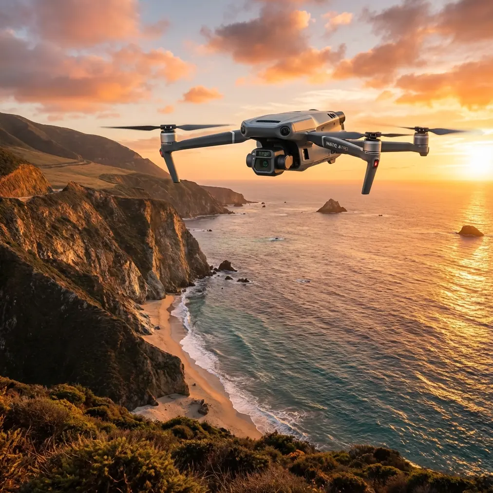
Capturing Highways in Low Light with the Mavic 3T: What Actually Matters in the Field
META: A specialist’s field-focused guide to using the Mavic 3T for low-light highway capture, with practical insight on thermal signature tracking, sensor setup, transmission reliability, and safe data collection workflows.
Highway work at dusk and after dark exposes a truth that daylight mapping often hides: not every drone workflow survives bad contrast, moving headlights, wind shear over pavement, and long linear corridors. The Mavic 3T can, but only when the operator treats it less like a camera drone and more like a sensor platform.
I’ve seen this firsthand in corridor documentation projects where the brief sounded simple—capture pavement condition, drainage edges, signage visibility, and thermal anomalies along several kilometers of roadway in low light. On paper, that looks like a straightforward mission. In practice, low-light highway capture is where aircraft stability, transmission discipline, thermal interpretation, and battery management start to matter all at once.
The Mavic 3T earns its place here because it closes a gap between visual capture and thermal awareness. That matters on highways for one reason above all: the road environment changes faster than the eye does. By the time an operator spots something unusual in the RGB feed, the aircraft may already be over it. Thermal signature gives you a second layer of perception that can reveal heat-retaining surfaces, recently active machinery, overheated roadside equipment, or living obstacles near the shoulder.
One encounter still stands out. During a predawn highway inspection pass, the visual scene looked flat—dark verge, muted lane markings, and intermittent glare from distant vehicles. The thermal view, though, picked up a bright irregular form moving near a drainage ditch parallel to the road. It turned out to be a deer approaching the embankment. Because the animal presented a clear thermal signature before it was easy to identify visually, the flight path was adjusted early and safely. That single moment explains why low-light corridor work should never rely on one sensor alone.
The problem with highways at night isn’t just darkness
Low light is the obvious challenge, but not the most damaging one. The deeper problem is inconsistency.
Highways produce alternating visual conditions every few seconds: reflective lane paint, blacktop heat retention, concrete barriers, headlight bloom, shadowed shoulders, and vegetation edges with poor separation. If you are trying to collect imagery for photogrammetry, these variations can reduce tie-point consistency. If you are documenting assets or thermal irregularities, they can also cause operators to misread what they’re seeing.
That’s why the Mavic 3T is particularly useful in this niche. It allows a highway team to cross-check thermal and visual information during flight instead of waiting until post-processing to discover missed targets.
O3 transmission plays a bigger role here than many operators admit. In daylight, brief signal quality dips are annoying. At night along a long road corridor, they are far more consequential. Highway missions often involve elongated flight geometry, with the aircraft moving away from the pilot over a narrow path rather than circling a single site. A stable downlink is what keeps framing disciplined and helps the pilot maintain confidence in obstacle awareness and scene interpretation. If your low-light mission depends on identifying small roadside features or verifying a heat source near culverts, weak situational feedback is not a minor inconvenience. It is a data-quality problem.
Why the Mavic 3T is more than a thermal drone in this scenario
Many people approach the Mavic 3T as if thermal alone is the story. On highways, it isn’t. The aircraft’s value comes from how thermal, visual confirmation, transmission integrity, and mission efficiency combine into a single field workflow.
For low-light capture, the thermal payload helps identify what deserves attention. The visual system then provides context: is that hotspot a power component, a recently used vehicle pull-off, pooled water holding residual warmth, or an animal near the shoulder? That sequence—detect first, verify second—is much more effective than attempting to “see everything” with visible imagery in poor ambient light.
This is where Mavic 3T operations also intersect with classic aviation engineering logic. One of the reference materials discusses rolling bearing designation systems and notes that a bearing’s basic code can be built from seven Arabic numerals, with each position representing dimensional and structural characteristics. It also points out that when the leftmost digit is “0,” it may be omitted. At first glance, that seems far removed from drone operations. It isn’t.
Why does that matter operationally? Because highway capture in low light rewards the same mindset embedded in mechanical standards: precision in small details prevents failure in larger systems. Bearing classifications exist because dimensional tolerance and internal structure affect performance under load. Drone operators face an analogous reality. Gimbal behavior, motor smoothness, and airframe response all depend on component consistency, even if the pilot never sees those underlying tolerances. On a long low-light mission, smooth sensor stabilization is not cosmetic. It directly affects image usability, especially when collecting corridor imagery that may later support photogrammetry or repeat-condition comparison.
The same source also mentions tolerance grades denoted by letter classes such as CG, E or EX, D, C, and B, ordered from lower to higher precision. That detail is a useful reminder that not all “working” systems are working equally well. In drone terms, a platform that merely stays airborne is not necessarily delivering the precision needed for repeatable highway documentation. At night, the margin between acceptable and excellent becomes visible in blur, drift, and inconsistent framing.
Setup discipline matters more than most pilots expect
The second reference document is about transmitter programming and describes enabling and disabling functions like HOLD and REVO through a mode-based settings interface. One line is especially relevant: the operator enters program setting mode, uses a MODE key to select a function, then uses SELECT and data input controls to change whether that function is active. Another passage explains how gyro-related mixing can be adjusted through a switch to create different sensitivity settings.
This may come from a different aircraft context, but the operational lesson transfers cleanly to the Mavic 3T: low-light highway work is won before takeoff by deliberate configuration, not by improvisation in the air.
Too many missions begin with a generic profile left over from a previous job. That is a mistake. If you are capturing highways in low light, sensitivity, gimbal response, flight speed, return behavior, obstacle strategy, and thermal palette choices should all be intentional. The old transmitter manual’s logic—enter setup mode, choose the exact function, confirm whether it is on or inhibited—is a good mental model for modern drone operators. Every flight-critical behavior should be consciously enabled, disabled, or tuned. Nothing should be assumed.
That matters because low-light highway environments punish lazy settings. An overly aggressive stick response can make it harder to hold a smooth corridor line. Excessive yaw speed can smear context when reviewing roadside assets. Poorly planned gimbal pitch behavior can make it harder to compare successive runs. And if your team is switching between thermal search, asset documentation, and photogrammetry support, profile management becomes a practical necessity rather than a convenience.
Building a reliable highway capture workflow
Here is the workflow I recommend when the Mavic 3T is tasked with low-light highway capture.
1. Split the mission into detection and documentation passes
Trying to do everything at once often degrades everything. Use an initial pass to identify thermal anomalies, wildlife presence, drainage irregularities, and roadside heat sources. Then conduct a tighter documentation pass focused on visual evidence and geometry.
This separation improves operator focus. During the first pass, thermal signature interpretation takes priority. During the second, image overlap, angle consistency, and target framing matter more. If the end goal includes photogrammetry, this second pass should be planned around overlap and repeatability, with GCP strategy determined in advance where ground access is feasible.
2. Respect corridor geometry
Highways are linear. That sounds obvious, yet many teams still fly them as if they were open lots. Corridor missions should be planned around communication continuity, turnaround points, and visibility of critical roadside features. BVLOS planning, where legally permitted and operationally approved, should never be treated casually. Long roads tempt teams into stretching flights beyond sensible communication and observation discipline.
The Mavic 3T’s transmission capability helps, but it does not cancel operational responsibility. O3 transmission is a strength, not a substitute for planning.
3. Use thermal as an attention filter, not a final answer
Thermal can show you where to look. It does not always tell you what you are looking at. Pavement that retained heat through the evening can mimic significance. So can recently vacated maintenance pull-outs, transformer housings near roadside systems, or even reflective artifacts under certain conditions.
Cross-reference thermal detections with the visual feed whenever possible. This is especially important if your deliverable may influence maintenance scheduling or site prioritization.
4. Plan battery transitions around data continuity
Hot-swap batteries are not just a convenience in corridor work. They preserve tempo. Highway missions become inefficient when every battery change forces a complete reorientation of mission context. Structured battery swaps let the crew maintain sequence, preserve capture logic, and resume from known checkpoints.
At night, this also reduces cognitive load. Teams perform better when handoffs are predictable. That sounds mundane, but repeatable field habits are exactly what prevent omissions on long, dark corridor jobs.
5. Protect the data path
AES-256 matters for more than policy paperwork. Highway inspection content can include critical infrastructure elements, contractor work zones, and sensitive asset layouts. Secure handling should extend from transmission choices and device hygiene to storage, transfer, and client delivery. The technical capability is only useful if the workflow around it is equally disciplined.
What operators often get wrong
The most common failure I see is overconfidence in visibility. Pilots assume that because the screen image looks “good enough,” the captured dataset will also be good enough. Those are different questions.
The second failure is trying to stretch one flight profile across multiple objectives. Thermal scanning, asset verification, and photogrammetry support each demand different pacing and framing logic.
The third is underestimating wildlife. Low-light highway environments are active ecological edges. Deer, dogs, birds, and smaller warm-bodied animals can appear where visual contrast is poor. The deer encounter I mentioned earlier was not unusual. What was unusual was catching it early enough to alter the route without rushed control input. That is the difference sensor fusion makes.
If your team is building or refining this kind of workflow, a direct field discussion often saves more time than trial-and-error. I often suggest operators compare mission variables before deployment through a quick technical chat on WhatsApp for corridor planning.
Where the Mavic 3T fits best
The Mavic 3T is not the answer to every corridor challenge, and pretending otherwise helps no one. But for low-light highway capture, it fills a very practical middle ground: portable enough for rapid deployment, capable enough to add thermal awareness, and efficient enough for recurring inspections and documentation passes.
That makes it particularly useful for:
- pavement and shoulder condition checks after dusk
- drainage and culvert review
- roadside asset inspection
- work-zone monitoring in low ambient light
- pre-dawn corridor screening before daytime engineering follow-up
- training teams on multisensor interpretation in real infrastructure environments
Its strongest role is not replacing engineering review or survey-grade planning. Its strongest role is improving what the field team knows, sees, and records when ambient light is working against them.
The real takeaway
Low-light highway capture is not a test of bravery or improvisation. It is a test of systems thinking.
The references behind this article come from very different corners of aviation and control practice. One describes the coded precision behind bearing standards, including a seven-digit basic designation system and tolerance classes that separate rough adequacy from true precision. Another walks through deliberate transmitter setup, where functions must be selected, activated, inhibited, and tuned rather than assumed. Those ideas map surprisingly well onto Mavic 3T operations.
That is the operational significance.
When you fly the Mavic 3T over highways in low light, your results depend on that same culture of exactness: sensor interpretation, profile configuration, transmission awareness, battery sequencing, and data security all have to work together. Get that right, and the aircraft becomes more than a night-capable drone. It becomes a reliable decision tool for corridor teams working when visual certainty is hardest to achieve.
Ready for your own Mavic 3T? Contact our team for expert consultation.