Mavic 3T Field Report: Capturing Urban Power Lines When
Mavic 3T Field Report: Capturing Urban Power Lines When the City Goes Quiet
META: A specialist field report on using the DJI Mavic 3T for urban power-line capture, with thermal workflow insights, transmission reliability, flight stability context, and lessons from real-world city operations.
Urban utility inspection changes character when the streets empty out.
That sounds obvious, but it matters more than most drone operators admit. In a dense city, traffic, pedestrian flow, reflective surfaces, rooftop turbulence, and access restrictions usually shape every decision you make around a power-line mission. Remove the human movement, and another reality appears: line geometry becomes easier to isolate, thermal contrast often reads more cleanly, and route planning becomes less about avoidance and more about disciplined data capture.
One reference point that still sticks with me came from April 2022, when drone footage showed Shanghai’s streets largely deserted during COVID lockdowns, with millions of residents confined as cases rose in China’s biggest city. The footage was news, not an inspection case study. Even so, for anyone working with compact enterprise UAVs like the Mavic 3T, it highlighted something operationally useful: a low-activity urban environment reveals infrastructure in a different way. Roads become visual backdrops instead of clutter. Shadows are easier to read. Repetitive assets stand out.
For power-line capture in urban settings, that shift can be meaningful.
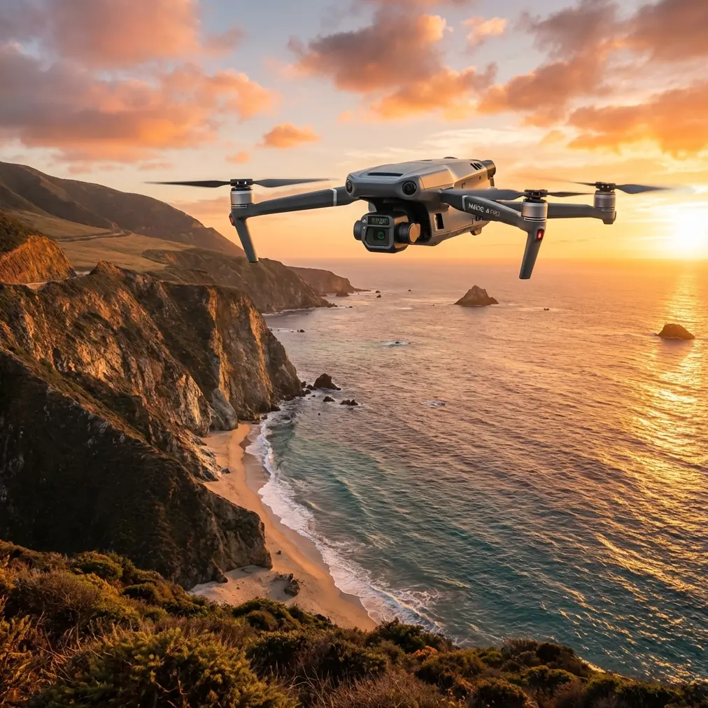
The Mavic 3T is especially well suited to this kind of work because it sits in a practical middle ground. It is compact enough to deploy from constrained launch points, yet capable enough to produce inspection-grade imagery when the flight plan is designed around asset condition, not just cinematic framing. That distinction is where a lot of urban missions either succeed or fail.
What the Mavic 3T is really doing on an urban line mission
When people talk about the Mavic 3T, they often jump straight to thermal capability. Fair enough. Thermal signature analysis is one of the reasons this aircraft earns a place in utility workflows. But on power lines in a city, the thermal camera is only part of the value.
The real strength is how the aircraft lets you layer observations.
You can inspect conductor alignment, fittings, insulators, and attachment points visually, while also checking for abnormal heat patterns at connectors or hardware interfaces. In a corridor lined with glass towers, concrete, rooftop HVAC units, and overlapping cables, the ability to cross-check thermal anomalies against visible context is what saves time later in review. False positives are common in dense environments. Hot rooftops, sunlit metal edges, and nearby exhaust systems can all confuse less disciplined operators.
That is why the Mavic 3T works best when flown as a data-collection tool, not a floating camera.
On urban power-line capture, I usually structure the mission around three outputs:
- Context imagery for route documentation and stakeholder review
- Close visual inspection frames for hardware condition assessment
- Thermal passes to identify suspect components and compare heat behavior across similar structures
The mission only becomes efficient if those three layers are captured in the same operational rhythm.
Why deserted streets changed the reading of urban infrastructure
Let’s go back to the Shanghai lockdown footage. Streets were largely deserted. Millions remained under restrictions. From an infrastructure observer’s perspective, that kind of environment strips away one of the biggest challenges in urban aerial imaging: background motion.
Motion in the lower frame can interfere with visual interpretation more than many teams realize. Vehicles create flashing highlights. Pedestrian clusters complicate privacy management. Constant traffic introduces visual noise that competes with line routes and poles. When the streets are quiet, the utility network becomes more legible.
That matters for Mavic 3T operators because urban power-line capture is often less about seeing the wire itself and more about seeing its relationship to everything around it. Clearance to building edges. Pole-top congestion. Cable crossing zones. Attachment stress around corners. A calmer street scene helps all of that read better in post.
There is also a thermal angle. Reduced road traffic can lower transient heat noise at street level, which may help when interpreting lower-elevation assets and support structures near roadsides. It does not magically solve thermography, but it can reduce confusion during analysis.
Stability isn’t just a flight controller feature
This is where the aerodynamics references become surprisingly relevant.
A technical extract from the aircraft design handbook discusses how changes in configuration—flaps, landing gear, speed brakes, damping engagement, even external loads—alter forces and moments over time. It also notes that changes in flight state such as speed, altitude, track angle, and sideslip angle affect dynamic response, and that for practical applications, a small-disturbance assumption can be accurate enough to model these effects.
You are not flying a crewed aircraft with deployable gear on a Mavic 3T line inspection. But the principle translates perfectly to urban drone work: configuration and flight-state changes are never free. Every change in speed, angle, and positioning shifts the imaging outcome.
For power-line capture, that means the pilot should avoid unnecessary transitions during critical image acquisition. A line pass with changing groundspeed, frequent yaw corrections, and inconsistent standoff distance creates a messy dataset. The aircraft may remain safe and controllable, but the inspection record becomes weaker.
Operationally, this has two direct consequences:
- Hold a consistent geometry relative to the asset during each capture segment
- Separate transit behavior from capture behavior rather than mixing both in one pass
That handbook extract also describes modeling control response over time after configuration changes. Again, the significance for Mavic 3T work is practical, not academic. If you demand precise thermal and visual alignment, you need to respect the aircraft’s settling behavior after any maneuver. Snap into position too aggressively and shoot too early, and the data quality drops before the pilot notices.
In urban corridors, this is one of the biggest hidden differences between average and excellent operators.
A note on mechanical load thinking and why it matters near structures
The second handbook extract focuses on loads, stiffness, and impact forces, including how landing-gear shock loads transfer through a structure and how force components act in different axes. That may sound far removed from a compact UAV inspecting utility lines. It is not.
The useful lesson is structural thinking.
Urban drone missions near power infrastructure should always be planned with force paths in mind. Not because the Mavic 3T has landing gear shock problems like a manned aircraft, but because the environment around the aircraft is full of surfaces and turbulence interactions that behave mechanically. Wind shear off building faces, vortex roll from roof edges, and compressed airflow in alley-like corridors all introduce disturbances from different directions. If you think in terms of force components rather than “it feels a bit windy,” your positioning becomes sharper.
The handbook’s axis-based treatment of forces is a good reminder that disturbances are directional. A drone holding station beside a power line may look stable from the screen view while still getting nudged in a way that affects framing consistency or thermal spot placement. In other words, stable enough to fly is not always stable enough to inspect.
That distinction matters a lot with the Mavic 3T because the platform can collect useful data quickly, which sometimes tempts teams to accept marginal hover conditions. In my experience, cities punish that habit.
Where O3 transmission and AES-256 actually matter
Urban power-line work depends on confidence in the link.
O3 transmission is not just a brochure term when you are flying around reflective facades and signal-rich environments. In city inspection work, feed reliability affects pilot judgment, obstacle awareness, and the timing of visual and thermal captures. You do not need to dramatize it. You just need to recognize that urban RF conditions are messy, and a stable live view is a genuine productivity tool.
AES-256 matters for a different reason: utility imagery often contains sensitive infrastructure context even when the mission is entirely civilian. Substations, rooftop access layouts, feeder routes, and maintenance conditions should not be treated casually. Secure transmission and disciplined data handling belong in the workflow, especially when multiple stakeholders are reviewing captures.
This is one reason I advise teams to define their image management process before flight day, not after. The Mavic 3T can gather more useful data in one shift than many organizations are ready to process cleanly.
The accessory that made the biggest difference on one urban job
The most useful third-party add-on I have seen for this kind of mission was not exotic. It was a high-visibility landing pad with weighted edges and a compact rooftop anchoring kit.
That sounds minor until you try deploying in a dusty rooftop plant area surrounded by vents, loose debris, and intermittent gusts. A stable launch-and-recovery zone improved safety, reduced foreign object risk, and cut down on rushed hand movements during battery swaps. On one downtown utility survey, that simple accessory did more to improve mission consistency than any software tweak.
I would put it ahead of many flashy accessories because urban inspections are won through repeatable setup discipline. The Mavic 3T rewards that.
If you are comparing rooftop deployment options or accessory fit-outs for line work, send the mission outline here: urban inspection setup notes
Thermal signature reading on power lines: what experienced teams do differently
Experienced Mavic 3T operators do not chase every hotspot.
They compare like with like.
A connector that appears warm means little in isolation. A connector that runs measurably warmer than adjacent components under similar load and exposure conditions is far more interesting. That sounds basic, yet many reports still overemphasize single-frame thermal anomalies without context.
In urban environments, reflective heating from nearby building materials can distort assumptions. So can partial shading. The right approach is to build a short comparative series:
- same asset, multiple angles
- similar assets on the same route
- visible image paired with thermal frame
- enough standoff consistency to preserve interpretability
The Mavic 3T makes this workflow realistic because it is fast to reposition and efficient to deploy between sites. That speed is useful only if the pilot resists the urge to rush the evidence.
Photogrammetry, GCPs, and when they fit this mission
Most urban power-line captures with the Mavic 3T are inspection-driven, not classic mapping exercises. Still, photogrammetry has a place when the client needs corridor context, structure offsets, or site redevelopment planning around utility assets.
If that is part of the brief, GCP strategy needs realism. In dense urban spaces, ground control may be limited by access, traffic management, rooftop separation, or simple line-of-sight logistics. The solution is often selective control placement tied to the decision-making need, not blanket over-collection.
For example, if the job is mainly about documenting pole locations relative to building edges and access routes, a targeted corridor model can be more useful than a massive city block reconstruction. The Mavic 3T is not trying to replace a full fixed-wing mapping program here. It is being used intelligently within a mixed inspection-and-survey workflow.
Battery strategy in the city
Hot-swap thinking changes urban productivity.
You may not literally hot-swap on the aircraft in the way some larger systems support, but the operating mindset still applies: minimize downtime, structure flights into short objective-based segments, and land with enough reserve to avoid rushed recoveries in complex spaces.
For city power-line capture, I prefer dividing missions by asset cluster rather than by battery percentage alone. That keeps the visual record cleaner and makes post-processing easier. It also reduces the temptation to stretch a sortie to “finish just one more span,” which is how urban recoveries become untidy.
What about BVLOS?
For this specific reader scenario—capturing power lines in urban areas—BVLOS discussions should stay grounded in local rules, waivers, and risk management. In most practical city utility work with the Mavic 3T, the stronger pattern is still tightly controlled corridor operations with clear observation planning, not casual extension of range for its own sake.
The aircraft may be capable. The environment is the limiting factor.
That is the right mindset.
The real lesson from a quiet city
The Shanghai lockdown footage was memorable because it showed a megacity stripped of its usual movement. For drone professionals, it also offered a visual lesson: when urban motion falls away, infrastructure tells a clearer story.
That is exactly how the Mavic 3T should be used on power-line missions. Not as a generic flying camera, but as a precise observer of relationships—heat against hardware, line against structure, corridor against city fabric.
The aircraft’s value shows up when the operator understands that stable flight is only the beginning. Consistent geometry matters. Disturbance direction matters. Data pairing matters. Secure transmission matters. Even a humble rooftop landing accessory can matter.
In the end, urban power-line capture is not about getting airborne. It is about returning with evidence that engineers can trust.
Ready for your own Mavic 3T? Contact our team for expert consultation.