Capturing Windy Venues With the DJI Mavic 3T
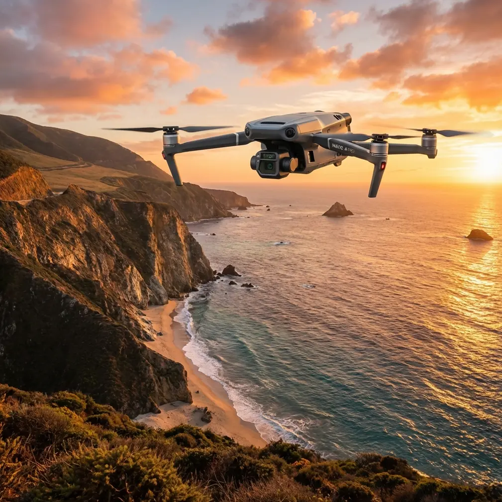
Capturing Windy Venues With the DJI Mavic 3T: A Technical Review From the Field
META: A technical review of the DJI Mavic 3T for capturing venues in windy conditions, covering thermal imaging, telephoto detail, O3 transmission, AES-256 security, photogrammetry workflow, and real-world field reliability.
Wind changes everything at a venue.
It changes how a drone holds a line over an open stadium approach. It changes how quickly a pilot can trust an orbit around a waterfront event site. It changes the margin for error when the job requires both visual documentation and fast situational awareness across a large footprint. That is exactly where the DJI Mavic 3T becomes interesting—not as a generic enterprise drone, but as a compact aircraft that solves a very particular problem: collecting usable aerial data when the site is exposed, dynamic, and too busy for wasted passes.
I have spent enough time around venues, temporary event infrastructure, and outdoor commercial sites to know that windy capture days tend to expose weaknesses fast. Position drift becomes obvious. Framing consistency breaks down. Transmission confidence matters more than spec-sheet bragging. The Mavic 3T earns its place because it combines a stable flight platform with a sensor package that is unusually practical for site documentation, safety checks, and pre-event visual assessment.
This is not a drone you choose only because it flies. You choose it because its payload mix lets one aircraft do several jobs on a windy venue day without turning the workflow into a juggling act.
Why the Mavic 3T Fits Wind-Exposed Venue Work
Venue capture is rarely just “get pretty aerials.” A real assignment often includes perimeter documentation, roofline and façade checks, thermal confirmation on mechanical zones, crowd-flow planning visuals before opening, and a clean set of reference images for operations teams. On a site with gusting air moving between structures, a pilot does not want to switch platforms for each of those tasks.
The Mavic 3T’s multi-sensor configuration is what gives it operational value here. Its thermal camera allows you to identify heat differences that a standard visible camera would miss, while the visual imaging system gives you the context needed to make those thermal observations meaningful. That combination matters when you are checking rooftop HVAC loads before an event, scanning concession infrastructure for abnormal heat patterns, or comparing shaded and sun-exposed zones around temporary structures.
The phrase “thermal signature” gets thrown around too loosely. In venue work, the point is not the phrase itself. The point is what that thermal information helps you decide. A warm electrical box on a service lane, heat accumulation on a roof section, or uneven temperature behavior near utility equipment can alter how a facility team prioritizes inspection. The Mavic 3T shortens that path from observation to action.
Then there is the telephoto capability. For venue exteriors, telephoto observation reduces the need to push the aircraft unnecessarily close to structures during gusty conditions. When wind is bouncing around corners and over roof edges, that extra stand-off distance is not a convenience. It is a better risk posture.
Wind Is a Workflow Problem, Not Just a Flight Problem
Pilots often talk about wind in terms of whether the aircraft can “handle it.” That is only half the story. The bigger question is whether the drone can hold enough consistency in flight to preserve the quality of the deliverable.
Photogrammetry is a good example. If you are building a venue model for planning, maintenance documentation, or site change tracking, repeatable image capture matters. Wind can disrupt overlap, alter aircraft attitude between passes, and increase the chance that your data set becomes harder to process cleanly. The Mavic 3T is not usually discussed first as a pure photogrammetry platform, but in practical site documentation it can still play a useful role when the mission demands more than a standard visual-only workflow.
If you are using GCPs, the discipline becomes even more important. Ground control points only improve the final output if your capture geometry stays consistent enough for the software to work with confidence. On an exposed venue, that means the aircraft’s ability to maintain track and the pilot’s ability to adapt route planning to wind direction actually affect the business value of the mission. A bad pass is not just a bad pass. It can mean a model that introduces doubt into measurement, planning, or reporting.
This is one of the reasons the Mavic 3T works well for commercial teams that need versatility more than lab-perfect specialization. It is compact enough to deploy quickly, but sophisticated enough to produce layered site intelligence from a single launch window.
The O3 Transmission Link Matters More Than Most Buyers Realize
People tend to fixate on sensors and forget the connection between pilot and aircraft. That is a mistake, especially at large venues.
The Mavic 3T’s O3 transmission system is one of the features that becomes more valuable the larger and more obstructed the site gets. Windy venues often include grandstands, temporary rigging, steel structures, broadcast compounds, roof parapets, and reflective surfaces that complicate signal confidence. A robust link is not just about maintaining video feed quality. It supports better decision-making when the pilot is dealing with fast-changing air movement and multiple areas of interest.
At a practical level, clear transmission means the pilot can verify edge detail on rooflines, inspect signage mounts, or judge whether a thermal anomaly is real or simply environmental noise. In venue capture, hesitation costs time. Reliable downlink reduces second-guessing.
There is also the matter of data security. Enterprise operations increasingly care how flight data and media are protected, especially when the site involves proprietary layouts, restricted infrastructure, or commercially sensitive event planning. AES-256 encryption is not a flashy field feature, but it is a meaningful one. If your team is documenting a private venue redevelopment, a logistics compound, or a high-profile commercial site, secure transmission and data handling are operationally relevant, not just compliance language.
A Wildlife Encounter That Proved the Sensor Stack Was Worth Having
One of the more revealing venue surveys I have seen involved an outdoor property on the edge of a wetland corridor. The mission was straightforward: capture the venue footprint, review roof sections, and document peripheral access roads before a seasonal event setup. Wind was steady, with stronger gusts sweeping across the open side of the site.
Mid-survey, a small deer moved out from the vegetation line and crossed near a service route behind the venue. That kind of moment reminds you why sensors and situational awareness matter beyond the planned shot list. The visible camera picked up movement first, but the thermal feed made it easier to maintain awareness as the animal moved through partial cover near fencing and shaded brush.
That was operationally significant for two reasons. First, it helped the crew avoid shifting launch-recovery activity toward the animal’s path. Second, it showed how thermal imaging can support safer site awareness in mixed-use environments where commercial property meets natural habitat. No drama. No inflated heroics. Just a better-informed crew making quieter, smarter decisions.
For venue managers working near parks, waterfront edges, golf properties, or semi-rural hospitality sites, that sort of unexpected variable is not rare. The Mavic 3T’s sensor combination helps keep the flight mission aligned with the realities on the ground.
Thermal Is Not Just for Search Tasks; It Has Real Venue Utility
Too many reviews treat thermal payloads as niche tools. In venue operations, they are often quietly useful.
Consider a large event complex before dawn. A visual camera can document parking layouts, staging zones, and access points. The thermal camera can add another layer by revealing heat concentration around electrical infrastructure, kitchen exhaust zones, rooftop equipment, and recently active vehicles in service areas. That does not replace an engineering inspection, but it helps teams target where closer review may be warranted.
The Mavic 3T becomes especially valuable when that thermal context needs to be gathered quickly across multiple structures or temporary installations. If a venue team wants a first-pass understanding of how power distribution, mechanical systems, or insulated structures are behaving, thermal imagery can reduce guesswork.
This is also where the aircraft’s portability matters. On a windy day, deployment speed counts. Venue conditions can change by the hour. A compact thermal-capable platform that can be airborne quickly gives operators a chance to work around weather windows rather than lose the day.
Battery Management and Time-on-Site Efficiency
Long venue days are often lost to small inefficiencies. Walking gear across a sprawling site. Rebuilding mission plans after conditions shift. Waiting on batteries to catch up. The Mavic 3T is at its best when teams treat it as a field efficiency tool rather than just an imaging device.
Hot-swap batteries are often discussed in broader enterprise drone conversations because they keep aircraft on task with minimal downtime. For venue operators, the concept is simple: preserve momentum. If the wind settles for a short period, the team needs to exploit that window immediately. Fast battery changes help maintain capture continuity, especially when multiple deliverables are being collected in one session.
That matters even more when documenting large entertainment grounds, race facilities, resorts, or exhibition campuses where a single battery cycle may only cover part of the site at the required detail level. A drone that supports disciplined turnarounds fits real operations better than one that looks impressive only in controlled conditions.
Where It Sits in Mapping and Inspection Workflows
The Mavic 3T is not trying to be every aircraft for every mission. That is exactly why it works.
For pure high-volume corridor mapping or highly specialized surveying, other platforms may take the lead. But for mixed commercial assignments—inspection, thermal review, visual documentation, and selective photogrammetry—it is unusually efficient. A venue operator or drone service provider can move from broad overhead context to thermal interpretation to telephoto detail without changing aircraft.
That efficiency compounds when teams are working with architects, facility managers, event planners, or insurers who all want different answers from the same site visit. One stakeholder wants a broad site overview. Another wants rooftop condition detail. Another wants heat-related anomalies flagged. The Mavic 3T lets a single mission satisfy all three more gracefully than a single-purpose payload would.
BVLOS often enters strategic discussions for large-site programs, especially when operators think about scaling repeated inspections across campuses or remote assets. In practice, any such operation depends on local rules, approvals, and organizational maturity. Still, the Mavic 3T’s connectivity, compact deployment profile, and enterprise feature set make it relevant to organizations building more advanced inspection programs over time, even if current venue capture remains within standard visual operating frameworks.
What Buyers Should Actually Pay Attention To
If you are evaluating the Mavic 3T for windy venue capture, ignore the temptation to reduce the decision to camera resolution alone. The better questions are operational.
Can the platform gather both visible and thermal intelligence in one deployment? Can it maintain pilot confidence over a large and obstructed venue footprint? Can it support secure handling of site-sensitive imagery? Can it reduce the need to bring multiple aircraft and multiple crews?
For many commercial teams, the answer is yes. That is where this aircraft proves itself.
A lot of buyers also underestimate the value of workflow support. If your operation needs help choosing the right field setup for venue surveys, thermal inspections, or mixed mapping jobs, it makes sense to speak with someone who understands deployment realities rather than just specifications. For direct field-oriented advice, you can reach out here: https://wa.me/85255379740
Final Assessment
The Mavic 3T is a strong technical fit for capturing venues in windy conditions because it solves practical field problems instead of chasing abstract ones. The O3 transmission link supports confident decision-making across large properties. AES-256 addresses real commercial concerns around sensitive site data. The thermal payload adds operational context that visual capture alone cannot provide. And when a site throws in variables—gusting wind, structural turbulence, wildlife movement near the perimeter, or the need to document several asset types in one flight—the aircraft remains useful rather than narrow.
That is the distinction that matters.
A venue job rarely rewards a drone for being impressive on paper. It rewards the platform that gets stable, actionable results when the site is awkward, the schedule is tight, and the conditions are less than ideal. The Mavic 3T is one of the few compact enterprise aircraft that consistently makes sense in that environment.
Ready for your own Mavic 3T? Contact our team for expert consultation.