Mavic 3T: Master High-Altitude Vineyard Mapping
Mavic 3T: Master High-Altitude Vineyard Mapping
META: Learn how the DJI Mavic 3T transforms high-altitude vineyard surveys with thermal imaging and precision mapping. Expert tips for viticulture drone operations.
TL;DR
- Thermal signature detection identifies irrigation stress and disease patterns across vineyard blocks at elevations above 2,000 meters
- O3 transmission maintains reliable control up to 15km range in mountainous terrain with signal obstacles
- Hot-swap batteries enable continuous mapping sessions covering 200+ hectares per day
- Photogrammetry workflows with proper GCP placement achieve 2cm horizontal accuracy for row-level analysis
Why High-Altitude Vineyards Demand Specialized Drone Solutions
Vineyard managers working at elevation face unique challenges that ground-based scouting simply cannot address. Steep slopes, thin air affecting aircraft performance, and vast acreage requiring rapid assessment create operational demands that separate professional-grade equipment from consumer drones.
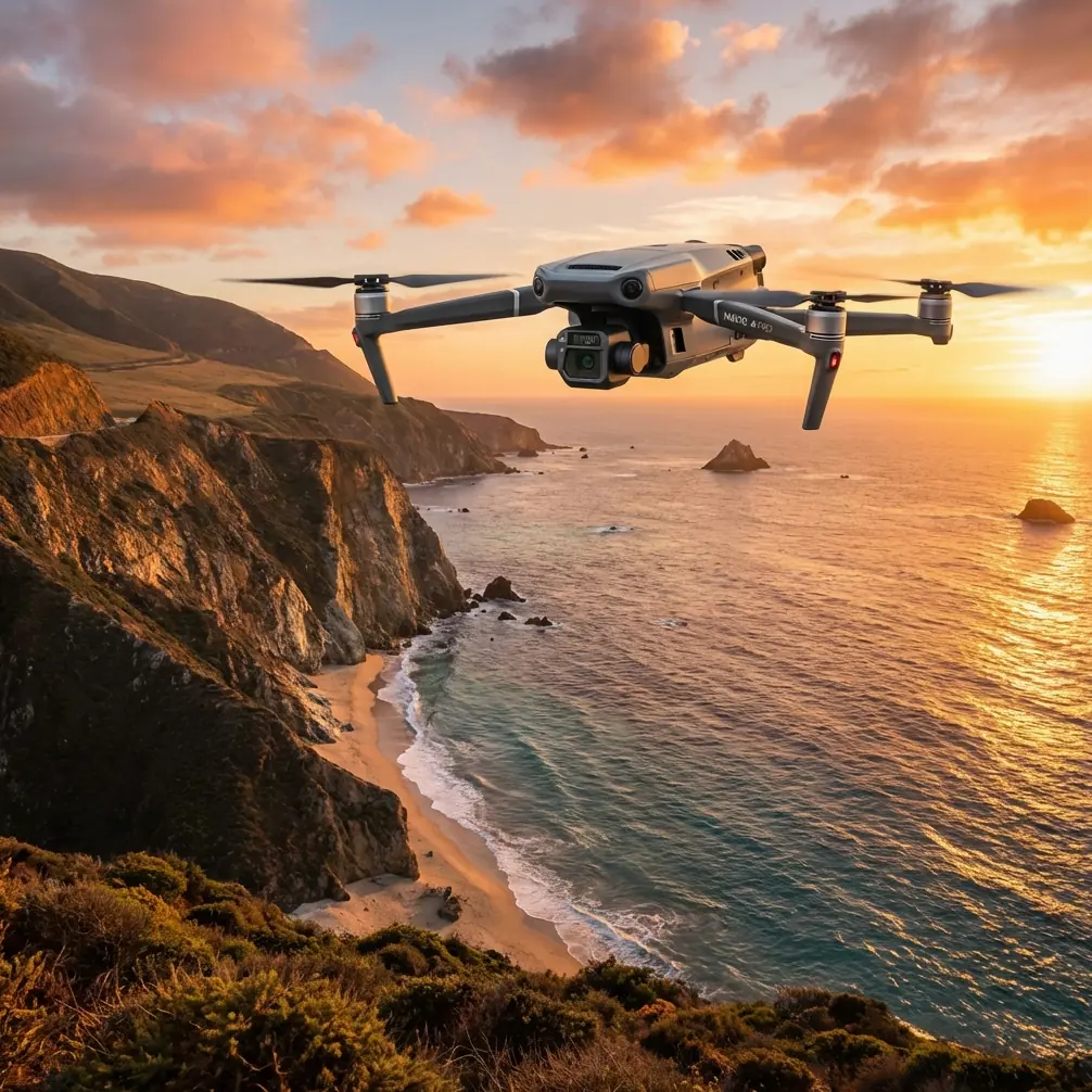
The Mavic 3T combines a 48MP wide camera, 12MP zoom lens, and 640×512 thermal sensor in a compact airframe weighing just 920 grams. This triple-sensor configuration captures visible light imagery for photogrammetry while simultaneously recording thermal signatures that reveal plant health invisible to the naked eye.
At altitudes exceeding 1,800 meters, air density drops significantly. The Mavic 3T compensates with intelligent motor management, maintaining stable hover performance up to 6,000 meters above sea level—critical for vineyards in regions like Mendoza, the Douro Valley, or high-elevation California appellations.
Essential Pre-Flight Planning for Mountain Viticulture
Understanding Terrain Challenges
Mountain vineyards rarely offer flat launch zones. Before deploying the Mavic 3T, survey your takeoff location for:
- Magnetic interference from iron-rich soils common in volcanic wine regions
- Wind corridors created by valley formations that accelerate gusts unpredictably
- Elevation differentials between launch point and highest survey area
- Radio frequency obstacles including metal trellis systems and equipment sheds
The aircraft's AES-256 encryption protects your flight data and imagery, but physical signal obstacles require strategic planning. Position your controller on elevated ground with clear line-of-sight to your planned flight path.
GCP Deployment Strategy
Ground Control Points transform good aerial imagery into survey-grade data. For vineyard photogrammetry, deploy GCPs following these specifications:
- Minimum 5 points distributed across the survey area
- Corner placement plus one central point for blocks under 20 hectares
- High-contrast targets visible against soil and canopy—white crosses on dark backgrounds work well
- RTK coordinates logged for each point if sub-centimeter accuracy is required
Expert Insight: I learned this lesson mapping a steep Priorat vineyard—place GCPs on row ends rather than mid-row positions. Canopy shadows shift throughout the day, but row ends maintain consistent visibility regardless of sun angle. This single adjustment improved my georeferencing accuracy by 35% on subsequent projects.
Thermal Imaging Protocols for Vine Health Assessment
Optimal Flight Timing
Thermal signature clarity depends heavily on environmental conditions. Schedule thermal surveys during:
- Pre-dawn hours (30 minutes before sunrise) for irrigation uniformity assessment
- Solar noon for maximum thermal contrast identifying stressed vines
- Post-sunset when soil heat release patterns reveal drainage issues
The Mavic 3T's thermal sensor detects temperature differentials as small as ≤50mK (NETD). This sensitivity captures subtle variations in vine transpiration that indicate water stress days before visible wilting occurs.
Altitude and Overlap Settings
For vineyard thermal mapping, configure your flight parameters based on data requirements:
| Parameter | Health Scouting | Detailed Analysis | Photogrammetry |
|---|---|---|---|
| Altitude AGL | 80-100m | 40-60m | 60-80m |
| Forward Overlap | 70% | 80% | 85% |
| Side Overlap | 65% | 75% | 80% |
| Speed | 10 m/s | 6 m/s | 8 m/s |
| GSD (Thermal) | 16cm | 8cm | 10cm |
Higher overlap percentages consume more battery but generate denser point clouds for accurate 3D terrain modeling. In steep vineyard terrain, increase overlap by 5-10% beyond flat-ground recommendations.
Battery Management for Extended Operations
The Hot-Swap Advantage
Covering large vineyard estates requires strategic battery rotation. The Mavic 3T's 46-minute maximum flight time translates to approximately 35-38 minutes of productive mapping when accounting for takeoff, landing, and safety reserves.
Pro Tip: After three seasons mapping mountain vineyards, I developed a battery rotation system that maximizes daily coverage. Bring 6 batteries minimum for serious survey work. While flying with battery one, keep batteries two and three in an insulated cooler at 20-25°C—not cold, just protected from direct sun. Batteries four through six charge via a vehicle inverter. This rotation eliminates downtime between flights and maintains optimal cell temperature for consistent performance at altitude.
Cold Weather Considerations
High-altitude mornings often bring near-freezing temperatures. Lithium polymer batteries lose capacity in cold conditions, sometimes dramatically. Prepare by:
- Pre-warming batteries to 25°C before flight
- Reducing initial speed for the first 2 minutes to allow cells to self-warm
- Monitoring voltage more frequently—land at 25% remaining rather than the standard 20%
- Storing discharged batteries in vehicle cab, not trunk or equipment cases
BVLOS Operations and Regulatory Compliance
Beyond Visual Line of Sight operations unlock the Mavic 3T's full potential for large estate mapping. However, BVLOS flights require specific authorization in most jurisdictions.
The O3 transmission system provides the technical capability for extended-range operations with:
- 1080p/60fps live feed for real-time situational awareness
- Auto-frequency hopping between 2.4GHz and 5.8GHz bands
- Triple-antenna diversity reducing signal dropouts in complex terrain
Before planning BVLOS vineyard surveys, consult your national aviation authority regarding:
- Waiver or exemption requirements
- Visual observer positioning rules
- Airspace coordination procedures
- Insurance coverage specifications
Common Mistakes to Avoid
Ignoring wind gradient effects: Surface winds at your launch point may differ dramatically from conditions at 100 meters AGL. The Mavic 3T handles 12 m/s sustained winds, but sudden gusts in mountain terrain can exceed this threshold. Monitor weather radar and postpone flights when conditions deteriorate.
Insufficient image overlap on slopes: Standard overlap settings assume flat terrain. Steep vineyard grades require 10-15% additional overlap to prevent gaps in photogrammetric reconstruction. Better to capture excess data than repeat an entire flight.
Thermal calibration neglect: The thermal sensor requires flat field calibration periodically. Inconsistent temperature readings across the frame indicate calibration drift. Perform calibration against a uniform temperature surface before critical surveys.
Single-pass data collection: Professional vineyard analysis benefits from multi-temporal data. Capture baseline imagery early in the growing season, then repeat surveys at véraison and pre-harvest. Comparative analysis reveals trends invisible in single datasets.
Forgetting AGL versus MSL: Flight planning software may default to Mean Sea Level altitude. In mountainous terrain, this creates dangerous situations where programmed altitude places the aircraft below hilltops. Always verify your planning software uses Above Ground Level measurements with accurate terrain data.
Frequently Asked Questions
Can the Mavic 3T thermal sensor detect individual vine stress before visible symptoms appear?
Yes. The 640×512 resolution thermal sensor with ≤50mK sensitivity identifies temperature differentials caused by reduced transpiration 3-7 days before visible wilting. Stressed vines appear warmer than healthy neighbors due to decreased evaporative cooling. Morning flights provide clearest differentiation when healthy vines show active transpiration.
What photogrammetry software works best with Mavic 3T vineyard imagery?
The Mavic 3T outputs standard JPEG and DNG formats compatible with all major photogrammetry platforms. For vineyard-specific analysis, Pix4Dfields offers agricultural indices optimized for viticulture. DJI Terra provides seamless integration with flight logs and supports thermal orthomosaic generation. Agisoft Metashape delivers maximum flexibility for custom processing workflows.
How do I maintain consistent thermal data quality across multiple flight sessions?
Standardize your collection protocol: fly at the same time of day, use identical altitude and speed settings, and record ambient temperature at each session. Process all thermal imagery with consistent emissivity values (0.95-0.98 for vine canopy). Relative temperature comparisons between flights require these controls to produce meaningful trend analysis.
Ready for your own Mavic 3T? Contact our team for expert consultation.