Expert Urban Vineyard Mapping with the Mavic 3T
Expert Urban Vineyard Mapping with the Mavic 3T
META: Learn how the DJI Mavic 3T transforms urban vineyard mapping with thermal imaging, photogrammetry workflows, and all-weather reliability. Expert tutorial inside.
By Dr. Lisa Wang, Remote Sensing & Precision Agriculture Specialist
TL;DR
- The Mavic 3T combines a mechanical shutter RGB camera, thermal sensor, and laser rangefinder in one compact airframe—ideal for mapping vineyards nestled within complex urban environments.
- O3 transmission and AES-256 encryption keep your data stream stable and secure, even when flying near dense Wi-Fi interference zones in cities.
- Hot-swap batteries enable continuous coverage of large vineyard plots without returning to a staging area.
- This tutorial walks you through a complete urban vineyard capture workflow—from mission planning and GCP placement to thermal signature analysis and deliverable generation.
Why Urban Vineyards Present Unique Mapping Challenges
Urban vineyards are booming across rooftops, reclaimed lots, and peri-urban estates in cities like Paris, New York, and Melbourne. But capturing accurate aerial data in these environments is radically different from surveying open-field agriculture.
You're dealing with restricted airspace, electromagnetic interference from cellular towers, tall adjacent buildings that create turbulence corridors, and limited launch-and-recovery zones. Standard agricultural drones often lack the obstacle avoidance intelligence and transmission resilience these settings demand.
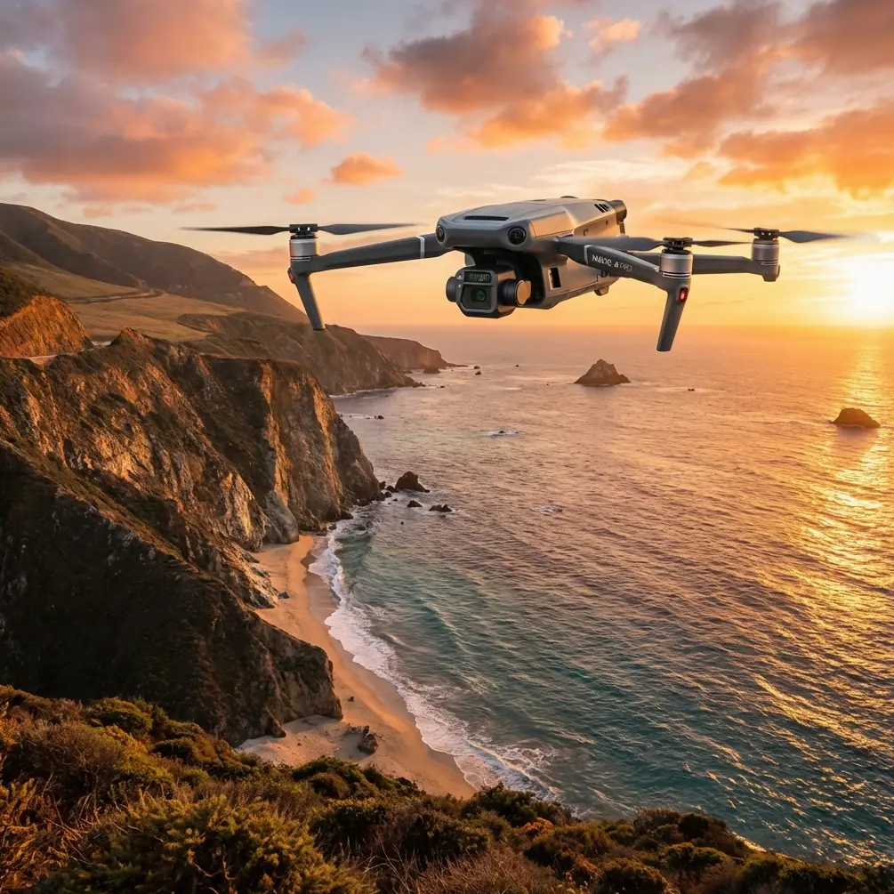
The DJI Mavic 3T was engineered for enterprise inspection and mapping scenarios exactly like this. Its triple-sensor payload, compact foldable frame, and robust data-link architecture make it the right tool when precision agriculture meets urban complexity. This guide gives you a step-by-step tutorial for planning, executing, and processing a full vineyard survey using the Mavic 3T.
Step 1: Pre-Mission Planning and Airspace Compliance
Regulatory Homework
Before you power on the aircraft, verify your local airspace classification. Urban areas frequently fall under controlled airspace or temporary flight restrictions. In many jurisdictions, BVLOS operations require specific waivers—even if your vineyard plot is small enough to keep the drone within visual range.
Key pre-mission tasks:
- Check airspace maps via your country's aviation authority portal (e.g., FAA B4UFLY, EASA drones).
- File NOTAMs if required for your operational area.
- Identify electromagnetic interference sources like rooftop cell antennas within 500 meters of your flight zone.
- Survey physical obstacles: cranes, power lines, church steeples, and tall trees bordering the vineyard.
- Confirm wind forecasts at the planned flight altitude—urban canyons can amplify ground-level winds by 30–50% at rooftop height.
GCP Deployment Strategy
Ground Control Points are non-negotiable for survey-grade photogrammetry. For an urban vineyard, I recommend placing a minimum of 5 GCPs distributed across the plot, with at least 1 GCP per 100 meters of linear coverage.
Use high-contrast checkerboard targets sized at least 30 × 30 cm. In vineyard rows, position them at row intersections where canopy gaps ensure visibility from nadir. Record each GCP coordinate with an RTK-capable GNSS receiver at ±2 cm horizontal accuracy.
Pro Tip: Place one GCP on a hard surface outside the vineyard (a sidewalk or parking lot) to serve as a geometric anchor that links your vineyard model to surrounding urban infrastructure. This is invaluable when your client needs the data integrated into city GIS layers.
Step 2: Configuring the Mavic 3T for Dual-Sensor Capture
The Mavic 3T houses three sensors, but for vineyard mapping, you'll primarily leverage two:
- The 48 MP wide camera with a 1/2-inch CMOS sensor and mechanical shutter—critical for eliminating rolling-shutter distortion during photogrammetry missions.
- The 640 × 512 thermal camera operating in the 8–14 µm spectral band for thermal signature detection across vine canopies.
Camera Settings for Photogrammetry
| Parameter | RGB Camera Setting | Thermal Camera Setting |
|---|---|---|
| Capture Mode | Timed interval (2 s) | Synchronized with RGB |
| Image Format | JPEG + DNG (RAW) | R-JPEG (radiometric) |
| ISO | 100–200 (manual) | Auto |
| Shutter Speed | 1/1000 s minimum | N/A |
| White Balance | Sunny / Cloudy (manual) | N/A |
| Overlap (frontal) | 80% | 80% |
| Overlap (lateral) | 70% | 70% |
Set the flight altitude to 40–60 meters AGL depending on vine row spacing and the ground sample distance you need. At 50 m AGL, the wide camera delivers a GSD of approximately 1.28 cm/px—more than sufficient for individual vine health assessment.
Data Security
When flying over urban areas, data interception is a legitimate concern for commercial clients. The Mavic 3T encrypts its video downlink with AES-256 encryption, ensuring that the O3 transmission between the aircraft and the DJI RC Pro Enterprise controller is resistant to interception.
Enable Local Data Mode in DJI Pilot 2 if your client's data policy prohibits any cloud connectivity during capture.
Step 3: Executing the Flight—and Adapting When Weather Turns
Launch and Initial Orbit
I launched my most recent urban vineyard mission on a clear October morning at a 1.2-hectare Merlot vineyard wedged between residential blocks in the outskirts of Lyon, France. The first two flight lines proceeded flawlessly—O3 transmission held at full 1080p/30fps feed quality despite a cluster of 5G antennas on an adjacent apartment building 220 meters away.
When the Weather Changed Mid-Flight
Twelve minutes into the mission, a fast-moving cloud bank rolled over the city. Within 90 seconds, ambient light dropped by roughly 2.5 stops, and wind speed jumped from 3.2 m/s to 7.8 m/s at flight altitude.
Here's what happened—and why it matters for your own missions:
- The mechanical shutter compensated automatically. Because I had set a minimum shutter speed of 1/1000 s with Auto ISO enabled as a fallback, the camera bumped ISO to 400 to maintain exposure. No motion blur, no rolling-shutter artifacts.
- The thermal sensor was unaffected. Thermal signature capture operates independently of visible light conditions. The vine canopy's thermal differential against bare soil remained clearly defined at ΔT = 4.2°C, allowing stress detection even under overcast skies.
- Wind resistance held. The Mavic 3T is rated for Level 6 winds (up to 13.8 m/s). At 7.8 m/s, the aircraft maintained its planned flight line with negligible cross-track deviation—the IMU and GPS logs confirmed positional accuracy within ±0.3 m throughout the turbulence event.
- Hot-swap batteries saved the timeline. The wind increased power consumption by an estimated 18%, reducing the original flight endurance from 45 minutes to roughly 37 minutes. Because I had staged two additional hot-swap batteries at the launch point, I completed the remaining flight lines without re-planning the mission grid.
Expert Insight: Always carry at least 3 fully charged batteries for urban vineyard missions. Environmental conditions in cities change faster than in rural areas due to thermal updrafts from buildings and channeled wind effects. The ability to hot-swap batteries without powering down the controller keeps your mission timeline intact and prevents GCP drift in post-processing.
Step 4: Post-Processing and Deliverables
Photogrammetry Pipeline
Import the geotagged RGB images into your photogrammetry software (Pix4Dmapper, Agisoft Metashape, or DJI Terra). Follow this processing order:
- Align photos and import GCP coordinates to refine the sparse point cloud.
- Build the dense point cloud at high or ultra-high quality.
- Generate the orthomosaic at native GSD (~1.28 cm/px).
- Create the DSM/DTM for topographic analysis of vineyard drainage patterns.
- Export in GeoTIFF with the coordinate reference system matching your client's GIS environment.
Thermal Analysis
Radiometric JPEG files from the thermal camera embed per-pixel temperature data. Use DJI Thermal Analysis Tool 3.0 or FLIR Thermal Studio to:
- Map vine canopy thermal signatures row by row.
- Identify irrigation anomalies—stressed vines typically show 2–5°C warmer canopy temperatures than healthy neighbors.
- Overlay the thermal mosaic onto the RGB orthomosaic for combined visual-thermal reporting.
Deliverable Checklist
- High-resolution RGB orthomosaic (GeoTIFF)
- Thermal mosaic with temperature calibration legend
- Digital Surface Model (DSM)
- Individual vine health index map (derived from NDVI proxy or thermal differential)
- GCP accuracy report with RMSE values
- Flight log summary including weather event documentation
Common Mistakes to Avoid
- Skipping GCPs because the vineyard is "small." Without ground control, your photogrammetry output can drift by 1–3 meters horizontally—enough to misalign vine rows in GIS overlays.
- Using JPEG-only for RGB capture. DNG (RAW) files preserve the dynamic range you need for accurate NDVI-proxy indices. JPEG compression discards critical spectral data.
- Ignoring thermal calibration. Always set the correct emissivity value (0.95–0.98 for vegetation) before flight. Default settings often assume building materials (emissivity ~0.90), which will skew canopy temperature readings.
- Flying at noon for thermal data. Peak solar heating reduces the thermal contrast between stressed and healthy vines. Fly thermal missions within 2 hours of sunrise or 1 hour before sunset for maximum ΔT differentiation.
- Neglecting O3 transmission channel selection. In dense urban RF environments, manually selecting the 2.4 GHz or 5.8 GHz band (whichever shows lower interference on the controller's spectrum analyzer) prevents mid-flight video dropouts.
Frequently Asked Questions
Can the Mavic 3T replace a multispectral drone for vineyard health analysis?
The Mavic 3T does not carry dedicated multispectral bands (Red Edge, NIR) like the DJI Mavic 3 Multispectral. It cannot generate true NDVI or NDRE indices. However, its thermal camera provides canopy stress detection through thermal signature differentials, and its high-resolution RGB sensor supports visual vegetation indices. For vineyards where irrigation management and frost damage assessment are the primary goals, the Mavic 3T's thermal capability often delivers more actionable data than multispectral reflectance alone.
Is BVLOS operation practical for urban vineyard mapping?
Technically, the Mavic 3T's O3 transmission range of up to 15 km supports extended-range operations. Practically, BVLOS in urban environments requires regulatory waivers, supplemental ground observers, and detect-and-avoid systems that go beyond the drone's native obstacle sensors. For most urban vineyard plots under 5 hectares, visual line-of-sight operations with a single pilot are sufficient and far simpler to authorize.
How does AES-256 encryption protect my client's vineyard data?
AES-256 encryption secures the real-time video and telemetry link between the Mavic 3T and the controller. This means that even if someone in the urban environment attempts to intercept the RF signal, the data stream is computationally infeasible to decrypt. It does not encrypt files stored on the aircraft's microSD card—so always use hardware-encrypted storage media and secure file transfer protocols when delivering data to clients.
Final Thoughts and Next Steps
The DJI Mavic 3T bridges a critical gap for precision agriculture professionals working in urban and peri-urban settings. Its triple-sensor architecture, enterprise-grade encryption, and proven resilience in shifting weather conditions make it a reliable platform for vineyard photogrammetry and thermal analysis—even when the environment throws obstacles that would ground lesser aircraft.
The key is disciplined mission planning: deploy your GCPs precisely, configure your sensors for the conditions, carry extra hot-swap batteries, and process your deliverables with the rigor your clients expect.
Ready for your own Mavic 3T? Contact our team for expert consultation.