Field Report: Capturing Vineyards in Complex Terrain
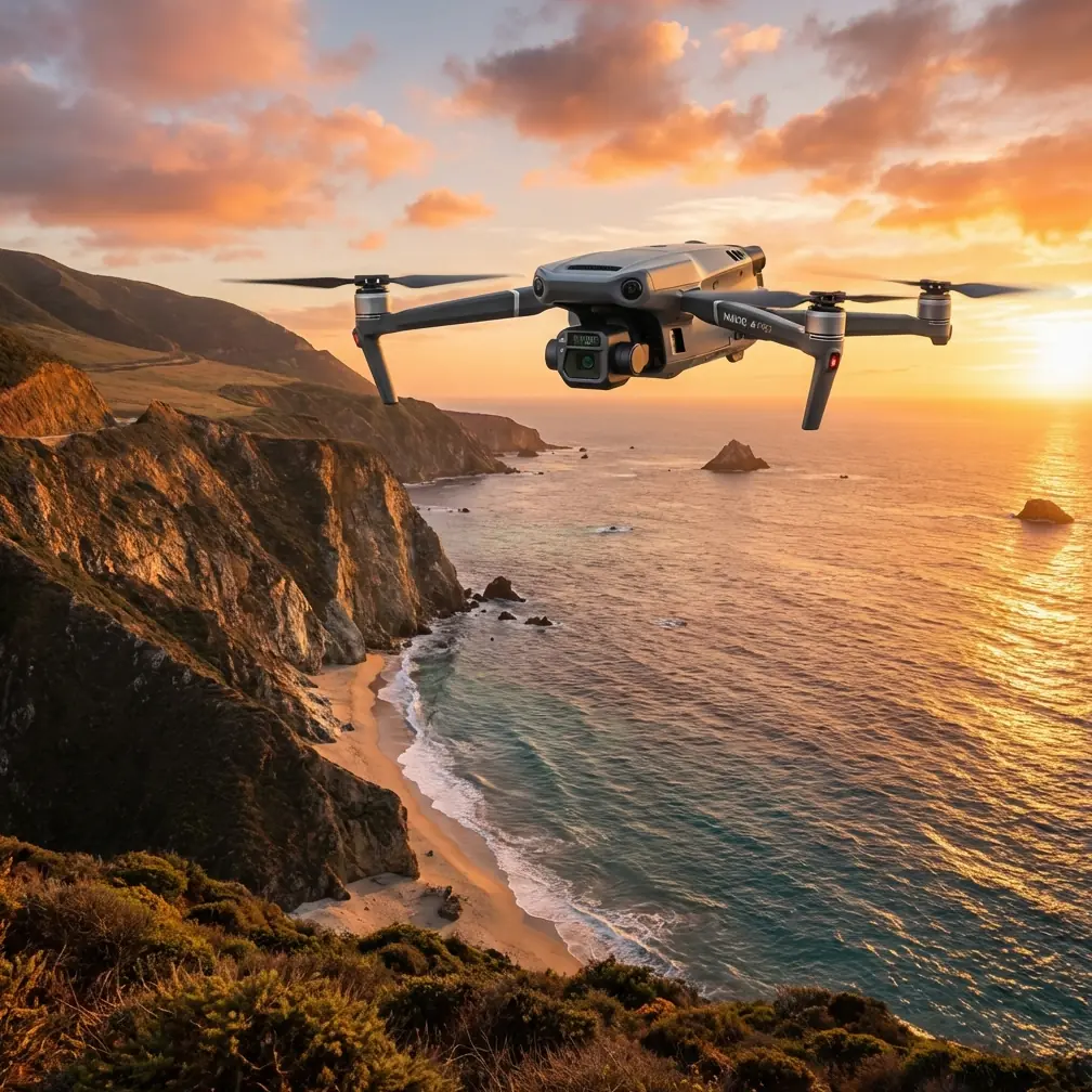
Field Report: Capturing Vineyards in Complex Terrain with the Mavic 3T
META: A practical field report on using the DJI Mavic 3T for vineyard imaging in steep, uneven terrain, covering thermal signature work, photogrammetry limits, O3 transmission, RTK workflow, GCP strategy, and real operational gains.
By Dr. Lisa Wang, Specialist
Vineyards look orderly from the road. In the air, especially in broken terrain, they rarely are.
Rows bend around slope changes. Trellis height varies. Morning shadows linger in one block and disappear in the next. Access roads cut through parcels at odd angles, and the same irrigation issue can present very differently on a ridge versus a hollow. That is why the Mavic 3T deserves a more specific conversation than the usual “good drone for agriculture” shorthand. In vineyard work, and particularly in complex terrain, its value comes from the way several systems interact under pressure: thermal sensing, a stabilized zoom workflow, dependable transmission, and practical field deployment.
This report is based on how the Mavic 3T fits real vineyard capture tasks rather than spec-sheet admiration. The short version: it is not a perfect photogrammetry platform in the strict mapping sense, but it can be extremely effective for vineyard scouting, thermal anomaly detection, targeted inspection, and decision support when the terrain itself is the main complication.
Why complex vineyard terrain changes the drone equation
Flat farmland rewards repeatability. Vineyards on hillsides reward adaptability.
In stepped or sloped parcels, image collection is affected by three things at once: changing stand-off distance to canopy, shifting sun angle across rows, and inconsistent line-of-sight to the aircraft. This is where the Mavic 3T’s combination of visual and thermal payloads matters. Instead of flying one mission for visible imagery and returning later with another platform to investigate stress or irrigation irregularities, crews can often identify the problem block in one sortie and then tighten the inspection immediately.
That saves time, but more than that, it preserves context. A thermal signature only means something when you can relate it to row structure, drainage, road access, vine vigor, and exact location on the slope. The Mavic 3T is useful because it allows the operator to move between those layers quickly.
The payload mix that matters in vineyards
The Mavic 3T is built around a three-camera concept that is especially relevant for viticulture: a wide camera for general situational capture, a tele camera for stand-off inspection, and a thermal camera for heat-pattern analysis.
In vineyards, that mix changes how teams work. The wide camera gives you the spatial story. You can see row geometry, access paths, missing plants, erosion features, and edge effects near roads or tree lines. The tele camera then lets you inspect details from a safer and more stable position, which is valuable on steep slopes where flying low and close to trellis lines adds unnecessary risk. The thermal sensor brings a different layer altogether: not pretty imagery, but actionable contrast.
For example, irrigation irregularities often appear first as thermal inconsistency before obvious visual canopy decline. Likewise, blocked emitters, uneven soil moisture retention, and localized stress zones can create patterns that are easier to spot thermally during the right environmental window. In a complex vineyard, that is a major operational advantage because walking every suspect block on foot is slow and often misleading when elevation and aspect are changing the picture every few meters.
Thermal signature is useful, but only if you respect timing
This is where many operators make bad assumptions.
A thermal signature in a vineyard is not a diagnosis on its own. It is a clue. If you fly too late in the day, solar loading can flatten meaningful contrast or create false hotspots on soil, rocks, road edges, or infrastructure. If you fly too early, dew and overnight cooling patterns may overemphasize some zones. The Mavic 3T makes thermal capture easy enough that some users forget interpretation is still the hard part.
In practice, I’ve found the best vineyard thermal work with the Mavic 3T comes when missions are tied to a specific question. Are you trying to identify irrigation non-uniformity? Check post-maintenance valve performance? Spot drainage accumulation after a weather event? Compare vigor expression between blocks with different rootstocks? The answer should dictate timing, altitude, and overlap strategy.
That matters because the Mavic 3T is strongest as a rapid thermal reconnaissance tool. It helps you narrow the search area quickly. Once a suspect thermal pattern is found, the visual and zoom cameras help confirm whether the anomaly tracks with canopy condition, bare soil exposure, damaged lines, vehicle compaction, or some other physical cause.
O3 transmission is more than a comfort feature on a hillside
Many pilots talk about transmission only when discussing maximum range. That misses the real vineyard issue.
On uneven terrain, the signal link is constantly challenged by ridgelines, tree stands, outbuildings, and the geometry of the slope itself. DJI’s O3 transmission system is useful here not because it invites long-distance flying, but because it supports confident positioning and image review when the aircraft is working across fragmented topography. In a vineyard with terraced sections or separated parcels, stable live video makes route adjustments faster and reduces hesitation during inspection passes.
That has a direct quality impact. If the operator can clearly assess row alignment, thermal contrast, and scene composition in real time, fewer re-flights are needed. In commercial vineyard work, avoiding repeat flights is not just about battery economy. It is about preserving comparable conditions. The light and thermal environment can change enough within a short period that a second mission is no longer equivalent to the first.
Where the Mavic 3T fits in photogrammetry, and where it does not
The Mavic 3T can contribute to spatial documentation, but vineyard managers and consultants should be realistic. If the mission is strict survey-grade photogrammetry for engineering deliverables, as-built terrain modeling, or highly controlled orthomosaics, a dedicated mapping platform may still be the better choice.
That said, the Mavic 3T remains very useful for practical block-level documentation. It can produce excellent visual records for planning drainage corrections, documenting erosion channels, tracking canopy development patterns, and guiding field teams to exact problem areas. In this role, photogrammetry is less about perfection and more about operational clarity.
If you do need stronger positional confidence, ground control points matter. GCP placement in vineyards is often harder than people expect because rows, shadows, and slope transitions can make them less visible from the air. On complex terrain, I prefer fewer but more strategically placed GCPs with clear contrast near elevation breaks, access intersections, and block boundaries rather than a purely uniform distribution. Their job is not just to support processing; they help anchor interpretation in places where terrain changes are driving the agronomic story.
For teams using the RTK version of the platform ecosystem or integrating corrected outputs into broader farm GIS workflows, that extra discipline pays off. It reduces ambiguity when comparing thermal anomalies against irrigation zones, soil maps, and historical yield patterns.
AES-256 matters when vineyard data is commercially sensitive
Not every farm talks openly about data security, but serious operators should.
The Mavic 3T platform supports AES-256 encryption, and that is operationally relevant in premium agriculture. Vineyard imagery can reveal varietal layouts, infrastructure investments, water management practices, disease pressure indicators, and harvest-readiness patterns. For estate vineyards, contract growers, and consulting agronomists, those details are commercially sensitive. Encryption is not a marketing detail. It is part of a professional data-handling posture.
This matters even more when flights are conducted by external service providers. If you are capturing data over high-value parcels and sharing outputs among owners, managers, agronomists, and irrigation consultants, secure handling should be treated as normal procedure, not a luxury.
Battery workflow becomes a real issue faster than most expect
The phrase “hot-swap batteries” gets used loosely around field operations, but the Mavic 3T conversation benefits from accuracy. The aircraft itself does not continue flying while batteries are exchanged, of course. What matters is whether your field workflow allows rapid turnaround between sorties with minimal delay.
In vineyards spread across steep terrain, battery management is often what decides whether the day feels efficient or fragmented. You launch for one block, identify an anomaly, reposition to another parcel, then return for a lower-altitude confirmation pass. If charging, storage, and swap discipline are sloppy, the rhythm collapses.
On one recent vineyard deployment, the single biggest improvement came from a third-party landing pad and gear organizer rather than from the aircraft itself. A rigid, high-visibility pad kept dust and plant debris out of the takeoff area, while a structured battery caddy reduced handling mistakes during repeated field moves. It sounds minor. It was not. In sloped, dusty vineyard access points, small workflow refinements can preserve both safety and tempo.
A practical vineyard capture workflow with the Mavic 3T
For complex terrain, I recommend dividing the mission into three layers rather than trying to solve everything in one automated pass.
1. Broad visual recon
Use the wide camera to establish terrain context, row orientation, water pathways, and access conditions. This is the phase where you identify shadow-heavy blocks, steep transitions, and sections where line-of-sight may become awkward.
2. Thermal pass tied to a specific agronomic question
Do not collect thermal data simply because the sensor is there. Fly with a hypothesis. Irrigation concern, stress comparison, drainage issue, post-repair validation—pick one. Thermal is most useful when it is narrowing decisions.
3. Tele confirmation
Once a block or zone is flagged, use the zoom capability to inspect from a measured position. This is where you often separate true canopy stress from confounding factors like exposed soil, maintenance activity, tractor tracks, or missing vines.
This layered method is especially effective in terrain where walking the whole site would consume the day and still fail to preserve the same perspective across blocks.
What about BVLOS?
BVLOS is often mentioned whenever transmission and large agricultural sites come up. In vineyard operations, though, the first priority is not capability in theory but compliance in practice. The Mavic 3T can support efficient coverage over sprawling estates, yet actual beyond visual line of sight operations depend on local regulations, approvals, risk management, and the operating environment. In broken vineyard terrain, legal and procedural discipline matters more than ambition. Most teams will get better results by planning segmented flights intelligently than by stretching operational limits.
A note on interpretation: the drone does not replace field expertise
The best Mavic 3T vineyard work happens when drone capture is treated as a decision accelerator, not a substitute for agronomy.
Thermal anomalies still need field verification. Visual canopy patterns still need context from irrigation history, recent weather, cultivar behavior, soil variability, and management actions. The aircraft helps you see where to look and what changed. It does not explain everything by itself.
That is why I favor using the Mavic 3T as a bridge tool. It connects management questions to field action. You can fly in the morning, identify a suspicious cool or warm zone, walk directly to the right rows, inspect emitters or soil condition, and make a decision before the day drifts away. In vineyards with complex terrain, that speed has real value.
The strongest use case for the Mavic 3T in vineyards
If I had to define its sweet spot in one sentence, it would be this: the Mavic 3T is at its best when a vineyard team needs fast, terrain-aware situational intelligence that blends thermal clues with visible confirmation.
That is different from saying it is the best tool for every kind of agricultural mapping. It is not. But for hillside estates, fragmented parcels, irrigation troubleshooting, drainage assessment, block comparison, and targeted canopy inspection, it offers a very efficient package.
The details that matter most are not glamorous. O3 transmission helps maintain confidence across uneven topography. AES-256 supports responsible handling of commercially sensitive imagery. A disciplined GCP approach improves spatial usefulness when documentation needs to feed into mapping workflows. And thermal capture, when timed correctly, can reveal patterns that row-walk scouting would miss or discover too late.
If your vineyard team is trying to work smarter in steep, visually deceptive terrain, that combination is hard to ignore.
If you want to compare setup options or discuss a vineyard-specific workflow, you can reach the team directly on WhatsApp here.
Ready for your own Mavic 3T? Contact our team for expert consultation.