Mavic 3T in Remote Wildlife Work: A Field Report on Thermal
Mavic 3T in Remote Wildlife Work: A Field Report on Thermal Signatures, EMI, and Flight Discipline
META: A field-based expert article on using the DJI Mavic 3T for remote wildlife capture, covering thermal signature reading, antenna adjustment under electromagnetic interference, O3 transmission, AES-256 security, battery strategy, and practical mapping workflow.
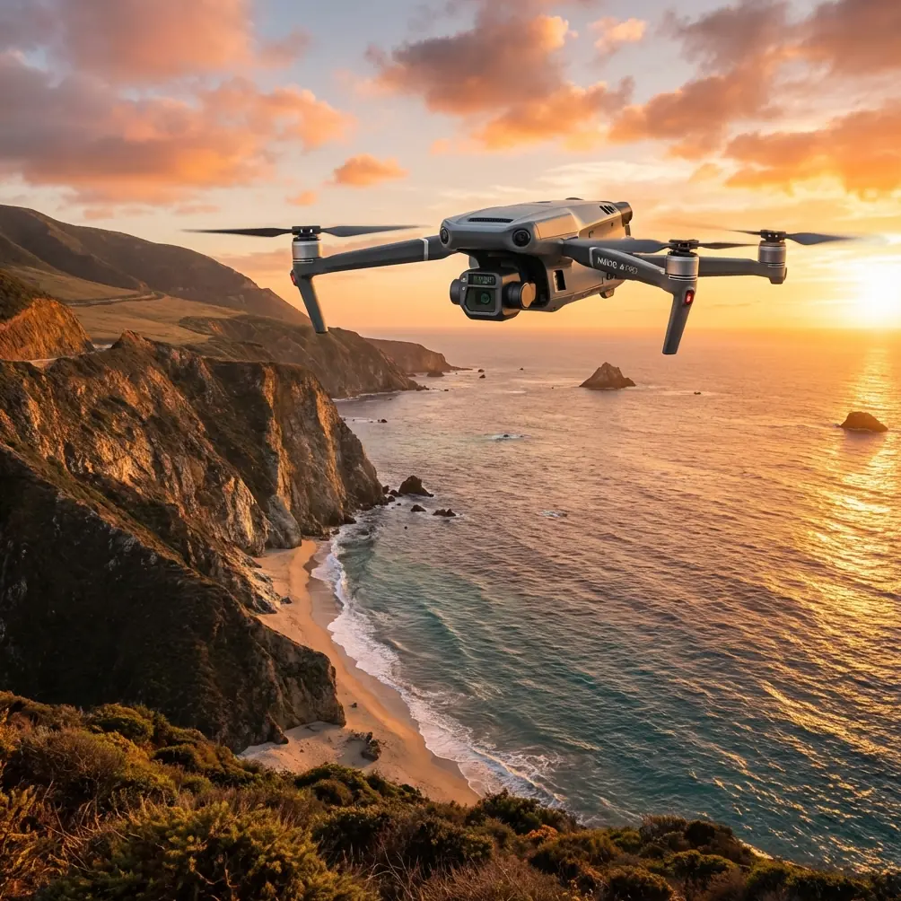
Remote wildlife work punishes weak equipment and even weaker planning. The Mavic 3T earns its place not because it is flashy, but because it solves a very specific field problem: how to document animals and habitat in places where visibility changes fast, access is poor, and every extra minute in the air needs to produce usable data.
I have used the Mavic 3T in the kind of terrain that exposes shortcuts. Wet valleys at first light. Dry ridgelines with patchy signal conditions. Forest edges where heat hangs in pockets and confuses less disciplined operators. In those conditions, a spec sheet means little on its own. What matters is how the aircraft behaves when the mission is wildlife observation first, image integrity second, and pilot workload always in the background.
The Mavic 3T is especially relevant here because it combines thermal imaging with a compact airframe and DJI’s O3 transmission system. That combination changes how remote wildlife capture can be done. You are not carrying a large platform into difficult terrain, yet you still gain the ability to separate an animal from the landscape by thermal signature rather than by color, contrast, or luck. That matters most at dawn, dusk, in broken canopy, and along water margins where animals may be visually hidden but still thermally distinct.
Why the thermal payload changes the job
In wildlife capture, the word “capture” should mean recording, identifying, and documenting, not disturbing. Thermal imaging helps reduce pressure on the animal because the pilot does not have to descend aggressively or circle repeatedly just to confirm presence. A clear thermal signature often gives you the answer from a safer stand-off position.
This is where the Mavic 3T becomes more than a camera drone. It becomes a decision tool.
A deer bedded near scrub can disappear in visible imagery, especially when the light is flat and the coat matches the ground. On thermal, the body shape often resolves first. A bird colony on a cool shoreline may present as a cluster of warmer points before any plumage or nesting detail appears in the visual feed. In remote work, that first thermal cue tells the operator whether to continue a pass, widen the search box, or leave the area undisturbed.
Thermal also sharpens habitat interpretation. You are not just seeing animals. You are seeing heat relationships across terrain. Sun-exposed rocks, shallow water edges, vehicle tracks, and tree shadows all affect the scene. That context matters because thermal imagery can mislead operators who assume every hot spot is biological. The Mavic 3T rewards patience here. You learn to read heat behavior, not just heat presence.
A practical example: in one upland survey pattern, several warm points appeared along a broken slope. At first glance, they suggested animal movement. A slower orbit and a second pass showed the pattern was static and tied to exposed stones that had retained heat after sunrise. Two hundred meters farther downslope, one smaller signature shifted position between frames. That movement, not the heat alone, made it the valid target. Thermal signature interpretation is a discipline. The aircraft gives you the view, but not the judgment.
The hidden challenge in remote areas: electromagnetic interference
People often assume remote wildlife zones are signal-clean by default. Not always. Electromagnetic interference can show up in surprising places: relay towers on ridgelines, buried utility corridors near access roads, weather stations, research equipment, even your own field vehicle and portable electronics clustered too close to takeoff.
This is where handling antenna position properly matters more than most operators admit.
The Mavic 3T benefits from O3 transmission, which is a meaningful operational detail, not a marketing footnote. In wildlife work, stable transmission preserves confidence during long visual sweeps, edge-of-range observation, and low-contrast thermal scanning. If the live feed drops in quality during an identification pass, the mission becomes guesswork. O3 helps hold the link, but link quality still depends on pilot technique.
When I encounter interference, I do not begin by blaming the environment. I start with geometry. Antenna adjustment is often the simplest correction with the biggest return. Many pilots point antennas directly at the aircraft, which is not ideal. The broad side of the antenna pattern should face the drone. In the field, that means subtly changing controller orientation as the aircraft moves across the survey area rather than locking your hands in one position and hoping the signal solves itself.
In hilly terrain, I also watch for self-induced shadowing. If the drone drops behind a ridge line or dense vegetation, no transmission protocol can fully defeat bad line-of-sight. The answer is not to push farther. It is to reposition. Sometimes five steps left on a rocky outcrop restores a stable feed. Sometimes the correct move is to relocate the home point entirely before relaunching.
For wildlife operators, this has direct significance. Signal discipline reduces repeated passes. Fewer repeat passes mean less disturbance. Better link stability also improves thermal interpretation because small movements, edge definition, and posture changes are easier to see in a consistent feed than in a compressed or stuttering one.
Security matters more in environmental data than many teams realize
Another field-relevant detail is AES-256 transmission security. That may sound abstract if your only concern is flying and filming, but it has real operational value for conservation teams, ecological consultants, and land managers. Sensitive wildlife locations, nesting sites, migration stopovers, and habitat surveys often should not circulate freely.
AES-256 matters because remote work increasingly involves shared teams, mobile operations, and data movement between field units and office analysts. Protecting transmission is part of protecting the dataset. For some projects, the risk is not theft of equipment. It is unauthorized exposure of ecologically sensitive coordinates or imagery. The Mavic 3T fits well into that workflow because secure transmission is already part of the platform’s architecture rather than an afterthought bolted on later.
Battery strategy in places that are hard to reach
Remote wildlife operations are rarely one-battery events. You may hike to launch points, wait for light, hold for animal activity, then need several short flights rather than one long mission. That changes how you think about power.
The phrase “hot-swap batteries” gets used loosely across the industry, but the practical issue is turnaround speed. In remote conditions, smooth battery changes preserve the morning window when thermal contrast is strongest. They also reduce rushed handling, which is when pilots drop packs, mis-seat connections, or relaunch without recalibrating their situational awareness.
With the Mavic 3T, disciplined battery rotation matters more than squeezing every final percent from a flight. Wildlife teams should build missions around reserve margins, not optimistic endurance estimates. Thermal observations often produce “one more pass” temptation. Resist it. The best data usually comes from the pass you planned, not the pass you force after your margin is gone.
I keep a simple field rule: if the aircraft is capturing a critical thermal sequence over difficult terrain, I want enough reserve to return, hover briefly for a stable recovery approach, and still absorb a wind shift. In remote valleys, wind can feel irrelevant at launch and become very relevant over the landing zone twenty minutes later.
Photogrammetry and wildlife work are not separate worlds
A lot of operators think of the Mavic 3T only as a search or observation aircraft. That is too narrow. In remote wildlife projects, photogrammetry can provide the environmental layer that makes thermal findings useful over time.
If you are documenting denning zones, water access routes, erosion around habitat, or seasonal vegetation change, a structured visible-light mapping pass can complement thermal observations. Ground control points, or GCPs, become especially valuable if the project will compare habitat conditions across months or feed into conservation planning. The thermal image tells you where heat was. The mapped model tells you what the landscape was doing around that event.
This is not a call to force every wildlife flight into a full mapping mission. It is a reminder that one of the Mavic 3T’s strengths is flexibility. A team can conduct thermal reconnaissance at low-disturbance stand-off range, then return later for a carefully planned photogrammetry pass with GCP support where regulations, terrain, and project scope allow. The result is stronger interpretation and better repeatability.
Operationally, this matters because wildlife findings without spatial context can be hard to defend. A thermal sighting is helpful. A thermal sighting tied to repeatable mapped terrain features is evidence.
BVLOS talk needs restraint and realism
BVLOS is one of those terms that attracts attention quickly. In remote wildlife corridors, people mention it because the landscape is large and animal movement does not stop at the edge of visual line of sight. Still, good field practice starts with what is legally permitted, operationally justified, and safely supportable.
The reason BVLOS appears in serious Mavic 3T discussions is simple: some conservation and environmental workflows are spread over terrain that makes continuous direct observation difficult. But the aircraft’s utility should not be framed around pushing farther just because the link can support it. O3 transmission and compact deployment are valuable even within conservative operating envelopes. In remote wildlife work, mission design should favor launch point selection, overlapping observation zones, and carefully staged relocation over unnecessary extension.
That approach protects both the operation and the habitat.
Reading the scene, not just the screen
The strongest Mavic 3T operators in wildlife environments are not the ones who stare hardest at the monitor. They are the ones who connect what they see in the feed with what the terrain is likely doing.
A thermal signature along a river margin at sunrise behaves differently from one on an exposed hillside at noon. Animals under sparse canopy may appear and vanish as leaves, branches, and viewing angle alter the image. Moist ground can flatten contrast. Rock can hold heat longer than expected. Water often complicates detection near the edge where reflections and temperature shifts create visual ambiguity.
This is why field notes still matter. I log ambient conditions, time, wind behavior, cloud cover, and sun angle for every meaningful wildlife detection. The Mavic 3T gives the image. The notes explain the image later, when someone asks whether a target was likely an animal, an environmental artifact, or an uncertain contact that should not be overinterpreted.
A compact aircraft, if flown with discipline, is often the right aircraft
The Mavic 3T is not valuable because it tries to be everything. It is valuable because it covers a surprising amount of professional ground in a manageable package. For remote wildlife capture, that matters. You can carry it farther, set up faster, and work from difficult access points without building the entire day around transport logistics.
That compactness also changes team behavior. Smaller aircraft tend to encourage more frequent deployment, which can be a strength or a weakness. Used carelessly, that leads to unnecessary flights. Used well, it allows brief, targeted sorties timed around animal movement and light conditions rather than long, intrusive operations.
If your work involves documenting wildlife in remote places, the Mavic 3T is at its best when treated as a precise instrument rather than a general-purpose flying camera. Use thermal to reduce guesswork. Use O3 transmission intelligently, with active antenna adjustment whenever interference or terrain geometry starts to degrade the link. Respect the role of AES-256 when your imagery includes sensitive ecological information. Build battery strategy around return margin, not ambition. And when the mission expands beyond observation, support findings with structured photogrammetry and GCP-backed mapping where appropriate.
That is the real story of this aircraft in the field. Not hype. Not shorthand. Just a tool that becomes exceptionally useful when the operator understands what each technical detail means on a cold hillside, over a reed bed, or at the edge of forest where the animal is not visible yet, but the heat already gives it away.
If you want to compare notes on remote wildlife workflows or antenna setup under difficult signal conditions, you can message our field team here.
Ready for your own Mavic 3T? Contact our team for expert consultation.