Delivering Coastlines With the Mavic 3T in Extreme Temperatu
Delivering Coastlines With the Mavic 3T in Extreme Temperatures: A Field Report From the Edge
META: A field report on using the Mavic 3T for coastline operations in extreme temperatures, with practical insights on reliability planning, long-flight hardware checks, antenna positioning, thermal work, and maintenance-critical details.
The Mavic 3T is often discussed as a compact thermal aircraft. That description is accurate, but it misses the point for crews working coastlines in punishing weather. On a shoreline job, especially when temperatures swing hard and salt exposure never lets up, the aircraft stops being a spec sheet and starts becoming a chain of tolerances, confidence levels, battery discipline, and link stability.
That is where real outcomes are decided.
I’ve seen operators focus almost entirely on payload output: thermal signature quality, visible imagery, overlap, and map deliverables. Those matter. But on coastal missions, especially long corridor work over exposed edges, the bigger question is whether the platform and the team can keep producing consistent data when heat, cold, wind, moisture, and repeated launch cycles begin stacking small errors together.
For the Mavic 3T, this is not just a flight technique discussion. It is a reliability and maintainability discussion.
Why coastline delivery work is harder than it looks
A coastline is not a forgiving environment. It pushes every weak point at once.
Cold air can suppress battery performance at launch. Hot surfaces can distort thermal interpretation. Salt haze softens contrast. Wind direction changes around cliffs and sea walls. Bright water reflections can complicate visual navigation and image review. Repetitive takeoff-and-landing cycles during segmented corridor captures increase wear on fasteners, folding points, and mounting interfaces.
Now add a practical commercial objective: maybe you are documenting erosion, inspecting revetments, checking storm damage, building thermal shoreline records, or generating photogrammetry outputs that need clean alignment to GCPs. The work is not dramatic. It is technical. And because it is technical, small hardware decisions have outsized consequences.
That is why two details from traditional aircraft design practice deserve attention, even when we are talking about a compact UAV like the Mavic 3T.
Reliability planning is not abstract. It changes how you fly.
One useful reference from aircraft reliability design lays out acceptance confidence upper-limit coefficients for different fault counts and test schemes. Buried inside those numbers is a mindset commercial drone teams should borrow: reliability is not “the drone flew yesterday.” Reliability is a confidence-based judgment built from observed failures, exposure, and test conditions.
A concrete example from the source material: one acceptance table shows a coefficient of 4.18 for a zero-failure case under a given scheme, while another row rises to 5.58 when one fault is present. That jump matters. A single observed issue materially changes the confidence picture.
For Mavic 3T crews working coastlines in extreme temperatures, the operational lesson is straightforward: if your aircraft shows even one recurring anomaly during pre-deployment checks — unstable gimbal initialization, battery seating inconsistency, intermittent compass prompts, unusual arm resistance, or a degraded downlink in otherwise clean RF conditions — you should not dismiss it because the aircraft is still technically flyable.
One fault is not just one fault. In reliability terms, it changes what you can confidently expect from the next mission.
This is especially relevant for shoreline work where the aircraft may spend long legs at the edge of practical line-of-sight geometry. If you are planning around O3 transmission performance, your confidence should come from recent, repeatable field behavior in comparable conditions, not from a nominal range figure or a smooth inland test.
The hidden mechanical issue: long engagement, accumulated error
The second reference looks unrelated at first glance. It covers thread tolerances for special engagement lengths in aircraft hardware. Stay with it, because this is exactly the kind of engineering detail that separates durable field operations from avoidable downtime.
The source explains that when thread engagement length increases beyond standard assumptions, tolerance needs to be adjusted. It gives a clear numerical rule: for certain thread series with engagement lengths greater than 1.5 to 3 times the diameter, the pitch diameter tolerance should be 1.25 times the standard value; beyond 3 times the diameter, it may need to be 1.5 times the standard value. The reason is cumulative thread variation and the risk of interference during assembly.
What does that have to do with the Mavic 3T?
Everything, if your operation depends on repeatable field assembly and accessory mounting. Coastal teams often build workflows around repeated attachment cycles: tablet brackets, controller accessories, external sunshades, charging hardware, transport fixtures, landing gear add-ons where policy allows, and vehicle-based deployment kits. Over time, operators get casual with thread feel. They force engagement that “usually works.” In a salt-rich environment, with thermal expansion from midday heat and contraction from cold dawn starts, accumulated tolerance error shows up earlier.
The engineering lesson from that thread standard is simple: longer engagement does not automatically mean safer assembly. If the mating parts are off, longer engagement can actually increase the chance of binding, cross-threading, or hidden damage.
For Mavic 3T field teams, that means:
- Pay attention to any accessory fastener that suddenly feels tighter after temperature swings.
- Avoid over-relying on third-party mounts with vague machining quality.
- Treat repeated assembly resistance as an inspection trigger, not a minor nuisance.
- If a fitting must carry load in transport vehicles near the coast, inspect for cumulative wear, not just obvious damage.
This may sound small. It isn’t. A compromised mount can create vibration. Vibration degrades image quality, thermal interpretation, and photogrammetry consistency. On a corridor mission, that turns into recapture time, missed windows, and messy stitching.
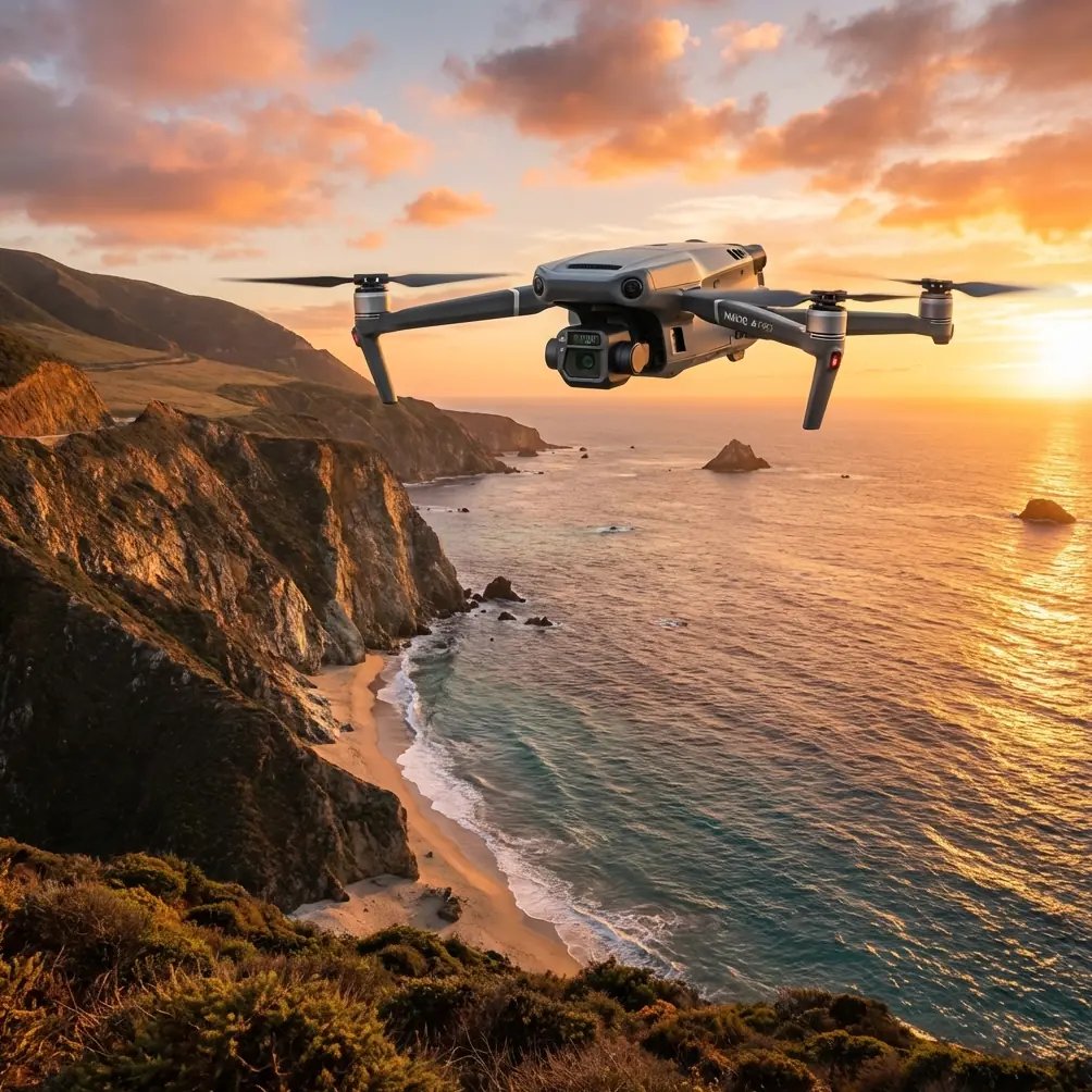
What the Mavic 3T does well on shoreline work
The Mavic 3T earns its place on coastline projects because it allows one crew to gather multiple layers of information without changing platforms.
The thermal system lets you inspect heat differentials that are invisible in standard imagery. In coastal infrastructure work, that can help identify moisture ingress patterns, delamination clues, exposed drainage behavior, or heat signatures tied to equipment shelters and shoreline assets. Thermal signature interpretation near water does require discipline; wet surfaces and reflective conditions can fool inexperienced analysts. But with controlled timing and consistent altitude, the M3T can reveal trends that matter.
The visible camera side supports photogrammetry and general situational documentation. When a coastline project needs both defect context and area-wide mapping, the ability to collect thermal observations and standard imagery within one deployment window is a practical advantage, not a marketing bullet.
The aircraft’s compact size also helps when launch points are ugly. Narrow shoulders, uneven access paths, exposed berms, service roads near surf zones — these are not ideal field conditions. A system that can be staged quickly and moved safely matters.
Extreme temperature discipline: what actually changes in the field
The mistake many teams make is treating “extreme temps” as a battery-only issue. It is wider than that.
In cold conditions:
- Initial battery voltage behavior deserves extra attention.
- Hover checks should be slightly longer before committing to a corridor leg.
- Plastic feel changes; fold and arm checks should be more deliberate.
- Screen readability and operator dexterity decline before people admit it.
In hot conditions:
- Surface temperature can distort thermal comparisons if you do not standardize mission timing.
- Controllers and mobile devices may become the first weak point.
- Aircraft cooling behavior during repeated short hops matters more than raw flight time.
- Vehicle storage between sorties can do more damage than the mission itself.
For shoreline work, the best operators create temperature routines, not temperature reactions. The routine is what keeps the data set comparable from sortie to sortie.
Antenna positioning advice for maximum practical range
This is the one tip too many pilots learn late.
If you want the strongest possible O3 transmission performance along a coastline, stop “aiming” the controller antennas at the aircraft like you would point a flashlight. That is not how you get the best link. The broadside of the antenna orientation matters more than pointing the antenna tips directly at the drone.
In practice:
- Keep the flat faces of the antennas oriented toward the aircraft’s position, not the tips.
- Raise your controller position slightly if terrain, parked vehicles, or sea walls are cutting the lower Fresnel zone.
- Do not stand directly behind metal railings, truck bodies, or reinforced concrete barriers.
- If the aircraft is moving along a lateral shoreline corridor, rotate your body gradually to preserve alignment instead of forcing the aircraft far off-axis.
- When flying from elevated bluffs, avoid crouching near the edge where the local ground geometry can partially shield the link.
The coast creates deceptive line-of-sight. You may see the aircraft clearly while the RF path is being compromised by structure, angle, or your own body position.
This is where experience beats assumptions.
AES-256, data handling, and why it matters near infrastructure
Many coastline missions involve sensitive commercial assets: ports, utility corridors, private industrial frontage, flood barriers, telecom installations, or environmental monitoring zones. The Mavic 3T conversation should not stop at capture quality. Data handling matters too.
If your workflow touches confidential site imagery or thermal records, secure transmission and storage practices should be built into the mission design from the start. AES-256 is not a decorative acronym in that context. It matters because shoreline jobs often involve third-party stakeholders, shared review cycles, and field data movement before final archiving.
That means:
- Standardize media handling after each sortie.
- Limit ad hoc device swapping in the field.
- Document who accesses thermal and visual files.
- Keep mission logs tied to deliverables and battery cycles.
Security, reliability, and maintenance all intersect more than most crews realize.
Photogrammetry, GCPs, and the reality of coastal mapping with the M3T
The Mavic 3T is not a one-click answer for every mapping challenge. Coastal photogrammetry is difficult because water edges are poor at giving software stable tie points, and uniform sand or rock textures can create weak reconstruction zones.
That is why GCP discipline matters. If your deliverable needs measurable consistency, especially across repeat shoreline surveys, do not rely solely on onboard positioning. Ground control gives your project a stable backbone when the coastal scene itself is visually inconsistent.
Thermal and visible outputs also serve different purposes. Thermal can indicate anomalies; visible data usually carries the heavier load for model generation and detailed orthographic context. Combining them intelligently is stronger than forcing either one to do the other’s job.
Maintenance habits that actually extend mission confidence
The two handbook references point in the same direction: confidence comes from respecting cumulative effects.
On the Mavic 3T, that means checking the little things before they become mission-level problems:
- Inspect folding arm joints for changed resistance, not just cracks.
- Watch for salt residue around seams and accessory contact points.
- Review propeller root fit after transport on rough roads.
- Keep battery insertion and latch feel consistent across all packs.
- Log repeated minor abnormalities, even if they never caused an aborted mission.
If your team wants a simple rule, use this one: repeatability is the early warning system. The aircraft should feel consistent, sound consistent, and initialize consistently. When it stops doing that, your confidence should drop before your ambition does.
A practical shoreline workflow for the Mavic 3T
For crews planning M3T coastal missions in extreme temperatures, the cleanest field rhythm usually looks like this:
- Stage batteries at a controlled temperature before launch.
- Run a brief hover and gimbal stability check before corridor commitment.
- Confirm antenna broadside alignment before each leg.
- Capture visible and thermal sets with consistent altitude and timing logic.
- Use GCPs whenever deliverables require repeatable geospatial comparison.
- Inspect mounting threads and accessory hardware after transport and after temperature swings.
- Log every anomaly, even one that seemed harmless.
That may sound conservative. It is. Commercial drone work near shorelines rewards conservative systems because the environment is already aggressive.
If you are building a serious Mavic 3T deployment plan for coastal inspections or mapping and want a second set of eyes on your workflow, message James directly here: https://wa.me/85255379740
The Mavic 3T is a very capable coastal tool, but capability alone does not deliver clean outcomes. Reliability logic, tolerance awareness, and disciplined RF practice do. The crews that understand that tend to come home with usable data the first time, even when the weather is mean and the shoreline gives them no favors.
Ready for your own Mavic 3T? Contact our team for expert consultation.