Delivering Along the Coast With the Mavic 3T
Delivering Along the Coast With the Mavic 3T: What Actually Matters in the Field
META: Expert insights on using the Mavic 3T for coastal delivery support, thermal scouting, BVLOS planning, and workflow design that reflects real aerospace development discipline.
Coastal operations punish lazy planning.
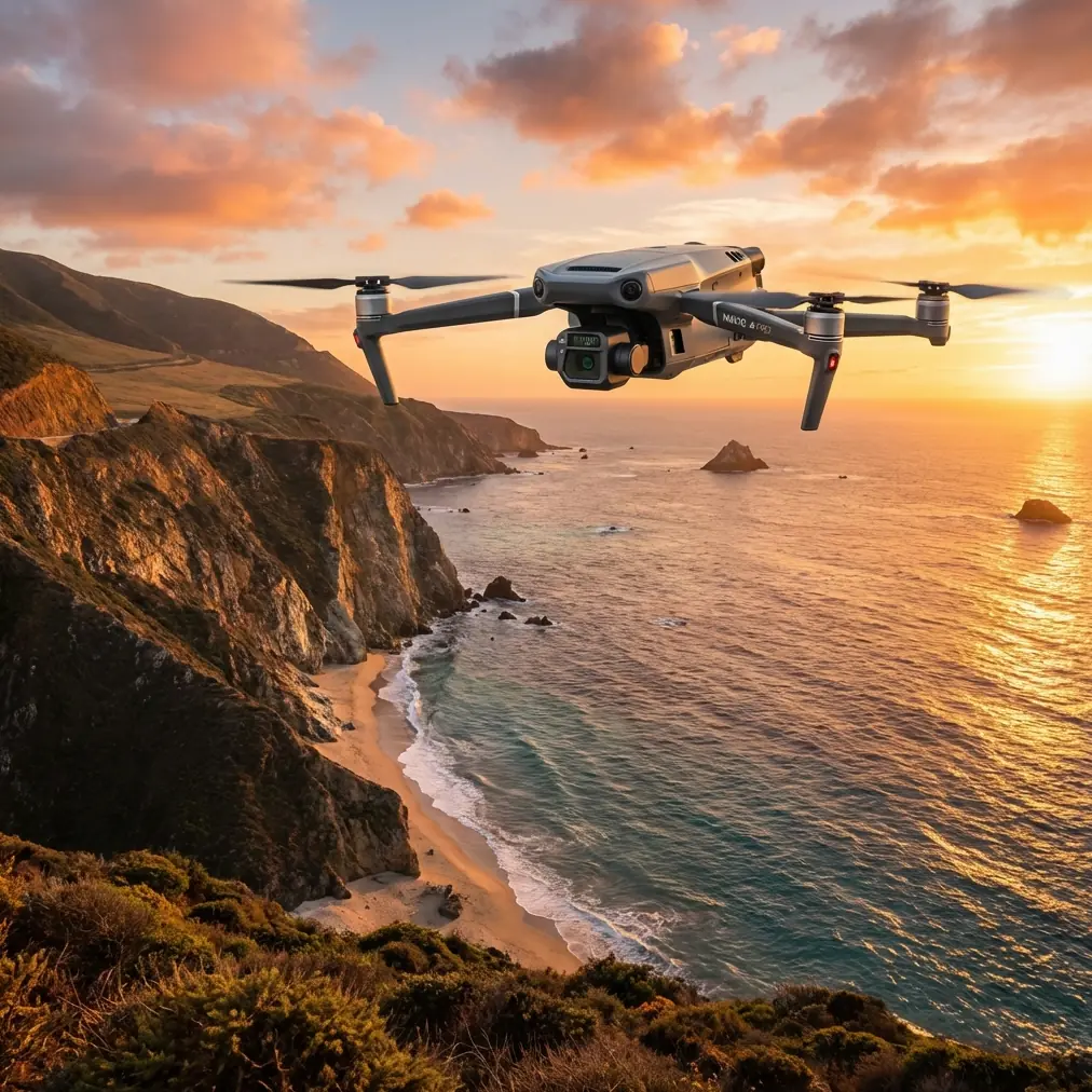
Salt haze softens contrast. Wind changes character every few hundred meters. Launch points are rarely ideal, and once you move beyond a short visual hop, the mission stops being “just a drone flight” and starts becoming a systems problem. That is exactly why the Mavic 3T has earned attention in shoreline logistics support, infrastructure checks near docks and seawalls, and route verification for coastal delivery work. Not because it is small, but because it allows a compact team to make decisions quickly.
The smarter way to think about the Mavic 3T in this context is not as a flying camera. It is a node in a larger operational chain: route assessment, thermal confirmation, communications reliability, documentation, battery rotation, and post-mission feedback. When teams ignore that chain, they get fragile results. When they design around it, the aircraft becomes unusually effective.
As Dr. Lisa Wang would put it, the coastal environment exposes every weak assumption in your workflow.
The real problem: coastal delivery is not only about flight time
Most people discussing delivery along coastlines focus on obvious specs—range, camera quality, wind resistance. Useful, but incomplete. The harder problem is repeatability. Can the same team run the same route assessment at different tide levels, under changing light, with enough confidence to support an actual commercial process?
That question matters whether the mission is checking a shoreline drop corridor before a logistics run, surveying access points for island-adjacent facilities, documenting landing zones for medical resupply training, or verifying temporary routes after storm damage. In all of those cases, the aircraft is supporting delivery operations, even when it is not physically carrying the payload.
Here is where the Mavic 3T becomes interesting. The thermal payload gives operators a second layer of environmental intelligence that a standard visual-only platform cannot provide. Along the coast, surface conditions can be deceptive. Wet rock, shaded concrete, exposed machinery, vessel decks, and people in workwear can blend into clutter visually, especially late in the day. Thermal signature analysis helps crews separate what is merely visible from what is operationally relevant.
That distinction is not academic. If you are validating a delivery corridor near piers or shoreline service structures, thermal can quickly confirm occupied work zones, active equipment, heat-emitting obstructions, or recently used access paths that would otherwise require boots on the ground.
Why aerospace development logic applies to a small drone mission
One of the more overlooked lessons from civil aircraft design is that successful platforms are built and deployed in stages, not by instinct. The source material behind this article makes that point clearly. It describes civil aircraft development as a complex systems engineering effort divided into structured phases: feasibility research, pre-development, development, production and operation, then end-of-life handling. It also emphasizes something especially relevant to drone teams: in the pre-development stage, manufacturers stay in close contact with users, conduct route visits, present technical solutions, listen to feedback, identify early users, and secure initial orders before scaling the program.
That may sound far removed from a Mavic 3T on a shoreline, but it is actually the right operating model.
A coastal delivery workflow built around the Mavic 3T should follow the same discipline:
- Feasibility stage: define the actual operational need. Are you validating drop points, scouting shoreline hazards, documenting marine access, or building a repeatable BVLOS route package?
- Pre-development stage: visit the route physically, interview site users, test communications, compare battery consumption, and refine the flight plan based on real feedback.
- Development stage: formalize checklists, conduct repeated trial missions, document transmission behavior, and build the route library.
- Operational stage: run the mission as a service, while feeding field data back into the system.
This is not overkill. It is the difference between a drone demo and a working coastal program.
The source text also highlights the role of a work breakdown structure, or WBS, as the foundation for technical management, staffing, resources, cost, schedule, and documentation. For Mavic 3T operators, that has direct operational significance. A coastal team should separate responsibilities clearly: pilot in command, visual observer where required, thermal analyst, battery/logging lead, and client-side route coordinator. Even in a small company, assigning those roles reduces confusion and improves traceability.
When salt air, glare, and limited launch windows are part of the job, ambiguity is expensive.
What the Mavic 3T solves particularly well on the coast
The Mavic 3T’s strength is not brute capacity. It is layered awareness in a portable format.
1. Thermal signature for route validation
A delivery corridor can look open but still be operationally unsuitable. Thermal imagery helps identify occupied maintenance areas, active vehicles near dock edges, machinery that may create convection or interference close to structures, and warm-bodied activity in low-contrast backgrounds. In dawn, dusk, or overcast conditions, this becomes especially useful.
For coastal readers, one practical example is seawall and jetty access assessment. A visual image may show a clear path. Thermal can reveal recent human activity around a nominally empty zone, helping teams avoid selecting a drop or hover point too close to workers.
2. Visual and thermal pairing for faster decisions
Thermal on its own can mislead if the operator lacks context. The Mavic 3T works best when thermal and visual views are interpreted together. That pairing matters during coastal logistics support because shore textures produce clutter: reflective surfaces, dark wet patches, vessel shadows, and heat retention in concrete.
A trained operator can move from “something is there” to “this is a forklift parked under partial cover near the receiving zone” much faster when switching between sensors.
3. O3 transmission for coastal stand-off operations
Coastal teams often launch from suboptimal ground positions—behind low structures, near service vehicles, or from a narrow shoreline strip. Reliable transmission becomes part of mission viability, not a convenience. O3 transmission is a meaningful asset here because it supports stronger situational continuity when the ground team cannot chase the aircraft along the route.
That does not eliminate the need for route discipline. It simply means the aircraft is better suited to maintaining operational awareness across uneven shoreline geometries.
4. AES-256 for sensitive commercial work
This gets overlooked until a client asks about it. Port-adjacent inspections, utility routes, private coastal developments, and industrial shoreline assets often involve sensitive imagery. AES-256 matters because data protection is not just an IT box to tick; it is part of whether the drone program can be approved internally by serious organizations.
In practical terms, that makes the Mavic 3T easier to integrate into commercial workflows where imagery governance is scrutinized.
The accessory that changed the workflow
The most useful upgrade I have seen in coastal Mavic 3T work was not flashy. It was a third-party high-visibility landing pad with weighted edge reinforcement and a foldable windbreak panel.
On paper, that sounds minor. In practice, it solved three persistent shoreline problems:
- rotor wash kicking sand or shell fragments during takeoff,
- unreliable home-point launch surfaces on uneven ground,
- and visual confusion during battery swap cycles when crews were working fast.
Pair that with hot-swap batteries at the ground station level—not aircraft hot-swapping in the literal sense, but a disciplined battery rotation process where one set is charging while another is cooling and another is flying—and sortie tempo improves noticeably. Coastal missions often fail not because the aircraft lacks capability, but because the team burns time between flights.
A simple pad-and-windbreak setup gave crews a cleaner launch environment and better repeatability. That is exactly the kind of accessory that enhances capability without pretending to change the aircraft itself.
Where photogrammetry and GCPs fit in
The Mavic 3T is usually discussed for thermal inspection, but coastal delivery support often benefits from a mapping layer as well. If you are building repeatable routes around shoreline structures, landing clearances, or temporary receiving areas, photogrammetry becomes useful for more than pretty maps. It gives the team a geometric reference for route planning, obstacle review, and client reporting.
This is where GCPs matter.
Ground Control Points are not always necessary for rough visualization, but when the route needs to align with actual site dimensions—say, offset from railings, utility boxes, berm edges, or pier furniture—they improve confidence in the model. That has operational significance. A delivery support team can compare planned approach corridors against a georeferenced site model instead of relying on memory and screenshots.
On dynamic coastlines, even modest shifts in staging areas can matter. A photogrammetry baseline built with GCP support turns route planning into something auditable.
BVLOS changes the conversation
Any mention of BVLOS in a coastal environment should trigger a planning conversation, not excitement. Beyond visual line of sight operations raise the standard for mission design, communications, risk controls, and documentation. The Mavic 3T can support the data-gathering and route-validation side of that effort well, especially during program buildout, but the key point is procedural: BVLOS readiness is not a feature you buy. It is a capability you engineer.
That idea mirrors the source material exactly. In the pre-development stage of civil aircraft programs, teams do deeper studies, complete configuration design, build definition documents, prepare specifications, compare major equipment options on technology, schedule, and cost, and create the technical basis for detailed design and production. For a Mavic 3T coastal operation, the analog is straightforward:
- define the shoreline mission architecture,
- compare launch sites and signal paths,
- document battery and weather thresholds,
- identify early user teams,
- gather route feedback,
- and produce standardized mission files and SOPs.
Without that discipline, “BVLOS capable” becomes a slogan. With it, it becomes a documented operating pathway.
A practical coastal workflow that works
For teams using the Mavic 3T to support coastal delivery operations, this sequence has proven effective:
Pre-mission
- Walk the shoreline route and identify interference zones, emergency recovery areas, and alternate launch spots.
- Build a simple WBS-style checklist: flight planning, battery status, thermal objectives, mapping objectives, data handling, and post-flight reporting.
- Confirm whether the day’s task is thermal reconnaissance, photogrammetry, route validation, or all three. Mixing objectives without priority causes bad flights.
Field execution
- Launch from a controlled pad, especially on sandy or debris-prone surfaces.
- Use thermal early, while the scene still has contrast value.
- Switch to visual framing for structural context and client-facing records.
- Monitor link quality continuously if operating around shoreline infrastructure where reflections and obstructions can change abruptly.
Post-mission
- Tag thermal findings by operational significance, not by image count.
- Compare site changes against previous models if GCP-backed mapping exists.
- Feed route observations back into the SOP. That user-feedback loop is straight out of disciplined aircraft development, and it works.
If your team needs help setting up a cleaner Mavic 3T coastal workflow, route validation template, or accessory stack, you can message a specialist here.
The bigger takeaway
The Mavic 3T is at its best on the coast when teams stop treating it like a standalone gadget and start treating it like part of a managed aviation system.
That sounds lofty for a foldable UAV, but the reference material supports the point. Civil aircraft programs succeed by moving through defined phases, staying close to users, documenting requirements, and organizing work systematically. Those are not big-aircraft habits only. They are exactly the habits that make a Mavic 3T deployment reliable in difficult environments.
For coastal delivery support, the aircraft’s thermal signature capability helps crews see what visual-only systems miss. O3 transmission improves confidence when shoreline geometry is awkward. AES-256 helps satisfy commercial data requirements. Photogrammetry and GCP workflows add spatial discipline. A smart third-party launch accessory can remove friction from every sortie.
None of that matters if the operation itself is improvised.
The best Mavic 3T coastal teams I have seen are not the ones chasing maximum specs. They are the ones building a repeatable process: route visit, user input, technical comparison, documented mission structure, feedback loop. In other words, they borrow the seriousness of full-scale civil aviation development and apply it to compact UAV work.
That is why their results hold up when the wind comes sideways, the light drops, and the shoreline stops being forgiving.
Ready for your own Mavic 3T? Contact our team for expert consultation.