Mavic 3T Delivery Tips for Construction Sites in Complex Ter
Mavic 3T Delivery Tips for Construction Sites in Complex Terrain
META: Practical Mavic 3T workflow for construction-site delivery in difficult terrain, with pre-flight safety checks, thermal use, transmission reliability, data handling, and mission planning insights.
By Dr. Lisa Wang, Specialist
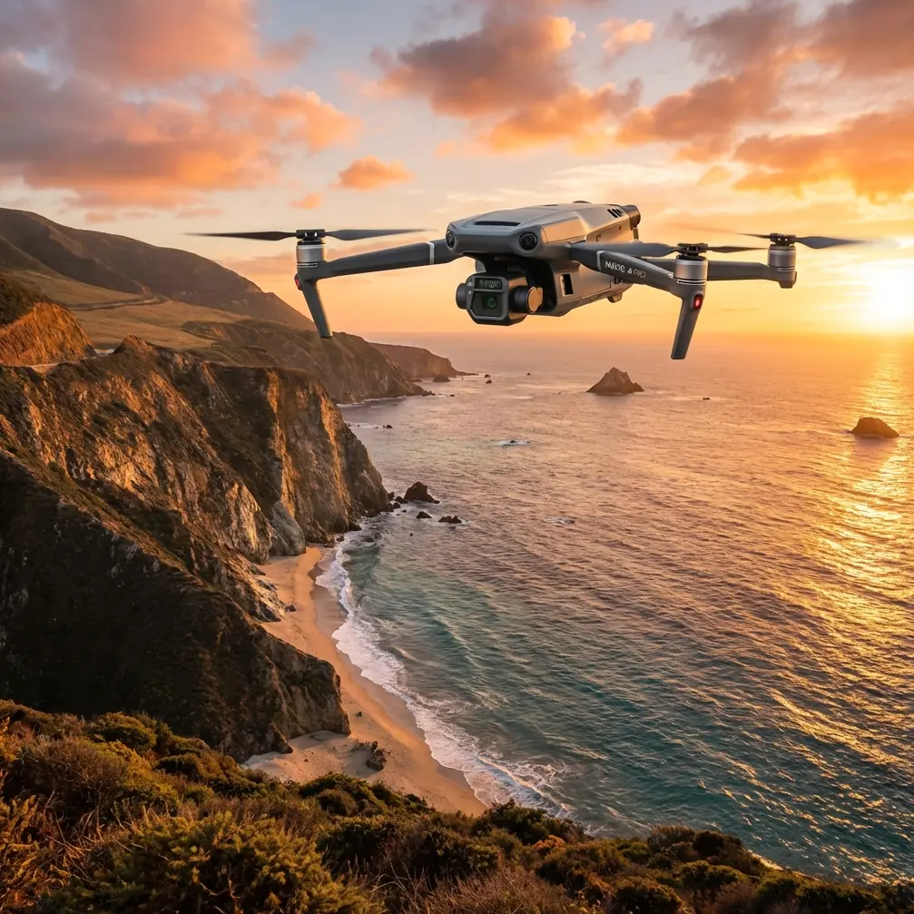
Construction delivery by drone sounds simple until the site fights back.
Grade changes. Dust. Rebar. Temporary structures. Blind approaches between cut slopes and scaffold lines. On paper, the Mavic 3T looks like a compact aircraft with thermal capability and strong transmission. In the field, its value depends on how well the operator builds a disciplined process around those tools.
For teams moving small payloads, documents, samples, or critical parts across active construction zones, the real question is not whether the aircraft can fly from point A to point B. It is whether it can do that repeatedly, safely, and with enough situational awareness to avoid the kinds of small mistakes that become expensive on a site with changing terrain.
This article focuses on that operational layer: how to prepare and use the Mavic 3T for civilian delivery work in complex construction environments, with a specific emphasis on safety checks, terrain awareness, communications discipline, and data integrity.
Start with the step most crews skip: clean before you power up
One of the most underrated pre-flight habits is basic cleaning.
Not cosmetic cleaning. Functional cleaning.
Before the first battery goes in, wipe the vision sensors, thermal window, wide camera glass, and any obstacle-sensing surfaces exposed to site dust. If the aircraft has been transported in an open vehicle or used near concrete cutting, dry debris can sit on sensor faces and distort what the aircraft “sees.” A site supervisor may think of dust as a nuisance. The aircraft may interpret it as glare, blur, or blocked input.
That matters because safety systems are only as good as the quality of the information reaching them. A delivery mission over rough terrain often includes low-altitude transitions, improvised landing zones, and visual clutter. Dirty forward or downward sensing surfaces can reduce confidence during takeoff, landing, and obstacle interaction.
I treat this as a non-negotiable step, especially when thermal signature interpretation is part of the mission. Smudges on the thermal lens do not just make the image ugly. They can blur temperature edges that help a pilot distinguish equipment, workers’ pathways, recently operated machinery, or heat-retaining surfaces near a drop zone.
The same discipline appears in mature aircraft engineering far beyond small drones. In conventional aerospace design references, interchangeability and interface reliability are emphasized because systems only remain dependable when installation conditions and interfaces stay controlled. Document 2 points to this directly through the ARINC 700 series, where ARINC 701, 702, and 703 define factors such as installation provisions, wiring, input/output interfaces, transmission characteristics, and power characteristics. The operational lesson for a Mavic 3T team is straightforward: consistency at the interface level matters. On a construction site, your “interfaces” are the battery contacts, payload mount condition, sensor surfaces, remote controller links, and mission data pipeline. If those are sloppy, flight reliability degrades long before any dramatic warning appears.
Map the terrain like a delivery operator, not a camera operator
Many Mavic 3T users come from inspection or public-safety-style workflows and naturally think in terms of observation first. Delivery on a construction site requires a different mindset.
You are not simply documenting terrain. You are threading through it.
Complex terrain means more than hills. It includes haul roads carved into slopes, partially enclosed staging areas, cranes, retaining walls, temporary offices, spoil piles, concrete forms, steel stacks, and changing vehicle routes. A route that worked yesterday may be partially blocked today.
This is where photogrammetry habits and GCP discipline still matter, even if the mission itself is not a mapping flight. If your team has current site models or orthomosaics tied to reliable ground control points, you can make better route decisions around elevation breaks, radio-shadow pockets, and safe handoff zones. GCP-backed site data reduces guesswork. On a cut-and-fill project, a five-meter elevation assumption error can produce a very different obstacle environment from what the pilot expected.
The Mavic 3T’s thermal capability adds another practical layer. Late afternoon or early morning thermal passes can reveal active equipment zones, generators, recently moved vehicles, and sun-heated surfaces that may complicate a proposed landing spot. Thermal is not a substitute for visual confirmation, but on busy terrain it helps the crew understand the site’s energy pattern, not just its shape.
That is especially useful when delivery destinations are temporary. A fixed laydown zone with clear markings is ideal. Real sites often give you a patch of compacted soil beside a trench box and call it a landing area. Thermal and visual cross-checking can help determine whether that patch is truly clear, recently trafficked, or sitting next to active machinery.
Build a route around transmission reality
The Mavic 3T platform is often discussed in terms of O3 transmission performance, and rightly so. In construction operations, however, the headline is not maximum range. It is signal predictability.
Complex terrain punishes assumptions. Rock faces, steel structures, concrete cores, containers, and equipment clusters can interrupt line-of-sight and create unstable signal behavior even on relatively short flights. A delivery route should be designed around the places the link is most likely to degrade, not the places it is strongest.
That means walking the route, if possible. Stand where the remote pilot will actually be. Look at crane booms, berms, site cabins, and vertical structures. Ask where vehicles park during peak activity. Identify where the aircraft might briefly drop behind terrain or built obstacles during departure or final approach.
The site may tell you a route is “clear” because no one sees a tree line or tower in the way. RF conditions are less forgiving. An open path from overhead can still be messy from controller position.
Here the logic from aerospace interchangeability standards is surprisingly relevant again. Document 2 notes that for complex systems such as FCCS, FMCS, and TCCS, interchangeability categories exist because these systems have many multiplexed interfaces with other subsystems. In practical drone terms, a delivery mission is also multi-interface work: aircraft to controller, controller to operator, operator to site team, aircraft to terrain model, mission plan to actual site condition. The more interfaces you are managing, the less room there is for ambiguity.
So keep the route simple. Avoid unnecessary doglegs. Use clearly defined decision points:
- launch
- terrain-crossing segment
- approach corridor
- landing or drop action
- return corridor
- alternate recovery point
Simple route architecture lowers workload when conditions change mid-flight.
Treat encryption and data handling as operational safety, not IT housekeeping
AES-256 often gets mentioned as a security specification and then forgotten. On construction projects, that is a mistake.
Delivery flights can expose sensitive site information: staging locations, progress status, infrastructure layouts, equipment positioning, and contractor workflows. If the Mavic 3T is used for both delivery and documentation, the same flight ecosystem may carry imagery, thermal records, route logs, and operational notes. Strong encryption is not just a compliance talking point. It protects project confidentiality and reduces the risk of operational leakage across subcontractors or external stakeholders.
More practically, secure data handling improves team confidence in using the platform for mixed missions. If the aircraft is collecting thermal imagery during route verification and visual records during delivery confirmation, the project team needs confidence that this data remains controlled.
That becomes even more relevant on large infrastructure jobs where multiple contractors are working different sectors. Data discipline should be built into the workflow from the start: who receives route screenshots, who stores flight logs, who can review thermal captures, and how site models are distributed.
Pay attention to heat, stress, and battery handling
Complex terrain sites rarely offer a clean drone pad, a shaded bench, and perfect battery management. Flights happen from truck tailgates, temporary tables, and dusty corners of active work areas.
That environment makes thermal and stress management more than a convenience issue.
A useful analogy comes from Document 1, which discusses aluminum alloy conditions and a crucial manufacturing principle: when materials are chosen in a cold-work-hardened or pre-stretched state, parts should not be heat-treated again because that would erase the benefits of the hardening or pre-stretching process. It also notes that some alloys, such as 7075-T7352 and 7050-T7452, are preferred for variable cross-section structural members below 120°C because of good stress-corrosion resistance and relatively high fracture toughness, while 7851 involves creating 1% to 3% permanent deformation to relieve stress before artificial aging.
You do not need to be building aircraft structures to learn from that. The operational message is that heat history and stress history matter. Materials and systems behave differently when exposed to the wrong thermal cycle or unmanaged residual stress.
For a Mavic 3T crew, the parallel is obvious:
- do not leave batteries baking in direct sun on metal surfaces
- do not move immediately from hot vehicle storage to immediate high-load flight without checks
- do not assume repeated short hops are gentler than one planned mission
- do not ignore swelling, impact marks, or connector contamination
If your operation uses hot-swap batteries as a field rhythm, remember that speed can hide degradation. Fast turnaround is useful only if each swap includes a quick inspection of contacts, seating, and battery temperature condition. On dusty construction sites, battery management is often where disciplined teams separate themselves from casual operators.
Use thermal as a route-validation tool, not just a search view
The Mavic 3T’s thermal sensor becomes more valuable on construction delivery when it is used before the transport segment, not only during it.
A short thermal scan of the intended drop or landing area can reveal:
- recently occupied ground
- idling equipment near approach paths
- heat-emitting generators or temporary power units
- solar loading differences that indicate unstable surfaces or material stacks
- personnel clustering that may not be immediately obvious in visual clutter
This is especially useful in low-contrast visual conditions such as dusty evenings or overcast mornings. Construction teams often underestimate how visually chaotic a site can become from the pilot’s perspective. Thermal helps simplify the picture.
That said, thermal interpretation requires restraint. A bright area does not always mean hazard, and a cool area does not automatically mean safe. Use it to refine situational awareness, then confirm with visual inspection and site communication.
Keep site communication tight and plain
Delivery success depends as much on the ground receiver as the pilot.
Before launch, confirm three items with the receiving team:
- Exact receiving point
- Receiving window
- Abort signal or alternate point
Do not rely on “near the excavator” or “beside the lower pad.” Those references move.
Use one named landing or handoff zone. If conditions shift, use one pre-agreed alternate. If the site is noisy or spread out, message the route graphic ahead of time. If you need a direct field coordination channel, share a simple contact path such as our site ops WhatsApp line with the relevant supervisor before the mission day.
This is not about marketing or convenience. It is about reducing verbal ambiguity when terrain, dust, and machinery noise make radio or phone communication imperfect.
Be conservative about BVLOS thinking
BVLOS is often discussed as the next efficiency layer for site logistics, and in some operations it may eventually fit. But complex terrain is exactly where operators can talk themselves into more than the site environment supports.
Even when regulations and procedures allow expanded operational envelopes, the site itself may not. Terrain masking, moving obstacles, unplanned crane activity, and frequent layout changes can erode the predictability that BVLOS-style routines depend on.
For most construction delivery work with the Mavic 3T, disciplined corridor planning and strong visual oversight will outperform ambitious route expansion. The goal is dependable repetition, not theoretical throughput.
A field-ready Mavic 3T workflow that actually holds up
If I were building a standard operating sequence for construction delivery in difficult terrain, it would look like this:
1. Review yesterday’s site changes
Check new stockpiles, crane positions, road diversions, scaffold growth, and temporary structures.
2. Clean all sensing and imaging surfaces
This includes thermal and visual optics before power-up.
3. Inspect aircraft and battery interfaces
Look at arms, propellers, battery contacts, latches, and landing area contamination.
4. Validate route on current site imagery
Use the latest photogrammetry output if available, ideally tied to GCP-backed control.
5. Conduct a short thermal reconnaissance
Confirm landing zone activity and identify heat-related anomalies around the path.
6. Test communications from actual pilot position
Do not test link quality from a different part of the site and assume the result transfers.
7. Brief the receiving team in plain language
One route, one landing zone, one alternate, one abort instruction.
8. Fly a conservative profile
Minimize complexity. Keep path geometry easy to manage.
9. Reassess before the return leg
Construction sites change by the minute.
10. Log what changed
Signal weak points, dust issues, thermal observations, and ground coordination problems should feed the next mission.
The Mavic 3T is at its best on construction delivery work when operators stop treating it as a flying camera with extra sensors and start using it as a tightly managed site tool. Clean interfaces. Reliable route logic. Controlled data. Verified landing areas. Sensible battery discipline.
That is what turns capability into repeatable field performance.
Ready for your own Mavic 3T? Contact our team for expert consultation.