Mavic 3T in Complex Terrain: A Field Delivery Case Study
Mavic 3T in Complex Terrain: A Field Delivery Case Study on Altitude, Thermal Awareness, and Reliable Route Planning
META: Expert case study on using the DJI Mavic 3T for field delivery support in complex terrain, with practical guidance on flight altitude, thermal use, mapping workflow, and O3 transmission limits.
When people ask whether the Mavic 3T is suitable for field delivery work in difficult terrain, they usually mean something more specific: can it help a team move intelligently across valleys, ridgelines, tree belts, terraces, irrigation cuts, and uneven access roads without wasting time or missing hazards?
That is the right question.
The Mavic 3T is not a cargo aircraft. It is not the machine that carries heavy farm inputs across a mountain basin. Its value in a delivery workflow sits elsewhere, and in many operations that role is more decisive than payload. It scouts. It verifies. It maps. It checks access lines. It helps teams decide where people, vehicles, and small consignments should go before those movements become expensive or risky.
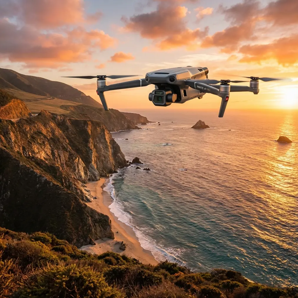
For delivery support in agricultural fields with broken topography, the Mavic 3T earns its place because it combines thermal imaging, a wide visual camera, a tele camera, and the operational convenience of a compact airframe. In the real world, that combination matters more than spec-sheet theater. A crew can move from launch to useful data quickly, and that speed is often the difference between a clean day and a delayed one.
The scenario: delivering across terraced and uneven farmland
A useful example is a mixed farm zone divided by elevation changes rather than neat rectangular boundaries. Picture orchards on one side, row crops on another, and service roads that look passable from the ground entrance but disappear into ruts, washouts, or soft shoulders as the route climbs. Add tree lines, low morning fog in pockets, and patchy mobile coverage. Now the delivery question becomes operational, not theoretical.
A team may need to move seed trays, sensors, irrigation parts, veterinary supplies, or lightweight field tools to remote sections without sending vehicles down the wrong track. In that environment, the Mavic 3T becomes an aerial decision engine. Before anyone commits to a route, the aircraft can confirm which access points are open, where standing water is affecting soil stability, and whether workers in outlying blocks are where they are expected to be.
Thermal signature becomes especially useful early and late in the day. Not because thermal is magic, but because it reveals contrast that the eye can miss. A damp drainage line can stand out against drier soil. A recently used vehicle path may read differently from untouched ground. Livestock, people, and operating equipment can also be located faster when visual clutter is high. In a field delivery context, that means less guesswork before dispatching ground teams.
Why the Mavic 3T fits this job
The strongest argument for the Mavic 3T is not a single sensor. It is the way the platform compresses several jobs into one flight.
You can launch for a quick wide-area scan, switch to thermal to inspect suspect terrain, use zoom to verify a gate, culvert, or embankment condition, and then return with enough visual context to brief the team clearly. In complex terrain, that multi-layer workflow is more valuable than raw endurance alone.
Its O3 transmission system is also operationally significant. In open country with broken terrain, transmission quality often fails first at the exact moment you need confidence most: when the aircraft moves behind a ridgeline or into a corridor bordered by trees. O3 does not remove terrain shielding, but it improves the practical control and live-view experience compared with older short-range assumptions many field teams still carry. That translates into more stable reconnaissance near topographic interruptions, provided pilots keep line-of-sight obligations and site rules in mind.
Security matters too. AES-256 is not just a brochure detail. If your delivery planning involves farm layouts, infrastructure locations, worker movement patterns, or sensitive production zones, encrypted data handling is part of professional practice. Agricultural operations are increasingly data-rich businesses. Route imagery and thermal captures can reveal more than outsiders need to see.
The most useful altitude insight for this scenario
If I had to give one altitude rule for Mavic 3T field delivery support in complex terrain, it would be this:
Start your reconnaissance at roughly 60 to 90 meters above ground level, then adjust lower only when you need decision-grade detail.
That range is a sweet spot for this kind of work.
At around 60 to 90 meters AGL, you usually get enough field context to read route continuity, slope transitions, terrace spacing, vehicle access quality, tree interruptions, and drainage patterns in one coherent frame. Go too low too early and you become trapped in fragments. You see the next bend, not the whole route. Go too high and you flatten the terrain visually; subtle rises and access hazards become less obvious, especially in mixed vegetation.
The phrase “above ground level” matters here because complex terrain punishes pilots who think only in takeoff-point altitude. If you launch from a ridge shoulder and then descend into a basin, or the reverse, your apparent clearance can change quickly. Operationally, that affects both obstacle margin and the usefulness of thermal readings. Flying at a consistent mission altitude relative to terrain, rather than a static launch reference, gives cleaner reconnaissance results.
For route verification, my preferred workflow is simple:
- First pass at 70 to 80 meters AGL for the whole corridor
- Second pass at 40 to 60 meters AGL over problem segments
- Targeted zoom or thermal spot checks only where the first pass raises doubt
That sequence protects battery life, keeps the mission organized, and prevents crews from overflying every meter at low level just because the drone can.
What thermal adds that RGB alone often misses
Field teams sometimes underuse the thermal camera because they assume it is only for search tasks or night operations. That misses the point.
In delivery planning, thermal signature helps separate active from inactive space. A track that looks identical to another on the visual feed may reveal moisture retention, vehicle heat traces, equipment status, or animal presence. In cold mornings, culverts and wet depressions can present strong contrast. In warmer afternoons, exposed rock, roadbeds, irrigation hardware, and shaded ground can produce different thermal behavior that helps confirm what you are really looking at.
The trick is not to interpret thermal as a direct answer. Use it as a question generator.
Why is that patch cooler? Why does this route edge differ from the center? Why is there heat near a pump zone where no team should be working yet?
Those are practical prompts for delivery decisions. They tell you where to slow down, reroute, or verify before assigning a vehicle or sending staff on foot.
Mapping the route before the route matters
This is where photogrammetry and GCP discipline come in, even though the Mavic 3T is often discussed as a quick-response aircraft rather than a mapping platform.
If a farm or estate handles recurring deliveries to difficult sectors, a one-off live scan is useful but limited. The bigger operational gain comes from building a repeatable site model. Orthomosaic outputs and elevation-aware route maps help managers pre-classify access lanes, identify seasonal choke points, and document safer fallback paths. If your terrain changes with rain, runoff, or cultivation cycles, this becomes even more valuable.
Ground control points, or GCPs, raise the trust level of those maps. Without them, a route plan may look visually convincing while still drifting enough to create confusion at a gate junction or irrigation branch. With properly placed GCPs, your route layers become more dependable for repeat operations, contractor coordination, and post-season comparisons.
That matters because field delivery in complex terrain is rarely a one-day issue. It is an ongoing logistics pattern. A route that works in dry conditions may fail after irrigation, after pruning debris accumulates, or after a terrace edge softens. Once mapped accurately, those changes are easier to spot and communicate.
Battery management is a planning issue, not an accessory issue
Hot-swap batteries are not native to the Mavic 3T in the way they are on larger enterprise platforms, but the operational principle still applies: battery handling discipline determines whether the aircraft remains useful during active field support.
Teams lose time when every sortie is treated as a standalone flight with no staging logic. In delivery support, the aircraft should be integrated into the movement cycle. One battery set should be cooling, one should be charging, and one should be ready for launch. The drone’s compact format helps here because redeployment is quick, but only if the team treats power as part of mission design rather than post-flight admin.
This is especially relevant in broken terrain, where headwinds, altitude changes, and repeated climbs can erode expected endurance faster than flat-land planning suggests. The answer is not to stretch each battery. The answer is to keep flight segments short, scoped, and linked to actual decisions.
The BVLOS temptation and the safer reality
Complex fields often create the urge to push farther than is operationally wise, especially when a route disappears behind topography. That is where people begin talking loosely about BVLOS.
The commercial reality is simpler. Even where beyond visual line of sight operations may be possible under specific regulatory frameworks, field teams should not confuse technical capability with routine entitlement. Ridgelines, vegetation, and uneven RF conditions create uncertainty quickly. For most civilian delivery support workflows using the Mavic 3T, a segmented line-of-sight reconnaissance plan is cleaner and more defensible than trying to force a single long mission through obstructed terrain.
Use launch points intelligently. Leapfrog if needed. Build corridor understanding in sections. That approach usually produces better data anyway.
A practical field method that works
If I were advising a farm logistics team using the Mavic 3T for recurring support in this environment, the field method would look like this:
Start at the highest accessible and legally suitable launch point with a clear view of the corridor. Run a wide visual pass at around 75 meters AGL. Mark any route discontinuities, washouts, heavy shade zones, or blocked gates. Then switch to thermal over the suspect areas, especially near water channels, culverts, and low-lying field access tracks. Follow with targeted zoom verification. Capture enough stills and screen references that the driver or field supervisor can act without reinterpretation.
Where the site is used repeatedly, graduate from ad hoc checks to structured mapping. Build a baseline orthomosaic, add GCPs for consistency, and annotate seasonal delivery lanes. That turns the drone from a flying observer into a logistics system component.
If your team is setting up that workflow and needs a fast operational sounding board, this Mavic 3T field planning contact is a practical place to start.
What this means for real operators
The Mavic 3T works best in complex field delivery scenarios when operators resist the urge to treat it as either a toy scout or a miracle platform. It is neither. It is a compact enterprise aircraft that excels at reducing uncertainty.
The details that matter are not glamorous. O3 transmission helps preserve situational awareness as terrain complicates the link. AES-256 supports professional handling of sensitive site imagery. Thermal signature interpretation gives context to route conditions that RGB alone may blur. Photogrammetry and GCP workflows turn one day’s reconnaissance into an operational map. And the altitude choice, often overlooked, shapes whether the flight produces usable route intelligence or just attractive footage.
For most farms, estates, and land-management teams working in uneven ground, the best starting altitude is not extreme. It is disciplined. Roughly 60 to 90 meters AGL gives the Mavic 3T room to show the terrain as a system. Once you can see the system, delivery decisions become faster, safer, and easier to repeat.
That is the real advantage.
Ready for your own Mavic 3T? Contact our team for expert consultation.