High-Altitude Field Delivery With Mavic 3T
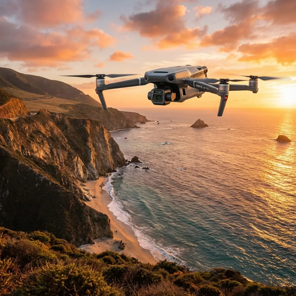
High-Altitude Field Delivery With Mavic 3T: What Actually Matters in the Air
META: Practical Mavic 3T advice for high-altitude field delivery, including antenna positioning, thermal checks, O3 link stability, battery strategy, and route planning for safer commercial operations.
By Dr. Lisa Wang
High-altitude field delivery sounds straightforward until the environment starts stripping away your margin. Thinner air changes climb behavior. Wind tends to shear across ridgelines. Temperatures swing harder between takeoff and arrival points. On paper, the Mavic 3T gives you a compact platform with thermal imaging, efficient flight performance, and the O3 transmission system. In practice, those advantages only show up when the operation is built around airflow, signal integrity, and battery discipline.
That is the real story here.
Most articles about the Mavic 3T stay at the feature level. For field delivery work in upland agriculture, remote infrastructure support, and mountain-adjacent sites, features are secondary. What counts is how the aircraft behaves as a system when range, elevation, heat management, and landing uncertainty all come together in one flight.
The best way to think about the Mavic 3T in this setting is not as a camera drone with delivery ambitions. Think of it as a compact aerial utility platform whose reliability depends on controlled flow: airflow around the aircraft, data flow through the radio link, and operational flow through every takeoff, transit, drop, and recovery cycle.
The High-Altitude Problem Isn’t Distance Alone
Operators often assume the challenge is raw range. That is too narrow.
At higher elevations, delivery flights become vulnerable for three reasons at once:
- The propulsion system has less aerodynamic cushion because the air is thinner.
- The radio link can become inconsistent when terrain masks the controller or reflects signal energy unpredictably.
- Energy reserves shrink faster than expected when the aircraft must climb, stabilize in gusts, and possibly hold position while the landing or drop zone is verified.
This is where the Mavic 3T earns its place. The thermal payload is not just useful for search tasks or inspections. In field delivery, thermal signature assessment can help verify whether a drop point is occupied by people, livestock, irrigation equipment, or sun-heated obstructions that are harder to distinguish in visible imagery. That matters when your delivery point is a rough field edge instead of a graded pad.
Just as important, the O3 transmission link gives the operator the possibility of maintaining a stable command and video connection over broken terrain. But “possibility” is the key word. The system can only perform well if the pilot understands antenna geometry.
Antenna Positioning Advice That Actually Extends Useful Range
If you remember one thing from this article, make it this: do not point the controller antennas directly at the aircraft.
With Mavic-class systems, the strongest part of the antenna pattern is generally broadside to the antenna face, not off the tip. In the field, that means the flat side of the antenna orientation should face the drone’s flight path as much as possible. At high altitude, where flights often pass over terraces, gullies, and uneven ridges, poor antenna alignment can degrade link quality long before the aircraft reaches the edge of its usable energy envelope.
Here is the practical method I recommend:
- Keep the controller at chest height rather than down by the waist.
- Rotate your body so your torso does not block the line to the aircraft.
- Angle the antennas so their faces, not their ends, are presented toward the drone.
- If the aircraft is crossing a slope or going behind a contour break, move a few steps to restore a cleaner Fresnel zone instead of waiting for signal bars to drop.
- Avoid standing beside metal fencing, parked vehicles, or corrugated sheds, which can create multipath reflections.
This sounds basic, but it is usually the difference between a clean O3 feed and a hesitant one. In mountain agriculture, the issue is not only distance. It is the interaction between terrain and dynamic pressure on the signal path. One of the reference engineering principles behind reliable aircraft system routing is that flow paths must remain unobstructed and must not be compromised by external pressure effects. Applied to drone communications, the lesson is obvious: give the transmission path a clean exit and protect it from avoidable interference.
That same design logic appears in conventional aircraft manuals, where vent lines must remain clear and their outlets must be positioned so external airflow does not choke discharge. For Mavic 3T operators, your “vent path” is the radio path. Terrain, body shielding, and antenna misalignment are the modern equivalents of a blocked outlet.
Thermal Is Not a Luxury in Field Delivery
A lot of teams underuse the thermal camera on the Mavic 3T because they still associate it mainly with emergency response or maintenance inspections. In high-altitude field delivery, thermal imaging can reduce uncertainty before commitment.
A visible camera may show you a clear landing area, but thermal can reveal:
- irrigation pipes heated by sun exposure
- recently operated machinery
- livestock resting in scrub near the drop point
- warm human presence near a supposedly clear unload area
- waterlogged zones cooling unevenly compared to firm ground
This is operationally significant because field delivery fails most often at the last segment, not during cruise. The aircraft gets there, but the delivery zone is less usable than expected. Thermal signature comparison gives you one more layer of verification before descent or release.
If your mission also supports farm documentation, the Mavic 3T can pair tactical thermal review with broader photogrammetry workflows. That does not mean it replaces a dedicated mapping aircraft in every case. It means one platform can inspect the route, validate access points, and capture imagery that helps refine future drop locations. When repeated missions are involved, adding GCPs to your field survey process improves positional consistency across delivery planning maps, especially where high-altitude terrain distorts visual judgment.
The Battery Problem Is Usually a Planning Problem
Battery performance at altitude punishes casual assumptions. The Mavic 3T may feel efficient on flatland training flights, then behave very differently on a route that begins in a valley, climbs over a shoulder, and approaches a farm shelf in gusty conditions.
Watch for three hidden drains:
- sustained climb load
- hover corrections in unstable air
- extended decision time at the destination
The fix is not only carrying more batteries. The fix is sequencing the mission properly.
I advise operators to divide each route into four energy blocks:
- outbound transit
- arrival verification
- delivery action
- reserve for reroute or go-around
That third block is where many estimates go wrong. If the site is unclear, if workers have shifted vehicles, or if livestock have drifted into the target area, the aircraft may need to orbit while the pilot reassesses. That is not wasted time. It is the difference between a controlled operation and a rushed descent.
This is also where hot-swap batteries on the ground become part of the larger workflow. While the Mavic 3T itself is not “hot-swapping” in the airborne sense, fast turnaround practices matter for remote field logistics. If your team stages charged sets, verifies temperature condition before launch, and records consumption by route and elevation, you build real operating data instead of relying on nominal figures.
The strongest delivery teams do not ask, “How long can the Mavic 3T fly?” They ask, “How much battery does Route C consume when afternoon upslope winds start at 14:00?” That is the right question.
Airflow, Heat, and Why Old Aircraft Design Logic Still Helps
One surprising source of insight for drone operators comes from traditional aircraft system design. The reference material highlights two engineering ideas that are directly useful here.
The first is the need for unobstructed cooling and vent flow, with no dead zones where hazardous buildup can collect. The second is the requirement that outlets be arranged so external airflow does not create pressure conditions that block proper exhaust or venting.
Translated to Mavic 3T field delivery, these ideas become a checklist for ground and flight operations:
- Do not launch from cramped enclosures, vehicle beds with clutter, or narrow corners where rotor wash recirculates dust and heat.
- Avoid takeoff spots where wind wraps unpredictably around walls, storage bins, or rock faces.
- During repeated sorties, give batteries and aircraft time to reject heat rather than rushing turnarounds in direct sun.
- If operating from a field support vehicle, keep charging, battery staging, and aircraft prep organized so warm packs are not immediately cycled back into demanding climbs.
There is another detail in the reference data that deserves attention: one aircraft hydraulic protection concept specifies that a perforated guard should have an effective hole area of at least 70% of the connected passage area to keep flow resistance low. You do not apply that number literally to a drone body. But the underlying principle is excellent: protective structures should not choke the system they are meant to protect.
For Mavic 3T crews, this matters when adding third-party mounts, payload adapters, sunshades, tethered accessories, or improvised carrying fixtures. If any add-on restricts airflow, blocks sensors, or interferes with cooling around critical components, you may be trading convenience for degraded reliability. Protection is only useful if it preserves function.
Delivery Route Design: Build for Visibility, Not Just Efficiency
The shortest line on a map is rarely the best field delivery route in high terrain.
A good Mavic 3T route keeps three things in balance:
- line of sight for the O3 link
- terrain clearance margin
- energy cost of climb and repositioning
That often means flying along contours or using a shoulder line that maintains better controller visibility instead of cutting through a low saddle where signal can drop abruptly. If your operation is moving toward more advanced workflows, route rehearsal with photogrammetry and terrain data can make a real difference. Even simple orthomosaic references, improved with GCP-backed checkpoints, can help identify where the aircraft will likely disappear behind terrain from the pilot’s position.
This becomes especially relevant when discussing BVLOS planning frameworks. Even if your current operation remains within visual line of sight, route design habits should be disciplined enough to support future compliance pathways. That means documented hazards, repeatable launch points, link-quality notes, weather thresholds, and clear abort logic.
Security and Data Handling Matter More Than People Admit
Field delivery often involves more than moving small items. It can involve land records, farm locations, infrastructure access points, and imagery of private operations. The Mavic 3T’s support environment is often discussed in terms of flight performance, but data handling deserves equal respect.
Where encrypted workflow options such as AES-256 are part of your broader ecosystem, they help protect route records, mission files, and sensitive visual or thermal datasets. For agricultural cooperatives, industrial sites, and utility-adjacent field teams, this is not an abstract IT issue. It affects trust, auditability, and whether clients are comfortable scaling drone-supported logistics.
A Practical Mission Template for High-Altitude Field Delivery
If I were briefing a new Mavic 3T team for upland field delivery, the sequence would look like this:
1. Pre-map the route
Use prior imagery, terrain review, and known field access points. Mark likely signal-shadow areas.
2. Choose the pilot position for radio geometry
Do this before takeoff. The best standing point is the one that preserves the cleanest path for O3, not necessarily the most convenient parking spot.
3. Verify antenna orientation
Broadside toward the aircraft. Re-adjust as the route changes azimuth.
4. Build the battery plan around altitude and hover contingency
Do not treat destination verification as a minor time allowance.
5. Use thermal before descent
Check for warm obstacles, people, livestock, or equipment that visible imaging may flatten into the background.
6. Keep turnaround disciplined
Manage battery temperature, dust, and launch area airflow.
7. Log what changed
Wind onset time, battery use by route, signal dips by waypoint, thermal surprises at the site. These notes become your operational edge.
If you want a field-ready checklist built around your terrain and payload workflow, you can message our operations desk directly here: ask for a Mavic 3T high-altitude delivery checklist.
Why the Mavic 3T Fits This Job Better Than Many Teams Expect
The Mavic 3T is often underestimated because of its size. That is a mistake. In high-altitude field delivery support, compactness can be an advantage. It allows faster deployment, more flexible launch positioning, and easier relocation when terrain forces a better signal angle. Add thermal capability, dependable transmission architecture, and a workflow that can connect inspection, route validation, and site verification, and the aircraft starts to make a lot more sense.
But the platform only performs at that level when the operator stops thinking like a casual pilot and starts thinking like a systems engineer.
That is the thread running through everything above. Keep flows unobstructed. Respect heat. Protect link quality from terrain and body shielding. Do not let protective add-ons compromise cooling or sensing. Use thermal as a decision tool, not an afterthought. And treat every battery cycle as route intelligence.
That is how you turn the Mavic 3T from a capable aircraft into a reliable field delivery asset in high country.
Ready for your own Mavic 3T? Contact our team for expert consultation.