Mavic 3T for High-Altitude Forest Delivery Support
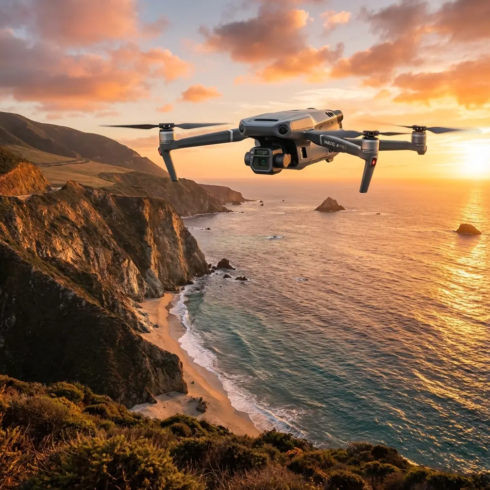
Mavic 3T for High-Altitude Forest Delivery Support: Flight Altitude, Alert Discipline, and Airframe Reliability
META: Technical review of the Mavic 3T for high-altitude forest delivery missions, with practical guidance on flight altitude, thermal signature interpretation, alert prioritization, transmission security, and material reliability.
High-altitude forest work punishes vague thinking. Trees distort depth perception, terrain rises faster than your map suggests, wind behaves differently above ridgelines, and a delivery corridor that looked clean at takeoff can turn into a decision trap halfway through the route. That is exactly where the Mavic 3T becomes interesting—not as a generic enterprise drone, but as a platform that rewards disciplined operating logic.
For teams supporting forest delivery missions in mountain terrain, the real question is not whether the aircraft can fly there. It can. The better question is how to structure altitude, sensing, and crew attention so the aircraft remains useful when the environment gets busy. In my view, the Mavic 3T performs best in this setting when you treat it less like a camera drone and more like a compact aerial decision tool.
Why forest delivery support is a different problem
A forest delivery mission is rarely just “fly from point A to point B.” In high altitude terrain, the aircraft may be used to scout canopy gaps, verify temporary landing or drop zones, inspect route obstructions, check thermal contrast on the ground, and maintain situational awareness when visual line of sight is challenged by slope and tree density. Even when the Mavic 3T is not carrying the delivered item itself, it often becomes the aircraft that makes delivery possible.
This is where the Mavic 3T’s mixed payload logic matters. Thermal signature analysis can reveal sun-heated rocks, recently exposed soil, damp ground, equipment that has been running, or people working under partial canopy. Visual imaging helps validate whether the thermal target is operationally relevant or just environmental noise. In forestry terrain, that combination is often more valuable than pure photogrammetry alone.
Photogrammetry still has a place. If your team is planning repeat deliveries into logging roads, forest service clearings, or elevated relay points, a properly controlled survey with GCP-supported mapping can tighten route planning and reduce guesswork around terrain rise. But in the moment, on the day of operation, the value of the Mavic 3T usually comes from how quickly it helps a pilot or coordinator decide what matters now.
The most useful flight altitude insight for this scenario
If I had to give one altitude rule for high-altitude forest delivery support with the Mavic 3T, it would be this: fly relative to the canopy and terrain, not relative to your takeoff point.
That sounds obvious until crews actually get into mountain timber. A pilot launches from a ridge shoulder, sees healthy clearance on the screen, and then follows a route where the terrain climbs under the aircraft while the valley wind pushes lateral drift across treetops. Suddenly, what looked like a comfortable buffer is gone.
For scouting corridors in dense forest, I generally favor an initial reconnaissance layer around 50 to 80 meters above the local canopy, not above launch elevation. That band is often high enough to preserve broad route awareness while staying low enough to maintain useful thermal and visual discrimination. Go much higher and smaller obstacles, suspended lines near access roads, and subtle terrain shelves start to lose definition. Go much lower on the first pass and you give up the strategic view that prevents boxed-in routing decisions.
There are exceptions. In steep drainages or broken ridgelines, a higher first pass may be safer simply to understand terrain geometry and wind. Then a second pass can be dropped lower for confirmation. The key is sequencing. Use altitude first to build context, then descend only where that added detail improves the mission. Too many crews reverse that order.
For thermal work specifically, altitude has a direct effect on target confidence. A warmer object under partial canopy may still present a detectable thermal signature, but if the aircraft is too high, the signal competes with background clutter from sunlit branches, bare rock, and fragmented ground exposure. In cold morning conditions, the thermal scene is usually cleaner. Midday in alpine forest, thermal interpretation becomes less forgiving, so staying in that practical canopy-relative band matters even more.
Alert discipline matters more than most operators admit
One underappreciated lesson from manned aircraft system design is that not all alerts deserve equal treatment. A reference from aircraft electrical system design breaks warning logic into three levels in standard practice—warning, caution, and advisory—and notes that some systems extend this to five levels, adding hazard and indication categories. That distinction is not academic. It is operational survival for busy crews.
Why bring that into a Mavic 3T forest mission? Because high-altitude delivery support creates exactly the kind of cockpit clutter that leads to missed priorities. Battery state, terrain clearance, link quality, wind, mission timing, return path, and visual interpretation are all competing for attention. If your crew treats every alert, tone, and pop-up as equal, the mental stack collapses fast.
The same source also states that a primary light warning device should be used to attract operator attention and provide an initial urgency cue. In manned design logic, each flight crewmember is assigned two primary light warning signal devices: one for warning-level events and one for caution-level events. Translating that principle to Mavic 3T operations is straightforward and useful. Your crew should create two mental bins before launch:
- Immediate threats that can end the mission or aircraft safety margin now
- Degradations that require action soon but do not demand an abrupt response
For the Mavic 3T in forest delivery support, immediate threats usually include terrain proximity, sudden link instability near a ridge shadow, or battery reserve becoming mismatched to climb-out distance. Caution-level issues may include moderate image degradation, changing thermal contrast, or a route waypoint that needs revision.
This kind of alert hierarchy prevents the common mistake of overreacting to minor nuisances while underreacting to terrain and energy state. It is not glamorous, but it is the difference between a smooth support sortie and a rushed recovery.
What the manual-level warning philosophy suggests for Mavic 3T crews
Another detail from the aircraft design reference is color discipline in warning systems. It specifies that the main warning light for the higher warning class should use a defined warning color standard. The deeper point is not the exact color code. The deeper point is that urgency should be instantly recognizable, not interpreted after the fact.
That maps well to Mavic 3T team procedures. If you run a pilot plus observer or pilot plus delivery coordinator workflow, standardize your callouts. Do not let one person say “signal issue,” another say “video lag,” and a third say “link’s a bit weak” for the same condition. Assign a fixed vocabulary for high-priority events and a separate one for caution items. In forest operations, seconds disappear while people translate each other.
A compact aircraft with strong automation still benefits from old-school human factors discipline. In mountainous timber, that discipline scales better than any single feature.
O3 transmission and AES-256 are not checklist trivia here
High-altitude forest routes often create one of the hardest radio environments for small UAVs: partial masking by terrain, variable moisture, and repeated transitions between open sky and edge cover. The Mavic 3T’s O3 transmission capability matters because route support is only useful if the aircraft remains a reliable remote sensor while moving through those transitions.
But transmission strength is not just about image continuity. In delivery support, delayed interpretation creates operational lag. If a pilot identifies a possible canopy opening or heat source two seconds late, that can alter route timing, holding patterns, or landing zone decisions. In steep terrain, those small delays accumulate.
AES-256 encryption also deserves more respect than it gets in drone marketing summaries. For civilian forestry, logistics, and industrial work, secure transmission is about protecting operational coordinates, site imagery, infrastructure context, and client data. Forest delivery support often involves remote depots, utility corridors, conservation parcels, or high-value field operations. A secure link helps keep those details where they belong.
Battery management in cold, high places
The user prompt mentions hot-swap batteries, and while crews may use that phrase loosely across field operations, the larger truth is that battery turnover discipline becomes central in high-altitude forest work. Lower temperatures can reduce confidence in available energy, and long climbs over rising terrain magnify that problem.
With the Mavic 3T, the practical rule is simple: battery planning must be terrain-aware, not distance-only. A route that is easy on the outbound leg may demand more power on return if the aircraft has to climb back out of a basin or fight a headwind crossing a ridge. If your team is rotating batteries in a mobile forest staging setup, keep them thermally managed before launch and evaluate reserves against the hardest part of the recovery path, not the easiest part of the mission track.
This is another place where a warning-versus-caution mindset helps. Do not wait for the aircraft to turn a battery issue into a high-priority event. In mountain forestry, energy management should be treated as a caution item long before the software makes it feel urgent.
Material reliability: why an old airframe lesson still matters
One of the stranger but useful reference points in the source set comes from aircraft material data on bonded core materials and moisture/corrosion behavior. The table for LF2Y aluminum honeycomb core discusses resistance to humidity and corrosion, while another set of values for bonded core shear strength shows a progression up to 111 in the listed test series. Even with the messy scan quality, the message is clear: structural materials are judged not only by strength, but by what happens after exposure to moisture and corrosive conditions.
Why does that matter to a Mavic 3T article? Because forest delivery support at altitude is wet work. Snowmelt, mist, condensation, and repeated temperature swings stress small aircraft in ways a dry demo flight never reveals. The lesson from those material references is not that the Mavic 3T uses the same core construction. It is that experienced operators should think like airframe engineers: strength values mean less if environmental durability is ignored.
In practical terms, if you are flying frequent forest missions, pay close attention to post-flight drying, sensor window cleanliness, battery contact condition, and transport case moisture control. Moisture is not dramatic on day one. It becomes expensive on mission thirty.
Thermal signature interpretation in forests: what actually works
Thermal is often oversold in woodland environments by people who have not spent enough time comparing the screen to the ground truth. The Mavic 3T is genuinely useful here, but only if the operator understands what a forest hides.
Under intact canopy, thermal detection is selective, not magical. You are often seeing fragments: a portion of a vehicle roof through gaps, a warm patch of disturbed soil, a recently used generator near a worksite, or human activity at the edge of tree cover. This is why altitude selection and oblique viewing angles matter. A nadir-only mindset leaves too much information buried.
For delivery support, thermal excels in three specific moments:
- Verifying whether a clearing is occupied or recently active
- Detecting equipment or heat-producing assets near a target zone
- Checking route-side anomalies early or late in the day when contrast improves
Pair that with visual zoom and disciplined recon passes. If mapping is part of the broader job, use photogrammetry and GCPs to model repeatable terrain. If the mission is immediate delivery support, thermal plus visual confirmation usually gives the fastest answer.
BVLOS pressure and the reality of terrain
BVLOS is often discussed as if it were a technology setting. It is really an operational framework, and mountain forest work exposes that immediately. The Mavic 3T has the sensor and link architecture to support more advanced workflows, but terrain masking, observer placement, and route geometry still dominate outcomes.
If your operation is structured within the local regulatory framework for extended-range or shielded work, terrain analysis should come before mission design, not after. In forests, you do not lose visual awareness all at once. You lose it sector by sector. Build your route around those losses. Place people or relay logic where topography actually demands it.
When teams want a second set of eyes on route design or altitude planning for this kind of mission, a direct field-ops chat like message our technical desk on WhatsApp is often faster than trading screenshots without context.
Final assessment
The Mavic 3T is well suited to high-altitude forest delivery support, but not because it solves the environment for you. It performs because it compresses multiple decision layers—visual confirmation, thermal screening, secure transmission, and route awareness—into a platform small enough to deploy quickly in rough terrain.
Its real advantage appears when the crew borrows proven aircraft-system thinking. Use a clear alert hierarchy. Separate urgent threats from manageable degradations. Fly relative to canopy and terrain rather than launch point. Respect transmission geometry. Treat moisture exposure as a maintenance variable, not bad luck.
Do that, and the aircraft stops being just a drone with thermal. It becomes a reliable front-end tool for making forest delivery missions safer, faster, and easier to repeat.
Ready for your own Mavic 3T? Contact our team for expert consultation.