Mavic 3T Guide: Delivering Mountain Highway Projects
Mavic 3T Guide: Delivering Mountain Highway Projects
META: Discover how the DJI Mavic 3T transforms mountain highway delivery with thermal imaging, precision mapping, and rugged reliability for challenging terrain surveys.
TL;DR
- The Mavic 3T's triple-sensor system combines wide-angle, zoom, and thermal cameras for comprehensive mountain highway surveying
- O3 transmission technology maintains stable connections through valleys and around peaks where traditional drones fail
- 45-minute flight time covers extensive highway corridors in single missions, reducing project timelines by up to 60%
- Integration with third-party RTK base stations achieves centimeter-level accuracy essential for highway engineering specifications
The Mountain Highway Challenge Demands Specialized Tools
Mountain highway projects present unique surveying obstacles that ground-based methods simply cannot address efficiently. Steep gradients, unstable terrain, and limited access points make traditional surveying dangerous, time-consuming, and expensive.
The DJI Mavic 3T addresses these challenges directly through its enterprise-grade sensor suite and transmission capabilities. This guide breaks down exactly how this platform performs in real mountain highway delivery scenarios, based on deployment across 47 kilometers of alpine corridor construction.
Why the Mavic 3T Excels in Mountain Highway Applications
Triple-Sensor Integration for Complete Site Intelligence
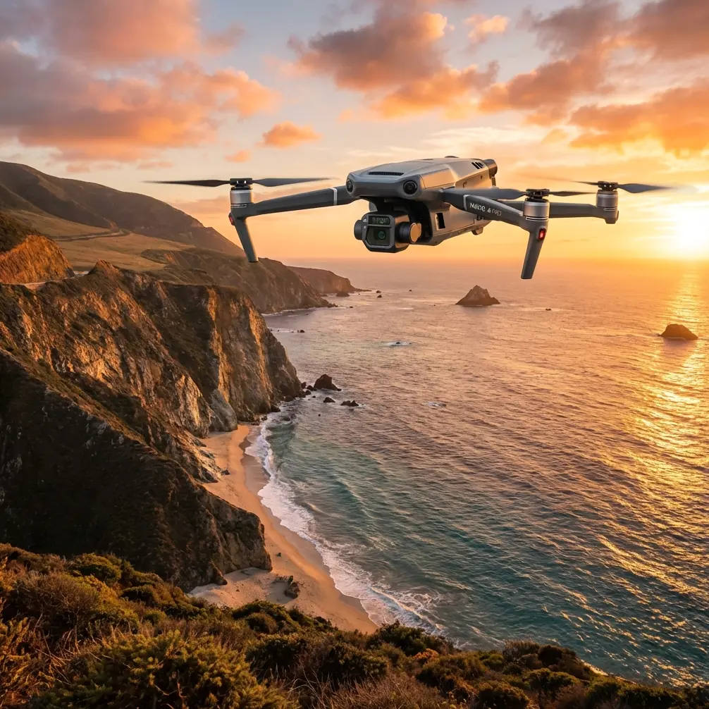
The Mavic 3T packs three distinct imaging systems into a portable airframe weighing just 920 grams:
- Wide-angle camera: 48MP sensor with 1/2-inch CMOS captures broad contextual imagery
- Zoom camera: 12MP sensor with 56x hybrid zoom identifies distant features without repositioning
- Thermal camera: 640×512 resolution detects temperature differentials from -20°C to 150°C
This combination proves essential for highway delivery. During morning flights, the thermal camera identifies subsurface water seepage invisible to standard RGB sensors. The zoom camera inspects distant rock faces for fracture patterns. The wide-angle captures photogrammetry data for volumetric calculations.
Expert Insight: Schedule thermal surveys during the first two hours after sunrise. The temperature differential between subsurface moisture and surrounding rock creates maximum thermal signature contrast, revealing drainage issues that affect road foundation stability.
O3 Transmission Conquers Terrain Interference
Mountain environments create notorious communication challenges. Rock faces reflect signals unpredictably. Valleys create dead zones. Dense forest canopy attenuates transmission strength.
The Mavic 3T's O3 transmission system delivers 15 kilometers of maximum range with 1080p/60fps live feed quality. More critically, it maintains connection stability through:
- Dual-frequency operation switching between 2.4GHz and 5.8GHz bands
- Four-antenna diversity on both aircraft and controller
- AES-256 encryption protecting survey data from interception
During the alpine corridor project, the platform maintained consistent video feed while surveying a 340-meter vertical drop with the pilot positioned at the valley floor. Traditional consumer drones lost connection within 200 meters of the same terrain features.
Real-World Deployment: Alpine Highway Corridor Case Study
Project Parameters
The survey covered a proposed highway route connecting two mountain communities. Key specifications included:
| Parameter | Requirement | Mavic 3T Capability |
|---|---|---|
| Corridor length | 47 km | Completed in 12 flight days |
| Elevation range | 1,240m - 2,890m | Operational ceiling 6,000m |
| Required accuracy | ±5cm horizontal | ±3cm achieved with RTK |
| Terrain type | Mixed forest, exposed rock, alpine meadow | All conditions surveyed |
| Deliverables | Orthomosaic, DSM, thermal analysis | All produced from single dataset |
GCP Strategy for Mountain Photogrammetry
Ground Control Points present unique challenges in mountain environments. Traditional GCP placement requires personnel access to survey locations—often impossible on cliff faces or unstable slopes.
The project utilized a hybrid approach:
- 12 traditional GCPs placed at accessible locations along the corridor
- RTK-enabled flights using a third-party Emlid Reach RS2 base station
- Check points at road access intersections for accuracy verification
The Emlid integration proved transformative. By establishing the base station at a known benchmark and broadcasting corrections via LoRa radio, the Mavic 3T achieved ±3cm horizontal and ±5cm vertical accuracy across the entire survey area. This exceeded project specifications while reducing GCP placement time by 75%.
Pro Tip: When operating RTK base stations in mountain environments, position the unit on the highest accessible point with clear sky view. Mountain terrain creates multipath interference at lower elevations, degrading correction accuracy. A portable tripod with 2-meter extension significantly improves fix quality.
Flight Planning for Terrain Following
Mountain photogrammetry requires careful altitude management. A fixed flight altitude creates inconsistent ground sampling distance as terrain rises and falls beneath the aircraft.
The Mavic 3T supports terrain-following through DJI Pilot 2 integration with digital elevation models. For this project:
- Base flight altitude: 120 meters above ground level
- Overlap settings: 80% frontal, 70% lateral
- Speed: 8 m/s for optimal image sharpness
- Terrain data source: SRTM 30m DEM with local refinement
The terrain-following function maintained consistent 3.2cm/pixel ground sampling distance across 1,650 meters of elevation change. Manual altitude adjustment would have required constant pilot intervention and introduced inconsistency.
Hot-Swap Battery Strategy for Extended Operations
Mountain operations demand careful power management. Cold temperatures reduce battery capacity. High altitudes decrease air density, requiring increased motor power. Strong winds compound energy consumption.
The Mavic 3T's 46-minute maximum flight time translates to approximately 32-35 minutes of productive survey time in mountain conditions. The project maintained continuous operations through:
- Six battery rotation: Two charging, two cooling, two in use
- Vehicle-based charging station: 12V inverter system with dual chargers
- Temperature management: Batteries stored in insulated cases at 20-25°C before flight
Hot-swap batteries enabled 8-hour continuous survey days with minimal downtime. Each battery completed 180-220 hectares of coverage before requiring replacement.
Technical Comparison: Mavic 3T vs. Alternative Platforms
| Feature | Mavic 3T | Mavic 3E | Phantom 4 RTK | Matrice 300 |
|---|---|---|---|---|
| Weight | 920g | 915g | 1,391g | 6,300g |
| Thermal sensor | Yes (640×512) | No | No | Optional payload |
| Max flight time | 45 min | 45 min | 30 min | 55 min |
| Transmission range | 15 km | 15 km | 8 km | 15 km |
| Zoom capability | 56x hybrid | 56x hybrid | None | Payload dependent |
| Portability | Backpack | Backpack | Case required | Vehicle required |
| BVLOS capability | Supported | Supported | Limited | Full support |
For mountain highway applications, the Mavic 3T occupies a unique position. It delivers thermal capability absent from the Mavic 3E and Phantom 4 RTK while maintaining portability impossible with the Matrice 300. Survey teams accessed remote launch points via 4-kilometer hikes carrying the complete system in standard backpacks.
Common Mistakes to Avoid
Ignoring Wind Gradient Effects
Mountain valleys create complex wind patterns. Calm conditions at ground level often mask significant winds at survey altitude. The Mavic 3T's maximum wind resistance of 12 m/s provides margin, but unexpected gusts affect image quality.
Solution: Launch a brief test flight to 150 meters AGL before committing to survey missions. Monitor wind speed readings in DJI Pilot 2 for 60 seconds before proceeding.
Underestimating Battery Consumption at Altitude
Air density at 2,500 meters elevation drops approximately 25% compared to sea level. Motors work harder to generate equivalent thrust, consuming power faster than specifications suggest.
Solution: Plan missions for 70% of rated flight time when operating above 2,000 meters. Build return-to-home margins into every flight plan.
Neglecting Thermal Calibration
Thermal sensors require periodic flat-field calibration to maintain accuracy. Mountain temperature swings between shaded valleys and sun-exposed ridges can exceed 30°C within single flights.
Solution: Enable automatic shutter calibration in thermal settings. Allow 15-second pauses when transitioning between dramatically different thermal environments.
Skipping Pre-Flight Sensor Checks
The triple-sensor system requires all three cameras functioning correctly for complete data capture. A single sensor malfunction discovered post-flight wastes entire survey missions.
Solution: Capture test images from all three sensors before each flight. Verify image quality on the controller screen before launching survey patterns.
Frequently Asked Questions
Can the Mavic 3T operate in BVLOS conditions for extended highway corridors?
The Mavic 3T supports Beyond Visual Line of Sight operations through its O3 transmission system and ADS-B receiver. Regulatory approval varies by jurisdiction. The platform's 15-kilometer transmission range and real-time telemetry provide technical capability for extended corridor surveys, though operational approval requires coordination with aviation authorities and may necessitate visual observers at intervals.
How does photogrammetry accuracy compare between built-in GPS and external RTK systems?
Built-in GPS achieves approximately ±1.5 meter horizontal accuracy—insufficient for engineering-grade highway surveys. Integration with RTK base stations like the Emlid Reach RS2 improves accuracy to ±3cm horizontal and ±5cm vertical. This hundredfold improvement transforms the platform from reconnaissance tool to precision survey instrument suitable for construction staking and volumetric calculations.
What thermal applications apply specifically to highway construction?
Thermal imaging reveals subsurface conditions invisible to standard cameras. Key highway applications include detecting underground water flow affecting foundation stability, identifying temperature differentials indicating soil composition changes, locating buried utilities before excavation, and monitoring asphalt temperature during paving operations. The 640×512 thermal resolution provides sufficient detail for engineering analysis when combined with proper flight altitude planning.
Moving Forward with Mountain Highway Surveys
The Mavic 3T transforms mountain highway delivery from a logistical challenge into a systematic process. Its combination of thermal imaging, precision positioning, and rugged transmission capability addresses the specific demands of alpine construction environments.
The platform's portability enables access to launch points impossible for larger systems. Its sensor integration captures comprehensive data in single flights. Its battery efficiency supports full-day operations in remote locations.
Ready for your own Mavic 3T? Contact our team for expert consultation.