Mavic 3T Field Report: Low-Light Highway Delivery Work
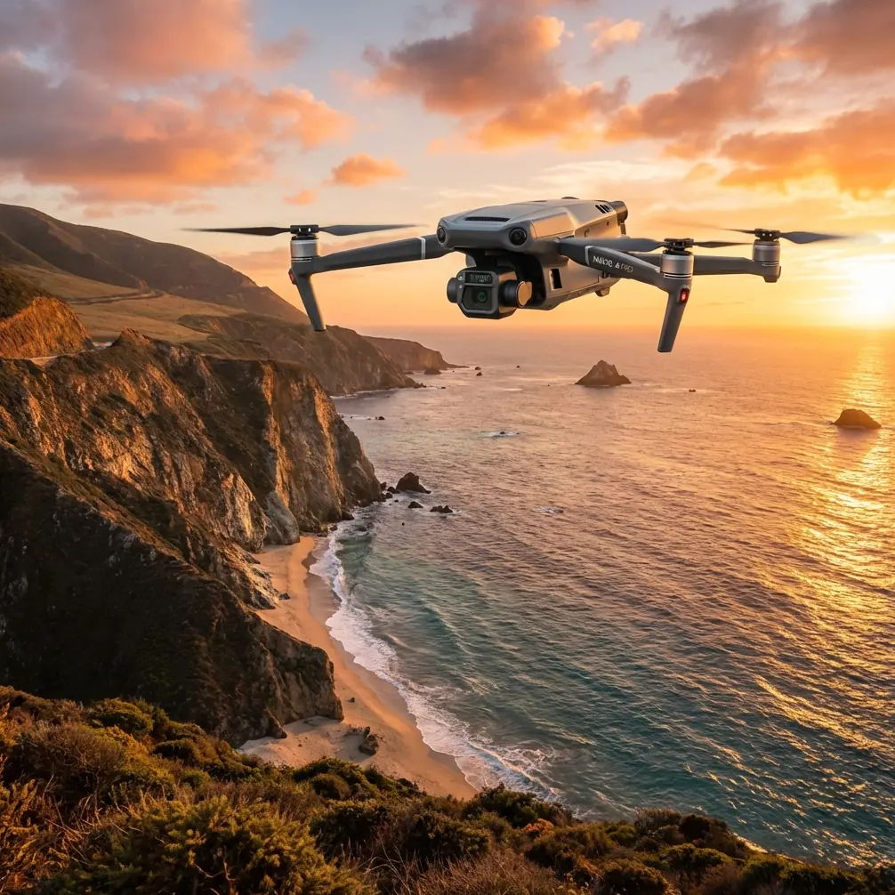
Mavic 3T Field Report: Low-Light Highway Delivery Work Starts Before Takeoff
META: Expert field report on using the Mavic 3T for low-light highway delivery and corridor operations, with practical pre-flight discipline, thermal interpretation, transmission reliability, and weight-balance lessons drawn from aircraft design principles.
By Dr. Lisa Wang, Specialist
Highway delivery work in low light has a habit of exposing every shortcut in your workflow.
Not the obvious ones. The quiet ones. A slightly hazed sensor window. A rushed battery swap. A payload setup that technically powers on, but shifts the aircraft’s behavior just enough to affect image consistency on a long corridor run. When the task is time-sensitive and the route runs through dim interchanges, overpasses, construction segments, and service lay-bys, the Mavic 3T becomes more than a compact thermal drone. It becomes a decision tool. And decision tools only work when the operator respects the details.
That is the central lesson from repeated Mavic 3T deployments on low-light highway jobs: safe and useful output depends less on airborne improvisation than on disciplined setup. One of the most overlooked steps is also the simplest—cleaning the safety-critical surfaces before launch.
The pre-flight cleaning step most crews treat as optional
Before any night or dusk mission, I want the aircraft on a stable surface with a light source angled across the body. Then I check and clean, in order:
- obstacle sensing windows
- thermal lens cover area
- visible camera glass
- auxiliary lighting surfaces if fitted
- arm joints and landing surfaces
That sounds basic. It is not trivial.
Highway environments are dirty. Fine grit, diesel residue, spray from passing traffic, and moisture film can build quickly during mobile operations. On the Mavic 3T, a thin layer of contamination can degrade two things that matter immediately in low light: obstacle perception confidence and image interpretation. A thermal signature is only as useful as the clarity of the optics and the confidence of the pilot in what the system is actually “seeing.”
I have watched crews blame “weak thermal contrast” when the real issue was residue on the lens area after a roadside setup near active traffic. The aircraft still flew. The feed still looked usable. But thermal edges softened enough to make a warm vehicle shoulder stop blend into the surrounding pavement. That is exactly the kind of small degradation that becomes operationally expensive when you are trying to verify delivery access points, identify safe landing-adjacent spaces, or inspect temporary staging zones along a highway corridor.
So yes, clean the aircraft. Not because it is neat. Because it preserves the integrity of low-light sensing.
Why low-light highway delivery is a special case for the Mavic 3T
Many pilots talk about low-light work as if it were simply “night flying with thermal.” Highway operations are harder than that description suggests.
The environment is long, repetitive, and full of confusing heat sources. Road surfaces hold residual warmth. Guardrails may reflect or radiate differently depending on recent weather. Parked maintenance vehicles, portable generators, recently used equipment, and even drainage structures can create misleading hotspots. Delivery-related work along highways often also involves temporary handoff locations, short dwell times, and frequent repositioning by the crew on the ground.
This is where the Mavic 3T earns its place. The combination of thermal sensing, visible imaging, and stable digital transmission gives the operator more than one way to verify what is happening. Thermal tells you where energy is. The visual camera tells you what the object is. Reliable transmission tells you whether you can trust your timing and flight decisions at distance.
The O3 transmission link matters here for a reason beyond convenience. In corridor work, especially when tracking progress along a highway alignment, you do not want delayed interpretation. Small delays compound. A vehicle enters the frame, a contractor steps into a shoulder area, a loading point becomes active, and the operator must decide whether to continue, pause, or reposition. Stable video and control responsiveness reduce decision friction.
For teams handling commercially sensitive route data or infrastructure imagery, AES-256 is not a marketing bullet. It is part of the operational chain of custody. Highway projects often involve unpublished works, utility staging, access arrangements, and contractor movement patterns. Secure transmission and data handling are not abstract concerns when you are documenting logistics on live infrastructure.
What older aircraft design logic still teaches us about a compact drone
The reference material behind this article comes from aircraft design manuals, not drone brochures. At first glance, one section deals with spline tolerances measured in micrometers. Another explains load-balance charts and the use of an index-based method to determine an aircraft’s final center of gravity from an empty-aircraft starting point. Neither mentions the Mavic 3T. Both still matter.
Let’s start with the balance concept.
One source describes how a crew begins with the aircraft’s empty-weight center of gravity as a starting point, then applies the effect of each added item in sequence until the final index is reached. The logic is straightforward: every added component changes the aircraft state, and the final operating condition is only understood when those changes are accumulated correctly. The same text notes that some loading charts use evenly spaced marks where each interval equals a unit-weight index, with the unit chosen by the designer—for example, “100 kg” in a manned-aircraft context.
Why should a Mavic 3T operator care?
Because the principle survives miniaturization. On a drone, the absolute masses are smaller, but the operational truth is the same: configuration changes alter behavior. Swap accessories, change propeller condition, fit protective covers, add third-party mounting hardware, shift battery condition across cycles, and you are changing the aircraft state—even if only slightly. On a low-light highway run, slight changes show up as practical issues: hover corrections near structures, subtle framing inconsistency in repeated passes, or greater pilot workload in crosswind conditions above embankments.
The point is not that you must build a full balance chart for every Mavic 3T mission. The point is that professional crews think in states, not in assumptions. Start with a known baseline. Record what changed. Expect the aircraft to reflect those changes.
That same mindset appears in the mechanical reference as well. One table lists tooth-direction tolerances, including values such as 4, 7, 11, 12, and up to 30 micrometers depending on class and geometry. Another section gives dimensional deviation ranges for external spline diameters, with values like -52, -30, and -35 micrometers in smaller bands, expanding to larger negative deviations such as -173 and -104 micrometers in bigger size ranges. To a drone operator, these may seem remote. They are not.
Those numbers remind us what aerospace-grade repeatability actually looks like. Micrometers matter in mechanical interfaces because accumulated error becomes vibration, wear, backlash, or alignment drift. On a compact UAV, you may never see the tolerance table for every internal component, but you absolutely live with the consequences of mechanical precision. Gimbal stability, fold-arm consistency, motor smoothness, and sensor alignment all depend on small tolerances being controlled somewhere in the product chain.
Operationally, that matters when the aircraft is doing low-light corridor documentation and delivery support. If you want thermal and visual overlays to be trustworthy from pass to pass, if you want photogrammetry tie points to hold together when you revisit a segment, if you want the aircraft to feel predictable after a battery swap in a cold roadside environment, then you are really asking the machine to convert fine manufacturing tolerances into field consistency.
Thermal is not enough. Interpretation wins the mission.
The Mavic 3T’s thermal capability is often discussed as if it automatically clarifies a scene. In practice, thermal simplifies some tasks and complicates others.
For low-light highway delivery support, thermal is best treated as a prioritization layer. It tells you where to look first. It does not remove the need for visual confirmation. A warm patch near a shoulder could be a recently parked vehicle, exposed equipment, a generator housing, a person, or just pavement retaining heat unevenly. The skilled operator uses thermal to flag anomalies, then uses the visual camera and flight geometry to classify them.
This matters when working around delivery corridors and handoff points. You may be checking whether a temporary receiving zone is clear, whether ground staff are in expected positions, or whether a support vehicle has arrived. Thermal signature helps you find activity fast. It does not excuse sloppy identification.
I also advise crews to keep a disciplined angle strategy. Straight-down views are useful for map logic, but oblique angles often improve interpretation of barriers, embankments, parked vehicles, and access-lane clutter. If the mission also has a documentation requirement, capture a repeatable visual set suitable for later photogrammetry where possible. The Mavic 3T is not just a thermal observer; it can be part of a broader site record. If you need measurable outputs later, plan your overlap, note any GCP placement strategy in advance, and do not assume that a hurried low-light pass will be enough for reliable reconstruction.
Battery handling in mobile roadside operations
Highway jobs are rarely static. The crew vehicle moves. Launch points change. Batteries cycle fast. This is where hot-swap discipline becomes the difference between orderly work and creeping risk.
Every swap should include three checks: seating, latch confirmation, and a brief post-power-on hover assessment before the aircraft commits to the corridor again. Why hover? Because roadside urgency encourages immediate departure. A short stability check catches issues while the aircraft is still close and recoverable.
Think back to the aircraft-balance reference. In that system, each added or changed item shifts the final index. On the Mavic 3T, the battery is not just energy storage. It is part of the aircraft state. Change the battery, and you have changed temperature condition, voltage behavior, and potentially the way the aircraft settles into the first minute of flight. This is especially noticeable in cool, low-light operations where one pack came from a warmed case and the next has been exposed longer than planned.
BVLOS thinking without pretending every mission is BVLOS
Many highway readers are interested in BVLOS because corridor work naturally pushes in that direction. Fair enough. But even when the mission remains within the local visual and regulatory framework, BVLOS-style planning improves outcomes.
That means route segmentation, contingency landing logic, communication discipline, and a stronger emphasis on link quality and data confidence. The Mavic 3T’s O3 transmission helps, but no transmission system replaces route design. If a section includes overpasses, reflective surfaces, elevation changes, or roadside vegetation that can complicate signal geometry, plan those factors before takeoff rather than discovering them live.
If your team needs a second opinion on route setup or low-light workflow, you can send a mission outline through this direct M3T planning chat.
A practical workflow for low-light delivery support on highways
Here is the field sequence I trust most with the Mavic 3T:
- Clean first, power second. Dirt hides in plain sight at dusk.
- Confirm aircraft state. Props, battery, payload surfaces, firmware status, storage, and home point logic.
- Brief the route as segments. Not one continuous line, but manageable decision blocks.
- Use thermal for detection, visual for confirmation.
- Capture repeatable imagery where documentation may later matter. Think ahead to photogrammetry and GCP-supported reconstruction if the site could require evidence-grade mapping.
- Treat each battery swap as a state change.
- Review anomalies immediately after landing while context is fresh.
That last step matters more than people admit. Highway scenes change fast. If a thermal anomaly or access issue appears during flight, annotate it while the crew still remembers traffic flow, weather, and ground activity. Waiting until the next morning strips away half the meaning.
What makes the Mavic 3T genuinely useful here
Not that it flies. Plenty of aircraft fly.
What makes the Mavic 3T useful in low-light highway delivery operations is that it compresses several high-value functions into one fieldable platform: thermal screening, visual verification, secure data handling, and dependable transmission in a package that can move with a roadside team. That only pays off when the operator brings aircraft-grade thinking to a small drone.
The old manuals behind this discussion were written for larger aviation systems, but their lessons translate cleanly. Precision matters. Sequence matters. Starting condition matters. Every added variable changes the aircraft state. And when tolerances shrink to the micrometer level in the design world, the field result you experience is confidence—or its absence.
With the Mavic 3T, low-light highway work is not won by flashy flying. It is won by clean sensors, repeatable setup, disciplined interpretation, and respect for how small changes become operational outcomes.
Ready for your own Mavic 3T? Contact our team for expert consultation.