Delivering Solar Farm Surveys at High Altitude With the Mavi
Delivering Solar Farm Surveys at High Altitude With the Mavic 3T: What Actually Changes in the Field
META: Specialist guidance on using the Mavic 3T for high-altitude solar farm delivery missions, with practical advice on thermal signature capture, antenna positioning, O3 transmission, GCP strategy, and battery management.
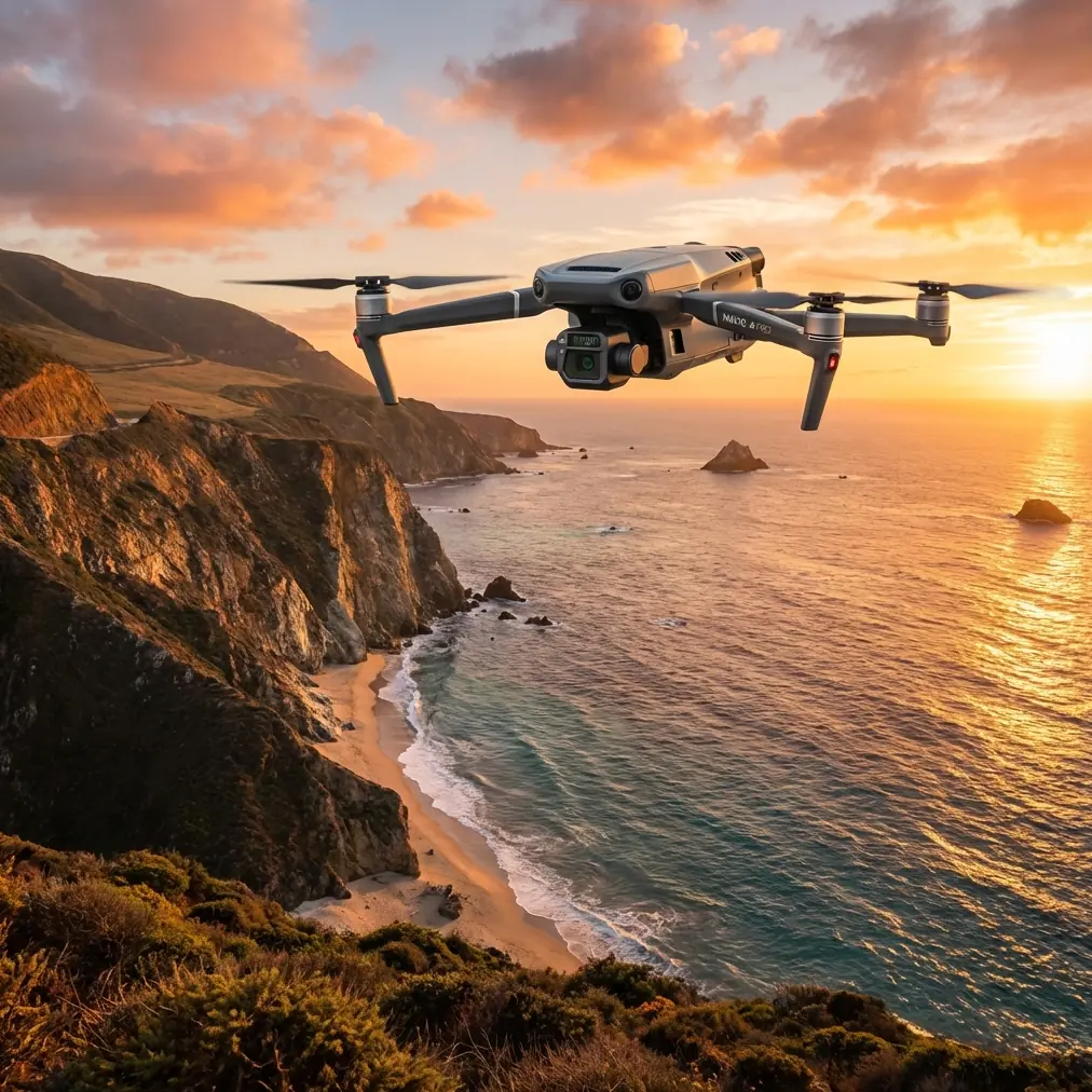
High-altitude solar sites punish weak planning. The air is thinner, the weather turns faster, and wide arrays of dark glass can confuse both pilots and sensors if the workflow is not built for the terrain. For teams using the Mavic 3T, that matters because this aircraft sits in an unusual middle ground: portable enough to move between remote inverters and ridgeline access roads, but capable enough to collect thermal and visual intelligence that can shape maintenance decisions the same day.
If your mission is delivering survey capability across a mountain solar installation rather than simply flying a short visual check, the Mavic 3T can be extremely effective. But only if you treat altitude as an operational variable, not just a line in the site brief.
I work with crews that use compact enterprise UAVs in demanding inspection environments, and the same pattern keeps repeating. The aircraft itself is rarely the limiting factor. The real issue is whether the team adapts the mission profile to the way the Mavic 3T sees, transmits, and consumes power in thin air over repetitive solar geometry.
That is the real problem.
The solution is to stop treating a high-altitude solar farm as a normal PV survey done a little higher up. It is its own operating environment, and the Mavic 3T has specific strengths that become more valuable when you lean into them correctly.
The first problem is not thermal imaging. It is logistics.
On paper, many operators think first about hotspot detection. In reality, the first operational challenge is getting meaningful coverage over a large, elevated site without wasting battery cycles repositioning, re-planning, or waiting out weak signal conditions from poor pilot placement.
A mountain solar farm often spreads across stepped terrain, with rows that disappear behind grade changes. That means line of sight is fragile even when the aircraft is technically close. The Mavic 3T’s O3 transmission system is a major advantage here because it gives crews a more resilient video and control link than older compact platforms, but transmission performance still depends heavily on where the pilot stands and how the controller antennas are aimed.
This is where good teams separate themselves quickly.
For maximum range and stability, do not point the tips of the antennas directly at the aircraft. The broad face of each antenna should be oriented toward the drone, because that is where the strongest radiation pattern sits. On terraced solar fields, I usually advise pilots to choose a position slightly elevated above the current array block rather than deep within panel rows or beside metal service structures. In practice, moving even 20 to 30 meters to clear a local obstruction can clean up the link dramatically. That change is operationally significant because a clean feed is not just about comfort. It supports consistent framing, better thermal interpretation in real time, and fewer aborted legs that waste battery reserves needed for the next segment.
The portable form factor of the Mavic 3T also matters more at altitude than many buyers expect. Large mapping aircraft can deliver excellent output, but when roads are narrow, weather windows are short, and technicians need to move between substations and panel groups quickly, deployment speed becomes part of data quality. If the team can reposition fast enough to keep flying during the stable part of the day, they collect more comparable thermal data and reduce the distortion caused by changing irradiance.
Thermal success on solar farms depends on timing, not just the sensor
The Mavic 3T gets attention because of its thermal capability, and rightly so. But with elevated solar sites, the thermal signature you capture is only as useful as the environmental discipline behind it.
At high altitude, solar installations often experience sharp temperature swings, stronger wind exposure, and cloud movement that changes panel loading quickly. That creates a common mistake: crews launch as soon as they arrive, collect imagery under mixed conditions, and assume the thermal layer will sort itself out later. It usually does not.
For panel fault detection, comparative consistency matters. If one section of the site is flown in stable sun and another after a cold gust front moves through, your anomaly set gets noisier. The Mavic 3T is excellent for targeted thermal inspections because it can move efficiently from string to string, but operators need to sequence the mission around the site’s thermal behavior. That usually means identifying the blocks with the highest maintenance priority first, then flying them while irradiance is steady enough to support pattern comparison across adjacent rows.
This is also where the aircraft’s dual role becomes valuable. You are not limited to a thermal-only narrative. The visual payload helps confirm whether a suspicious heat pattern is more likely tied to soiling, cracked cells, connection issues, shadowing, or a physical defect around frame edges or junction areas. For a high-altitude site, where sending a technician back to verify a false positive may involve long travel over rough access roads, reducing ambiguity at the capture stage saves real time.
Photogrammetry at altitude needs discipline around GCPs
Many Mavic 3T discussions drift immediately toward emergency response or security work. For solar farm delivery missions, that is too narrow. One of the most practical uses of the aircraft is combining thermal inspection with photogrammetry-derived site context, especially when maintenance teams need to document row-level conditions, drainage changes, access constraints, or storm effects around array infrastructure.
But there is a catch.
At high-altitude sites, relying on a quick autonomous flight alone can introduce alignment problems, especially over repetitive solar patterns where panels look nearly identical from above. This is where GCP strategy becomes more than a mapping checkbox. Ground control points provide positional discipline when the site’s visual texture is repetitive and the terrain changes elevation across the project footprint.
If you are building an orthomosaic or a progress model around a mountainous PV field, distribute GCPs across both horizontal spread and vertical relief. Do not cluster them near the access road simply because that is where it is convenient to walk. Operationally, this matters because the maintenance team may later compare thermal findings against a map layer to locate suspect modules near drainage channels, combiner boxes, or slope transitions. Weak control geometry at a high-altitude site can turn a useful dataset into one that requires manual interpretation every time.
The Mavic 3T is not always the first aircraft people mention for detailed photogrammetry, but in the field it can still play a valuable role when the mission goal is actionable site intelligence rather than pure survey volume. The advantage is that one platform can support both thermal triage and visual context collection during the same deployment window.
Battery strategy is where high-altitude missions are won or lost
Thin air changes aircraft behavior. You feel it in climb efficiency, in hover confidence under gusts, and in the speed with which a tidy mission plan unravels if the team underestimates reserve requirements. That is why battery management on a high-altitude solar farm should be treated as a mission system, not a consumable detail.
The Mavic 3T benefits from hot-swap batteries operationally because crews can keep the aircraft moving between inspection segments without long resets. On a large mountain site, that translates into more consistent data collection during the part of the day when thermal contrast is most usable. If the team has to pause too long between legs, sun angle and panel loading change, and your anomaly comparison gets weaker.
Hot-swapping also supports a segmented flight architecture. Instead of attempting one long, broad mission over mixed terrain, break the site into logical blocks tied to battery availability, terrain masking, and retrieval options. That matters for safety as much as efficiency. At altitude, return decisions need more conservatism. A route that feels comfortable on a lowland site can become marginal if headwinds build along a ridge or if the aircraft must climb out from behind a slope to restore the strongest transmission geometry.
The key operational habit is simple: land earlier than your low-elevation instincts tell you to. Preserve margin for the unexpected climb, not the expected cruise.
Signal security and site confidentiality are not side issues
Solar farms are infrastructure assets, and many owners now care about data governance almost as much as defect detection. The Mavic 3T’s AES-256 encryption is relevant here because thermal and visual inspection data can reveal equipment layout, site access paths, and security-sensitive details. In a remote high-altitude project, teams often transmit and review footage on the fly while maintenance contractors, EPC staff, and owner representatives are all involved. Encrypted transmission helps reduce exposure during active operations.
That is not a marketing detail. It affects whether sensitive inspections can be conducted confidently in mixed operational environments.
For teams supporting utility-scale assets, secure link architecture also helps build trust with clients who increasingly ask how imagery is handled during capture rather than only after export. The right answer is not just a storage policy. It starts with what happens in the air.
BVLOS thinking influences even VLOS missions
Not every solar farm operation with the Mavic 3T will be conducted under BVLOS authority, and many will remain strictly visual line of sight. Still, BVLOS-style planning improves performance even when the rule set does not change.
Why? Because high-altitude solar sites force operators to think in terms of terrain-driven link quality, emergency landing options, segment boundaries, and communication discipline. Those are the same habits that mature beyond-line-of-sight programs require.
For example, when I design procedures for elevated PV sites, I ask crews to define relay points, terrain masks, and contingency landing zones before launch. That sounds conservative until a weather edge rolls over the ridge and the pilot has to decide whether to continue the final inspection pass or recover immediately. The crew that has already mapped those decision points usually gets the aircraft home with data intact.
The Mavic 3T rewards that kind of planning because it is agile enough to exploit short windows and precise enough to gather useful evidence fast. But agility without structure produces messy datasets.
Antenna positioning advice that actually helps in the field
Since range and link stability are a recurring concern on large solar sites, this deserves direct treatment.
If you want the best practical O3 performance from the Mavic 3T on a high-altitude installation:
Keep the controller chest-high and stable rather than down at waist level while walking. Small body movements and human shielding matter more than people think.
Aim the flat faces of the antennas toward the aircraft’s path, not the antenna tips.
Avoid standing beside trucks, metal fencing, inverter housings, or dense combiner infrastructure when launching or flying long straight legs.
If the aircraft is moving across sloped terrain, reposition yourself before the ridge line starts to block the direct path. Do not wait until the signal graph looks poor.
Use terrain to your advantage. Sometimes stepping upslope a short distance gives a better overall corridor than staying near the service road.
This is one of those areas where a ten-second decision saves an entire battery cycle.
If your team is building a repeatable operating procedure and wants a field checklist tailored to mountain PV sites, I often recommend sharing mission specifics early through this quick coordination channel: message Dr. Lisa Wang’s flight support desk. That keeps the technical discussion focused on layout, elevation, and inspection goals instead of generic platform talk.
What the Mavic 3T does best on elevated solar projects
The Mavic 3T is not the answer to every utility-scale survey problem. If the requirement is maximum acreage coverage under a pure mapping brief, a different platform may be more suitable. But that misses the point of why this aircraft is so effective for many high-altitude solar operations.
Its strength is convergence.
You can move quickly across difficult terrain. You can capture thermal evidence and visual context in one deployment. You can work with secure transmission through AES-256. You can take advantage of O3 transmission performance, provided the crew understands antenna geometry and pilot positioning. And with hot-swap battery workflows, you can maintain momentum during the narrow windows when thermal inspection is worth doing.
That combination is operationally significant because mountain solar sites rarely present only one problem at a time. The team may need to verify a suspected hotspot, document access erosion near a row, confirm equipment status around a skid, and produce imagery that helps maintenance crews find the exact area without ambiguity. The Mavic 3T handles that kind of mixed mission better than many operators realize.
For high-altitude solar farm delivery work, the aircraft should not be treated as a compact substitute for something bigger. It should be treated as a precision field tool whose value appears when the workflow is tuned to terrain, weather, power margins, and signal geometry.
That is the shift that turns a difficult site into a manageable one.
Ready for your own Mavic 3T? Contact our team for expert consultation.