Mavic 3T for High-Altitude Venue Deliveries
Mavic 3T for High-Altitude Venue Deliveries: What Actually Matters in the Field
META: Expert technical review of the DJI Mavic 3T for high-altitude venue delivery support, covering thermal signature, O3 transmission, AES-256 security, battery strategy, and payload-ready workflow.
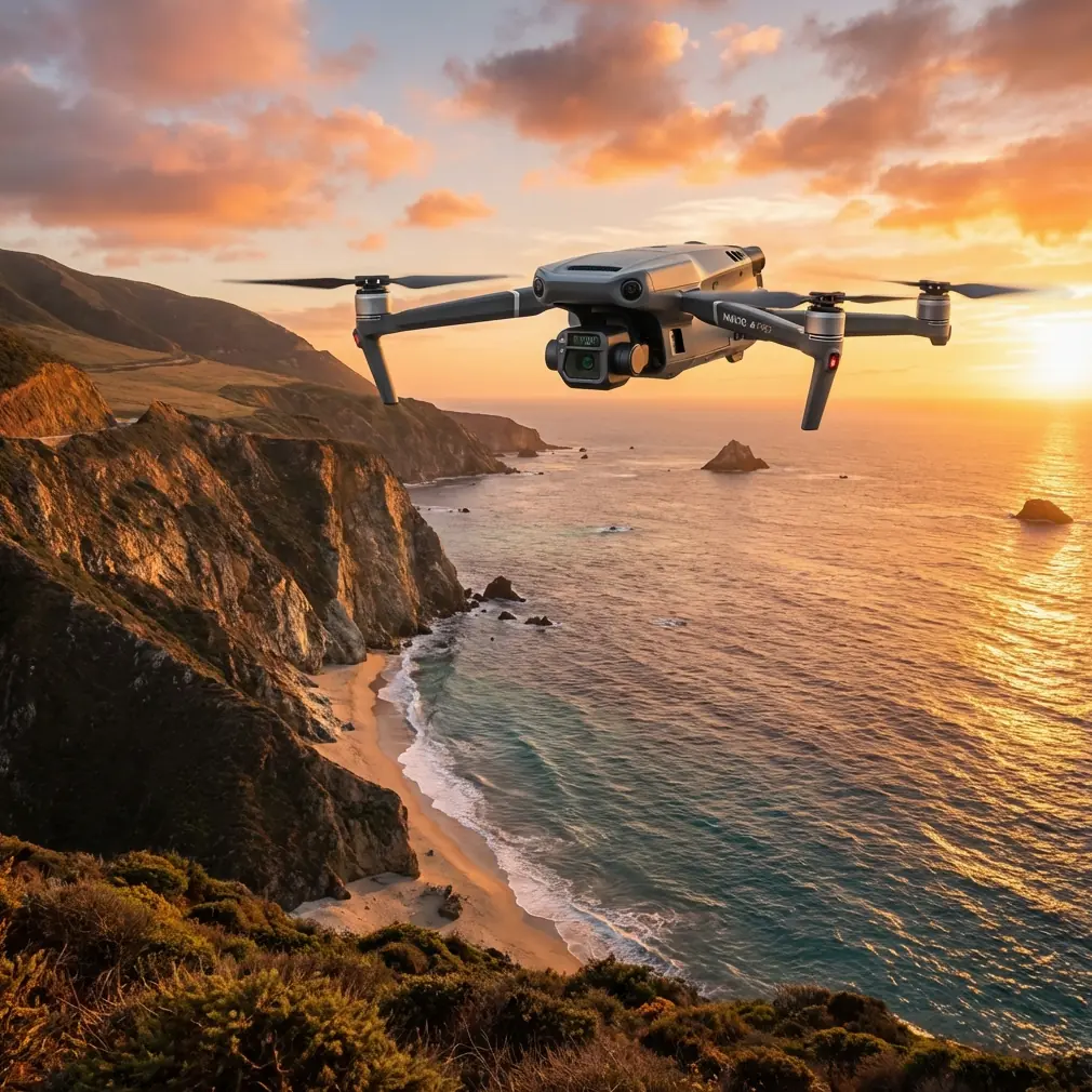
The DJI Mavic 3T gets talked about as a thermal inspection aircraft, and that reputation is deserved. But when the mission shifts to supporting deliveries at high-altitude venues, its value shows up in a different way. Not as a heavy-lift platform, and not as a marketing prop. It becomes a coordination tool, a route-validation aircraft, a thermal overwatch asset, and in some scenarios, the fastest way to understand whether a venue logistics plan will hold up once weather, terrain, and human movement begin to interfere.
That distinction matters.
If you are planning operations around a mountain resort, elevated event complex, ridge-top hospitality site, or any venue where thin air and broken terrain complicate movement, the Mavic 3T should not be evaluated like a simple camera drone. Its usefulness comes from how several systems work together: thermal imaging for situational awareness, visual zoom for route confirmation, O3 transmission for link stability, and encrypted data handling with AES-256 where sensitive venue operations are involved. Add the right third-party accessory, and the aircraft becomes far more practical for real field teams than its compact size suggests.
I have seen a lot of operators misread this aircraft. They look at the thermal sensor, tick the “inspection” box, and move on. For high-altitude venue delivery support, that leaves a lot on the table.
The Mavic 3T Is Not the Delivery Aircraft. It Is the Decision Aircraft.
That may sound like a semantic trick, but it is operationally precise.
At altitude, the biggest enemy is not just payload limitation. It is uncertainty. Wind behaves differently around structures and ridgelines. Temperatures shift faster. Human traffic concentrates in narrow corridors. Temporary staging zones that looked acceptable during planning suddenly become unsafe once service staff, guests, vehicles, and utility equipment enter the same space.
The Mavic 3T reduces that uncertainty before a larger problem develops.
Its thermal payload gives operators a way to detect active machinery, vehicle concentration, generator heat, roof exhaust zones, and the human patterns that matter when you are trying to deliver medical kits, venue supplies, communications gear, or urgent maintenance components. A visible-light drone can show congestion. A thermal drone shows activity density, hidden equipment load, and whether a route is genuinely clear or just visually quiet.
That is where thermal signature becomes more than a buzzword. At a high-altitude venue, thermal contrast is often easier to interpret than standard RGB imagery in early morning, dusk, fog edges, or uneven shadow. You can identify where personnel are gathering behind structures, where service vehicles have recently stopped, or where equipment is running hotter than it should. For delivery support, that changes route decisions in real time.
Why O3 Transmission Matters More in Mountain Venues
DJI’s O3 transmission system is one of those features that sounds routine until you work a venue where terrain is constantly trying to break your link.
In open flatland, stable transmission is nice to have. In high-altitude operations around lodges, amphitheaters, ski infrastructure, switchback roads, retaining walls, and utility corridors, it becomes part of the safety case. The Mavic 3T’s O3 transmission gives the operator a stronger basis for maintaining image clarity and control confidence when line-of-sight geometry is less forgiving.
That matters for two reasons.
First, a support drone is often being used ahead of movement, not just above it. You are launching to inspect an approach path, verify a landing zone, or check whether a transfer handoff point is still usable. Video dropouts during that phase do not just degrade situational awareness. They delay decisions, which compounds battery use, staff idle time, and risk exposure.
Second, high-altitude venues are often exactly the type of places where people begin discussing BVLOS operations. That conversation should be handled carefully and within the applicable regulatory framework, but the technical foundation still matters. Even in operations that remain strictly compliant with current visual-observer requirements, robust transmission quality is central to route confidence and crew coordination. The better the link, the more accurately your team can distinguish a viable corridor from a risky one before committing other assets.
AES-256 Is Not a Footnote When Venues Expect Discretion
Venue logistics are not always public-facing. Some involve VIP movement, medical readiness, security staffing, asset staging, or restricted back-of-house circulation. In those environments, the mention of AES-256 is not a checklist feature. It is a concrete reassurance that mission data handling has been designed with security in mind.
For operators supporting premium resorts, private events, or critical infrastructure adjacent to public venues, secure transmission and data controls matter operationally as much as they matter contractually. Security teams do not want sensitive route imagery moving through an ecosystem they cannot trust. Venue managers do not want maps of service access points casually exposed. If your flight operations include thermal scans of occupancy patterns or logistics staging, that data deserves protection.
This is one reason the Mavic 3T often fits into professional workflows better than hobby-grade aircraft. It speaks the language of enterprise risk management. Not perfectly, not universally, but credibly.
Battery Strategy at Altitude: Why “Hot-Swap” Thinking Changes the Mission
The Mavic 3T does not use literal hot-swap batteries in the same way some larger enterprise platforms do, but operators planning high-altitude venue support should still think in hot-swap terms. In other words: build the workflow around immediate turnaround, staged battery rotation, and minimal cooling delay between short, purposeful sorties.
That mindset is vital because altitude punishes inefficiency.
You do not launch the Mavic 3T and wander. You predefine micro-missions. One flight for route check. One flight for landing-zone confirmation. One flight for thermal crowd scan before a handoff window. One flight for post-delivery verification if conditions are shifting. Fast battery replacement at a sheltered staging point keeps the aircraft in circulation as a rapid-response sensor rather than a one-off observer.
This is where a third-party accessory can genuinely improve outcomes. A rugged multi-battery charging hub from a field-focused manufacturer, paired with a weather-shielded transport case, makes a noticeable difference on mountain jobs. That combination sounds mundane until you are rotating packs in cold air beside a service road with limited setup time. Better battery organization means fewer handling errors, fewer partially warmed packs entering the aircraft, and much tighter mission rhythm.
I would go further: for high-altitude venue work, I rate a robust charging and transport ecosystem as more valuable than most cosmetic accessories people buy first.
Thermal Plus Zoom: The Best Part of the Mavic 3T Workflow
The strongest field habit with the Mavic 3T is to stop treating the thermal and visual systems as separate tools.
Thermal identifies anomalies. Zoom explains them.
That pairing is especially useful at venues where you need to validate delivery conditions without intruding on guests or disrupting staff. A thermal pass may reveal a cluster of people near a supposedly clear drop-off corridor. The zoom camera then tells you whether they are service staff waiting in the correct area, spectators gathering in the wrong place, or contractors who have parked equipment where it should not be.
For elevated venues, this reduces unnecessary repositioning. Instead of moving teams physically to verify each change, the aircraft does the first layer of interpretation from the air. That saves time and lowers exposure on steep or congested access routes.
It also supports better incident prevention. If a utility cabinet is running unusually hot near a staging area, the thermal sensor may spot it before staff on the ground notice anything abnormal. If snowmelt or moisture is changing how vehicles are moving through a shaded service lane, the drone gives command staff a wider and faster reading of the problem.
Where Photogrammetry and GCP Still Fit In
The Mavic 3T is not the first aircraft many professionals choose for dedicated photogrammetry, but dismissing that capability entirely would be a mistake. For high-altitude venues, especially those with repeated seasonal operations, building a current site model has real value.
A practical approach is to use the Mavic 3T for operational overwatch and targeted mapping updates rather than pure survey replacement. When paired with ground control points, or GCPs, its imagery can contribute to route planning, temporary logistics zone layout, and verification of terrain changes after weather events or construction activity.
This matters because delivery planning at mountain venues often fails on the edges. Not the obvious main roads or helipad-scale surfaces, but the secondary movement spaces: maintenance lanes, terrace transitions, backup handoff pads, generator clearances, and emergency reroute options. Updated photogrammetric context, even if collected selectively, helps teams understand grade, obstacle spacing, and structural changes with more precision than memory-based planning ever will.
In practice, the workflow can be simple. Use earlier mapping outputs to establish probable approach and staging options. Confirm them with current Mavic 3T flights. Then use thermal data on the operational day to see whether the venue is behaving the way the map suggested it would. Static model, then live truth. That is a strong pairing.
The Limits You Need to Respect
There is a tendency to over-credit compact enterprise drones. The Mavic 3T is excellent within its role, but that role has edges.
It is not the platform to use when the mission truly requires carrying meaningful payload mass. It is not a substitute for a purpose-built delivery aircraft. It is not a cure for poor site planning, and it does not remove the need for clear operational approvals, observer positioning, communications discipline, or weather thresholds tailored to altitude.
It also demands discipline in interpretation. Thermal imagery is powerful, but it can mislead operators who do not understand reflection, environmental masking, or how surface materials behave in mountain light and temperature swings. A warm shape is not always a person. A cool corridor is not always safe. Expertise still matters more than the screen.
That said, when operators understand those limits, the Mavic 3T becomes unusually efficient. Small enough to deploy quickly. Sophisticated enough to inform serious decisions. Secure enough for sensitive venue work. Stable enough to remain relevant in challenging topography.
A Practical High-Altitude Venue Setup
If I were equipping a team specifically for this kind of work, I would build the Mavic 3T package around speed, continuity, and clarity.
Start with protected battery rotation and a charging system designed for field conditions. Add a high-visibility landing pad if the venue includes dust, snow residue, or mixed-surface staging. Use a tablet hood or high-brightness monitor solution if glare is severe. Keep thermal interpretation standardized across pilots so that route decisions are based on shared thresholds, not individual guesswork.
Most importantly, write the drone into the delivery workflow before the mission day. Do not improvise its role after you arrive. Define whether the aircraft is responsible for pre-drop route validation, landing-zone scan, crowd movement monitoring, post-drop confirmation, or all four. The Mavic 3T performs best when it is treated as part of the logistics architecture, not a last-minute extra.
Teams that need a direct operational discussion around mountain venue workflows can message our flight planning desk here. That conversation is usually more useful than another generic checklist because the right setup changes with elevation, terrain shielding, staffing model, and what the venue is actually trying to move.
Final Assessment
For high-altitude venue delivery support, the Mavic 3T is easy to underestimate if you focus only on what it can carry. The real question is what it helps you avoid: blind approaches, unstable handoff zones, misread congestion, delayed decisions, and preventable exposure for ground teams.
Its thermal signature analysis gives you live operational context that standard video often misses. O3 transmission improves confidence where terrain tries to interrupt awareness. AES-256 strengthens the case for using it around sensitive venue operations. And when paired with practical third-party field accessories, especially battery and transport solutions, the aircraft becomes a reliable part of a professional deployment rhythm rather than a fragile add-on.
That is the right way to judge the Mavic 3T in this niche. Not by hype. By how quickly it turns ambiguity into actionable information when altitude, terrain, and timing are all working against you.
Ready for your own Mavic 3T? Contact our team for expert consultation.