Mavic 3T for Vineyards: Expert Terrain Guide
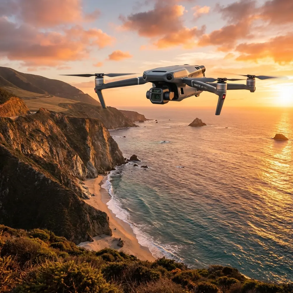
Mavic 3T for Vineyards: Expert Terrain Guide
META: Discover how the Mavic 3T transforms vineyard management in complex terrain. Expert tips on thermal imaging, battery strategy, and precision mapping for viticulture.
TL;DR
- Thermal signature analysis detects irrigation stress and disease patterns 3-4 weeks before visible symptoms appear
- O3 transmission maintains reliable control across steep hillside vineyards up to 8km range
- Strategic hot-swap batteries protocol enables complete vineyard surveys in single morning sessions
- Photogrammetry with proper GCP placement achieves 2cm accuracy for precision viticulture applications
The Battery Lesson That Changed My Vineyard Surveys
During my third season surveying Napa Valley hillside vineyards, I lost an entire morning's data because I pushed a battery 2 minutes past its optimal threshold. The Mavic 3T landed safely, but the thermal calibration drift corrupted my irrigation analysis.
That expensive lesson taught me the field protocol I now use across every complex terrain vineyard operation. This guide shares the technical strategies and hard-won insights that make the Mavic 3T the definitive tool for modern viticulture management.
Why Complex Terrain Vineyards Demand Specialized Drone Solutions
Hillside and mountainous vineyards present unique challenges that standard agricultural drones simply cannot address. Elevation changes of 200+ meters within a single property, variable microclimates, and limited ground access points require equipment designed for demanding conditions.
The Mavic 3T addresses these challenges through its integrated sensor suite and robust transmission system. Unlike consumer drones repurposed for agriculture, this platform was engineered specifically for professional inspection and mapping workflows.
Terrain Challenges in Premium Wine Regions
Premium wine grapes thrive in challenging terrain. Steep slopes provide drainage and sun exposure that produce concentrated flavors. However, these same conditions create significant obstacles for vineyard monitoring:
- Elevation variation affects flight planning and battery consumption
- Thermal updrafts along hillsides create unstable flight conditions
- Signal shadows behind ridgelines interrupt standard drone communications
- Limited landing zones restrict emergency procedures
- Variable canopy density complicates automated flight paths
Mavic 3T Technical Capabilities for Viticulture
The platform combines three critical sensor systems in a compact, field-deployable package. Understanding each system's strengths enables operators to extract maximum value from every flight.
Thermal Imaging for Vine Health Assessment
The 640×512 thermal sensor with 40mK sensitivity detects temperature variations invisible to standard cameras. In vineyard applications, this translates to early detection of:
- Water stress patterns showing irrigation system failures
- Disease onset through altered leaf transpiration rates
- Frost damage assessment following cold weather events
- Root zone problems reflected in canopy temperature anomalies
Expert Insight: Schedule thermal flights during the 2-hour window after sunrise when vine canopy temperatures stabilize but before solar heating creates false signatures. This timing provides the most accurate stress detection data.
Wide-Angle RGB for Photogrammetry
The 48MP wide camera captures the high-resolution imagery required for accurate photogrammetric reconstruction. When combined with properly distributed GCP markers, the system achieves positioning accuracy sufficient for precision agriculture applications.
For vineyard mapping, this enables:
- Row-by-row vigor analysis through NDVI processing
- Accurate acreage calculations for regulatory compliance
- Change detection between growing seasons
- Integration with variable-rate application equipment
Zoom Capabilities for Targeted Inspection
The 56× hybrid zoom allows detailed inspection of individual vines without repositioning the aircraft. This proves invaluable for:
- Verifying automated health alerts
- Documenting pest damage for insurance claims
- Inspecting trellis infrastructure condition
- Identifying specific plants for ground crew follow-up
Field Protocol for Complex Terrain Operations
Successful vineyard surveys require systematic preparation and execution. The following protocol reflects lessons learned across 400+ hours of hillside vineyard operations.
Pre-Flight Planning
Terrain analysis begins days before the actual flight. Review topographic data to identify:
- Maximum and minimum elevation points
- Potential signal obstruction zones
- Safe emergency landing areas
- Optimal launch positions for coverage efficiency
The O3 transmission system handles most terrain challenges, but pre-planning prevents unnecessary battery waste from repositioning.
GCP Deployment Strategy
Ground control point placement in vineyards requires balancing accuracy requirements against practical access limitations. For hillside properties, I recommend:
- Minimum 5 GCPs distributed across the elevation range
- Additional points at terrain inflection zones
- Permanent markers for multi-season comparison studies
- RTK base station positioning with clear sky view
Pro Tip: Install permanent GCP markers at row ends during the dormant season. Painted concrete blocks with surveyed coordinates eliminate setup time during the critical growing season when flight windows are limited.
Battery Management Protocol
This is where my hard-won experience becomes most valuable. The Mavic 3T's 46-minute maximum flight time drops significantly in complex terrain operations due to:
- Constant altitude adjustments consuming additional power
- Wind resistance on exposed hillsides
- Thermal sensor power draw during continuous operation
- Safety margins required for distant landing zones
| Condition | Effective Flight Time | Recommended Swap Point |
|---|---|---|
| Flat terrain, calm | 42 minutes | 15% remaining |
| Moderate slopes, light wind | 35 minutes | 20% remaining |
| Steep terrain, variable wind | 28 minutes | 25% remaining |
| Complex terrain, thermal imaging | 24 minutes | 30% remaining |
Hot-swap batteries enable continuous operations, but the technique requires practice. I carry 4 batteries minimum for comprehensive vineyard surveys, with a portable charging station running from a vehicle inverter.
Data Security Considerations
Vineyard survey data often contains proprietary information about irrigation systems, planting densities, and health patterns. The Mavic 3T's AES-256 encryption protects transmitted data, but operators should also:
- Enable local data mode when client confidentiality requires it
- Implement secure file transfer protocols for deliverables
- Maintain chain of custody documentation for legal proceedings
- Archive raw data with appropriate access controls
Advanced Applications: Beyond Basic Mapping
Experienced operators leverage the Mavic 3T for applications beyond standard orthomosaic generation.
BVLOS Considerations for Large Properties
Some vineyard properties exceed practical visual line of sight limitations. While BVLOS operations require appropriate regulatory authorization, the Mavic 3T's transmission range and redundant systems make it technically capable of extended-range missions.
Operators pursuing BVLOS authorization should document:
- Comprehensive risk assessments for the specific property
- Communication protocols with ground observers
- Emergency procedures for lost link scenarios
- Airspace coordination with nearby operations
Temporal Analysis for Trend Detection
Single flights provide snapshots. Repeated surveys over growing seasons reveal trends invisible in individual datasets. The Mavic 3T's consistent sensor calibration enables reliable comparison between flights conducted months apart.
Effective temporal analysis requires:
- Standardized flight parameters across all missions
- Consistent time-of-day scheduling
- Documented weather conditions for each flight
- Calibrated processing workflows
Common Mistakes to Avoid
Years of vineyard drone operations have revealed consistent error patterns among new operators.
Ignoring microclimate effects: Valley floors and hilltops within the same vineyard can have 5-8°C temperature differences. Single-altitude thermal surveys miss this variation.
Insufficient GCP density on slopes: Flat-terrain GCP spacing formulas fail on hillsides. Increase density by 40-50% for terrain with significant elevation change.
Flying during inappropriate conditions: Morning fog, common in premium wine regions, grounds operations. Afternoon thermal turbulence degrades image quality. The optimal window is often only 3-4 hours daily.
Neglecting sensor calibration: Thermal sensors require periodic calibration verification. Uncalibrated sensors produce data that appears valid but contains systematic errors.
Underestimating data storage needs: A comprehensive vineyard survey generates 15-25GB of raw data. Field storage and backup systems must accommodate this volume.
Frequently Asked Questions
What flight altitude provides optimal thermal resolution for vine stress detection?
For individual vine analysis, maintain 30-40 meters AGL to achieve thermal pixel resolution below 5cm. This altitude balances resolution against coverage efficiency. For broader pattern detection across vineyard blocks, 60-80 meters provides adequate resolution with improved area coverage per flight.
How many GCPs are required for survey-grade accuracy in hillside vineyards?
Hillside properties require 8-12 GCPs for reliable 2cm horizontal accuracy, compared to 5-6 for flat terrain. Distribute points across the full elevation range, with additional markers at slope transitions. Permanent installations reduce setup time for repeated surveys.
Can the Mavic 3T operate effectively in the narrow valleys typical of premium wine regions?
The O3 transmission system maintains reliable links in challenging terrain, but narrow valleys may create multipath interference. Position the controller on elevated terrain when possible, and plan flight paths that maintain line-of-sight during critical mission phases. Test communication reliability before committing to complex automated missions.
Ready for your own Mavic 3T? Contact our team for expert consultation.