Mavic 3T Field Report for Mountain Vineyards
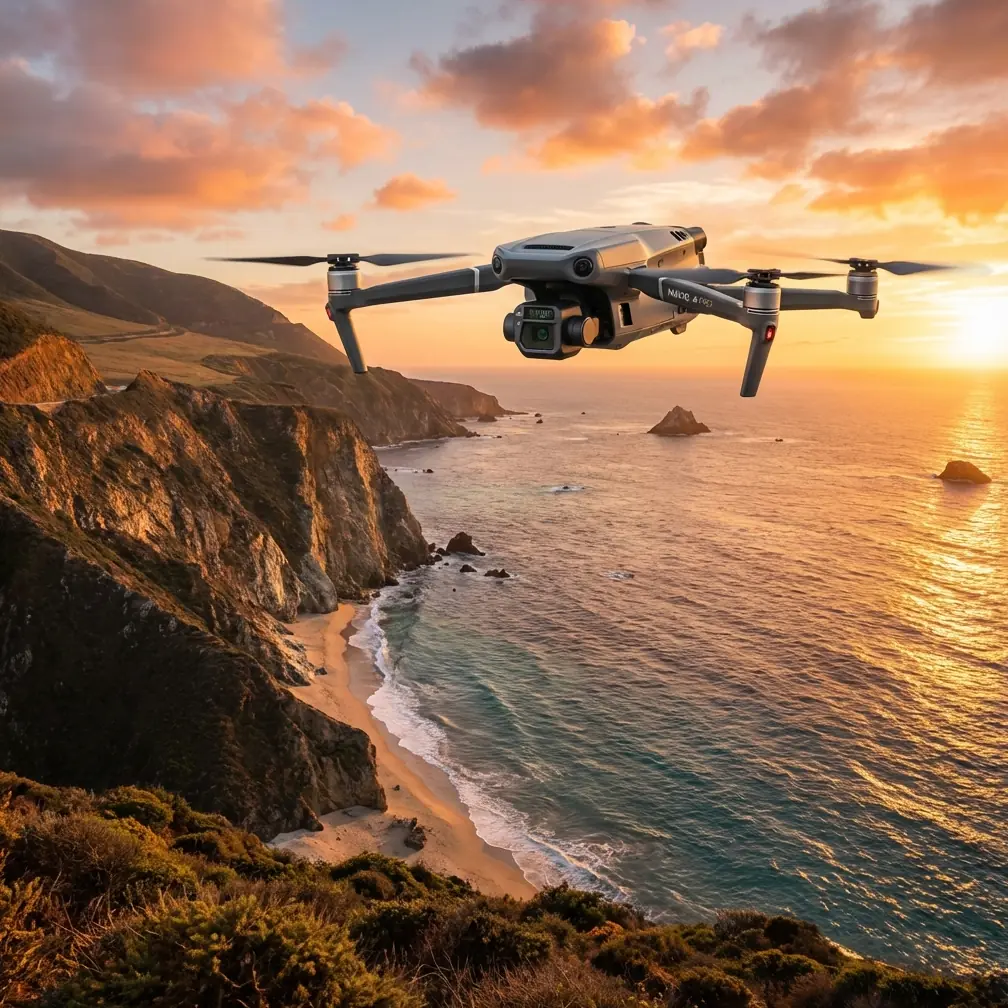
Mavic 3T Field Report for Mountain Vineyards: Flight Altitude, Payload Stability, and Why Small Mechanical Details Decide the Day
META: A field-focused Mavic 3T article for mountain vineyard delivery and inspection missions, with practical altitude insight, thermal workflow notes, and setup lessons drawn from aircraft fluid-control and servo installation principles.
Mountain vineyards punish vague planning.
Terraces break line of sight. Wind curls up the slope, then drops into rows without warning. Morning shade hides obstacles that look obvious at noon. And if you are using a Mavic 3T for delivery support in this kind of environment—moving small urgent items, checking drop zones, validating access paths, and documenting conditions—you quickly learn that success has less to do with headline specs and more to do with control discipline.
This field report is built around a simple question: what is the best flight altitude for a Mavic 3T working above vineyards in mountain terrain?
The short answer is that there is no single number. The useful answer is more operational: fly high enough to smooth the terrain-induced turbulence and maintain a clean visual and transmission corridor, but low enough to preserve thermal contrast, branch-level awareness, and precise positioning over terraces. In practice, that means selecting altitude relative to the vine canopy and local slope, not relative to the launch point alone.
For most mountain vineyard support runs, I prefer to think in bands rather than one rigid altitude. For reconnaissance and route verification, a moderate height above canopy often gives the best tradeoff. It reduces the risk of snagging into wires, poles, anti-hail netting edges, and uphill rotor wash, while still keeping enough image detail to read row spacing, road condition, and handoff points. If I need thermal confirmation—locating recently active machinery, checking whether a vehicle or worker zone is occupied, or verifying a package handoff point at dawn—the altitude usually needs to come down slightly so the thermal signature remains clean and not diluted by excess ground area in the frame.
That may sound obvious, but the reason matters. On mountain vineyards, terrain angle changes what the aircraft “feels” aerodynamically. A flat-land pilot who simply sets a safe height above the home point can end up either too high over the lower terraces or uncomfortably compressed against the uphill side. The Mavic 3T rewards pilots who anchor altitude to the working surface.
What makes the 3T especially useful here is not just the thermal payload. It is the way several systems combine. The thermal camera helps sort cold shadows from genuinely inactive areas. The visible camera supports precise situational review and photogrammetry-style documentation when needed. O3 transmission helps when the aircraft is working across fractured terrain where ridges and vines constantly threaten signal geometry. If the team is handling sensitive agricultural site data, AES-256 matters too. In vineyards, route maps, stock movement notes, storage areas, and infrastructure layouts are commercially sensitive even when the mission is routine.
Still, transmission and optics do not solve the hardest problem on their own: consistency.
That is where the reference material behind this piece becomes more useful than it first appears.
One source discusses a fuel transfer system in aircraft where valve resistance must match the resistance of a control line. It also compares performance in two conditions: level flight and a climb at a 30° pitch angle. Another source covers servo installation basics, including keeping the servo arm and linkage at 90°, leaving 5–10 units of wire slack, and being careful with extension length, especially beyond 46 cm.
These are not drone manuals. Yet the engineering logic transfers remarkably well to Mavic 3T operations in mountain vineyards.
Start with the first point: a system behaves differently when orientation changes. In the aircraft example, calculations are made separately for level flight and for a 30° climb because flow and resistance are not static once geometry shifts. The same principle explains why a Mavic 3T that feels perfectly settled crossing one vineyard block can become busy and power-hungry when climbing obliquely over a steep face. Slope angle changes airflow, ground effect relationships, and pilot perception. If you are delivering a small urgent payload to a terrace access point, that matters. The best route is not always the shortest line on the map. Often it is the path that asks the aircraft to make fewer abrupt energy corrections.
That is one reason I advise pilots to avoid hugging steep terrain on the uphill side unless the mission absolutely requires it. A slightly higher, cleaner transit path often costs little in time and pays back in stability. Stable aircraft behavior means cleaner thermal imagery, fewer attitude corrections over the drop zone, and better battery predictability.
Battery predictability is its own subject in mountain work. Hot-swap batteries are not just a convenience in agricultural operations; they support tempo. Vineyard teams do not want long pauses while a drone sits idle and a weather window closes. But fast turnaround only helps if every preflight habit is disciplined. Here the servo manual offers a useful analogy. It emphasizes neutral geometry, correct connector orientation, and enough cable slack to prevent vibration damage. On the Mavic 3T, the spirit of that advice applies to payload mounting checks, controller cable strain, charging station organization, and any accessory setup used in the field vehicle. Mechanical and electrical tidiness reduce small faults that become large interruptions once the aircraft is on a mountainside.
The “90°” detail from the servo reference is worth translating directly into drone practice. In fixed-wing or helicopter control systems, a linkage set square at neutral protects control authority and symmetry. For Mavic 3T operators, the equivalent is making sure the aircraft starts from a clean baseline: calibrated sensors, level takeoff surface, balanced payload assumptions, and a route plan that does not begin with an aggressive climb or yaw-heavy departure. If neutral is wrong, everything downstream becomes compensation. You can still fly the mission, but you are using capacity to fight avoidable imbalance.
The wire-slack detail matters too. The source advises leaving 5–10 of slack so vibration does not damage the lead. In vineyard drone operations, vibration and repeated transport are real issues, even with compact systems. Hard cases bounce in pickup beds. Controllers are set on stone walls. Charging leads get tugged in a hurry. If you are integrating tablets, external screens, or field charging layouts, cable strain management is not cosmetic. It protects continuity. The manual also warns against excessive extension length, flagging 18 inches, or 46 cm, as a threshold where current demands can become more serious in some servo setups. For drone teams, the operational lesson is broader: every extra connection and improvised extension adds one more failure point in a field environment already full of dust, moisture, and rushed handling.
Now back to altitude.
For vineyard delivery support, I divide Mavic 3T flights into four altitude intentions.
First is corridor acquisition altitude. This is the height where you establish safe, stable transit over a block without chasing every contour. The goal is to maintain terrain awareness, preserve O3 transmission quality, and keep enough margin over trellis systems and poles. In mountain vineyards, this is often higher than new pilots expect.
Second is assessment altitude. Once over the active terrace or receiving area, you step down to a height where the visible sensor can confirm landing or handoff conditions and the thermal sensor can separate people, equipment, and sun-warmed surfaces with confidence. This is where thermal signature interpretation gets practical. Too high and a worker standing near a retaining wall becomes less distinct from the background, especially after the stone has been heating.
Third is precision approach altitude. If the aircraft is supporting a controlled handoff or close visual check, the transition should be short and deliberate. Do not spend extra time low over vines in gusty cross-slope air. Descend, verify, complete the task, climb back to the corridor.
Fourth is mapping altitude. This is different from delivery work, but often requested on the same day. If the vineyard manager wants a quick terrain or row-condition dataset, photogrammetry demands more consistency than delivery scouting. Here, GCP use becomes valuable if the output will inform drainage changes, access improvements, or terrace repair planning. The Mavic 3T can support this kind of combined operational day, but only if the pilot resists mixing flight profiles carelessly. A mapping pass wants repeatability. A delivery verification pass wants adaptability.
That separation is what experienced operators do well.
Another point often missed in mountain vineyards is that thermal is not just for “finding heat.” It is for sorting relevance. Early in the day, irrigation leaks, recently operated utility equipment, vehicles, worker movement, and sun-exposed rock all create different thermal behavior. Choosing altitude changes your ability to interpret that behavior. If your frame includes too much slope and too many mixed materials, thermal contrast becomes messy. Fly a little lower over the target area and the scene often becomes intelligible.
There is also a communications factor. When teams ask about BVLOS in mountainous agricultural settings, the real issue is usually not desire for distance but the temptation to let terrain obscure decision quality. Even where regulations, waivers, or local operating structures define what is allowed, the mountain itself remains the real constraint. O3 transmission is powerful, but signal strength alone should not trick a team into operating with poor terrain comprehension. A route that preserves clean geometry and repeatable return options is better than one that simply proves the aircraft can reach the far side.
One of my preferred field habits is to run the first sortie as a calibration mission for the site, not just for the aircraft. Take off, climb to corridor altitude, cross one or two terrace levels, descend to assessment altitude over a selected point, then climb back out. Watch how wind changes with height. Check where the thermal image becomes useful instead of merely interesting. Note whether the receiving point is better approached from below the slope, across it, or from the ridge side. By the second sortie, the best altitude is usually obvious.
If your team wants a practical mountain-vineyard mission template for the Mavic 3T, send the site layout here: share your route details on WhatsApp. A simple terrain sketch and canopy height note are often enough to identify the right working altitude bands.
The larger lesson from the source material is elegant. In the aircraft fuel-system example, the designer does not assume one condition explains the system. They calculate for level flight and for a 30° climb because attitude changes the whole picture. In the servo setup example, tiny installation details—90° linkage alignment, 5–10 slack in the lead, caution around extension length beyond 46 cm—prevent reliability problems later. Put those ideas together and you get a better Mavic 3T workflow for mountain vineyards: respect changing geometry, and respect small setup details.
That is how you keep a short agricultural support mission from becoming an avoidable recovery exercise.
The Mavic 3T is exceptionally capable in this terrain when flown with that mindset. Use thermal for decision-making, not decoration. Use altitude relative to canopy and slope, not the launch point. Keep route geometry simple. Preserve stable transit bands. Step down only when the task demands it. And treat every connector, battery change, cable path, and preflight baseline as part of the mission, because they are.
In vineyard operations, aircraft control is only half the job. The rest is system discipline.
Ready for your own Mavic 3T? Contact our team for expert consultation.