Delivering Wildlife Support in Windy Conditions With the Mav
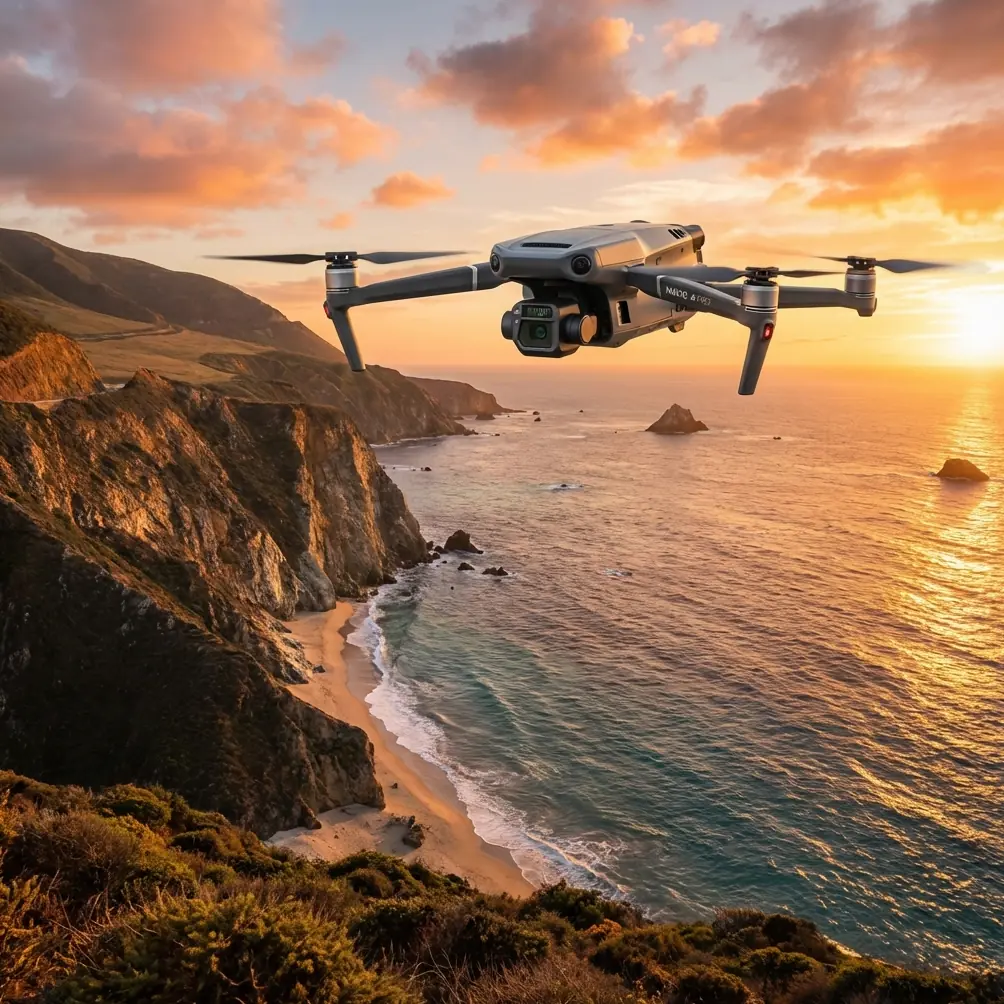
Delivering Wildlife Support in Windy Conditions With the Mavic 3T: Field Methods That Actually Hold Up
META: Practical Mavic 3T best practices for windy wildlife delivery and support missions, with thermal workflow tips, sensor trust checks, O3 link discipline, and payload decision-making in unstable air.
I’ve seen more drone plans fail in wind than in rain.
Not because the aircraft couldn’t fly. Because the crew trusted a tidy checklist more than the ugly details that matter once the air turns uneven and the target is alive, moving, and easily stressed.
If your mission involves the Mavic 3T and wildlife support in windy conditions, the real challenge is not simply keeping the aircraft airborne. It’s maintaining sensor confidence, preserving thermal interpretation, managing link stability, and making delivery choices that do not create a second problem on top of the first.
The Mavic 3T is often discussed as if its value starts and ends with thermal signature detection. That misses the point. In field work around wildlife, especially when wind pushes the aircraft off ideal lines and vegetation is moving, the aircraft becomes a decision platform. Every subsystem matters: visible imaging, thermal confirmation, transmission integrity, battery handling, and the discipline to treat onboard data like something that can degrade gradually rather than fail all at once.
That last point is where an unlikely lesson from classical flight-control engineering becomes useful. In one aircraft design reference, the logic behind self-checking systems is brutally practical: verify the simplest function first, compare the result with an expected value, then use that verified layer to test more complex functions. The text describes this as an “inverted pyramid” approach to processor self-test. It also describes a watchdog timing concept: if a system is not refreshed within a defined interval, it is treated as not having completed the task. Those aren’t just old flight-computer ideas. They map surprisingly well to how a serious Mavic 3T team should operate in wind.
For wildlife support, that means you do not begin by trusting the most impressive feature. You begin by proving the simple things are still true.
Start with a low-level trust check, not a dramatic launch
Before a windy deployment, I run what is effectively a field version of that inverted-pyramid logic.
First: aircraft health, IMU status, compass behavior, battery seating, gimbal movement, thermal calibration response, and visual camera clarity. Only after those basics hold do I move to route logic, waypoint behavior, thermal scan assumptions, and any photogrammetry or GCP-linked mapping layer. If the simple layer is not clean, there is no reason to trust the complex layer.
This matters more than most operators admit. In calm air, a minor inconsistency may stay hidden. In gusting air, it multiplies. A slightly delayed gimbal response becomes target ambiguity. Small positional wander becomes thermal misregistration. A weak transmission margin becomes hesitation at exactly the wrong moment over a ridge line or a tree break.
The watchdog concept from the same reference is equally relevant. The original discussion centers on a timed refresh pulse; if the update does not arrive within the specified period, the system assumes computation failed. In Mavic 3T field practice, your equivalent is a live operator rule: if your telemetry, image interpretation, or mission progress is not being revalidated at short intervals, treat the assumption as stale. Don’t keep flying on yesterday’s certainty from 20 seconds ago.
In wind, stale certainty is dangerous.
What “delivering wildlife in windy” should mean in practice
Let’s be precise. In civilian conservation work, “delivery” can mean several things:
- dropping or placing lightweight monitoring aids in pre-cleared areas
- bringing small emergency veterinary supplies to a field team
- carrying locator or observation support gear to a remote edge
- moving lightweight bait-free, non-invasive environmental sensors for habitat monitoring
What it should not mean is improvising stressful close-proximity behavior around animals.
With the Mavic 3T, the aircraft is usually strongest as a support-and-verification platform even when a payload task is involved. Wind changes the hierarchy. In still air, delivery accuracy might dominate. In wind, animal welfare and approach stability come first.
A real field pattern: the boar at the scrub edge
One of the clearest examples I’ve seen involved a dawn support run near broken scrub and open grass after a night of heavy wind shear. The team was trying to move a lightweight field package toward a temporary wildlife care position without pushing through the terrain on foot. The Mavic 3T picked up a thermal signature near the intended corridor that looked at first like residual ground warmth tangled with brush motion. On the visible feed, the shape resolved only in fragments because the vegetation was moving in gusts.
The thermal view mattered, but not by itself. The signature held shape through several angle changes and remained coherent while the brush around it flickered. That distinction is operationally significant. Wind often creates false confidence in both directions: operators either over-trust thermal blobs or dismiss them as clutter. Here, the team used the aircraft’s sensor combination the right way. They did not force a direct transit. They widened the approach, confirmed the subject was a wild boar sheltering at the scrub edge, and rerouted the support drop farther off to avoid agitation.
That’s the practical value of the Mavic 3T in wildlife operations. Not just “it has thermal,” but that it can help you avoid pressuring an animal when the environment is already unstable.
Wind changes thermal reading more than people expect
Thermal signature work in wind is full of traps.
Strong airflow strips surface heat differently across rock, grass, mud, and fur. Moving branches introduce intermittent occlusion. If you’re flying oblique angles, the animal may present only a partial outline, which can look weak or broken on the thermal channel. Add sunrise transition and the scene can become deceptive fast.
So the rule is simple: never make a wildlife decision from one pass.
Use repeat angles. Use visible confirmation where possible. Watch how the signature behaves against moving surroundings. Stable shape under changing viewing geometry tells you more than a single bright patch ever will.
This is also where O3 transmission performance matters beyond marketing specs. In windy terrain, video confidence is often lost in little fragments, not complete blackouts. Slight hesitation, compression smearing in vegetation, or delayed image refresh can all distort interpretation. If the image is not clean enough to support a welfare-sensitive decision, your mission objective must step back. You can’t “push through” uncertainty just because the aircraft is still controllable.
Build your route around escape corridors, not shortest paths
The common amateur instinct is to fly the shortest line from launch to target. In wildlife work, especially in wind, shortest is often the noisiest and least forgiving route.
Instead, map three things:
- Your own safe approach lane
- The animal’s likely movement corridor
- Your fallback loiter zone if the scene changes
If you’re working with terrain data or prior photogrammetry, this gets much easier. Even a modest site model anchored with GCPs can reveal wind-exposed saddles, sheltered low spots, and line-of-sight interruptions that matter to both aircraft control and animal response. The Mavic 3T is not a dedicated heavy mapping platform, but as part of a broader field workflow it can still contribute valuable spatial intelligence.
The key is not to overcomplicate the mission. Use mapping to reduce surprises, not to justify a rigid plan.
Why battery workflow matters more in wind than the flight time chart suggests
Wind punishes batteries in a non-linear way. You may hold position longer than expected, climb more aggressively for clearance, or spend extra time on re-approach after identifying wildlife activity near the route.
That’s why hot-swap batteries are not just a convenience in field support operations. They preserve mission rhythm. If your observation window is narrow—say, a cooling thermal scene just after dawn—you do not want a long interruption between sorties while the subject moves or environmental contrast collapses.
But hot-swapping only helps if your handoff discipline is clean. Log battery temperature, approximate remaining capacity on recovery, and wind conditions for each sortie. Over time, that creates a much more reliable mission profile than any generic endurance estimate.
In plain language: the battery that looked “fine” in light air may be your weak link in gusts.
Treat signal security and signal quality as separate issues
AES-256 matters for protecting mission data, especially in conservation work where habitat locations or sensitive species information should not be casually exposed. But secure transmission is not the same thing as resilient transmission.
A link can be well-encrypted and still be operationally poor if you’ve chosen a bad antenna orientation, a poor launch point, or a route that repeatedly places ridges and dense vegetation between you and the aircraft. For wildlife teams discussing future BVLOS frameworks, this distinction becomes even more serious. Before you think about extending range procedures, prove that your link discipline is mature at conservative stand-off distances in wind.
That means:
- maintaining line-of-sight whenever practical
- avoiding terrain-shadow transitions mid-task
- resisting the urge to descend behind cover just because thermal contrast looks tempting there
- defining a hard threshold for image quality loss, not just signal bars
If your thermal interpretation depends on frames you would hesitate to defend in a debrief, the aircraft should not be used to make that call.
Material thinking belongs in drone operations too
The second reference source looks unrelated at first glance. It discusses polyurethane materials, including castable polyurethane with a tensile strength of 3500 psi minimum and elongation of 280% minimum, along with rigid closed-cell foam properties such as water absorption, compressive strength, and resistance requirements.
Why does that matter for a Mavic 3T wildlife mission?
Because windy field work is hard on every protective interface you use around the aircraft and the support kit. If you are moving delicate veterinary items, small sensors, or environmental sample tools, impact management and moisture control matter. Closed-cell rigid foam is valuable because low water uptake and crush resistance help maintain package integrity in damp grass, unstable footing, and repeated vehicle-to-field handling. Castable polyurethane’s combination of strength and flexibility points to another useful lesson: packaging should absorb abuse without transmitting it directly to the contents.
Operationally, that means your success is not defined only by whether the Mavic 3T reaches the site. It is also defined by whether the delivered item is still usable after wind-driven approach adjustments, landing-zone compromise, or a rough set-down on uneven ground.
This is one of those details experienced crews respect instinctively. The drone gets the attention. The packaging quietly decides whether the mission delivered value.
A working windy-weather method for the Mavic 3T
Here’s the field sequence I recommend.
1. Validate the simplest systems first
Borrow the inverted-pyramid logic. Confirm aircraft health, camera clarity, thermal readiness, battery security, and link quality before any complex mission assumptions.
2. Establish a refresh rhythm
Use your own “watchdog” discipline. Reconfirm aircraft state, route assumptions, and target interpretation at short intervals. If the update loop breaks, abort or hold.
3. Scan before transit
Run a thermal and visible reconnaissance pass over the intended corridor. Wind can shift wildlife into places that looked clear on the map.
4. Approach from outside the animal’s likely stress axis
Avoid direct overhead or head-on movement if a detour gives the animal more room and lowers acoustic pressure.
5. Use cross-confirmation, not single-sensor confidence
Thermal signature plus visible behavior plus terrain context beats any one stream alone.
6. Preserve battery margin for a second decision
In wind, the first approach often teaches you something new. Keep enough reserve to act on it without rushing recovery.
7. Protect what you’re carrying
If the payload or support item cannot survive a rough arrival, the mission plan is incomplete.
8. Log the mission like an engineering test
Wind speed bands, route changes, image quality issues, animal response, battery draw, and packaging outcomes should all be captured. That’s how good teams get better.
When not to use the Mavic 3T for the delivery portion
There are cases where the Mavic 3T should remain an observation and route-clearance tool rather than the delivery platform itself.
If gusts are variable enough to compromise precise placement, if the animal cannot be confidently excluded from the approach zone, or if image quality is too inconsistent to validate the corridor, do not force the drop or placement. Use the aircraft to reduce uncertainty for the ground team instead.
That is not a downgrade. It is proper mission design.
Final thought from the field
The best Mavic 3T wildlife operations in wind do not look dramatic. They look cautious, deliberate, and occasionally boring. That’s a compliment.
They borrow from the logic of high-reliability flight systems: prove the basics first, isolate uncertainty early, and fall back to a safe value when the inputs no longer deserve trust. If you want to compare route design ideas or payload handling setups for habitat work, you can message our field team here.
The aircraft’s thermal capability, O3 transmission, and secure data handling are all useful. But the thing that separates a professional wildlife mission from a risky one is judgment under partial information. Wind exposes whether that judgment is real.
Ready for your own Mavic 3T? Contact our team for expert consultation.