Mavic 3T in Mountain Coastline Work: A Field Report
Mavic 3T in Mountain Coastline Work: A Field Report on Reliability, Payload Thinking, and What Actually Keeps the Aircraft Useful
META: Expert field report on using the Mavic 3T for mountain coastline missions, with practical insight on reliability, thermal workflow, accessory choices, transmission stability, and spare-part planning.
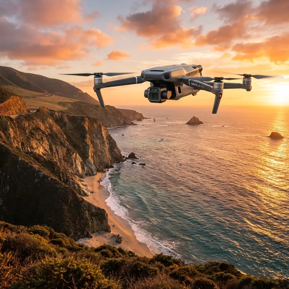
The Mavic 3T is often discussed as a compact thermal drone, but that framing misses what matters in the field. On a mountain coastline, the aircraft is not judged by a spec sheet. It is judged by whether it stays useful when wind rolls over ridgelines, when landing options are poor, when salt air starts to influence every exposed surface, and when one small failure can cancel the rest of the day.
That was the real lesson from a recent civilian imaging assignment along a steep coastal mountain corridor. The mission set was mixed: thermal sweeps for surface temperature anomalies on rock faces and structures, visual capture for client reporting, and limited photogrammetry passes where terrain allowed safe overlap and line discipline. The aircraft was the Mavic 3T. The takeaway was not simply that it can do the job. It was that the job becomes much easier when you think about the drone the way larger aviation programs think about aircraft availability.
That may sound like an odd comparison for a foldable platform, but the reference material behind this piece points in exactly that direction.
One of the source documents breaks aircraft supportability into levels of replaceable parts: LRU, SRU, and SSRU. In plain language, the top-level replaceable item has the most immediate effect on whether the aircraft can still work. If that item is missing, the aircraft’s ability to perform its intended mission drops immediately. Lower-level part shortages still matter, but they affect operations indirectly through repair delays. That logic translates surprisingly well to the Mavic 3T.
For a mountain coastline team, the practical LRUs are not abstract engineering labels. They are the flight batteries, props, gimbal protection components, charging infrastructure, controller, and any mission-critical external accessory that cannot fail without disrupting the sortie sequence. Lose a prop set to damage on a rocky launch site and the aircraft is grounded. Lose battery readiness because your field charging chain is poorly planned and your drone may be physically intact but operationally unavailable. A compact enterprise aircraft does not escape logistics. It just hides logistics behind portability.
That distinction matters more than most operators admit.
The coastline problem is not distance. It is interruption.
In mountainous coastal work, line-of-sight conditions change constantly. You may begin with a clean view over open water and then move fifty meters along a ridge only to find that the terrain itself is now blocking your safest visual corridor. The Mavic 3T’s O3 transmission link is a major advantage here because it helps preserve image confidence and control awareness in difficult topography, but stable transmission is only one layer of mission continuity. The stronger question is this: what happens when one element of the kit drops out?
The supportability reference describes how a top-level replaceable item directly affects whether the aircraft remains in a full mission capable state. That concept is useful for Mavic 3T crews doing environmental surveys, cliffside inspections, infrastructure checks, or coastline filming with thermal context. If your thermal workflow depends on a single tablet mount, one charging hub, or one controller cable, those items should be treated with the same seriousness as flight batteries. They may not be glamorous, but they are mission enablers.
On our assignment, a third-party high-gain antenna reflector for the controller turned out to be one of those quiet upgrades that paid off. Not because the standard system was weak, but because mountain coastlines create odd radio geometry. Reflections off wet rock and water, plus quick changes in aircraft bearing relative to the operator, can produce moments where marginal signal stability becomes distracting. The accessory did not transform the aircraft. It reduced friction. That is the kind of accessory I trust: one that improves consistency rather than pretending to rewrite the aircraft’s core capability.
Thermal on the coast behaves differently than many inland operators expect
The Mavic 3T’s thermal value is obvious when looking for heat contrast, but coastlines in mountain regions complicate thermal signature interpretation. Sun-warmed rock, shaded vegetation, damp surfaces, and wind exposure can all create misleading contrast edges. If you are documenting retaining walls, drainage paths, rooflines, or surface defects near cliff-adjacent facilities, thermal imagery becomes more meaningful when paired tightly with your visual camera passes.
This is where the Mavic 3T earns its place. Not because thermal alone tells the whole story, but because rapid switching between visual and thermal perspectives lets an operator validate whether a hotspot is structural, environmental, or simply a product of uneven solar loading. In practice, that means fewer false assumptions in the field and fewer embarrassing revisions later.
I also found that photogrammetry planning in these locations benefits from restraint. The aircraft can collect strong visual data, but mountain coastlines are rarely ideal mapping theaters. Wind vectors shift, terrain breaks your geometry, and safe GCP placement can be limited by slope and access. If your client wants measurable outputs, your planning has to start on the ground. A beautiful set of oblique passes is not the same thing as a dataset that supports dependable reconstruction. The Mavic 3T can contribute useful site models, but only when overlap, route discipline, and GCP logic are treated as operational priorities rather than afterthoughts.
Reliability starts with what larger aviation already learned decades ago
The second source document contains a dry but valuable idea: repair turnaround is never just about the failed part. It is also about delay between fault occurrence, transport, stock availability, and administrative lag. In traditional aviation support, this delay can push an aircraft from fully mission capable to not mission capable even when the actual failed component is repairable.
For Mavic 3T operators, the same pattern appears in smaller form. A damaged gimbal damper, a missing charging hub, or a controller issue may not be expensive or dramatic, but if it happens before a coastal deployment and your replacement pipeline is slow, your aircraft is effectively sidelined. The bottleneck is not the repair itself. The bottleneck is the time between discovering the issue and restoring full field readiness.
That is why I advise enterprise Mavic 3T crews to classify their own inventory in three tiers.
First tier: items that directly determine if the aircraft can launch and complete the mission safely. Batteries, propellers, controller, aircraft body, and charging gear.
Second tier: items that determine if the mission can produce the required output. Memory media, screen visibility accessories, landing pads for rough terrain, mission-specific mounts, and tablet interfaces.
Third tier: items that support comfort or efficiency but do not decide mission viability on their own.
This sounds simple, yet many crews invert the order. They obsess over software features and underinvest attention in the replacement logic of basic field hardware.
A number from the reference material that changes how I think about harsh environments
The first source document is about aviation fuel properties, not drones directly, but one detail is worth dwelling on. It lists a crystallization start temperature as low as -60°C for certain aviation fuel categories, alongside conductivity requirements of at least 50 pS/m under fueling temperature conditions. Those are not drone operating specs, and they should not be misread as such. Their value here is conceptual.
They remind us that real aviation has always treated environmental reliability as a systems problem. Low-temperature behavior, flow characteristics, and electrostatic handling are not side notes; they are operational necessities. For Mavic 3T work on mountain coastlines, the equivalent mindset is to stop treating battery temperature, salt exposure, and moisture management as minor preflight checks.
Cold air at elevation can suppress battery performance early in the sortie. Salt mist can accumulate invisibly over repeated operations. Wet rock launch points increase contamination risk during takeoff and landing. If you operate the Mavic 3T as though portability exempts it from environmental discipline, the aircraft will eventually correct that assumption for you.
My own routine now includes a stricter transition process between flights: visual check of motor areas, quick wipe-down protocol for exposed surfaces after salt-heavy legs, and battery rotation planned around thermal condition instead of simple state-of-charge convenience. None of that is dramatic. All of it preserves mission continuity.
Security and transmission matter more when the scenery is spectacular
Coastline jobs often involve resorts, utility corridors, construction sites, private estates, or sensitive infrastructure near scenic terrain. That creates two pressures at once: difficult airspace management and high expectations around data handling. The Mavic 3T’s AES-256 security posture is not a marketing footnote in this context. It matters because clients increasingly care about who can access flight data, imagery, and mission records when surveys are conducted around private or commercially sensitive property.
Pair that with O3 transmission and you get a more professional field workflow: stable situational awareness for the operator, cleaner review confidence for the client, and fewer compromises when staging from awkward mountain positions. No one hires a drone team because the link budget sounds impressive. They hire the team because the mission appears controlled. Security and transmission quality are part of that perception, and part of the reality behind it.
Why battery strategy matters more than headline endurance
I hear too many conversations about flight time that ignore sortie structure. In the mountains above the coast, the operational limit is often not pure endurance. It is battery sequencing under changing weather and terrain access. If your batteries are ready in the wrong order, or if your charging pattern does not match the day’s best weather windows, theoretical endurance figures become meaningless.
This is where hot-swap habits, even on platforms that do not support literal uninterrupted airborne swapping, become a planning mindset: land, exchange, relaunch with the least possible dead time and no confusion over pack status. Label packs by cycle history and intended use. Reserve your strongest batteries for the highest-elevation or longest-reposition legs. Keep one pack untouched as contingency. Again, this is less about gadget enthusiasm and more about maintaining a full mission capable state.
The supportability document’s distinction between direct and indirect impact is useful here. A dead battery directly stops the aircraft. A disorganized battery inventory indirectly stops the aircraft by creating avoidable uncertainty. Both reduce output. One just feels more excusable until you miss the weather window.
BVLOS conversations should begin with terrain honesty
Some operators invoke BVLOS as if it automatically signals sophistication. In mountain coastline work, the more relevant issue is whether the route, visual observation plan, and communications setup honestly match the terrain. Even where regulatory frameworks allow advanced operations, topography punishes overconfidence. The Mavic 3T’s transmission system is strong, but ridge shadow, changing wind, and interrupted visual geometry can turn an apparently simple leg into an operational compromise.
For inspection or environmental documentation, I would rather see a disciplined series of segmented flights than one ambitious route that tries to stretch the site in a single pass. The aircraft is capable. The environment is usually the limiting factor.
The real strength of the Mavic 3T on a coastal mountain job
After multiple sessions in this kind of terrain, I would summarize the Mavic 3T’s strength this way: it compresses thermal observation, visual documentation, and agile deployment into a package that can be moved quickly between hard-to-access launch points without surrendering enterprise discipline.
That last part matters. Portability often tempts teams into casual operations. The Mavic 3T rewards the opposite approach. If you apply structured spare planning, disciplined battery management, realistic mapping expectations, and transmission-aware positioning, it becomes a very serious tool for civilian mountain coastline work.
If you are building out your own field kit and want a practical discussion about accessories, redundancy, or mission setup, you can message our Mavic 3T team here. I would especially recommend that before committing to a coastline workflow built around thermal and site documentation, because the right support kit is rarely obvious from product photos alone.
The larger lesson from the reference material is unexpectedly simple. Aircraft usefulness is determined not only by design, but by what happens when parts, supplies, or conditions interfere with the mission. On a mountain coast, that lesson becomes visible very quickly. The Mavic 3T performs well there, but only when the operator respects the same fundamentals that have governed aviation support for decades: readiness, redundancy, and environmental discipline.
Ready for your own Mavic 3T? Contact our team for expert consultation.