Mavic 3T for Coastal Construction Filming
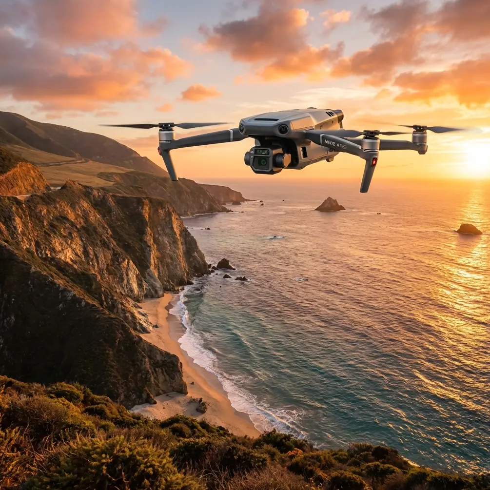
Mavic 3T for Coastal Construction Filming: What Actually Matters on Real Job Sites
META: Expert technical review of the Mavic 3T for filming coastal construction sites, with practical insight on thermal use, stability, transmission, payload logic, and operational details that affect survey and inspection results.
Coastal construction is unforgiving on equipment and on lazy workflow design. Salt in the air, bright reflective surfaces, wet concrete, cranes, rebar forests, changing wind lanes between structures, and a worksite that can shift by the hour. If you are evaluating the Mavic 3T for filming and documenting this kind of environment, the real question is not whether it can fly and record. The question is whether it can deliver reliable visual evidence, repeatable inspection passes, and enough operational resilience to keep crews moving without introducing uncertainty.
I’ve spent enough time around industrial drone programs to know that buyers often focus on camera headlines first. On a coastal construction site, that’s usually backwards. The Mavic 3T becomes valuable when its imaging stack, flight stability, transmission integrity, and data discipline all work together. That is what separates a drone that produces attractive footage from one that supports engineering review, progress verification, and safety-oriented site awareness.
From that perspective, the Mavic 3T is best understood as a compact field tool for mixed visual and thermal documentation rather than simply a flying camera.
Why coastal construction changes the evaluation
A standard inland build has its own challenges. Coastal work adds a few more layers. The atmosphere can soften contrast at longer viewing distances. Marine haze can flatten visual texture. Glare coming off water and metal roofing can trick exposure and complicate edge definition. Wind is less predictable because open shoreline gusts meet partially completed structures and create turbulent pockets.
Those factors matter because construction filming is rarely just “content.” On serious projects, imagery needs to help answer practical questions:
- Is cladding installation uniform across elevations?
- Are moisture pathways beginning to appear around envelope transitions?
- Is stockpile movement matching the schedule?
- Are drainage routes and temporary works behaving as expected after tide and rain cycles?
- Can project managers compare progress week to week from consistent camera positions?
The Mavic 3T fits this environment well when the operator treats it as a repeatable inspection platform, not as an improvisational filming toy.
The thermal side is not a gimmick on coastal jobs
The single biggest reason the Mavic 3T stands out on construction work is thermal signature interpretation in parallel with visible imaging. Along the coast, thermal becomes useful sooner than many teams expect. Moisture intrusion, insulation gaps in partially enclosed structures, electrical anomalies in temporary power setups, and heat differentials across mechanical plant can all create patterns that a visual-only workflow may miss.
That does not mean thermal replaces proper engineering diagnosis. It means thermal helps you find where to look.
On a concrete-heavy site near water, late afternoon and early evening often reveal the clearest thermal contrast because materials cool at different rates. A wall section that appears visually uniform can show an unusual temperature band where trapped moisture or incomplete sealing is present. Temporary electrical cabinets exposed to salty air may develop thermal irregularities that justify closer inspection before failure causes downtime.
This is where the Mavic 3T earns its keep. It lets one flight gather a visible record and a thermal layer without sending separate teams or repeating the same route with different aircraft. For project managers, that shortens the loop between observation and action.
A detail from aircraft engineering that surprisingly matters here
The reference material supplied for this article was not about drones directly. It came from aircraft design manuals, and that is useful because it reminds us how serious aerospace design becomes around apparently small components.
One reference describes standardized hose and fitting specifications, including a sample designation for a hose assembly with working pressure of 15 kgf/cm², dy = 12, and length L = 300 mm, marked in a format like HB4-129G-12Y12-15-300. It also lists multiple size variants and notes that some specifications such as (22) and (28) are restricted in new designs.
Why bring up hose standards in a Mavic 3T review? Because construction drone users often underestimate the value of disciplined component standardization. In aviation, repeatable performance depends on unglamorous details: sealing, routing, pressure tolerance, and limiting problematic sizes in new designs. On a coastal site, the same philosophy applies to your drone operation. Battery management, propeller replacement intervals, payload checks, SD card handling, and controller sealing habits are the drone equivalent of those standardized fittings. Small inconsistencies create field failures.
The operational significance is straightforward: if aerospace practice restricts marginal specifications in new designs, your site drone program should also eliminate avoidable weak links. Don’t mix battery ages casually. Don’t let crews use random exposure presets between missions. Don’t alternate between ad hoc flight paths and expect meaningful progress comparison. Reliability is built from controlled details.
The Mavic 3T rewards that mindset because it is compact enough to deploy quickly but capable enough that procedural discipline actually pays off in better data.
Stability and route repeatability matter more than cinematic flourish
For filming construction, especially if photogrammetry or progress comparison is part of the brief, consistency outranks drama. The Mavic 3T’s practical advantage is that it can move from oblique visual capture to inspection-style passes without changing aircraft class or field setup.
That matters when you are shooting retaining walls, piling zones, steel erection, façade progress, and shoreline protection works on the same day. A single compact platform is easier to stage around active subcontractors, and it is less intrusive when crews are pouring, lifting, or moving materials.
If you intend to use imagery downstream for photogrammetry, this is where discipline around GCP placement and camera geometry becomes decisive. The Mavic 3T can support mapping-adjacent workflows, but coastal construction introduces reflective surfaces and texture-poor zones that can weaken tie points. Ground control points need to be placed where they remain visible and stable despite mud, spray, and equipment movement. You should also expect that sea-facing edges and repetitive structural grids will need careful capture planning to preserve model integrity.
The aircraft’s usefulness rises when one operator can gather cinematic overviews for stakeholders and methodical overlap-driven imagery for technical teams in the same mobilization window.
Transmission confidence is not a minor spec on sprawling sites
Readers searching for Mavic 3T often fixate on sensor capability and forget communications. That is a mistake. A large coastal construction project can be electrically noisy and visually obstructed. Tower cranes, temporary site offices, steel framing, vessels, containers, and heavy plant all create a messy RF environment.
That is where O3 transmission becomes more than a brochure bullet. Stable downlink quality affects framing precision, thermal interpretation, and confidence when the aircraft is working along building edges or near infrastructure that blocks line of sight. If your visual feed degrades at the wrong moment, your thermal pass loses value because you cannot hold the angle you need or verify what you are seeing against the visible scene.
For organizations handling sensitive project imagery, AES-256 also matters. Construction documentation can include critical infrastructure layouts, phased access arrangements, or commercially sensitive design features. Secure transmission and disciplined file handling will not make your footage look better, but they absolutely affect whether the drone program is acceptable to the client, consultant, and site management team.
Ground loads, friction, and why that reference is relevant to launch planning
The second reference document focused on aircraft ground-load analysis. It describes how load components are resolved across axes and how vertical, drag, and lateral loads are determined during ground operations. It also ties those loads to friction coefficients and notes that special cases such as tire deflation require recalculating posture, compression, and resulting loads.
Again, not drone-specific. Still directly useful.
On a coastal construction site, launch and recovery surface quality is often the hidden risk. Operators get seduced by the flight profile and forget that the mission begins and ends on the ground. The aircraft reference stresses that even conventional aircraft require careful modeling of vertical load, drag load, and lateral load because geometry and friction conditions change. For drone crews, the translation is simple: don’t normalize unstable takeoff zones.
Wet plywood decks, dusty concrete slabs, steel bar mats, membrane roofing, and compacted fill near sea spray all change traction and debris behavior. If the friction and surface condition are variable enough that a manned-aircraft engineer would account for them in load analysis, then a drone crew should absolutely be using pads, clean setup areas, and strict rotor clearance rules.
The operational significance is not theoretical. I’ve seen excellent flights compromised by poor recovery decisions on wind-swept surfaces where grit and salt got kicked into rotors and gimbal assemblies. Ground discipline is part of image quality.
Wildlife is not a side note on coastal jobs
One site visit stands out. We were documenting progress on a shoreline retaining structure at first light when a pair of black-crowned night herons lifted from a drainage channel beside the work area. The useful part was not that the Mavic 3T “avoided birds” in some dramatic sense. The useful part was that its sensing and stable hover behavior gave the pilot enough situational awareness to pause, hold position, and re-route the pass without rushing the aircraft or pushing lower along the channel edge.
That is what professional obstacle sensing is for on civilian projects: not stunts, not aggressive flying, just enough awareness to preserve separation from wildlife, structures, and workers while keeping the mission orderly.
Coastal projects frequently overlap with bird activity, especially near tidal flats, drainage outfalls, and partially flooded excavations. A competent Mavic 3T operation respects that reality and builds timing windows that reduce disturbance. Early planning avoids awkward mid-flight improvisation.
Battery workflow can make or break a shift
People love to talk about camera payloads because they are visible. The less glamorous truth is that construction productivity often comes down to battery turnover. If your site requires repeated launches from multiple zones, you need a workflow that minimizes idle time between flights. That is why crews often ask about hot-swap batteries even when the platform itself has a specific battery handling procedure rather than literal powered hot replacement in the industrial docking sense.
The key point is operational continuity. Organized charging, temperature-aware rotation, and consistent battery health tracking matter more than squeezing every last minute from each pack. On salty, windy sites, reserve planning should be conservative. Fighting gusts on the return leg burns margin quickly, especially when you are holding precise inspection angles around vertical structures.
A team that manages batteries like calibrated field assets will always outperform a team that treats them like consumables.
Can the Mavic 3T support BVLOS-oriented programs?
In some enterprise conversations, BVLOS comes up immediately. For construction readers, the better framing is this: the Mavic 3T is highly effective in visual line-of-sight project workflows and can serve as part of a broader enterprise drone program, but operational approval and risk design should lead the discussion, not ambition.
For most coastal construction sites, the strongest return comes from repeatable local missions with disciplined data capture, secure handling, and clear maintenance routines. If your organization is building toward more advanced operational structures, the Mavic 3T can still be a practical stepping stone because it teaches the right habits: route planning, secure transmission, dual-modality imaging, and data interpretation across departments.
What I would pay attention to before choosing it
If I were assessing the Mavic 3T specifically for filming coastal construction sites, I would focus on five things:
Visible and thermal coordination
Not whether each camera is good in isolation, but whether your team can use both in one workflow to identify issues faster.Repeatable mission design
The aircraft is only as useful as your consistency in angles, altitude, overlap, and time-of-day capture.Transmission and data security
O3 transmission and AES-256 are operational assets, not marketing gloss, when sites are large and project data is sensitive.Ground handling discipline
The aircraft engineering references here underline a larger truth: stable operations depend on respecting loads, surfaces, and standardized procedures.Environmental realism
Salt, glare, wildlife, and shifting wind demand conservative planning. The Mavic 3T performs best when flown by teams who understand that.
If you’re building a serious coastal documentation workflow and want to compare notes on mission setup, thermal interpretation, or site-specific constraints, you can reach out here: message Dr. Lisa Wang’s field desk.
Final assessment
The Mavic 3T is not just a compact drone with thermal attached. For coastal construction, it becomes a highly efficient evidence-gathering platform when used with aviation-style rigor. That is the lesson hidden inside the reference materials. One source dealt with standardized hose assemblies, including a 15 kgf/cm² working-pressure example and restrictions on certain sizes in new design practice. Another described how aircraft ground loads are resolved across vertical, drag, and lateral directions, including changing conditions like reduced tire integrity. Both point to the same operational truth: dependable performance comes from respecting the system, not just the headline feature.
That is exactly how the Mavic 3T should be evaluated.
Use it for clean visual documentation. Use it for thermal signature screening. Use it for repeatable progress records tied to GCP-backed site mapping. Use it with secure transmission discipline. Launch it from surfaces you trust. Fly it with enough margin to handle wind and wildlife without stress.
Do that, and the Mavic 3T becomes far more than a filming tool. It becomes one of the fastest ways to turn a changing coastal construction site into organized, decision-ready information.
Ready for your own Mavic 3T? Contact our team for expert consultation.