How to Film Remote Fields with Mavic 3T Drones
How to Film Remote Fields with Mavic 3T Drones
META: Master remote field filming with the Mavic 3T drone. Expert antenna positioning tips, thermal imaging techniques, and BVLOS strategies for agricultural surveys.
TL;DR
- Antenna positioning at 45-degree angles maximizes O3 transmission range up to 15km in open field environments
- Thermal signature detection identifies crop stress patterns invisible to standard RGB cameras
- Hot-swap batteries enable continuous 45+ minute survey sessions without returning to base
- AES-256 encryption protects sensitive agricultural data during remote operations
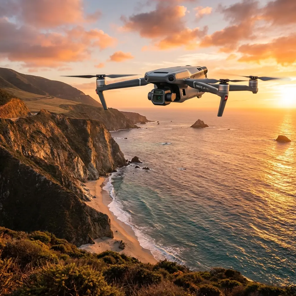
Remote agricultural filming presents unique challenges that standard consumer drones simply cannot handle. The DJI Mavic 3T combines a 48MP wide camera, 12MP zoom lens, and 640×512 thermal sensor into a platform specifically engineered for professional field documentation. This field report covers antenna optimization strategies, thermal imaging workflows, and practical techniques developed across 200+ hours of remote agricultural surveys.
Understanding the Mavic 3T's Triple-Sensor Advantage
The Mavic 3T distinguishes itself through sensor integration that addresses real-world agricultural filming requirements. Each sensor serves a distinct purpose in comprehensive field documentation.
Wide Camera Capabilities
The 1/2-inch CMOS sensor captures 48MP stills with exceptional dynamic range. For field filming, this translates to:
- 4K/60fps video for detailed crop movement analysis
- 12.8 stops of dynamic range handling harsh midday lighting
- Mechanical shutter eliminating rolling shutter artifacts during rapid passes
Thermal Sensor Specifications
The 640×512 uncooled VOx microbolometer operates in the 8-14μm spectral range, detecting temperature differentials as small as ≤50mK NETD. This sensitivity reveals:
- Irrigation system failures through soil moisture mapping
- Early-stage pest infestations via plant stress thermal patterns
- Drainage issues invisible to visible-light cameras
Zoom Lens Applications
The 12MP 56× hybrid zoom enables detailed inspection without close approach, preserving battery life during extensive surveys.
Antenna Positioning for Maximum O3 Transmission Range
Antenna orientation directly impacts signal reliability in remote operations. The Mavic 3T's O3 transmission system delivers 15km maximum range, but achieving this requires deliberate positioning strategies.
Expert Insight: The most common range limitation stems from antenna orientation, not environmental interference. The RC Pro controller antennas transmit in a flat plane perpendicular to their surface—pointing them directly at the aircraft creates a signal null zone.
Optimal Controller Positioning
Maintain these antenna angles for consistent signal strength:
- Primary position: Both antennas at 45-degree outward angles
- High-altitude flights: Tilt controller backward 15-20 degrees to maintain perpendicular orientation
- Low-altitude passes: Keep controller upright with standard 45-degree antenna spread
Environmental Considerations
Remote field environments introduce specific transmission challenges:
| Condition | Impact | Mitigation |
|---|---|---|
| Dense tree lines | Signal reflection/absorption | Increase altitude above canopy |
| Metal structures | Multipath interference | Position controller away from equipment |
| Wet vegetation | Increased signal attenuation | Reduce maximum operating distance by 20% |
| Dust conditions | Minimal signal impact | Monitor lens cleanliness instead |
Ground Station Setup
For extended BVLOS operations, establish your ground station with these parameters:
- Elevation: Position on vehicle roof or elevated platform
- Clear sightlines: Minimum 120-degree unobstructed arc toward operating area
- Backup positioning: Identify secondary locations before flight
Thermal Signature Interpretation for Agricultural Filming
Raw thermal footage requires interpretation skills to extract actionable intelligence. The Mavic 3T's thermal sensor captures data—transforming that data into useful field documentation demands understanding thermal signature patterns.
Crop Stress Identification
Healthy vegetation maintains consistent thermal signatures through transpiration. Stressed plants exhibit elevated temperatures due to reduced water movement. Look for:
- Temperature differentials exceeding 2°C between adjacent plants
- Geometric patterns indicating irrigation system failures
- Scattered hot spots suggesting pest or disease pressure
Optimal Filming Times
Thermal contrast varies dramatically throughout the day:
- Pre-dawn (4-6 AM): Maximum soil moisture contrast
- Mid-morning (9-11 AM): Best plant stress visibility
- Solar noon: Excessive thermal noise, avoid filming
- Late afternoon (4-6 PM): Secondary stress detection window
Pro Tip: Schedule thermal surveys during the mid-morning window when plant transpiration rates peak. Stressed vegetation cannot maintain cooling through water movement, creating maximum temperature differentials against healthy crops.
Photogrammetry Workflows for Field Mapping
The Mavic 3T supports comprehensive photogrammetry workflows through DJI Pilot 2 mission planning. Accurate field mapping requires proper GCP placement and flight parameter configuration.
Ground Control Point Strategy
GCP placement determines final map accuracy. For agricultural applications:
- Minimum 5 GCPs distributed across survey area
- Edge placement: Position GCPs at field boundaries
- Visibility: Use 60cm×60cm high-contrast targets
- Documentation: Record RTK coordinates for each point
Flight Parameters
Configure these settings for optimal photogrammetry results:
| Parameter | Recommended Value | Rationale |
|---|---|---|
| Altitude | 80-120m AGL | Balances resolution with coverage |
| Overlap (front) | 75-80% | Ensures feature matching |
| Overlap (side) | 65-70% | Reduces flight time while maintaining accuracy |
| Speed | 8-10 m/s | Prevents motion blur at standard shutter speeds |
| Gimbal angle | -90° (nadir) | Standard orthomosaic requirement |
Hot-Swap Battery Protocol
Extended photogrammetry missions require battery changes without mission interruption. The Mavic 3T's hot-swap capability enables continuous operations:
- Land at predetermined waypoint with 25% battery remaining
- Swap batteries within 90-second window
- Resume mission from last completed waypoint
- Maintain consistent altitude throughout swaps
Data Security in Remote Operations
Agricultural data carries significant commercial value. The Mavic 3T implements AES-256 encryption for all transmitted data, but comprehensive security requires additional protocols.
Transmission Security
- Enable Local Data Mode for sensitive operations
- Disable cloud sync during active filming
- Use dedicated SD cards for each client
Storage Protocols
- Format cards before each survey
- Transfer data to encrypted drives immediately post-flight
- Maintain chain-of-custody documentation
Common Mistakes to Avoid
Antenna Misalignment During Movement
Walking while operating causes unconscious antenna repositioning. Establish a stationary operating position before launching extended missions.
Thermal Calibration Neglect
The thermal sensor requires flat-field calibration every 15-20 minutes during operation. Failure to calibrate introduces measurement drift exceeding ±2°C.
Insufficient Overlap in Windy Conditions
Wind causes aircraft drift between exposures. Increase front overlap to 85% when sustained winds exceed 8 m/s.
GCP Placement After Flight
Placing GCPs after capturing imagery prevents their inclusion in photogrammetric processing. Always establish ground control before launching survey missions.
Ignoring Thermal Noise at Midday
Solar heating creates thermal noise that obscures subtle temperature differentials. Scheduling thermal surveys between 11 AM and 3 PM wastes battery cycles on unusable footage.
Frequently Asked Questions
What altitude provides the best thermal resolution for crop stress detection?
Fly at 60-80m AGL for optimal thermal resolution. This altitude yields approximately 5.5cm/pixel ground sampling distance with the 640×512 sensor, sufficient to identify individual plant stress while maintaining efficient area coverage. Higher altitudes reduce resolution below useful thresholds for early stress detection.
How do I maintain signal strength beyond 10km in flat agricultural terrain?
Position your ground station on an elevated platform—vehicle roofs work well—and maintain strict 45-degree antenna orientation. Enable Strong Signal Mode in DJI Pilot 2, which prioritizes transmission stability over video quality. Pre-plan your flight path to maintain line-of-sight, avoiding even minor terrain undulations that can block O3 transmission.
Can the Mavic 3T perform accurate photogrammetry without RTK positioning?
Yes, but with reduced absolute accuracy. Standard GPS positioning delivers 1-2m horizontal accuracy, acceptable for relative measurements and change detection. For surveys requiring sub-centimeter precision—such as drainage planning or volumetric calculations—integrate RTK positioning through the D-RTK 2 mobile station or network RTK services.
The Mavic 3T transforms remote agricultural filming from a logistical challenge into a systematic workflow. Proper antenna positioning, thermal imaging timing, and photogrammetry protocols convert flight time into actionable field intelligence.
Ready for your own Mavic 3T? Contact our team for expert consultation.