Mavic 3T Forest Filming Guide: High Altitude Best Practices
Mavic 3T Forest Filming Guide: High Altitude Best Practices
META: Master high-altitude forest filming with the DJI Mavic 3T. Expert tutorial covering thermal imaging, safety protocols, and pro techniques for stunning aerial footage.
TL;DR
- Pre-flight lens cleaning is critical—condensation and debris at altitude compromise both thermal accuracy and flight safety sensors
- The Mavic 3T's O3 transmission maintains reliable signal through dense forest canopy up to 15km range
- Thermal signature detection enables wildlife tracking and hazard identification impossible with standard cameras
- High-altitude operations require specific battery management strategies due to 30% reduced flight time in thin air
Why High-Altitude Forest Filming Demands Specialized Equipment
Forest cinematography above 3,000 meters presents unique challenges that ground most consumer drones. Thin air reduces rotor efficiency. Dense canopy blocks GPS signals. Temperature swings fog lenses mid-flight.
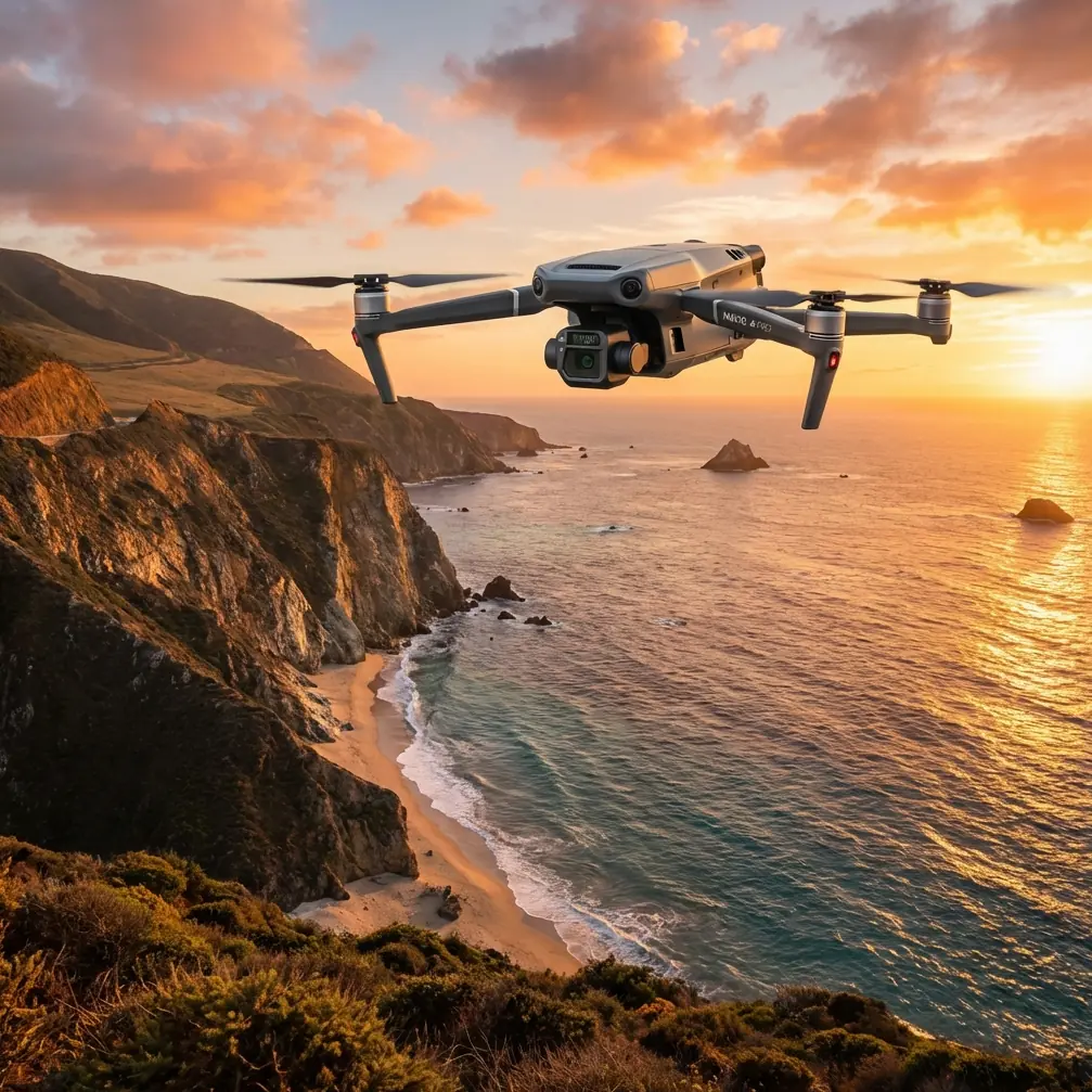
The DJI Mavic 3T addresses these obstacles with enterprise-grade engineering originally designed for industrial inspection work. Its triple-sensor payload—combining a 48MP wide camera, 12MP zoom lens, and 640×512 thermal imager—captures forest environments with unprecedented detail.
This tutorial walks you through the complete workflow for professional forest filming at altitude, from critical pre-flight preparation to advanced thermal imaging techniques.
The Pre-Flight Cleaning Protocol That Prevents Crashes
Before discussing camera settings or flight patterns, we need to address the step most pilots skip—and later regret.
Why Sensor Cleaning Matters More at Altitude
The Mavic 3T relies on multiple obstacle avoidance sensors positioned around its body. At high altitude, rapid temperature changes cause condensation to form on these sensors during ascent. Combined with pollen, dust, and tree debris common in forest environments, dirty sensors create dangerous blind spots.
Expert Insight: I've witnessed experienced pilots lose aircraft to sensor-related crashes in mountain forests. The Mavic 3T's forward, backward, upward, downward, and lateral sensors all require inspection. A single obscured sensor can cause the drone to fly directly into obstacles it would normally avoid.
The Complete Pre-Flight Cleaning Checklist
Follow this sequence before every high-altitude forest flight:
- Obstacle avoidance sensors: Wipe all six sensor pairs with a microfiber cloth
- Gimbal camera lenses: Clean the wide, zoom, and thermal lens covers
- Cooling vents: Clear debris from intake and exhaust ports
- Propeller mounts: Remove any accumulated material that could cause vibration
- Battery contacts: Ensure clean connection points for reliable power delivery
This process takes three minutes and prevents the majority of altitude-related equipment failures.
Configuring the Mavic 3T for Forest Environments
Camera Settings for Canopy Penetration
Forest filming requires balancing exposure for both shadowed understory and bright canopy tops. The Mavic 3T's 48MP sensor with f/2.8 aperture handles this contrast well, but manual configuration produces superior results.
Recommended settings for forest cinematography:
- Aperture: f/4.0 (increased depth of field for layered canopy)
- ISO: 100-400 (minimize noise in shadow areas)
- Shutter speed: 1/50 for 24fps, 1/100 for 48fps
- Color profile: D-Log M for maximum dynamic range
- White balance: 5600K (compensates for green color cast)
Thermal Imaging Configuration
The thermal camera transforms forest filming from purely aesthetic work into data-rich documentation. Wildlife researchers, forestry managers, and conservation teams rely on thermal signature detection to locate animals, identify diseased trees, and map water sources invisible to standard cameras.
Configure thermal settings based on your primary objective:
| Objective | Palette | Gain Mode | Isotherm |
|---|---|---|---|
| Wildlife detection | White Hot | High | Off |
| Tree health assessment | Ironbow | Low | Enabled |
| Water source mapping | Arctic | High | Off |
| Fire risk evaluation | Fulgurite | High | Enabled |
Pro Tip: Enable picture-in-picture mode to display thermal and visual feeds simultaneously. This allows you to correlate thermal anomalies with visible features in real-time, dramatically speeding up post-flight analysis.
Mastering O3 Transmission in Dense Canopy
The Mavic 3T's O3 transmission system represents a significant advancement for forest operations. Traditional drones lose signal when flying below canopy level or behind terrain features. O3's dual-antenna design and automatic frequency switching maintain connection in conditions that would ground older aircraft.
Signal Optimization Strategies
Forest canopy creates complex radio environments. These techniques maximize transmission reliability:
- Maintain line-of-sight to takeoff point when possible
- Position the controller antenna perpendicular to the drone's direction
- Avoid operations during rain—wet foliage absorbs radio signals
- Use the high-performance transmission mode for flights exceeding 5km
The system's AES-256 encryption ensures your footage and flight data remain secure, particularly important for commercial forestry clients and conservation organizations working in sensitive areas.
Battery Management at Altitude
Thin air forces motors to work harder, while cold temperatures reduce battery chemistry efficiency. These factors combine to cut flight time by 25-35% compared to sea-level operations.
Hot-Swap Battery Strategy
The Mavic 3T supports hot-swap batteries, allowing rapid field replacement without powering down the aircraft. For extended forest filming sessions, this capability proves essential.
Altitude-adjusted flight time estimates:
| Altitude | Temperature | Expected Flight Time |
|---|---|---|
| Sea level | 20°C | 45 minutes |
| 2,000m | 10°C | 38 minutes |
| 3,500m | 5°C | 32 minutes |
| 4,500m | 0°C | 28 minutes |
Carry minimum three batteries for serious high-altitude work. Keep spares warm in an insulated bag until needed.
Advanced Techniques: Photogrammetry and Mapping
Beyond cinematography, the Mavic 3T excels at creating detailed 3D models and orthomosaic maps of forest environments. Photogrammetry workflows benefit from the aircraft's RTK-ready design and mechanical shutter.
Ground Control Point Placement
For survey-grade accuracy, deploy GCP markers before flight. In forest environments, place points in clearings where they'll remain visible from altitude.
Recommended GCP distribution:
- Minimum 5 points for areas under 10 hectares
- 8-12 points for larger survey zones
- Checkerboard pattern targets visible in both RGB and thermal spectra
BVLOS Considerations
Beyond Visual Line of Sight operations unlock the Mavic 3T's full potential for large-scale forest mapping. However, BVLOS flights require specific regulatory approval in most jurisdictions.
Before attempting extended-range forest surveys:
- Obtain necessary aviation authority waivers
- Establish redundant communication systems
- Deploy visual observers at calculated intervals
- File detailed flight plans with relevant authorities
Common Mistakes to Avoid
Launching without GPS lock: At altitude, GPS acquisition takes longer. Wait for minimum 12 satellites before takeoff to ensure reliable positioning and Return-to-Home functionality.
Ignoring wind gradient: Wind speed increases dramatically above canopy level. A calm forest floor often masks dangerous conditions at flight altitude. Check forecasts for winds at your intended operating height.
Overlooking thermal calibration: The thermal camera requires flat-field calibration when temperatures change significantly. Failing to calibrate produces inaccurate readings and banded imagery.
Flying with cold batteries: Never launch with batteries below 20°C. Cold cells deliver reduced power and may trigger automatic landing at inopportune moments.
Neglecting firmware updates: DJI regularly releases updates improving high-altitude performance. Outdated firmware may lack critical stability improvements for mountain operations.
Frequently Asked Questions
Can the Mavic 3T operate above 5,000 meters altitude?
The Mavic 3T is rated for operation up to 6,000 meters above sea level. However, flight time decreases substantially, and pilots must unlock altitude limits through the DJI Fly app. Supplemental oxygen for the pilot becomes necessary at these elevations, and battery warming is mandatory.
How does thermal imaging perform through forest canopy?
Thermal radiation passes through gaps in foliage but cannot penetrate solid leaves or branches. The Mavic 3T's thermal camera detects heat signatures in clearings, along forest edges, and through sparse canopy. Dense, closed-canopy forests require flying below the tree line for effective thermal detection.
What's the best time of day for forest thermal imaging?
Early morning—30 minutes before sunrise to one hour after—provides maximum thermal contrast. Animals retain body heat while the environment remains cool, creating clear thermal signatures. Midday sun heats all surfaces uniformly, reducing detection capability.
Take Your Forest Filming to New Heights
High-altitude forest cinematography demands respect for both the environment and your equipment. The Mavic 3T provides the tools—thermal imaging, reliable transmission, and robust construction—but successful operations depend on proper preparation and technique.
Master the pre-flight cleaning protocol. Configure your cameras for the specific conditions you'll encounter. Manage batteries conservatively. These fundamentals separate professional results from frustrating failures.
— James Mitchell, Aerial Cinematography Specialist
Ready for your own Mavic 3T? Contact our team for expert consultation.