Filming Coastal Forests With the Mavic 3T
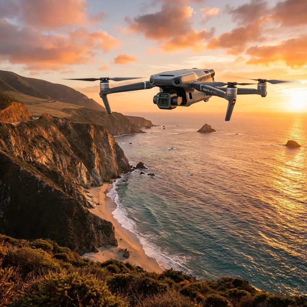
Filming Coastal Forests With the Mavic 3T: A Field Method That Actually Works
META: Expert how-to for filming coastal forests with the DJI Mavic 3T, covering thermal strategy, O3 transmission, battery planning, photogrammetry crossover, and real field considerations.
Coastal forests look cinematic from the ground and deceptively simple from the air. They are neither. Salt haze flattens contrast. Wind curls around ridgelines and breaks clean flight paths. Dense canopy swallows visual references, and once you move inland from the shoreline, GPS confidence can shift faster than many pilots expect. If your platform is the DJI Mavic 3T, the good news is that this aircraft gives you a very unusual advantage for this environment: it is not just a camera drone. It is a situational-awareness tool that happens to be highly capable at capture.
That distinction matters.
Most pilots approach the Mavic 3T as if it were simply a Mavic 3 with an added thermal payload. In coastal woodland work, that mindset leaves performance on the table. The real strength of the aircraft is the way its visible and thermal systems can be used together to solve the hardest part of forest filming: finding usable visual structure before conditions erase it. If you understand that, the Mavic 3T starts to outperform a lot of competing compact drones in ways spec sheets do not explain well.
This guide is built specifically for the reader trying to film forests near the coast, not for a generic enterprise mission. The goal is to help you get more reliable footage, safer flights, and better planning value from the Mavic 3T.
Why the Mavic 3T makes sense in coastal forests
Coastal forests punish indecision. Light changes quickly, the canopy creates hidden turbulence, and visual scouting from takeoff position is often poor. The Mavic 3T’s thermal capability helps you read the environment differently. At dawn, shaded gullies, wet ground, sun-touched trunks, and warm wildlife trails can separate into visible thermal patterns even when the standard camera sees a wall of green. That is operationally significant because it lets you identify flight corridors, temperature-defined clearings, and points of interest before you commit to a low-altitude cinematic pass.
This is where the Mavic 3T begins to pull ahead of many competitors in the compact class. A conventional prosumer filming drone may give you strong RGB footage, but it cannot pre-visualize the thermal behavior of a damp treeline or reveal where fog is lingering in a drainage cut. In practical terms, that means the Mavic 3T can reduce wasted setups. You spend less time probing blind and more time flying intentional lines.
The second major advantage is transmission resilience. DJI’s O3 transmission system is not magic, and forest density will still challenge signal quality, but in coastal environments where you may be working around mixed terrain, scrub, and interrupted sightlines, strong transmission stability matters as much as camera quality. It is easy to obsess over image specs and ignore the truth: if your downlink becomes unreliable at the exact moment you are threading along a treetop edge, your shot is gone and your risk goes up. O3 helps preserve confidence at the moments that count.
There is also a data-security angle that serious operators should not dismiss. The Mavic 3T supports AES-256 encryption, which is more than a checkbox for enterprise brochures. If you are documenting ecologically sensitive coastal land, restoration zones, critical infrastructure near shore, or private estates with forest cover, secure handling of mission data can become part of the job requirement. For some crews, that is the difference between being able to take the assignment and having to walk away.
Start with thermal, not with beauty shots
When pilots say they want to “film the forest,” they often mean they want low, drifting reveal shots through the canopy line, shoreline-to-woodland transitions, or top-down textures of creek systems and evergreen density. Fair enough. But on the coast, starting with cinematic intent alone is backward.
Start with a thermal scouting pass.
Not because the thermal camera will produce your hero footage. It usually will not. You start there because thermal gives you environmental intelligence. On cool mornings, streams hidden beneath cover can stand out as temperature bands. Recently sunlit clearings may read differently from sheltered depressions. Human activity, vehicles, warm rooftops near the forest edge, even concentrations of wildlife can appear before they are obvious in RGB. That allows you to make better decisions about route, timing, and safety.
A simple method works well:
- Launch early, before direct sun has equalized the scene.
- Run a higher, slower orbit to identify temperature contrasts.
- Mark useful lanes: breaks in canopy, drainage paths, edges of fog, warm structures, wildlife zones.
- Then switch your visible-camera plan around those findings.
This matters especially in coastal conifer and mixed broadleaf environments where visual monotony can make composition difficult. Thermal gives you a map of hidden variation. Once you know where the scene changes, your standard footage becomes more deliberate and often more dramatic.
Timing is everything in salt-air environments
Coastal forests are not static subjects. Their character changes by the hour.
The best Mavic 3T operators do not just ask whether the weather is flyable. They ask whether the thermal signature is readable and whether the visible scene has enough separation to justify the launch. Those are not the same thing.
Early morning is often the strongest window if your goal is to combine thermal interpretation with cinematic planning. The ground has had time to cool. Patches of retained heat can reveal structure. Moisture sitting in low ground may create clean atmospheric layering in RGB while still giving useful thermal contrast. Midday often compresses that difference. Once sun exposure evens out the landscape, thermal interpretation becomes less informative for pre-visualization, even if the visible image is still attractive.
That said, late afternoon can be excellent for shoreline-adjacent forests where side light cuts across trunk lines and canopy texture while thermal still picks up meaningful differences in exposed rock, wet sand margins, and shaded understory. You are not using thermal just for detection. You are using it to understand the energy pattern of the terrain.
That is a subtle but powerful shift.
Build your shot list around signal discipline
If you have flown coastal forest edges long enough, you know the trap. The visual line looks open from your position, but the moment the aircraft slips behind a stand of taller trees or drops into a contour fold, your connection margin shrinks. The Mavic 3T’s O3 transmission gives you a stronger operating cushion than many smaller imaging drones, but that does not excuse sloppy route design.
Plan flights in layers:
- First layer: high-altitude recon pass
- Second layer: medium-altitude composition pass
- Third layer: low-altitude cinematic pass only where signal behavior is already known
This is where experienced crews separate themselves from hobby-style improvisation. They do not discover RF problems during the hero run. They identify them one pass earlier.
In coastal terrain, I also recommend avoiding long lateral runs behind uninterrupted canopy walls unless you have already proven the route. A short reveal that keeps the aircraft near the forest edge usually gives better visual depth and lower signal uncertainty than pushing deep across dense cover. The Mavic 3T excels when used with discipline. It does not reward overconfidence.
Battery planning in the real world
Forest work near the coast has a way of stretching missions. You think you are filming one ridge and suddenly you are logging alternate approaches because wind at the tree line is different from wind over the beach. That is why battery planning on the Mavic 3T should be treated as part of the creative process, not just a safety checklist.
If you are working with hot-swap batteries in a field rhythm, use them to preserve momentum between reconnaissance and capture phases. The value is not only faster turnaround. It is continuity. You can scout a corridor thermally, land, swap immediately, and relaunch for visible capture while the light and the environmental pattern are still aligned. In coastal forests, that alignment can disappear fast.
This is also one area where the Mavic 3T has a practical edge over heavier enterprise rigs. Larger aircraft can bring more payload flexibility, but they often impose more setup drag. When conditions are changing minute by minute, a compact aircraft with serious sensing capability can be the smarter tool.
Use photogrammetry thinking even if the deliverable is video
This is one of the most underused habits in forest filming.
Even if your client wants cinematic footage, a photogrammetry mindset improves mission design. Think in overlapping coverage, repeatable paths, and reference consistency. If the location matters beyond a single video—erosion zones, storm impact, vegetation change, access-road condition—you may regret not capturing structured data while you were already on site.
The Mavic 3T sits at an interesting intersection here. It can support visual storytelling while also helping with mapping-oriented work. If you need to build a scene model or compare environmental changes over time, introducing GCPs in accessible clearings can improve spatial reliability for reconstruction workflows. In dense forest, photogrammetry will always be limited by canopy complexity, but edge zones, tracks, dunes, exposed ground, and cleared management areas can still benefit.
Operationally, this means one sortie can serve two purposes: produce footage and preserve a geospatial record. For environmental teams, land managers, and contractors documenting coastal woodland, that is extremely efficient.
Thermal is not just for search work
The Mavic 3T often gets mentally boxed into inspection, public safety, or wildlife detection. That misses its value for filmmakers and field documentarians.
In coastal forests, thermal helps answer questions that directly affect production quality:
- Where is the moisture concentration that may become fog on camera?
- Which access route is recently sun-exposed and easier to use safely?
- Which stand edge is warmer and likely to shimmer with rising air?
- Where are animals likely active, so you can avoid disturbance or capture behavior responsibly?
Those are filming questions. They are not only survey questions.
And this is exactly why the aircraft excels against competitors that rely solely on visible imaging. If the assignment requires more than aesthetic capture—if it requires environmental interpretation—the Mavic 3T becomes unusually efficient. You are not carrying separate systems or guessing what the forest is doing beyond what your eyes can see.
What to watch for in coastal woods
The Mavic 3T is capable, but coastal forests are excellent at exposing weak habits. A few issues deserve special attention.
First, fog banks and salt mist can trick you into flying for atmosphere when contrast is actually collapsing. Thermal may still show useful separation even when visible footage loses structure. If the RGB feed starts looking flat, do not assume the scene is cinematic just because it feels dramatic on location.
Second, wildlife. Thermal makes it easier to detect life under or near the canopy edge, which means it also makes it easier to avoid stressing animals with repeated low passes. That is a professional advantage if you choose to use it that way.
Third, legal and operational boundaries. If your mission design edges toward BVLOS concepts because the terrain invites long forest-line runs, stop and reset around your regulatory framework. Coastal environments can create the illusion of openness from elevated positions, but line-of-sight and command reliability still need to be treated conservatively.
Fourth, secure workflows. If your footage or thermal records involve protected land, private holdings, or sensitive sites, AES-256 support should be part of your handling protocol, not trivia buried in a spec page.
A practical mission template
If I were deploying the Mavic 3T for a half-day coastal forest shoot, I would keep it simple:
Arrive before sunrise. Walk the launch area and note humidity, wind direction, and any obvious salt haze. Fly an initial thermal reconnaissance pass at a safe, moderate altitude to identify temperature-defined features and potential routes. Land. Review quickly. Swap battery. Relaunch for a structured visible pass based on the thermal findings, starting higher and wider. Then move into low-altitude hero shots only after confirming signal behavior and turbulence patterns.
If mapping value is possible, collect overlapping coverage around key zones and log any GCP positions you can establish cleanly. Keep your batteries rotating so you can respond to the best light window rather than chasing it after the scene has changed.
And if you are planning a more technical woodland workflow or want to compare field setups for your site, you can message an operator here to pressure-test your mission design before you deploy.
That kind of preparation is where the Mavic 3T shines. Not as a one-click miracle. As a compact aircraft that lets a thoughtful pilot see more, decide faster, and film with fewer surprises.
The coastal forest is still going to be difficult. That part does not change. But with the Mavic 3T, difficulty becomes information, and information is what turns a risky flight into a controlled one—and ordinary footage into material that actually tells the truth about the landscape.
Ready for your own Mavic 3T? Contact our team for expert consultation.