Mavic 3T in Extreme Forest Conditions: A Field Report
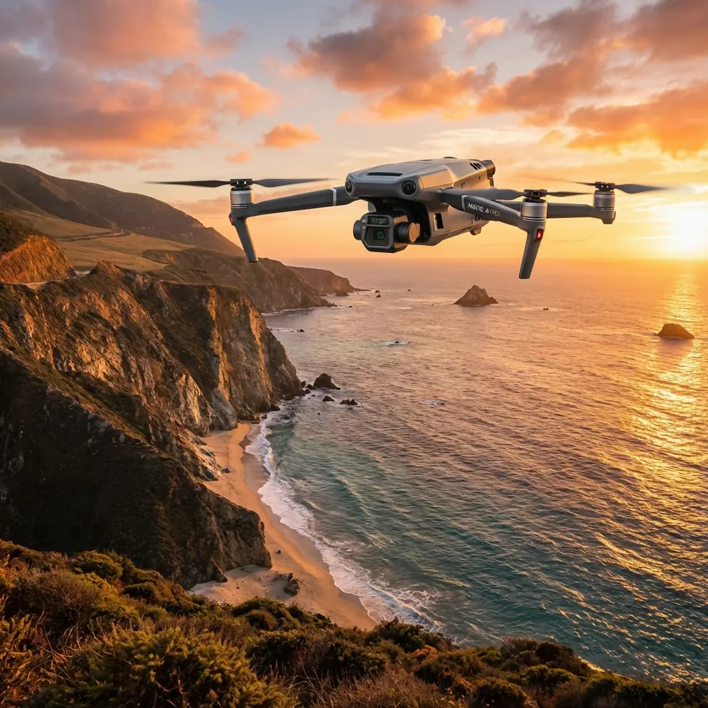
Mavic 3T in Extreme Forest Conditions: A Field Report on Fast Mapping, Thermal Detection, and Mobile Data Flow
META: Expert field report on using the Mavic 3T for forest work in extreme temperatures, with practical insight on thermal signature capture, rapid photogrammetry, mobile processing, and remote data transmission.
I’ve spent enough time around forestry crews, utility contractors, and emergency mapping teams to know that the aircraft is only part of the equation. In difficult woodland environments, especially when temperatures swing hard in either direction, the real question is not whether a drone can fly. It’s whether the whole workflow can keep pace with what the field is throwing at you.
That is why the most useful lens for evaluating the Mavic 3T is not the usual spec-sheet approach. A better frame comes from an older but still highly relevant surveying concept: the vehicle-based UAV emergency mapping system described by Xiao Jincheng and colleagues. Their central point was simple and operationally sharp. In time-critical field work, the bottleneck is rarely just image capture. The real constraint is whether remote sensing data can be acquired, processed, and transmitted quickly enough to matter.
That idea maps neatly onto forest operations with the Mavic 3T.
Why the Mavic 3T makes sense in forests when temperatures are working against you
Forests are messy sensing environments. Dense canopy blocks clean sightlines. Moisture, shade, and wind shear change quickly from one clearing to the next. Temperature extremes make battery planning less forgiving, and they also affect the quality of thermal interpretation. In that setting, the Mavic 3T’s value comes from how it combines visible imagery, thermal signature detection, navigation reliability, and relatively fast field deployment.
For teams filming forests in extreme cold mornings or heat-loaded afternoons, thermal is not a gimmick. It changes how you read the landscape. A standard RGB pass might show texture, color variation, and structural damage. Thermal can reveal stressed trees, hidden hotspots in brush or peat edges, warm machinery under canopy gaps, and heat-retaining surfaces that are invisible in normal visual contrast. That matters for environmental assessment, forestry operations, infrastructure inspection near wooded corridors, and post-event documentation.
But raw thermal imagery is only half-useful if it sits on a memory card while the team waits back at base.
The source paper’s emphasis on rapid data processing and remote data transmission is exactly where a modern Mavic 3T workflow either succeeds or fails. In the field, timing changes everything. If your forestry client, land manager, or operations lead has to wait half a day for stitched imagery, your aircraft was efficient but your mission was not.
The older emergency mapping model still explains modern drone success
The paper describes an integrated approach built on four pillars: remote sensing, geographic information systems, global positioning systems, and network communication technology. That combination was proposed for a vehicle-mounted UAV emergency surveying and mapping system designed to support fast image acquisition, on-site processing, output generation, and immediate remote transmission.
Those details matter because forest work often mimics emergency logistics even when the job is entirely civilian.
Think about a crew operating from a truck at the edge of a forest block after a windstorm. Or a conservation team documenting heat stress patterns during an extreme weather event. Or a utility vegetation unit assessing a corridor through dense timber. In each case, the job is mobile. The launch point may shift several times. Connectivity may be inconsistent. Decision-makers may be elsewhere. What you need is not just a drone, but a compact field system.
The Mavic 3T fits this model unusually well because it can be used as the airborne sensor node inside a truck-based workflow. Fly from a temporary roadside position. Land. Move imagery into a field laptop or controller-linked workflow. Generate quick orthomosaic previews or thermal review clips. Push selected outputs back to the office over available network links. The aircraft becomes one part of a live surveying chain rather than a standalone camera.
That is operationally significant. The paper argued that improving emergency surveying capability depends on making acquisition, processing, and transmission fast and efficient. In practical forestry terms, that means fewer dead periods between “we flew it” and “we know what we’re looking at.”
Extreme temperatures change how you should read thermal data
The phrase thermal signature gets thrown around too casually. In forests, thermal imagery is not an absolute truth layer. It is context-sensitive.
On very cold days, temperature separation between living organisms, machinery, water edges, and exposed ground can become easier to distinguish. That can help identify active equipment, warm drainage paths, compromised insulation on remote structures, or unusual heat points in slash piles and debris zones. In hot conditions, by contrast, the forest can become thermally cluttered. Sun-exposed surfaces retain heat, rocks can bloom in the image, and canopy openings can flatten the contrast you expected.
With the Mavic 3T, the lesson is to treat thermal collection as a timed operation, not a generic one. Early morning and late evening often produce cleaner differentiation than the middle of a hot day. If you are filming forests for asset monitoring or environmental review, your best thermal sortie may not align with your best photogrammetry sortie.
That split matters. RGB photogrammetry usually wants consistent light and disciplined overlap. Thermal analysis wants the most interpretable heat pattern. They are related missions, but not always the same mission.
Photogrammetry in woodland environments: useful, but only if you respect the limits
The paper’s core concern with rapid surveying support naturally leads to photogrammetry. The Mavic 3T can contribute useful visual data for quick mapping and site understanding, but forests are not kind to conventional reconstruction. Dense canopy reduces ground visibility. Repetitive textures can confuse matching. Shadows shift rapidly. Understory may disappear entirely from an overhead pass.
This is where GCPs can still earn their keep.
If the goal is accurate corridor review, roadside access planning, or documenting disturbed forest edges rather than dense interior canopy, a few well-placed ground control points near openings, tracks, and site boundaries can stabilize your model and improve confidence in measurement. You won’t force a perfect terrain model out of closed canopy with brute optimism. What you can do is improve the geospatial reliability of the surfaces and features you actually see.
That distinction separates usable deliverables from pretty-looking but weak mapping outputs.
In cold conditions, GCP management gets even more practical. Markers need to stay visible against frost, leaf litter, or patchy snow. In hot dry conditions, dust and glare can reduce clarity. The Mavic 3T itself is not the whole measurement system. Positioning discipline still matters.
O3 transmission is more than convenience in the woods
Forest flying exposes one of the oldest truths in UAV work: trees do not care about your signal plan.
The Mavic 3T’s O3 transmission capability is a major advantage, not because it defeats woodland physics, but because it gives you a more resilient live link when terrain and vegetation start fighting for control of the mission. In roadside launches, ridgeline work, and edge-of-canopy operations, stable transmission supports safer framing, steadier route execution, and faster confirmation that the data you need is actually being captured.
For field teams trying to operate from a vehicle-based setup, strong transmission also reduces needless repositioning. If you can maintain a reliable view and command link from the truck or a nearby clearing, you save time. And time, as the source paper stressed, is one of the real constraints in mission effectiveness.
There is another layer here. If your forest project involves remote stakeholders reviewing outputs off-site, AES-256 matters too. Secure transmission and protected data handling are not abstract enterprise features. Forestry, infrastructure, and environmental documentation can involve sensitive commercial sites, private land boundaries, or unpublished ecological findings. Fast transmission is useful; secure transmission is what keeps the workflow credible.
The accessory that made the difference
One of the more effective setups I’ve seen paired with the Mavic 3T in cold forest work involved a third-party vehicle power and battery conditioning case. It was not glamorous. It did not change the aircraft’s optics or add some magical capability. What it did was keep batteries in a more controlled state between flights and streamline charging from the field vehicle.
That mattered because extreme temperatures punish sloppy battery handling. In cold weather, launch performance and endurance can dip if packs are not managed properly. In hot weather, turnaround discipline matters for battery health and mission planning. Adding a robust field charging and warming solution turned the drone from a capable aircraft into a dependable system.
That is the kind of accessory choice experienced teams make. They invest in continuity, not just gadgets.
If you’re building a serious forest workflow around the Mavic 3T and want to compare practical field-kit options, one useful starting point is this direct WhatsApp line for deployment questions.
A vehicle-based workflow is the hidden multiplier
The reference paper was centered on a car-mounted UAV emergency surveying and mapping system, and that idea deserves more attention in commercial drone work. For forests, especially in extreme weather, the most efficient Mavic 3T setup is often built around the vehicle.
The vehicle becomes:
- transport hub
- battery management station
- data offload point
- first-pass processing desk
- communications relay
- weather shelter
- mission reset zone
That sounds obvious until you compare it with the common failure mode: a pilot carrying an excellent aircraft into the woods without a coherent field process. The result is avoidable friction. Batteries cool too much between sorties. Notes are scattered. Thermal review is delayed. Files remain unverified until the team has already left the site.
The paper emphasized on-site timely processing and output alongside immediate remote transmission. That sequence is critical. In forest operations, I recommend thinking in loops:
- Fly the Mavic 3T for a targeted capture objective.
- Land and verify data immediately in the vehicle.
- Produce a quick-look output for field interpretation.
- Transmit essential findings to remote stakeholders.
- Adjust the next flight based on what the first pass actually revealed.
That loop is where productivity lives.
What BVLOS discussions often miss in forest missions
BVLOS gets mentioned often in connection with large-area forestry, but people sometimes jump too quickly from “large forest” to “long-range drone.” The smarter question is whether the mission design, regulatory environment, and communications architecture support meaningful extended operations.
For many forest jobs, the Mavic 3T works best not by pretending to be a fixed-wing mapping platform, but by enabling repeated, fast, high-value flights from moving staging points. If BVLOS authorization is part of the program, fine. But even then, the paper’s logic still holds: the mission succeeds through integration of sensing, positioning, GIS, and communications, not through flight distance alone.
In other words, range without a responsive data chain is just delayed understanding.
What I would prioritize on a real forest assignment
If I were planning a Mavic 3T deployment for forest filming in extreme temperatures, the checklist would be built around workflow integrity rather than isolated features:
- Time thermal flights for interpretable heat contrast, not convenience.
- Use RGB captures separately when photogrammetry quality is the priority.
- Set GCPs where they will strengthen measurable outputs, especially near accessible edges and corridors.
- Run the mission from a vehicle-based station with disciplined battery handling.
- Validate footage and mapping inputs on site before leaving.
- Push priority outputs remotely as soon as they are usable.
- Treat O3 transmission and AES-256 as part of the operational framework, not marketing extras.
That approach is remarkably close to the reference paper’s core argument, even though the aircraft itself is newer and far more compact. The underlying principle has not changed. The value of aerial surveying in time-sensitive field work comes from compressing the gap between capture and action.
Final take
The Mavic 3T is a strong forest tool, especially when temperatures are challenging, because it supports more than image collection. It supports a mobile decision cycle. The article by Xiao Jincheng’s team identified the exact pressure point years ago: emergency and field surveying improve when remote sensing data can be obtained, processed, and transmitted quickly. Their integrated model of remote sensing, GIS, GPS, and network communication still describes what high-performing drone operations look like today.
For forestry and land-based commercial work, that means the smartest Mavic 3T operator is not the one who flies the longest. It is the one who builds the fastest reliable loop from thermal signature and visual capture to verified, shareable field intelligence.
Ready for your own Mavic 3T? Contact our team for expert consultation.