How I Plan Forest Filming Missions With the Mavic 3T in Comp
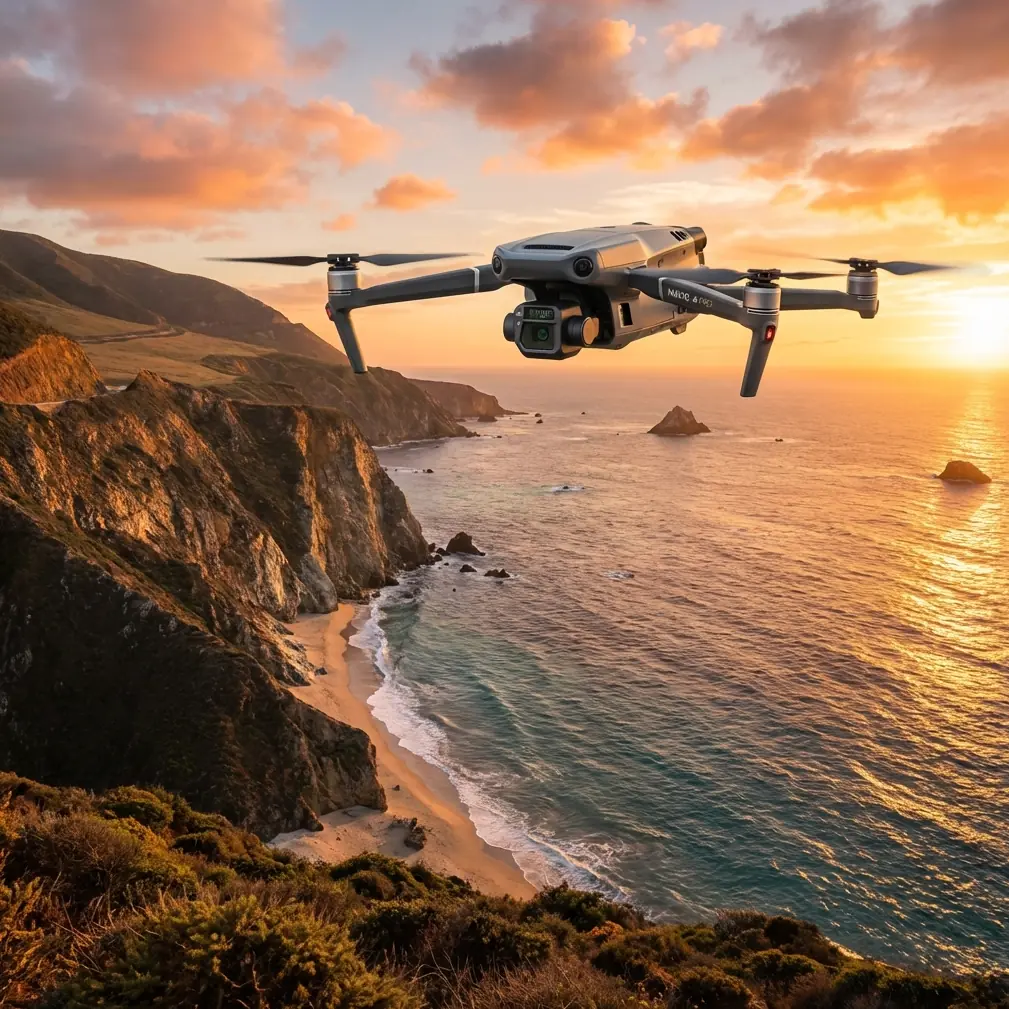
How I Plan Forest Filming Missions With the Mavic 3T in Complex Terrain
META: Practical Mavic 3T tutorial for filming forests in complex terrain, with flight altitude strategy, thermal workflow insight, transmission planning, and mission logic grounded in real aircraft system principles.
Filming forests sounds simple until the canopy starts lying to you.
From above, a forest can look uniform, even calm. In practice, it is a layered obstacle field: ridgelines steal signal, shaded gullies distort visual contrast, tree crowns hide terrain rise, and temperature shifts change what the thermal sensor sees from one slope to the next. If you are using the Mavic 3T in this environment, the real job is not just getting beautiful footage. It is building a flight method that stays readable, repeatable, and safe while the landscape keeps changing under the aircraft.
I approach this as both an imaging problem and an aircraft-systems problem. That matters because the best forest footage with the Mavic 3T usually comes from operators who think beyond the camera. They think about airflow, sensor readiness, timing logic, terrain-induced occlusion, and what the aircraft is actually “aware of” at each phase of flight.
That may sound abstract, but there is a practical payoff. Once you understand those layers, choosing the right altitude, sensor mode, and route becomes far easier.
The first decision is altitude, not camera settings
If you asked me for one actionable starting point for filming forests in complex terrain with the Mavic 3T, I would start with relative height over canopy, not absolute height from the takeoff point.
For most forest documentation and cinematic survey passes, I prefer a working band around 30 to 60 meters above the canopy, then adjust based on crown height variation, slope angle, and whether I need thermal interpretation or visible-light texture.
Why that range?
Below roughly 30 meters over the canopy in dense or mixed-height woodland, the aircraft starts dealing with a harsh combination of problems:
- tree crowns rise into your safety margin quickly
- lateral reveal shots become twitchy because small stick inputs look exaggerated
- terrain transitions can outpace your visual judgment
- transmission quality can degrade when the aircraft drops behind a ridge shoulder or dense stand edge
Above roughly 60 meters over canopy, the mission becomes easier to fly, but you begin sacrificing some of the intimacy that makes forest footage useful. Individual crown structure compresses. Gaps in the canopy become less legible. Thermal signature interpretation can also become less selective if your goal is to isolate subtle temperature separation in a cluttered natural background.
So 30 to 60 meters is not a rule. It is a high-value baseline. I narrow lower for controlled reveal shots over uniform crowns, and I climb higher when the forest sits on broken terrain with steep elevation changes or where transmission line-of-sight is fragile.
The key phrase is above canopy, not above launch point. In complex terrain, that distinction decides whether your plan makes sense or fails halfway through a pass.
Why complex terrain changes how the Mavic 3T should be flown
Operators often underestimate how much terrain behaves like a systems-level interference source. Ridges, bowls, and saddles affect more than composition. They affect signal geometry, visibility, and thermal behavior.
The Mavic 3T’s O3 transmission is a major asset in forest work because it gives you stronger situational confidence when your route stretches across uneven land. But even a strong digital link cannot repeal topography. A folded slope can block your path long before distance becomes the issue. That is why I plan forest shots around line-of-sight corridors and ridge crossing angles, not only around waypoint beauty.
This is also where secure handling matters. If your team is working on forestry documentation, environmental assessments, or infrastructure observations near wooded corridors, the presence of AES-256 transmission security is not just a technical badge. It matters operationally when project data includes location-sensitive imagery, thermal captures, or pre-development land records. In real fieldwork, secure transmission supports client trust and cleaner internal handling protocols.
But transmission quality is only one side of the equation. The forest itself also acts like a visual filter. Deep shadows, wet foliage, reflective leaves, and air movement can all mislead your interpretation of what the aircraft is showing you. A route that looked straightforward on a map may become visually compressed once the aircraft enters a ravine edge or tracks along a dark conifer stand.
That is why I never treat forest filming as “just fly lower for drama.”
What old aircraft design logic teaches us about drone planning
The reference material behind this article comes from aircraft design manuals, not drone marketing copy, and that is exactly why it is useful.
One cited source discusses windshield jet air blast rain and ice removal from a 1958 research report. Another references studies on boundary-layer thickness in conical diffusers, including a 12° 21-inch conical diffuser investigation from 1950. At first glance, that seems far removed from a compact UAV in a forest.
It is not.
Those older aircraft studies all point to the same engineering truth: performance depends on what happens at the interface between clean flow and disturbed flow, between ideal system assumptions and the messy conditions of the real world. Boundary layers, water impact, duct angle, contamination, and changing inlet conditions all affect performance. For manned aircraft, this shaped how designers thought about visibility, airflow management, and system reliability.
For Mavic 3T forest work, the same mindset helps. The aircraft is operating in a constantly disturbed environment: variable wind over tree crowns, shifting thermal contrast under cloud edges, changing signal quality near terrain folds, and visual confusion caused by overlapping textures. If you ignore these transition zones, you fly reactively. If you plan around them, you get steadier results.
The operational significance is straightforward:
Do not judge a route by open-sky behavior alone.
Just as inlet performance changes with boundary-layer conditions, your flight quality changes when the aircraft moves from exposed air into terrain-influenced airflow and signal geometry. Expect reduced predictability near canopy edges, ridge breaks, and descending slope lines.Sensor readability is environmental, not absolute.
The old windshield anti-icing and defogging references remind us that visibility is a system problem, not merely a lens problem. In forest filming, thermal signature interpretation and visible-light clarity are shaped by moisture, shade, angle, and atmospheric contrast. If the morning is wet and the canopy is still releasing temperature differences unevenly, your thermal story will look different from what you get an hour later.
That is why experienced operators do not simply ask, “What can the Mavic 3T see?” They ask, “Under what conditions is the scene legible?”
Use thermal as a reading tool, not a novelty layer
In forests, the Mavic 3T’s thermal capability becomes especially valuable when the visible scene is visually crowded. Dense crowns often hide structure in the RGB view. Thermal can help you separate drainage lines, identify cooler shaded pockets, spot recently sunlit clearings, and understand how the terrain is holding or releasing heat.
But thermal only helps if you know what you are looking at.
A thermal signature in wooded terrain is influenced by canopy density, slope aspect, time of day, moisture content, and the thermal inertia of exposed rock, soil, or tracks. If your mission is filming rather than pure inspection, I suggest using thermal first as a reconnaissance pass. Find contrast zones. Then use the visual camera to build the storytelling shots.
That sequence saves time. It also reduces random low-altitude exploration over trees.
For example, on a mountain forest edge, I often run a higher thermal observation pass around 50 to 70 meters above canopy to identify meaningful temperature transitions—stream corridors, sun-warmed ridge flanks, canopy openings—then descend into the 30 to 50 meter band for visible-light passes that emphasize terrain shape and movement.
In other words, thermal is not replacing your main footage. It is helping you decide where the main footage should happen.
Timing logic matters more than many pilots realize
The second reference document is about aircraft nose-wheel steering and damping logic, and it contains a detail that is surprisingly relevant to drone field discipline: a 28V DC supply powers the system electronics, and a 3-second delay circuit prevents immediate full-state transition until the proper condition is met. There is also a caution embedded in the source text: the cockpit green status light may indicate the system is in a steering-ready state even though it is not fully operational until another trigger condition occurs.
That is a very useful systems lesson for Mavic 3T operators.
A “ready” indication is not always the same as a mission-ready state.
Operational significance for forest filming:
- power-on is not the same as environmental readiness
- GNSS lock is not the same as terrain awareness
- a clear display is not the same as a stable route
- video feed availability is not the same as transmission resilience once the aircraft moves behind canopy or slope breaks
I use a drone version of that 3-second logic mentally, except I extend it to a longer checklist pause before launch. Once everything appears ready, I still hold position and verify:
- wind behavior at treetop level
- live image readability in shadow
- expected route against actual terrain rise
- home point quality
- likely return corridor if signal weakens
- battery strategy for repeat passes
That pause is often the difference between a smooth mission and an improvised recovery.
Battery workflow in forest terrain should be structured, not casual
If your operation includes repeated passes for filming, thermal recon, and photogrammetry support, hot-swap batteries become less of a convenience and more of a continuity tool. Forest light changes quickly. Fog lifts. Wind shifts. Sun angle moves across the slope. If you waste the best 12 minutes of conditions on long reset gaps, you lose the scene.
A disciplined hot-swap rhythm lets you preserve mission logic:
- first battery for terrain read and signal check
- second battery for primary visual capture
- third battery for thermal or supplemental angle work
- fourth battery for mapping overlap if the project also requires site documentation
This matters particularly when combining filming with photogrammetry. Many forestry and land-management teams want both cinematic footage and measurable spatial output from the same deployment. If that is your job, decide early whether your mapping leg needs GCP support. In dense forest, GCP visibility can be limited, so you need deliberate placement in open edges, logging roads, clearings, or stream-adjacent breaks. The footage team and mapping team should not work as if they are on separate missions.
The Mavic 3T is at its best when you use it as a multi-layer information platform, not a single-shot machine.
A practical route strategy for forest filming
Here is the mission shape I use most often in complex wooded terrain:
1. Start high enough to understand the terrain
Begin with a broad observation orbit or offset traverse at about 60 meters above canopy if legal and appropriate for the site. This is not the beauty pass. It is the intelligence pass.
Look for:
- ridgeline masking of signal
- thermal contrast lines
- uneven crown heights
- wind disturbance over exposed treetops
- possible emergency exit directions
2. Build one primary line, not five mediocre ones
Choose a single route that tells the story of the forest: following a drainage line, crossing from ridge to valley, or revealing canopy density changes.
A single clean pass is usually worth more than several improvised fragments.
3. Drop into the 30 to 50 meter above-canopy band
This is often the sweet spot for forest texture, depth, and slope readability with manageable risk. If the terrain is sharply broken, stay conservative and use lateral offset rather than trying to hug every contour.
4. Use thermal before committing to detail shots
If your visible scene feels visually flat, switch to thermal and inspect the same corridor. Often the terrain will immediately show you where the meaningful shot actually is.
5. Protect your link margin
Do not spend the strongest portion of your route diving into a blocked valley if the return path requires climbing back through weak line-of-sight geometry. O3 is robust, but bad route logic is still bad route logic.
6. Keep a communication path open
If you need field coordination for spotter placement, launch windows, or terrain screenshots during setup, I usually suggest teams keep a simple direct channel ready, such as this forest mission planning contact: https://wa.me/85255379740
Can the Mavic 3T support BVLOS-style planning discipline?
Yes, and that phrasing matters.
I am not saying every forest filming mission should be run BVLOS. Local regulations, permissions, and operational approvals govern that. What I am saying is that the Mavic 3T benefits from BVLOS-style planning discipline even when you remain within visual line of sight.
That means:
- route segmentation
- terrain-based contingency planning
- transmission corridor analysis
- battery reserve protection
- data handling discipline
- role clarity between pilot, spotter, and imaging lead
Forests punish casual workflow. Structured planning prevents that.
The real advantage of the Mavic 3T in forests
The Mavic 3T is not special because it can fly over trees. Many aircraft can do that. Its value is that it lets you combine visual capture, thermal interpretation, secure transmission, and efficient mission cycling in one compact field platform.
For forest filming in complex terrain, that combination matters more than any single headline spec.
The best results usually come from three decisions:
- choosing altitude by canopy relationship, not launch-point height
- using thermal to guide the visible story
- treating readiness as a sequence, not a switch
That last point is where the old aircraft references are unexpectedly useful. The diffuser studies, anti-icing specifications, and delayed steering logic all come from a world that understood something drone teams still relearn every day: systems rarely fail because one component is weak. They fail because the operator assumes “on” means “ready,” or assumes open-air performance will hold under disturbed conditions.
Forest operations are disturbed conditions by definition.
Fly the Mavic 3T with that in mind, and your footage gets cleaner, your mission logic gets sharper, and your decisions become easier to trust.
Ready for your own Mavic 3T? Contact our team for expert consultation.