Mavic 3T for Coastal Forest Work: A Field Tutorial Built
Mavic 3T for Coastal Forest Work: A Field Tutorial Built Around Pre-Flight Discipline
META: Practical Mavic 3T tutorial for coastal forest filming and inspection, with expert pre-flight checks, thermal workflow tips, transmission security context, and flight-document discipline that reduces field risk.
Coastal forests are hard on aircraft in quiet, expensive ways.
Salt haze settles on exposed surfaces. Fine sand gets into hinge lines and battery contacts. Humid air fogs lenses faster than many crews expect, especially when a drone leaves an air-conditioned vehicle and meets warm shoreline moisture. If you are flying a Mavic 3T in this environment for forestry documentation, habitat monitoring, infrastructure inspection near tree lines, or environmental filming, your best results usually do not start with the camera menu. They start with cleaning.
That may sound too basic for a high-end thermal platform. It is not. In coastal forest work, pre-flight cleaning is one of the most practical safety features you can add, because it protects every built-in feature you rely on afterward: stable imaging, obstacle sensing confidence, battery continuity, thermal clarity, and dependable link performance over dense vegetation.
I’ll frame this as a field tutorial, but there is a deeper engineering reason behind it. Aircraft design has always cared about shape, airflow, and system traceability. One classic design reference on civil aircraft propulsion discusses how inlet lip geometry, including a 1/4 ellipse profile and the ratio relationships around length and diameter such as L/D, directly affect critical aerodynamic behavior. That is a fixed-wing context, not a direct Mavic 3T design note, but the operational lesson carries over cleanly: small surface-condition changes at the leading edge matter more than they look. On a compact multirotor working in salty air, residue on the aircraft nose, sensor windows, and vent paths can have an outsized effect on performance confidence.
For Mavic 3T crews in coastal forests, that translates into one habit: clean first, configure second.
Why pre-flight cleaning matters more in a coastal forest than inland
A forest by the sea creates a layered environment. You are not just dealing with trees. You are flying through a mix of:
- suspended salt particles
- organic debris like pollen and leaf dust
- moisture from surf and fog
- shifting temperatures between shade, open sand, and sunlit canopy edges
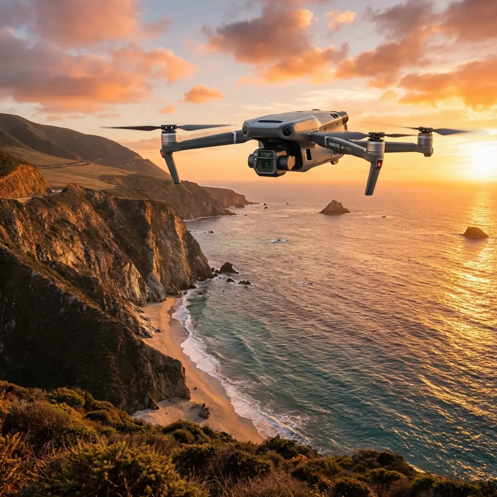
The Mavic 3T is often chosen in these missions because it combines visible imaging and thermal signature interpretation in one compact platform. That is useful when you are documenting canopy stress, checking drainage patterns after storms, locating warm equipment in dense vegetation, or filming ecological change at dawn when contrast is strongest. But the more you rely on thermal and stabilized imaging, the less tolerant your workflow becomes of contamination on optics and aircraft surfaces.
A fingerprint on the thermal window is not just a cosmetic mistake. It can distort how temperature differences appear. Salt film on a wide camera lens can reduce contrast and make post-processing harder. Grit near folding arms or landing surfaces can also subtly affect readiness and handling during setup on uneven ground.
In short: if you are capturing data that people will later use for decisions, “good enough” cleaning is not good enough.
The pre-flight cleaning sequence I recommend for Mavic 3T crews
Before I explain settings or mission design, here is the field sequence. It takes only a few minutes when done consistently.
1. Choose a protected setup point
Do not unfold the aircraft at the windiest edge of the shoreline if you can avoid it. Move slightly inland, use the lee side of a vehicle, or work under a clean field shelter. The goal is simple: reduce airborne salt and sand during setup.
2. Inspect the nose, sensor windows, and thermal glass first
The highest-value surfaces on a Mavic 3T are the ones that directly affect imaging and situational awareness. Use a clean microfiber and approved lens-safe method. Do not rub dry grit across optical surfaces.
I always tell crews to inspect in this order:
- thermal window
- main visible camera glass
- obstacle sensing windows
- downward sensors and landing area surfaces
This order matters because people tend to notice the main camera first and forget the thermal side. In coastal forests, the thermal channel is often the one that reveals a hidden problem or confirms a suspected hotspot under canopy breaks. If the thermal image is compromised at launch, the mission may still look successful until you review data later and realize the temperature boundaries were softened by contamination.
3. Wipe battery contacts and check for residue
This is one of the least glamorous checks and one of the most valuable. Salt and humidity can create a thin film that interferes with clean electrical contact over time. A battery that seats normally is not automatically a battery making perfect contact.
If your operation rotates packs aggressively, especially in hot, humid conditions, build this into every swap. Even if your broader fleet uses hot-swap batteries on larger platforms, the principle is the same: electrical continuity in the field depends on clean interfaces, not assumptions.
4. Check the prop roots and motor vents
A grain of sand lodged where it should not be can turn into vibration, noise, or heat. You are not doing a teardown; you are doing a disciplined field scan. Spin each prop gently by hand, verify freedom of movement, and look for residue around motor tops and folding joints.
5. Confirm the landing surface is not contaminating the aircraft
Coastal forest crews often launch from improvised ground points: boardwalk edges, damp clearings, tailgates, or compact pads near marshland. If your takeoff zone throws dust or organic debris upward at spool-up, your careful cleaning work can be undone before liftoff.
A simple clean launch pad helps more than people think.
The engineering mindset behind this routine
There is another reference worth borrowing from aircraft design practice, and it has nothing to do with camera specs.
A flight-control design manual emphasizes that development quality depends on documentation across the whole lifecycle. It names detailed specifications, design reports, software documents, test task books, calculation reports, and test reports as essential quality anchors. One phrase from that material is especially relevant to Mavic 3T field operations: configuration management exists to keep the system’s technical state consistent across the development cycle and maintain document traceability.
Again, that text comes from a larger aircraft-system context, not from a drone quick-start sheet. But the operating lesson is directly useful: repeatable performance comes from controlling variables and recording changes.
For a coastal forest Mavic 3T crew, “configuration management” in the field can be surprisingly simple:
- note which battery was used on each sortie
- log whether the thermal window was cleaned
- record wind, humidity, and fog conditions
- document payload settings and transmission anomalies
- mark firmware, app version, and memory media used
- flag any lens condensation or obstacle-sensor warnings
This sounds procedural because it is. And procedure is what separates a reliable data flight from a pretty but questionable one.
A practical mission setup for filming forests in coastal conditions
Let’s make this specific.
Assume you are filming a coastal forest corridor for a mixed objective: visual storytelling, basic environmental documentation, and thermal review of drainage and vegetation stress near sunrise. The Mavic 3T can support that combination well, but your sequence matters.
Start with a visible-light reference pass
Before leaning on thermal signature interpretation, capture a clean visual pass along the edge transitions: beach to scrub, scrub to tree line, tree line to interior canopy openings. These edge zones often contain the strongest visible evidence of wind stress, erosion, standing water, or salt exposure.
Fly a conservative route first. In coastal forests, trunks and branches can interrupt O3 transmission in ways that are not obvious from the takeoff point. Dense vegetation, terrain undulation, and moisture-rich air all work against link margin. Keep line of sight where required, and if your organization is developing future BVLOS procedures, do not let ambition outrun regulation, site conditions, or signal reality. The Mavic 3T is capable, but the forest and the coast both tax communication paths.
Then use thermal intentionally, not continuously
Newer crews sometimes leave thermal on for long stretches without a hypothesis. That creates hours of footage with limited decision value.
Instead, use thermal where it answers a question:
- Is a drainage line retaining more moisture than expected?
- Are sun-exposed canopy edges heating unevenly?
- Is equipment or infrastructure near the tree line showing abnormal heat?
- Are there warm-bodied wildlife exclusion concerns that require pausing a low-altitude pass?
Thermal is strongest when paired with purpose and clean optics. That is why the pre-flight wipe-down matters so much here.
If mapping is part of the mission, separate it from cinematic flying
A lot of Mavic 3T users also support light photogrammetry tasks. In coastal forest environments, that only works well when you do not mix cinematic improvisation with mapping discipline.
If you need reconstructable imagery:
- maintain consistent altitude
- preserve overlap
- avoid dramatic speed changes mid-grid
- use GCPs where site access and vegetation allow
- mark tidal timing if shoreline boundaries matter
GCP placement near coastal vegetation deserves extra care because visual ground features can shift with leaf litter, shadow, and moisture. A control point that looked obvious at setup can become hard to interpret once the sun angle changes.
Secure transmission and data hygiene are not side topics
Many forestry and environmental clients now ask how flight media and transmission are handled, especially when sensitive land-use or infrastructure information is involved.
That is where terms like AES-256 stop being brochure material and become operationally relevant. If your workflow includes secure transmission and controlled storage practices, say so in your project notes. Secure data handling is part of professionalism, especially when flights document private land, utility corridors near forests, or restricted industrial interfaces.
The same applies to handoff discipline. If a crew member changed settings, swapped cards, or altered export workflow, log it. This is the drone-world version of the document-and-traceability culture described in formal flight-control development references. You are creating a chain of trust around your data.
A sample pre-flight checklist entry that actually helps later
Here is the kind of record I like to see in a Mavic 3T forest operation log:
- Site: coastal pine and mixed scrub corridor
- Time: 06:25 local
- Conditions: marine haze, light onshore wind, high humidity
- Aircraft status: thermal window cleaned, visual lens cleaned, obstacle sensors inspected
- Battery: Pack 3 installed, contacts checked clean
- Mission type: visual perimeter pass, thermal drainage review, short mapping segment
- Link note: O3 stable at launch point, minor attenuation near dense canopy pocket west sector
- Data note: AES-256 protocol active in standard workflow
- Post-flight note: light salt residue found on front surfaces after sortie
That single log entry can explain image differences later, justify a reflight, or protect your team from using inconsistent data in analysis.
The small support habit most crews skip
After the flight, clean the aircraft before packing it away.
This matters because salt and moisture left to sit become tomorrow’s problem. Post-flight wipe-down of the body shell, landing areas, battery exterior, and optics can preserve sensor reliability and reduce corrosion risk over time. If you only clean before flight, you are always reacting late.
For crews building a standard operating procedure, I also suggest keeping a simple support contact pathway for field questions that come up when conditions are changing fast. If you need a direct line for setup or workflow questions, message the support desk here. Use it when a mission is live and a small decision could affect the whole dataset.
What all this means for Mavic 3T users in coastal forests
The Mavic 3T is often discussed in terms of payload value, thermal capability, and compact deployment. Those things matter. But in coastal forest work, the difference between average output and trusted output is usually procedural.
A clean thermal window gives you better interpretation. Clean electrical contacts reduce avoidable power issues. A protected setup area preserves your sensors before takeoff. A mission log gives your imagery context. A disciplined separation between visual filming, thermal analysis, and photogrammetry prevents muddled results.
And there is a larger lesson here from conventional aircraft engineering. Surface geometry affects performance. Documentation protects quality. Even though those principles come from manuals discussing subjects as different as NACA-1 inlet shapes, L/D influence on critical Mach behavior, and formal configuration management for flight-control systems, they still point to the same field truth:
details that look small on the ground become operationally large in the air.
If you fly the Mavic 3T in coastal forests, build your workflow around that reality. Start with cleaning. Record what changed. Use thermal with intent. Protect the link. Separate storytelling from measurement. That is how you get data and footage you can trust, not just footage you happened to capture.
Ready for your own Mavic 3T? Contact our team for expert consultation.