Mavic 3T Filming Tips for Coastal Highways
Mavic 3T Filming Tips for Coastal Highways: A Field Specialist’s Problem-Solution Playbook
META: Practical Mavic 3T filming strategies for coastal highways, covering wind, salt air, thermal signature control, O3 transmission limits, battery workflow, and accessory upgrades.
Coastal highway filming looks simple until you put a drone in the air.
On paper, the assignment sounds routine: document traffic flow, inspect pavement edges, capture bridge approaches, maybe collect supporting imagery for maintenance planning or public works reporting. In the field, the job becomes a layered technical problem. Wind shear rolls off the water. Salt haze softens contrast. Vehicles move fast, but not predictably. Concrete, asphalt, guardrails, and tidal moisture all reflect heat differently, which complicates both visible and thermal capture. If the aircraft is a DJI Mavic 3T, the challenge is not whether it can do the work. It can. The real question is how to configure the mission so the aircraft’s mixed sensor package actually helps rather than overwhelms the operator.
That is where the Mavic 3T separates itself from a standard camera drone.
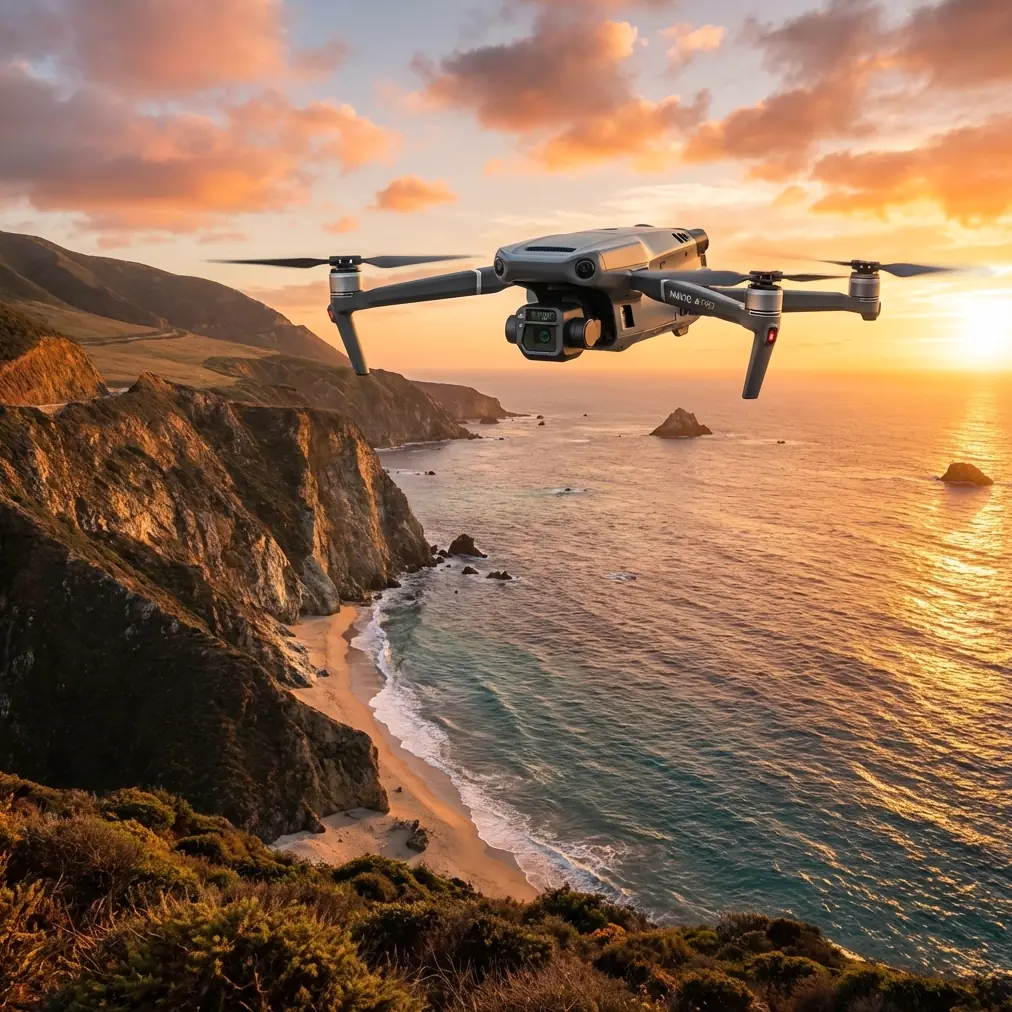
The Mavic 3T is often discussed as a compact thermal platform for public safety and infrastructure teams, but its real value on coastal highways is the way it lets one crew solve two different imaging problems at once. You are not just filming. You are building a layered situational record: visible imagery for context, thermal signature data for anomaly spotting, and stable georeferenced views that can support downstream mapping or inspection workflows. For a highway corridor near the coast, that combination matters more than headline specs.
The first operational problem is environmental inconsistency.
A highway beside open water is rarely exposed to one clean wind direction. Airflow bends around embankments, overpasses, sea walls, and service roads. You can take off in mild conditions and reach a span where the aircraft encounters a lateral push that feels like a different day entirely. The Mavic 3T handles wind well for its class, but coastal work punishes sloppy route design. Pilots who treat the mission like a scenic tracking shot usually waste batteries fighting the environment. The smarter approach is to break the corridor into shorter segments and assign each segment a specific capture objective: traffic context, surface condition, drainage path, shoulder erosion, or thermal scan of suspect joints.
That sounds basic, but it changes everything. Once the mission is segmented, battery planning becomes deliberate instead of reactive. The Mavic 3T’s flight time is strong enough for serious field use, yet coastal highway work can burn capacity quickly because repositioning consumes more energy than the camera task itself. If you add repeated low-altitude passes to maintain visual detail under hazy light, your margin shrinks fast. This is why hot-swap batteries are not just a convenience in roadside operations. They protect continuity. A crew can land, swap, log the previous segment, and relaunch before traffic, tide glare, or weather shifts enough to break image consistency.
The second problem is image ambiguity.
A lot of operators assume the thermal payload on the Mavic 3T exists mainly for nighttime searches or fire scenes. On a coastal highway, that is too narrow a view. Thermal signature work can help identify moisture intrusion beneath certain surfaces, drainage issues around culverts, unusual heat retention at patched areas, or friction patterns near heavily loaded approaches. It can also reveal where sun exposure is misleading the visible camera. Asphalt that appears visually uniform may present uneven thermal behavior, and those differences can point crews toward areas worth a closer engineering review.
But thermal is easy to misuse near the coast. Wet surfaces, recent sun loading, marine breeze cooling, and traffic-generated heat can all create false impressions. A specialist does not fly thermal as a magic filter. She uses it comparatively. Capture a thermal pass, then pair it with the visual record from the same geometry. If possible, repeat at a consistent time window so thermal differences mean something. On the Mavic 3T, that paired workflow is the practical advantage. You do not have to deploy one aircraft for visible imagery and another for heat mapping. You can interpret both in context while the road condition, traffic pattern, and lighting remain aligned.
That matters even more when the assignment includes photogrammetry or corridor mapping.
The Mavic 3T is not always the first aircraft people mention for photogrammetry, but in real municipal and contractor workflows it often gets pressed into hybrid roles. A highway team may start with filming, then realize the same mission needs measurable outputs for slope analysis, shoulder width validation, drainage documentation, or repeat-progress comparison. In those cases, discipline around overlap, altitude consistency, and ground control becomes critical. If you are using GCP markers to improve spatial reliability, the visible camera pass has to be planned with mapping logic, not just cinematic instinct. The difference between “useful footage” and “defensible project data” often comes down to whether the operator respected mapping geometry from the start.
This is one reason I advise coastal corridor crews to separate storytelling passes from documentation passes. The Mavic 3T can do both, but not equally well in the same flight profile. A lower, more dynamic pass may be perfect for stakeholder reporting. It is rarely ideal for photogrammetry. Meanwhile, a high-overlap nadir sequence that supports orthomosaic generation may look dull on screen but becomes far more valuable once engineers or asset managers start asking quantitative questions. Trying to force both goals into one battery cycle usually weakens both outputs.
Transmission reliability is the next hinge point.
Coastal highways often create deceptively difficult radio environments. Open space helps, but long reflective runs of water, moving vehicles, roadside infrastructure, and bridge steel can all complicate signal behavior. The Mavic 3T’s O3 transmission system is a major asset here because stable live view at distance is not just about convenience. It affects framing precision, safety judgment, and confidence when the aircraft is tracking a long corridor with limited launch points. If you are inspecting or filming a roadway shoulder with only a few safe staging areas, robust transmission gives you more flexibility in how you divide the route.
Still, transmission strength should never be mistaken for permission to stretch operational boundaries carelessly. Even where teams are planning toward BVLOS frameworks or future waivers, highway work near the coast demands conservative route design and clean visual procedures. Salt air, glare, and moving-background clutter can reduce situational awareness faster than many inland operators expect. Use the transmission capability to improve mission quality, not to rationalize poor risk tolerance.
Security also deserves a brief, realistic mention. Infrastructure imaging can involve sensitive locations, traffic behavior records, and project data that agencies do not want casually exposed. The Mavic 3T’s AES-256 capability matters because encryption is not a marketing ornament in this context. It is one piece of a larger chain of custody for captured data. If you are filming critical transport assets or public works corridors, image handling standards should be discussed before takeoff, not after somebody asks where the files were stored and who had access.
Now to the most overlooked part of coastal highway work: accessories.
A third-party accessory can turn the Mavic 3T from a capable aircraft into a much more efficient field tool, and the best example is a high-visibility landing pad with weighted corners and a salt-resistant surface coating. That may sound less exciting than a lens gadget, but on coastal roads it is the accessory that earns its place first. You are often launching from gravel pull-offs, sandy maintenance areas, or narrow asphalt shoulders scattered with debris. Clean launches protect the gimbal and reduce the chance of salt spray, grit, or fine shell dust entering moving parts. That matters on every drone, but especially on a platform expected to deliver clean thermal and visual alignment repeatedly across a workday.
The second accessory I recommend is a third-party sun hood for the controller screen. Again, not glamorous. Extremely useful. Coastal brightness can wash out preview detail, and that makes thermal interpretation harder than many crews expect. Tiny hot spots, edge bleed, and subtle heat transitions are easier to misread when the display is fighting glare. A simple hood improves judgment immediately. If a team is operating with a remote decision-maker or field coordinator, I also like adding a rugged tablet mount from a reputable accessory maker so mission notes, GCP references, and corridor segment plans stay visible without constant device juggling.
There is another layer here: communication.
Highway filming tends to involve more stakeholders than a typical aerial shoot. Traffic managers, maintenance supervisors, survey teams, public information staff, and safety officers may all want something different from the same flight. The Mavic 3T supports a smarter answer to that pressure if the operator defines mission outputs in advance. One pass for thermal anomaly screening. One pass for visible inspection documentation. One pass, if needed, for polished corridor visuals. That structure keeps expectations under control and reduces the common mistake of improvising capture priorities in the air.
If you are building a workflow for a specific corridor and want to compare setup options with a field team, it can help to message a mission planner directly before the first deployment day. A 10-minute pre-brief is often enough to avoid wasting several batteries on avoidable route mistakes.
The most effective Mavic 3T crews I see in coastal highway environments do one thing differently from casual operators: they stop thinking like camera people and start thinking like evidence builders. Every choice serves interpretation later. Altitude is chosen for measurable detail, not just aesthetics. Thermal passes are flown with timing discipline. GCP use is planned before takeoff when mapping may be needed. Battery swaps are organized around corridor logic. Transmission capability is treated as a safety and quality tool. Encryption is folded into the handling process from the beginning.
That is why the Mavic 3T remains such a practical platform for this type of mission. Not because it is the biggest aircraft or the most specialized mapping rig, but because it compresses several valuable capabilities into a package that can move quickly between roadside staging points. For coastal highways, where conditions shift by the minute and access windows are rarely generous, that flexibility is operationally significant.
The mistake is to see it as a drone that merely happens to include thermal. The better view is that the Mavic 3T is a compact corridor documentation platform. Used properly, it lets a single field team capture visible context, heat behavior, and structured location-based imagery without dragging multiple aircraft and sensor setups through a windy roadside environment.
For coastal work, that efficiency is not abstract. It reduces setup friction, limits exposure to changing weather, and improves the odds that the data you bring home will still make sense when engineers, inspectors, or project managers start asking harder questions.
And that is the standard that matters.
Ready for your own Mavic 3T? Contact our team for expert consultation.