Mavic 3T Guide for Vineyard Work in Complex Terrain
Mavic 3T Guide for Vineyard Work in Complex Terrain: What the Old DroneDeploy Case Still Teaches Us
META: A field-driven Mavic 3T tutorial for vineyard operations in difficult terrain, connecting proven drone survey workflow lessons to thermal imaging, photogrammetry, battery management, and data handling.
By Dr. Lisa Wang, Specialist
If you film or survey vineyards in broken terrain, the aircraft matters less than the workflow. That sounds backwards until you’ve watched a steep block, a patchy canopy, and shifting light ruin what looked like a perfectly planned flight.
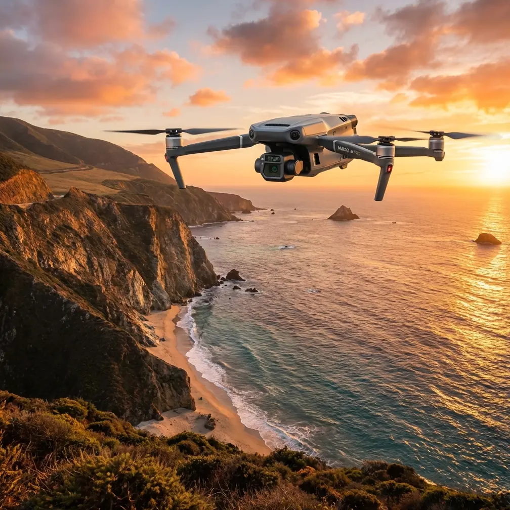
The Mavic 3T is often discussed for its thermal payload, compact airframe, and practical field deployment. Useful, yes. But the more interesting question is this: how do you turn that hardware into repeatable vineyard intelligence when slopes, row direction, wind exposure, and access roads all conspire against consistency?
A surprisingly relevant clue comes from an older DroneDeploy case. In that project, an Inspire 1 flew a preset route at roughly 100 meters, captured 66 images in 15 minutes, and the resulting data was processed in about one hour through a browser-based workflow. The operator’s point was not just speed. He argued that those 15 minutes delivered more complete and accurate site data than several hours of manned helicopter collection, at a fraction of the operating cost. Different aircraft. Different era. Same operational lesson: the value is in automated capture, disciplined processing, and fast sharing.
For vineyard teams working with the Mavic 3T today, that lesson still holds. Especially in complex terrain.
Why vineyards expose weak drone workflows
Vineyards are not flat test fields. Terraces break line of sight. Row orientation changes from one block to the next. Vines on a south-facing slope may present one thermal signature in the morning and a very different one after midday heat loading. Access can be poor, and launch points are often compromises rather than ideal stations.
That means a Mavic 3T mission for vineyard filming or assessment has to do two jobs at once. First, it needs to collect visually useful footage or still imagery. Second, it has to preserve enough geometric and thermal consistency to support decisions later. If you lose either, the mission becomes pretty but operationally thin.
The old DroneDeploy example matters because it showed how a preplanned route and automated data pipeline removed human inconsistency from the process. In that case, progress reporting accuracy was critical on a large construction site measuring about 73,000 square meters and involving four storage tanks. In vineyards, the stakes are different, but the need for precise repeatability is similar. You may be tracking canopy vigor, drainage-related stress, replant sections, irrigation anomalies, or row-by-row development. The drone is only useful if it lets you compare one flight to the next without guessing what changed due to method rather than crop condition.
What the Mavic 3T changes in the vineyard context
The Mavic 3T is a much more practical aircraft for dispersed agricultural work than older, bulkier systems. You can move quickly between blocks, deploy from narrow farm roads, and use thermal and visual data in the same field session. For vineyards in complex terrain, that flexibility matters because conditions often force you to adapt launch point, flight direction, and timing on the spot.
Thermal signature analysis is where the 3T becomes especially relevant. A visible camera can show canopy gaps, row alignment, erosion scars, vehicle damage, and missing posts. Thermal adds another layer: uneven transpiration patterns, irrigation irregularities, drainage-related cold or warm zones, and areas where canopy behavior is diverging before the issue becomes obvious from ground level. In steep vineyards, these patterns are often tied to elevation changes and soil variability rather than a simple uniform block-wide trend.
Still, thermal is easy to misuse.
If you fly too late, surface heating can flatten the contrast you need. If you mix altitudes between blocks, your comparison quality drops. If you let battery swaps push one part of the survey into a different sunlight window, your thermal map becomes harder to interpret. Good vineyard operators know this instinctively. The trick is designing the Mavic 3T workflow so that your data remains coherent.
A practical mission structure for complex vineyard terrain
Here is the tutorial version I recommend for Mavic 3T vineyard work.
1. Split the vineyard into operational zones, not just map blocks
Don’t plan the whole estate as a single mission unless the terrain is simple. In difficult sites, break it into zones based on slope aspect, elevation band, and row orientation. This reduces the chance that one battery cycle spans radically different lighting conditions.
This is one place where the older case study offers a useful benchmark. The operator succeeded because the route was defined before takeoff and the collection process was automated. That discipline is more important in vineyards than many people realize. If you improvise route geometry in the field, overlap consistency and viewing angle can drift. That weakens both photogrammetry and thermal comparison.
2. Decide whether the day’s priority is cinema-style filming, photogrammetry, or thermal assessment
Trying to maximize all three in one pass usually compromises each one.
- If the goal is visual storytelling, prioritize path smoothness, reveal angles, and terrain-safe altitude control.
- If the goal is photogrammetry, maintain overlap discipline and use GCP where high positional confidence matters.
- If the goal is thermal assessment, standardize time of day, altitude, and speed first.
GCP use is often dismissed for vineyard work because many teams just want relative patterns. But on steep sites or multi-date comparison programs, a few well-placed ground control points can tighten your dataset and reduce uncertainty when comparing orthomosaics over time. That matters when trying to separate a genuine canopy issue from a map alignment problem.
3. Use terrain-aware planning conservatively
Complex terrain invites aggressive automation. Resist that instinct. Terrain-following can help maintain image scale, but you still need margin for trellis height changes, poles, shelterbelts, and sudden slope transitions. In vineyards with deeply cut access tracks and terraces, I prefer to build in more clearance than the map suggests.
This is also where reliable transmission matters. O3 transmission gives the pilot more confidence in difficult terrain and around partial line-of-sight obstructions common in vineyard landscapes. That does not mean pushing distance for the sake of it. It means preserving stable control and cleaner monitoring while working around ridgelines, blocks of trees, and elevation breaks.
The battery management tip most crews learn the hard way
Here’s the field habit I wish more Mavic 3T operators adopted: never use the “one more short block” logic on a battery that has already handled a climb-heavy mission.
On paper, the remaining percentage may look fine. In reality, vineyard terrain changes everything. A battery that performed comfortably on a lower section can sag much faster when the next leg demands repeated elevation gains, wind correction on an exposed ridge, and longer return distance to a safe landing spot.
My rule in complex vineyards is simple: if a battery has already powered a thermally sensitive mapping run, I do not assign it to the next comparison-critical block unless I can keep the timing and mission profile nearly identical. The reason is not only safety. It is data consistency. Battery state affects how aggressively you pilot, how much reserve you keep, and whether you rush the final lines. That changes image spacing and thermal timing.
Hot-swap discipline helps here. Stage your batteries in a fixed sequence, label them by cycle order, and match them to mission zones before takeoff. Don’t just grab whichever pack is closest. In practical terms, this keeps your morning thermal runs cleaner and reduces the chance that the upper terrace gets flown 18 minutes later than planned because the battery change became chaotic.
That may sound minor. It isn’t. In vineyard thermal work, a small drift in timing can alter the apparent temperature contrast enough to complicate interpretation.
Processing speed is not a luxury
The DroneDeploy case highlighted something many operators still underestimate: collection speed only matters if processing and sharing stay fast. In that older job, the pilot uploaded imagery after landing, and processing was completed in about an hour through the browser. That short turnaround let stakeholders review results quickly instead of waiting for a slow desktop pipeline.
For vineyards, this matters in two ways.
First, agronomy and operations teams often need same-day interpretation. If a block is showing thermal stress, they may want to inspect emitters, valves, drainage, or canopy management decisions immediately. A delayed dataset is often a missed intervention window.
Second, vineyard filming projects are increasingly tied to operational records, investor reporting, sustainability documentation, and seasonal planning. Fast processing means the footage or map becomes part of a decision chain, not an archival afterthought.
The Mavic 3T fits this style of work because it lowers deployment friction. But speed must not come at the cost of security. If your workflow involves moving field imagery across teams, AES-256 encryption and secure handling protocols matter, especially when the dataset includes identifiable farm infrastructure, production patterns, or proprietary trial blocks.
When thermal and photogrammetry should work together
Many crews separate thermal and mapping into different conversations. That’s a mistake in vineyard terrain.
Thermal can tell you where something is behaving differently. Photogrammetry helps explain the shape and spatial context of that difference. A warm strip may correspond to irrigation variation, but it may also align with a terrace edge, compacted service path, drainage interruption, or replant geometry. If you only look at the heat layer, interpretation becomes too speculative.
That is why I prefer a two-pass logic for serious vineyard analysis:
- A thermal-first pass during the best contrast window.
- A visual/photogrammetry pass designed for cleaner geometry and documentation.
In some sites, you can combine parts of this efficiently. In others, especially where slopes create uneven sun exposure, separating the missions produces better data.
About BVLOS in vineyard-scale operations
BVLOS is frequently raised in discussions about large estates and distributed holdings. It has obvious appeal where blocks stretch beyond easy visual access. But vineyard operators should treat BVLOS as a regulatory and operational framework question, not a convenience feature. For most teams, the smarter move is to optimize launch points, route segmentation, observers where appropriate, and battery staging before chasing extended mission concepts.
The reason is simple: complex terrain already adds enough variables. Tight, repeatable workflows usually beat ambitious ones.
A field-ready checklist for the Mavic 3T in vineyards
Before takeoff, I want five things settled:
- The vineyard is divided into zones that make thermal and visual comparison meaningful.
- Battery sequence is assigned to specific zones, not left to improvisation.
- Mission objective is explicit: filming, thermal inspection, or photogrammetry.
- GCP placement is decided if map accuracy needs to support multi-date comparison.
- Data transfer and processing path are prepared in advance.
If you need help tailoring a vineyard mission plan around your terrain and deliverables, you can message the field team directly here: discuss your vineyard workflow.
The bigger lesson from the old case study
What stands out in that 2016 workflow is not nostalgia for the Inspire 1. It is the operational logic. A pilot predefined the mission, flew it in 15 minutes, collected 66 images, and turned those images into a usable deliverable quickly enough for real project oversight. He also argued the result was more complete and precise than several hours of helicopter-based collection. That claim matters because it reframes aerial work from spectacle to system.
That same logic is exactly how the Mavic 3T should be used in vineyards today.
Not as a gadget for occasional overhead views. Not as a thermal camera that magically produces insight on its own. As a disciplined capture platform inside a repeatable workflow that respects terrain, timing, battery behavior, and processing speed.
If your vineyard has mixed elevation, fragmented blocks, and changing microclimates, the Mavic 3T can be remarkably effective. But only if you fly it with a surveyor’s mindset, even when the end product also needs to look good on screen.
That is the balance worth mastering. The aircraft gathers the data. The workflow makes it trustworthy.
Ready for your own Mavic 3T? Contact our team for expert consultation.