Mavic 3T in Vineyard Terrain: A Practical Flight Workflow
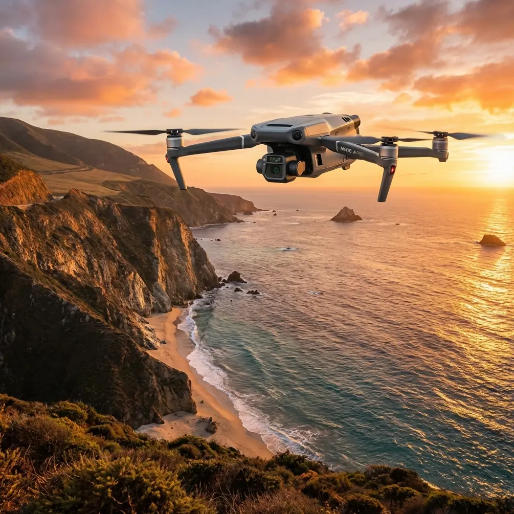
Mavic 3T in Vineyard Terrain: A Practical Flight Workflow That Starts Before Takeoff
META: Expert tutorial on using the Mavic 3T in steep, irregular vineyard terrain, with pre-flight safety cleaning, thermal use, photogrammetry discipline, and why vibration and composite behavior matter in real operations.
Filming vineyards sounds easy until you stand on the slope.
Rows bend with the hillside. Trellis lines create repetitive visual patterns that can confuse depth judgment. Wind spills over ridges in bursts rather than as a steady flow. One side of the block is in sharp morning light while the next terrace is still cool and shaded. In that environment, the Mavic 3T is not just a camera platform. It becomes a measurement tool, a terrain reader, and, if you fly with discipline, a reliable way to build repeatable footage and usable field data in the same mission.
I’ve found that crews often focus on settings first: exposure, route height, thermal palette, transmission quality. Those matter. But on complex vineyard terrain, the better starting point is structural and operational stability. That means understanding what vibration, material behavior, and simple pre-flight cleanliness do to the quality of every frame and every map.
The pre-flight step most operators rush past
Before power-up, clean the aircraft’s vision sensors, camera windows, thermal window, obstacle sensing surfaces, and landing area contact points.
That sounds basic. It isn’t.
On vineyard jobs, you are constantly dealing with dust, pollen, spray residue, fine soil, and sticky organic debris. A thin film on the sensing surfaces can reduce the reliability of safety features. A smudge on the thermal lens can flatten small temperature differences that matter when you’re trying to separate sun-warmed stone from stressed vines. Dust around the gimbal area can also introduce subtle micro-jitter into footage that operators incorrectly blame on wind or exposure settings.
This is where the job stops being “just drone flying” and becomes field aviation.
The reason that cleaning matters goes deeper than cosmetics. Aircraft design references have long treated vibration as a core structural issue, not an afterthought. In the handbook material on vibration calculation for typical structures, Chapter 44 includes frequency parameter tables for triangular plates, where the plate’s geometry directly affects natural frequency behavior. One example in the extracted table shows a frequency parameter of 25.04 under one boundary condition, while other configurations climb much higher, into values like 48.18 and beyond. The point is not that your Mavic 3T operator needs to run plate equations in the field. The point is that shape, support condition, and excitation all influence how a structure responds.
Operationally, that matters because vineyard flights produce exactly the kind of uneven excitation that reveals weak setup discipline. Fast braking over terraces, cross-slope yaw corrections, prop wash recirculation near embankments, and aggressive tracking shots along trellis lines all inject dynamic loads into the airframe-gimbal system. If the sensor surfaces are dirty, if the gimbal isn’t moving freely, or if a prop has contamination, small vibration problems can stack into visible image instability and less dependable obstacle behavior.
So yes, wipe it down. Methodically.
Why vineyard terrain exposes bad technique faster than open-field flying
Flat farmland is forgiving. Vineyards on broken terrain are not.
In complex terrain, you are asking the Mavic 3T to do several jobs at once:
- maintain stable framing over changing elevation
- preserve safe separation from posts, wires, and slope breaks
- hold transmission quality while hills and vegetation interfere with line of sight
- collect imagery that can later support photogrammetry, not just cinematic clips
- use thermal intelligently, where surface heating changes minute by minute
That’s where the Mavic 3T’s mixed role becomes useful. It can serve a content brief and a field operations brief if you build the mission correctly.
The biggest mistake I see is treating the mission as one continuous creative flight. On a vineyard slope, that usually produces compromised footage and weak data. A better approach is to split the operation into three passes: reconnaissance, structured capture, and cinematic pickup.
Pass 1: Reconnaissance with thermal and visual cross-checking
Start high and slow.
The thermal camera is not there to make everything dramatic. Its real value in vineyards is pattern detection. Thermal signature differences can show irrigation irregularities, uneven solar loading, moisture retention differences near walls or roads, and sometimes equipment or human activity in and around work areas that should affect your route planning.
But thermal only becomes trustworthy when you understand what you’re actually seeing. In steep vineyard terrain, a warm patch may indicate plant stress, or it may simply be a rock retaining edge that held heat overnight. A cool corridor may be denser vegetation, or it may be a shadowed terrace that has not yet equilibrated.
So during the first pass, use thermal to flag anomalies, then verify them visually before building your low-level route.
This is also the pass where transmission discipline matters. If your flight path will dip behind a ridge shoulder or a stand of trees, you need to think beyond raw distance. O3 transmission can be excellent, but terrain masking is still terrain masking. Don’t let confidence in the link tempt you into lazy positioning. Keep yourself where the aircraft has a clean communication geometry as long as possible, especially if you’re planning future repeat missions or more advanced corridor work.
If your organization operates under approvals that relate to BVLOS, remember that vineyard terrain adds complexity far beyond distance alone. Hills, vegetation, service tracks, and changing sightlines all alter the risk picture. Use the reconnaissance pass to identify where the terrain itself becomes the limiting factor.
Pass 2: Build imagery for photogrammetry, not just for viewing
The Mavic 3T is often discussed for thermal work, but on vineyards, its practical value grows when crews stop separating filming from mapping.
If the grower, estate manager, or agronomy consultant may later want terrain-aware visual documentation, plan a clean photogrammetry segment into the mission. That means stable altitude references, consistent overlap, and attention to row-direction effects. Vineyards are full of repeating textures, and repeating textures are where sloppy capture creates alignment headaches.
Ground control points, or GCPs, still matter if you want dependable spatial consistency in difficult terrain. On steep sites, a map that looks visually acceptable can still drift enough to reduce its value for measuring access paths, drainage lines, or row-edge changes. Even when you are not producing a formal survey product, GCP discipline improves the usefulness of repeat comparisons over time.
This is another place where the structural references are more relevant than they first appear. The handbook extract on typical vibration calculation mentions triangular plate frequency formulas using dimensions such as the triangle’s height and base. That kind of design logic reminds us that geometry drives response. In field terms, geometry drives capture quality too. A vineyard carved into terraces is not a simple flat target. Every change in angle, support, and shape affects how the aircraft moves and how the imaging system resolves detail.
If you are capturing rows on a side slope, resist the urge to fly too low just to make the footage feel dramatic. Low altitude plus repetitive row structure plus uneven turbulence is where tiny airframe disturbances become visible rolling distortions or imperfect overlap. Give the aircraft enough margin to fly a smooth line.
Pass 3: Cinematic pickup with the terrain, not against it
Once the reconnaissance and structured capture are complete, then collect your hero shots.
This is where operators usually try to “hug the vines” and race the contour. Sometimes that works. More often, the better result comes from flying diagonally across the terrain rather than parallel to every row. Diagonal movement reveals the vineyard’s shape, the grade transitions, the retaining features, and the relationship between the cultivated block and the surrounding landscape.
Use the terrain as a compositional tool instead of an obstacle.
A good vineyard sequence often needs three elements in one frame:
- row geometry
- slope information
- operational context such as roads, water features, or processing buildings
The Mavic 3T can gather that efficiently, but only if your flight is smooth. Again, that circles back to vibration control. In the source material, the vibration table shows how frequency parameters vary significantly under different boundary conditions and modal orders. That variation is a reminder that response is never fixed. Change the condition, change the behavior. In the field, your “boundary conditions” are things like payload cleanliness, prop condition, wind angle, speed changes, and how abruptly you command the aircraft around slope breaks.
The operator who understands this does not over-control the drone. They let the aircraft breathe.
Why material science belongs in a drone workflow conversation
At first glance, the composite materials reference looks far removed from a vineyard mission. It isn’t.
The materials handbook pages list multiple epoxy prepreg carbon-fiber and glass-fabric systems, including 250°F (121°C) cure materials and 350°F cure epoxy prepreg carbon-fiber tape and woven fabric families such as CYCOM and Fibredux variants. You do not need to know every material code to extract the useful lesson: modern aircraft structures depend on composites because they deliver stiffness and low mass in ways metal alone often cannot.
That matters to a Mavic 3T operator because lightweight stiffness is what lets compact UAVs carry stabilized payloads, resist ordinary in-flight loads, and stay efficient enough for productive field work. But composites also reward care. They are not an invitation to be casual with impacts, contamination, or heat soak in the back of a vehicle.
In vineyards, drones often spend too much time on tailgates, in dusty bins, or under direct sun between flights. If your operation relies on hot-swap batteries at a remote site, make sure the battery exchange workflow does not become a rough-handling workflow. Fast turnaround is useful. Sloppy turnaround shortens reliability.
Material science shows up in mission quality in subtle ways:
- stiffness supports gimbal stability
- low mass supports endurance and efficient handling
- surface condition affects thermal and visual payload performance
- impact discipline affects long-term alignment and repeatability
So when you pack the aircraft, you are not just protecting electronics. You are preserving a tuned flying structure.
Data security matters more than most vineyard clients realize
Many vineyard operators are now working with proprietary cultivation methods, yield monitoring, irrigation planning, and land-management data. If you are capturing imagery that could feed internal planning or consultant workflows, security is not a side issue.
This is why AES-256 level data protection language resonates in professional UAV operations. Even if the immediate job is “just filming,” the mission may still generate location, infrastructure, and crop-condition information that deserves careful handling. Professionalism on these jobs means discussing image custody, storage, transfer, and who receives raw thermal files versus processed outputs.
You don’t need to make the operation feel bureaucratic. Just be clear.
If a vineyard team wants to compare workflows for thermal documentation, route planning, or repeat seasonal flights, I usually suggest they start with a short planning exchange first, not with a field improvisation. A direct message through our vineyard UAV planning chat is often enough to sort route logic, terrain constraints, and deliverable format before anyone drives to site.
A practical sample workflow for a steep vineyard block
Here is the workflow I’d use on a mixed-slope estate with terraces and narrow service lanes:
1. Site arrival
Check wind behavior at different elevations, not just at the launch point. Look at dust level, pollen load, and morning moisture.
2. Clean before assembly check
Wipe visual sensors, thermal window, gimbal area, and airframe contact surfaces. Inspect props for residue and nicks.
3. Establish control points if mapping value matters
Place or verify GCPs where they remain visible from planned capture heights and represent the terrain changes across the site.
4. High reconnaissance pass
Use thermal and visual together to identify hot surfaces, shaded anomalies, access hazards, and line-of-sight dead zones.
5. Structured photogrammetry segment
Fly consistent overlap and speed. Avoid sudden yaw inputs over repeating row patterns.
6. Cinematic low- to mid-altitude segment
Use diagonal terrain reveals, rise-and-pullback shots, and selective row tracking where safe separation remains generous.
7. Battery and turnaround discipline
If using hot-swap cycles, keep the exchange area clean and shaded. Don’t leave the aircraft sitting in direct heat.
8. Post-flight review on site
Check thermal files for clarity, verify mapping coverage, and inspect for dust accumulation before the next launch.
That workflow is not glamorous. It works.
What separates a strong Mavic 3T vineyard operator from an average one
Not speed. Not bravado. Not flashy low passes.
The best operators understand that terrain, structure, materials, and data all connect. They know that a pre-flight wipe can protect sensor reliability. They know that vibration is not theoretical; it shows up in footage, map quality, and gimbal behavior. They recognize that composite airframes earn their performance through stiffness-to-weight efficiency, but only if treated with respect. They use thermal for interpretation, not spectacle. And they build flights that can support both storytelling and field decision-making.
That is where the Mavic 3T becomes genuinely useful in vineyards with complex terrain. It stops being a flying camera and starts becoming a disciplined aerial workflow.
Ready for your own Mavic 3T? Contact our team for expert consultation.