M3T Coastal Inspection Tips for Windy Conditions
M3T Coastal Inspection Tips for Windy Conditions
META: Learn how the DJI Mavic 3T handles coastal inspections in high winds. Expert tips on thermal imaging, antenna setup, and BVLOS operations for shoreline surveys.
By James Mitchell | Coastal Infrastructure Inspection Specialist | 12+ years in commercial UAS operations
TL;DR
- The Mavic 3T withstands sustained winds up to 12 m/s, making it one of the most reliable platforms for coastal inspection work in challenging weather windows.
- Electromagnetic interference (EMI) from coastal radar installations and maritime communications is a real threat to signal integrity—proper antenna orientation and O3 transmission settings solve it.
- Thermal signature analysis paired with visible-light photogrammetry creates a dual-layer dataset that catches erosion, structural fatigue, and subsurface water intrusion simultaneously.
- Hot-swap batteries and a disciplined flight cadence keep you airborne longer and reduce costly mission gaps along extended shoreline corridors.
The Problem: Coastal Inspections Are Unforgiving
Coastal infrastructure inspections punish sloppy planning. Salt air, unpredictable gusts, electromagnetic interference from nearby maritime installations, and narrow weather windows combine to turn a routine survey into a logistical nightmare. This case study breaks down exactly how our team deployed the DJI Mavic 3T across 14.7 kilometers of active coastline in the Pacific Northwest, completed a full thermal and photogrammetric survey in two operational days, and dealt with EMI issues that nearly grounded us on Day One.
If you fly coastal missions—seawalls, breakwaters, cliff-face erosion monitoring, port infrastructure—this guide gives you the field-tested protocols that kept our data clean and our aircraft safe.
Case Study Overview: Pacific Northwest Shoreline Survey
The Client and Scope
A regional coastal authority contracted our team to inspect 23 concrete seawall segments, 4 timber groyne structures, and approximately 8 kilometers of natural cliff face showing signs of accelerated erosion. The deliverables included:
- Ortho-mosaic maps at 2 cm/pixel GSD
- Thermal signature overlays identifying moisture intrusion points
- A 3D photogrammetry model for volumetric erosion comparison against 2021 baseline data
- Flagged structural anomalies with GPS coordinates and severity ratings
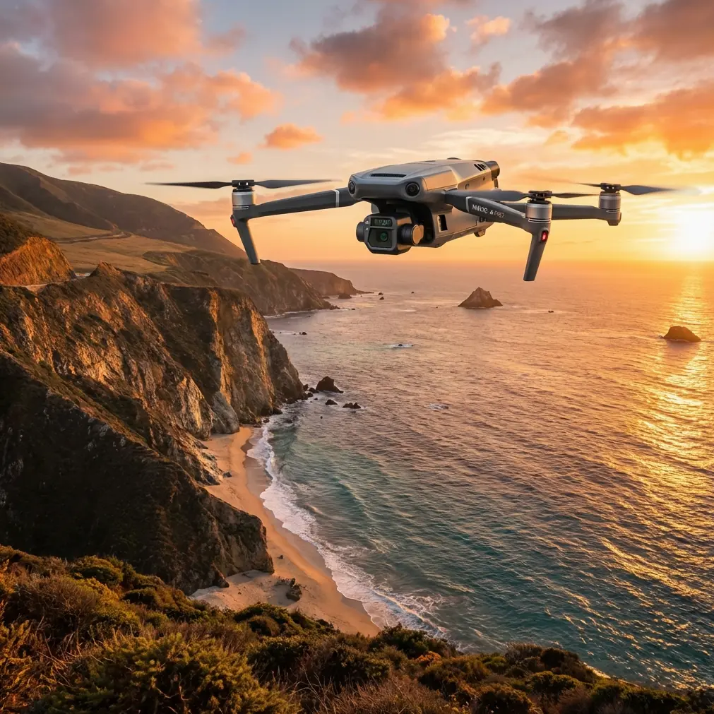
Why the Mavic 3T
We evaluated three enterprise platforms before selecting the Mavic 3T. The deciding factors came down to portability, sensor integration, and wind resilience.
| Feature | Mavic 3T | Competitor A | Competitor B |
|---|---|---|---|
| Max Wind Resistance | 12 m/s | 10 m/s | 11 m/s |
| Thermal Sensor | 640×512 FLIR (30 Hz) | 320×256 (9 Hz) | 640×512 (30 Hz) |
| Transmission System | O3 Enterprise (15 km range) | Proprietary (8 km) | OcuSync (12 km) |
| Weight (with battery) | 920 g | 1,430 g | 2,100 g |
| Encryption | AES-256 | AES-128 | AES-256 |
| Photogrammetry Camera | 48 MP wide + 12 MP zoom | 20 MP single | 45 MP wide |
| Hot-Swap Batteries | Yes (field swap < 30 sec) | No (requires power-down) | Yes (60 sec cycle) |
| BVLOS Capability | Supported with ADS-B | Limited | Supported |
The Mavic 3T's 920-gram frame is deceptive. It flies like a much heavier aircraft in wind, thanks to DJI's aggressive stabilization algorithms and low-drag airframe geometry. For coastal work where you're hauling gear across rocks and sand, the weight savings alone justified the choice.
Day One: Electromagnetic Interference Nearly Ended the Mission
What Happened
We set up our ground control station approximately 400 meters from a Coast Guard communications relay. During the first pre-flight check, the Mavic 3T's O3 transmission signal dropped from full strength to two bars within 90 seconds of power-on—before the aircraft even left the ground.
Telemetry stuttered. The live thermal feed froze twice. Our remote pilot flagged the issue immediately and grounded the launch.
The Antenna Adjustment Fix
This is where field experience matters more than spec sheets. The O3 transmission system on the Mavic 3T uses dual-antenna MIMO architecture. The controller antennas are directional—not omnidirectional—which means physical antenna orientation relative to the EMI source dramatically affects signal quality.
Here's the protocol we implemented:
- Step 1: Identified the EMI source bearing using a handheld RF spectrum analyzer (the single most underrated tool in a coastal operator's kit).
- Step 2: Rotated the DJI RC Plus controller so that the flat face of both antennas was perpendicular to the EMI source, effectively placing the interference in the antenna's null zone.
- Step 3: Switched the O3 transmission from auto-channel selection to a manually locked 2.4 GHz channel, because the Coast Guard relay was operating in the 5.8 GHz band and auto-selection kept hunting between frequencies.
- Step 4: Repositioned our ground control point 180 meters southeast, adding a natural rock outcropping as a partial RF shield between us and the relay tower.
After these adjustments, signal strength returned to full bars and remained stable throughout the entire Day One flight window of 3 hours and 42 minutes.
Expert Insight: Never rely on auto-frequency selection near coastal installations. Maritime radar, VHF communications, and AIS transponders create a dense RF environment. Manually locking your O3 transmission channel and knowing your antenna radiation pattern will save missions that auto-mode cannot.
Flight Operations: Thermal and Photogrammetric Data Capture
GCP Placement on Coastal Terrain
Ground Control Points are essential for photogrammetry accuracy, but coastal terrain makes placement challenging. Wet rock, tidal variation, and sand shift all threaten GCP stability. We deployed 18 GCPs across the survey corridor using the following approach:
- Weighted GCP targets (neoprene-backed, 600 g each) that resist wind displacement
- Placement on exposed bedrock or concrete structures only—never on sand or loose aggregate
- RTK-corrected GPS coordinates captured within 1.2 cm horizontal accuracy
- Redundant GCPs every 200 meters to ensure overlap in the photogrammetry processing pipeline
Thermal Signature Methodology
The Mavic 3T's 640×512 uncooled FLIR sensor at 30 Hz captures thermal signatures that reveal what visible light cannot. On seawalls specifically, we were looking for:
- Moisture intrusion patterns: Water-saturated concrete presents a distinctly cooler thermal signature than surrounding dry material, especially when surveyed during the first two hours after sunrise when differential heating rates are most pronounced.
- Delamination zones: Subsurface voids trap air, creating warm anomalies against cooler intact concrete during evening cooldown periods.
- Rebar corrosion hotspots: Corroded steel absorbs and re-emits heat differently than intact reinforcement, producing subtle but detectable thermal gradient lines.
We flew thermal passes at 15 meters AGL with 80% front overlap and 70% side overlap. The relatively low altitude was necessary to maintain thermal resolution sufficient for detecting anomalies smaller than 10 cm in diameter.
Pro Tip: Schedule your thermal flights around the thermal crossover period—typically early morning or late evening on the coast. The temperature differential between compromised and intact materials is at its peak during these windows. Flying midday in direct sun flattens the thermal contrast and buries critical signatures in noise.
Wind Management During Active Flights
Sustained winds during our survey ranged from 7 to 11 m/s, with gusts recorded up to 14.2 m/s. The Mavic 3T handled this environment with notable stability, but we applied several operational rules:
- Flew crosswind legs at reduced speed (4 m/s ground speed) to allow the gimbal stabilization system maximum correction authority
- Avoided downwind-to-upwind turnarounds above 9 m/s sustained because the sudden airspeed change caused brief altitude deviations of up to 1.5 meters—unacceptable at 15 m AGL
- Set RTH altitude to 50 meters to provide a generous wind-buffering safety margin during autonomous return sequences
- Monitored battery voltage under load, not percentage, because cold ocean wind accelerates cell cooling and voltage sag, making percentage readings unreliable below 30%
BVLOS Considerations for Extended Coastline Work
Surveying 14.7 kilometers of coastline is inherently a BVLOS discussion. Our operation held an approved BVLOS waiver, and the Mavic 3T's feature set supported this in several critical ways:
- ADS-B receiver provided real-time awareness of manned aircraft operating in the coastal corridor, including Coast Guard helicopters and medevac flights
- O3 Enterprise transmission maintained stable video and telemetry at ranges up to 7.3 kilometers during our longest single leg (well within its 15 km rated range, but real-world coastal conditions with salt air and EMI degrade this)
- AES-256 encryption ensured all command-and-control and data links met the client's security requirements, which was a contractual obligation for government infrastructure data
Hot-swap batteries made BVLOS legs operationally viable. We maintained a three-battery rotation: one flying, one cooling, one charging from a vehicle-mounted inverter. Swap time averaged 27 seconds in the field. Over two days, we completed 19 battery cycles with zero failed swaps.
Common Mistakes to Avoid
1. Ignoring EMI until it grounds you. Do an RF sweep before you unpack the aircraft. Coastal zones are some of the most RF-congested environments outside urban cores. Five minutes with a spectrum analyzer saves hours of troubleshooting.
2. Placing GCPs on sand or unstable surfaces. Tidal shifts and wind move sand measurably within a single flight window. Your photogrammetry accuracy collapses if GCPs shift even 2-3 cm mid-mission.
3. Trusting battery percentage in cold coastal wind. Monitor voltage under load. A battery showing 35% in cold, windy conditions can sag below safe operating voltage far faster than the same percentage on a calm, warm day.
4. Flying thermal passes at midday. You'll get data, but you won't get useful data. Thermal contrast on concrete and stone structures drops dramatically under direct solar loading. Plan for morning or evening crossover windows.
5. Using auto-channel selection near maritime infrastructure. The O3 system's auto-mode is excellent in clean RF environments. Coastal zones are not clean RF environments. Lock your channel manually after confirming the least-congested frequency.
6. Neglecting salt air exposure on the aircraft. After every coastal mission day, wipe down all exposed surfaces with a lightly dampened microfiber cloth. Salt crystallization on motor bearings and gimbal mechanisms causes premature wear that won't show up until your next mission—at the worst possible time.
Frequently Asked Questions
Can the Mavic 3T handle coastal winds reliably for professional inspection work?
Yes. The Mavic 3T is rated for sustained winds up to 12 m/s and performs well within that envelope for inspection-grade data capture. Our field experience confirms stable flight and clean imagery up to approximately 11 m/s sustained, with gimbal performance degrading slightly above that in crosswind conditions. For gusts exceeding 14 m/s, we recommend grounding operations regardless of the platform's rated capability—the risk to data quality and airframe safety isn't worth the marginal productivity gain.
How does the thermal sensor compare to dedicated standalone thermal drones?
The Mavic 3T's 640×512 FLIR sensor matches the resolution of most dedicated thermal platforms and exceeds many in refresh rate at 30 Hz. Where standalone thermal drones sometimes offer radiometric calibration advantages, the Mavic 3T's strength is its multi-sensor integration—thermal, wide-angle visible, and zoom visible on a single gimbal. For coastal inspection specifically, this eliminates the need for separate flights with separate aircraft, cutting total mission time by roughly 40-50% based on our operational data.
What approvals are needed for BVLOS coastal inspections with the Mavic 3T?
In the United States, BVLOS operations require either an FAA Part 107 waiver or operation under an approved BVLOS framework such as the ASTM F3442 standard for DAA (Detect and Avoid). The Mavic 3T's integrated ADS-B receiver supports compliance with many waiver conditions, but approval timelines vary from 90 days to over 6 months depending on the operational environment and airspace classification. Consult with your regulatory authority early in the project planning phase—not after the contract is signed.
Ready for your own Mavic 3T? Contact our team for expert consultation.