Mavic 3T on Cold Coastlines: A Field Case Study in Thermal
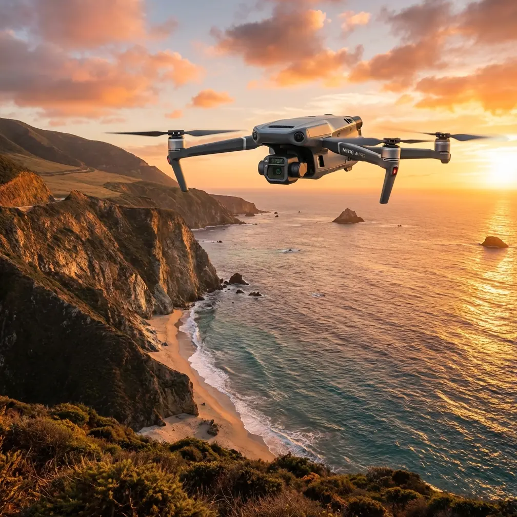
Mavic 3T on Cold Coastlines: A Field Case Study in Thermal Inspection, Wildlife Avoidance, and Data Confidence
META: Expert case study on using the DJI Mavic 3T for coastline inspection in extreme temperatures, covering thermal workflow, O3 transmission, AES-256 security, GCP strategy, and operational lessons.
Coastline inspection looks simple on a map. Fly the line, capture the imagery, flag erosion, identify damaged structures, head home. In practice, it is one of the more punishing environments a compact enterprise drone will face. Salt spray creeps into every seam. Wind shifts off cliffs and sea walls with no warning. Thermal contrast changes by the minute as wet rock, foam, sand, and concrete trade heat with air and water. When temperatures swing hard, batteries, sensors, and flight planning all start demanding tighter discipline.
That is exactly where the Mavic 3T earns its place.
This is not a generic overview of the platform. It is a practical case study built around a specific operating scenario: inspecting a cold coastline during severe winter conditions, where the pilot needs reliable thermal signature detection, stable transmission over broken terrain, secure data handling, and mapping outputs solid enough to support repeatable maintenance decisions. The mission profile also includes a real complication that many glossy product pages ignore: wildlife. On one sortie, the aircraft had to reroute around a cluster of grey seals resting above the tideline while still capturing usable thermal and visual evidence from a sea defense structure nearby.
That moment says a lot about what makes the Mavic 3T effective. It is not one feature. It is the way several systems work together under pressure.
The Mission Profile: Why Coastlines Expose Weak Workflows
A coastline inspection in extreme temperatures is a layered job. You are rarely looking for a single defect. You are trying to build a useful operational picture from different kinds of evidence.
On a typical cold-weather coastal mission, the inspection team may need to:
- check revetments, sea walls, rock armor, and access paths for movement or damage
- detect water ingress or heat anomalies in built structures along the shoreline
- produce photogrammetry outputs for change comparison over time
- avoid disturbing protected wildlife
- keep data secure when infrastructure inspection touches sensitive sites
The Mavic 3T fits this kind of work because it combines thermal and visible imaging in a package small enough to deploy quickly from awkward launch points. That matters on coastlines, where the ideal takeoff area often does not exist. You may be working from a narrow maintenance track, a harbor edge, or a turnout above a cliff. Larger platforms can certainly do the work, but they bring more setup friction. The Mavic 3T gets airborne fast, and in cold conditions, reducing ground delay is not a trivial advantage.
Cold weather shortens your margin for indecision. Battery management becomes a live issue from the first minute.
The Real Value of Thermal on a Shoreline
Thermal is often misunderstood in coastal work. Some teams expect it to behave like a magic defect finder. It is not. What it does well is reveal temperature differences that can guide closer interpretation.
On a winter shoreline, those differences can be pronounced. Wet voids behind concrete, seepage paths, drainage blockages, and compromised sections of built coastal protection can produce patterns that stand out when ambient conditions are low and stable enough. The challenge is separating meaningful anomalies from environmental noise. Sun angle, spray, tidal wetting, and differing material densities all distort the picture.
This is where an operator with Mavic 3T experience has an edge. The aircraft’s thermal payload helps you identify suspect zones quickly, but the real operational significance lies in pairing that thermal view with contextual visual data during the same flight. On exposed sea defenses, that can mean detecting an unusual cool band along a retaining structure, then immediately checking whether the visible image suggests a crack line, drainage outlet, saturation pattern, or simple surface moisture from wave action.
That kind of fast cross-checking is what turns thermal imagery into actionable inspection data.
During one survey section on a sub-zero morning, a low retaining wall near a slipway showed an elongated cold patch that continued beyond a visible joint line. Thermal alone might have encouraged overcalling it as hidden water ingress. The visual feed showed the area had been repeatedly washed by tide splash and shaded from morning sun, which changed the interpretation. Nearby, however, a second anomaly around a drainage point retained a distinct pattern long after surrounding surfaces normalized. That became the maintenance priority. Thermal did not replace judgement. It sharpened it.
O3 Transmission Matters More on Cliffs Than on Open Fields
People tend to discuss transmission systems as a headline spec. On the coast, link quality is not marketing copy. It is part of risk management.
The Mavic 3T’s O3 transmission capability is especially useful when the inspection route includes sea walls, harbor structures, rocky outcrops, or stepped cliffs that can interrupt line of sight in awkward ways. Coastal environments produce strange signal behavior. Elevation changes, reflective surfaces, and the need to keep safe standoff distances from unstable ground can all put pressure on the control link.
A stable feed matters for two reasons. First, it helps the pilot maintain precise aircraft positioning when investigating thermal anomalies near structures. Second, it supports safer routing when the mission has to flex around live obstacles, including birds and marine mammals.
That became obvious during the wildlife encounter.
Midway through an inspection pass, the thermal feed picked up several warm-bodied shapes gathered along a raised shingle bank. Visual confirmation identified them as grey seals hauled out above the wash line. The team’s objective was a nearby rock-bolted reinforcement section that still needed imaging. Instead of pushing directly overhead and risking disturbance, the pilot offset the route, widened the stand-off, and used the live feed to maintain the inspection angle from a safer lateral position.
This is exactly the kind of real-world adjustment that separates successful coastal drone operations from simplistic route-following. Thermal signature helped detect the animals before the drone got too close. The visual sensor confirmed what they were. O3 transmission stability helped the pilot hold confidence in the rerouted approach without turning a wildlife avoidance decision into an incomplete inspection.
The story is not that the drone “saw seals.” The significance is operational: the payload and link quality together reduced disturbance risk while preserving mission continuity.
Extreme Temperatures Expose Battery Discipline
There is no serious cold-weather drone workflow without a battery strategy. Extreme temperatures do not merely reduce endurance. They compress decision-making windows and punish crews that launch with optimistic assumptions.
For the Mavic 3T, this means pre-warming batteries, minimizing idle time on the ground, and planning shorter, more intentional flight segments rather than squeezing every possible minute out of each pack. Many coastal teams also build their route around staged battery swaps so that high-priority assets are captured early, before weather or cell temperature starts narrowing options.
Hot-swap batteries are not a literal feature of the aircraft in the way they are on some larger platforms, but the operational concept still matters here: treat battery changes as a structured turnaround process, not an interruption. In cold coastal work, that means the next pack is ready, the mission segment is pre-defined, and the team knows exactly what data still needs to be collected.
This sounds procedural because it is procedural. That is the point. Good coastal inspections are won in workflow design.
Photogrammetry on a Dynamic Coastline: Useful, but Only If You Respect the Limits
A lot of operators want one flight to do everything: thermal scan, visual inspection, and photogrammetry-grade mapping. Sometimes that works. Often it does not, especially near active shorelines.
The Mavic 3T can contribute valuable visible data for photogrammetry, but coastlines are not forgiving mapping subjects. Water movement, foam, reflective wet surfaces, and repeating textures can degrade reconstruction quality fast. If the goal is measurable change detection on sea defenses, access roads, cliff edges, or erosion-prone sections, your planning has to account for that.
This is where GCP placement becomes highly relevant.
Ground control points are not glamorous, but they are often the difference between a map that looks convincing and a model you can trust across time. On a coastline, GCPs should be placed where they are stable, clearly visible, and unlikely to be affected by tidal creep or shifting shingle. If your objective is longitudinal comparison, consistency in GCP layout matters almost as much as consistency in flight parameters.
The operational significance is straightforward: the Mavic 3T can gather useful visible imagery for shoreline documentation, but if you want defensible measurements, GCP discipline is non-negotiable. Without it, apparent structural change can easily be confused with alignment error, tide-state variation, or poor surface matching.
For teams building recurring inspection programs, that is a major distinction. A beautiful orthomosaic is not automatically a decision-grade dataset.
AES-256 and Why Security Belongs in the Conversation
Coastal inspection is not always a public-interest, low-sensitivity task. Many shoreline environments include port infrastructure, utility assets, fuel handling areas, restricted industrial boundaries, or transport interfaces. In those settings, image security stops being an administrative afterthought.
The Mavic 3T’s AES-256 support matters because inspection data can reveal more than the target defect. A single mission may capture access routes, camera placements, equipment layouts, and other operationally sensitive details. If you are flying near critical infrastructure, strong data protection is part of professional practice, not a box to tick later.
This is one of the more practical reasons the platform gets selected for enterprise use. Small aircraft are often judged only on mobility and sensor package. In reality, secure handling of captured information can be just as important as image quality, particularly when clients need confidence that field data remains protected through transfer and storage.
If your team is refining a secure coastal inspection workflow, it helps to compare field practices with experienced operators who already manage mixed thermal and visual datasets in sensitive areas. One useful starting point is this direct operations chat, especially if your projects combine infrastructure, wildlife constraints, and repeat survey requirements.
BVLOS: Relevant, but Not a Shortcut
Coastlines are exactly the kind of corridors that make people think about BVLOS. Linear assets, extended inspection paths, and limited access points naturally push operations in that direction. But BVLOS is not a magic switch you flip because the route follows a shoreline.
For Mavic 3T users, the smarter view is this: build a mission design that works safely and effectively within your current regulatory framework first. Then assess where BVLOS could add value if the operational case, approvals, and risk controls support it.
On coastlines, that usually means understanding communications reliability, emergency landing options, bird activity, public interface risks, and environmental triggers such as surf, gusting winds, and sudden visibility changes. If the operation scales later into a BVLOS model, those fundamentals remain the foundation.
The Mavic 3T is capable enough to invite ambitious planning. The environment still sets the terms.
What the Case Study Really Shows
After the flight set was complete, the output was not a single dramatic discovery. That is normal. Real inspection value usually comes from narrowing uncertainty.
The mission produced three useful outcomes:
- thermal screening isolated a smaller number of shoreline features that warranted manual follow-up
- visible imagery supported condition records and contextual interpretation of temperature anomalies
- route adaptation around grey seals preserved both wildlife welfare and inspection completeness
That combination is what makes the Mavic 3T so effective for coastline work in extreme temperatures. It is compact, but not superficial. It lets the operator gather multiple layers of evidence quickly, and when conditions become messy, that flexibility is often more valuable than raw endurance alone.
The best results come from respecting what the aircraft does well. Use thermal to guide attention, not replace engineering judgement. Use visible imagery to confirm context. Use O3 transmission as a safety and precision asset, especially around terrain breaks. Treat battery handling as part of mission design. If mapping matters, build around GCPs. If infrastructure sensitivity is in play, take AES-256 seriously.
That is the practical lesson from the field. The Mavic 3T is not just a convenient coastal drone. In the hands of a disciplined team, it becomes a fast, credible inspection tool for places where weather, terrain, and wildlife all compete for the pilot’s attention at once.
Ready for your own Mavic 3T? Contact our team for expert consultation.