Mavic 3T for Coastal Inspections: An Expert Field Method
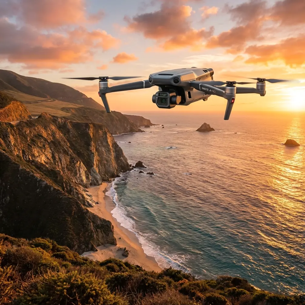
Mavic 3T for Coastal Inspections: An Expert Field Method That Actually Holds Up in Crosswinds
META: Practical Mavic 3T coastal inspection guide covering crosswind technique, thermal use, data capture discipline, and vibration-aware mission planning for reliable shoreline results.
I’ve lost more time to bad coastal wind calls than to sensor limitations.
That was the lesson on a shoreline assets job a few seasons ago. The site looked simple on paper: revetments, drainage outfalls, retaining edges, a few lighting structures, and a long strip of exposed coast where salt, spray, and constant wind had been chewing at everything. The drone platform was capable. The pilot was current. The problem was control discipline in crosswind, not hardware.
That’s why the Mavic 3T makes sense in coastal inspection work when it’s used with the right method. Not because it removes the environment. It doesn’t. It gives you enough sensing, transmission stability, and repeatable mission capability to deal with the environment without letting the environment dictate the quality of your data.
This guide is about that method.
Why coastal inspection is harder than it looks
Coastlines punish sloppy workflows. Wind rarely arrives from the direction you want. The surface below you changes from sand to rock to foam to reflective water. Thermal contrast shifts by the hour. GNSS can stay fine while visual cues degrade. And the final deliverable often has to support more than one purpose at once: defect detection, change tracking, basic photogrammetry, and maintenance planning.
The Mavic 3T is especially useful here because coastal teams often need two parallel views of the same scene:
- a visual record for condition assessment and mapping
- a thermal signature for moisture intrusion, void suspicion, drainage anomalies, heat-producing electrical assets, or material inconsistency
But those outputs are only valuable if the aircraft is flown in a way that respects wind geometry and structural loading realities.
That part gets missed.
The crosswind mistake that ruins shoreline data
One of the most useful pieces of classic aircraft handling theory for drone operators comes from crosswind landing practice. The old design literature describes a control method where the flight path is kept aligned with the intended centerline while the aircraft uses sideslip to counter the wind. In the source material, one operating condition sets the track angle and heading angle to zero while the wind effect is removed through slip alone. Operationally, that means you keep the path where it needs to be, even when the wind is trying to push you sideways.
For a coastline inspection pilot, that matters more than the textbook wording.
When you are following a seawall, drainage channel, or erosion edge, your real “runway centerline” is the inspection corridor. If your aircraft keeps crabbing and drifting in and out of that corridor, three bad things happen:
Your overlap degrades
Photogrammetry gets weaker because side overlap becomes inconsistent.Your thermal comparison gets less trustworthy
The angle of view changes too much between passes, which can alter apparent thermal contrast.Your pilot workload spikes
The mission becomes reactive instead of measured, and that usually shows up later in the dataset.
So with the Mavic 3T, I teach newer coastal operators to think in terms of corridor discipline, not just waypoint completion. If the shoreline edge is your reference line, fly as if that line matters more than your ego. The aircraft should travel the line cleanly, even if it means a small, controlled lateral attitude correction against the wind.
That old aerodynamic concept is not academic. It directly informs how you get usable inspection imagery over a windy coast.
What the Mavic 3T changes in the field
The Mavic 3T is not a heavy manned aircraft, and nobody should pretend otherwise. But it does offer a combination that is unusually practical for coastal work: compact deployment, thermal plus visual collection, robust downlink behavior through O3 transmission, and secure data handling with AES-256 support where organizational policy requires it.
For shoreline operations, those are not brochure bullet points. They reduce friction.
O3 transmission matters more near water than many teams expect
Over open shoreline, the radio environment can be deceptively clean while the visual environment is poor. Water glare, haze, changing contrast, and distance to structures can all make it harder to judge fine position from the pilot screen. A stable link helps preserve confidence during long lateral inspection runs, especially when you need to verify framing on revetment joints, outfall mouths, or linear cracks.
If your organization is pushing toward more advanced operations, this also becomes relevant to BVLOS readiness planning, even if your current mission remains strictly within your local legal visual line-of-sight requirements. Reliable command-and-monitoring behavior is part of the maturity path.
AES-256 isn’t glamorous, but it matters
Coastal inspections often involve infrastructure, utilities, port-adjacent assets, or private facilities that don’t want their imagery floating around uncontrolled. If your client’s concern includes transmission security or media handling practices, AES-256 becomes operationally useful, not merely technical trivia. It helps fit the Mavic 3T into more formal asset-management environments where IT and compliance teams are part of the approval chain.
A practical Mavic 3T workflow for coastlines
Here’s the workflow I use when the goal is repeatable shoreline inspection, not just a single attractive flight.
1) Start with the wind line, not the camera settings
Before launch, identify the direction that the crosswind will push the aircraft relative to the shoreline corridor.
This is where the source material on sidewind handling is useful again. It assumes a constant horizontal sidewind and treats the crosswind effect as significant enough to demand a deliberate control strategy. That matches coastal reality surprisingly well. Along a sea defense line or exposed beach edge, a “constant enough” lateral wind often exists over the exact section you care about.
Your first planning question should be:
Can I maintain a consistent track line parallel to the inspection feature without over-correcting every few seconds?
If the answer is no, don’t launch yet. Wait, reposition, or change the mission geometry.
2) Split the mission into thermal passes and mapping passes
People often try to collect everything in one sortie. That usually produces mediocre thermal interpretation and mediocre mapping instead of one strong dataset.
Use separate logic for each objective:
- Thermal pass: prioritize angle, timing, and interpretability
- Photogrammetry pass: prioritize overlap, altitude consistency, and geometry
For photogrammetry, I prefer simple shoreline segments with clear lane structure and well-placed GCP support where site control is necessary. Ground control can be awkward on beaches and coastal rocks, but when the deliverable has measurement value, disciplined control still wins over “good enough” GNSS optimism.
The Mavic 3T can absolutely contribute useful mapping outputs, but shoreline models get weaker fast when the operator lets wind-induced line drift compromise image spacing.
3) Use thermal for decision support, not fantasy diagnosis
Thermal imagery is powerful along coasts, but it needs context. A thermal signature on a retaining structure may indicate trapped moisture, differential heating, drainage concentration, or material variation. It does not automatically tell you which one.
That’s why I pair thermal observations with visible inspection notes and, if needed, a secondary pass at a different time window. Coastal surfaces can heat and cool unevenly because of shade, spray, saturation, and reflected energy. The Mavic 3T gives you fast access to these patterns. Your job is to avoid pretending the first thermal anomaly explains itself.
4) Watch for vibration logic even when the aircraft feels stable
The second reference document, while drawn from a very different aircraft context, contains a principle drone teams should respect: vibration behavior is not one-dimensional. It discusses measurement architectures with 32 sensors, 32 amplifiers, and 32 recording channels, creating 64 test points in a structured environment. That level of instrumentation is far beyond a compact UAV operation, but the lesson is valuable.
In aircraft testing, engineers don’t assume one reading explains the whole structure. They study multiple states, multiple points, and multiple frequencies because dynamic response changes with condition.
Bring that mindset to coastal Mavic 3T operations.
You may not have 64 test points, but you do have clues:
- gimbal micro-jitter in gusts
- prop condition changes after salt exposure
- frame resonance impression during fast crosswind correction
- image softness that appears only in certain headings
- thermal blur during abrupt yaw compensation
The same source also mentions response energy concentrated below 2000 Hz, with notable emphasis around 300 to 600 Hz in a severe vibration context. You don’t need to translate those values directly onto a Mavic 3T airframe to benefit from the core message: some dynamic problems live in specific bands and appear under specific operating states. In drone practice, that means your aircraft can seem perfectly acceptable during hover and then start degrading image quality during a lateral coastal run at speed.
So after each shoreline sortie, review data by segment, not just by mission summary. If one heading consistently looks worse, that is actionable.
5) Build battery swaps around shoreline geography
On long coastal stretches, battery planning should align with terrain breaks and retrieval logic, not just remaining percentage. If you’re working around access-limited embankments, tidal edges, or separated seawall sections, map your swap points before takeoff.
If your team uses hot-swap batteries on other platforms, don’t let that habit create unrealistic expectations with the Mavic 3T. The advantage here is rapid redeployment and compact logistics, not uninterrupted power architecture. Plan conservative recovery windows and preserve margin for headwind return legs.
Along coasts, the return can be the expensive part.
6) Don’t fly the same line the same way every time
Repeatability matters. Blind repetition does not.
If your goal is trend monitoring, keep the corridor and key viewpoints consistent. But change timing and angle where the inspection objective benefits. Early-day thermal, late-day visual texture, and oblique detail passes each answer different questions. The Mavic 3T is versatile enough that you should exploit those differences instead of flattening every mission into a single template.
How I handle a typical Mavic 3T coastal inspection day
A practical sequence looks like this:
Pre-site
- review forecasted crosswind direction and gust spread
- define primary corridor and fallback corridor
- identify GCP positions if mapping output requires tighter control
- set thermal objective before launch, not after anomaly hunting begins
On site
- perform a short control check perpendicular to the shoreline
- assess whether line-holding requires excessive correction
- inspect prop and gimbal behavior carefully in salt-heavy air
- decide whether the first sortie should be thermal or visual based on surface heating
During flight
- hold corridor geometry consistently
- avoid aggressive yawing to “save” framing
- use the downlink as a verification tool, not a crutch
- annotate any suspicious thermal signature with exact location context
After flight
- review imagery by heading and segment
- compare thermal anomalies with visible surface condition
- flag any repeatable image disturbance that could suggest vibration or gust-response issues
- decide whether a second pass is needed before leaving the site
If you need a second pair of eyes on a mission plan or coastal inspection workflow, you can message our UAV team here.
Where the Mavic 3T is strongest on the coast
The platform shines when the task requires quick deployment, mixed-sensor interpretation, and disciplined repeat passes over infrastructure such as:
- rock armor transitions
- seawalls and revetments
- culvert and outfall areas
- marina utility corridors
- coastal access roads
- retaining structures
- shoreline erosion boundaries
- roof and facade sections of coastal facilities
Its biggest strength is not raw endurance or payload complexity. It’s the speed with which you can move from “we need to inspect that exposed section” to “we now have a visual and thermal record tied to a coherent corridor.”
That speed matters when weather windows are narrow.
The expert mistake to avoid
The biggest error I see with the Mavic 3T in coastal work is treating it like a camera first and an aircraft second.
On sheltered sites, you can get away with that. On a coastline, the aircraft always has the first vote.
The old aerodynamic reference on sidewind handling makes this plain in a way modern drone content often forgets: crosswind isn’t just an inconvenience. It defines the control strategy. And the structural testing mindset from classic flight measurement literature adds the second half of the lesson: dynamic response changes by operating condition, so don’t trust a single “it looked fine” impression.
Put those two ideas together and the Mavic 3T becomes much more than a compact thermal drone. It becomes a reliable coastal inspection tool because you’re using it with proper respect for wind alignment, corridor discipline, and data quality checks.
That’s what made the difference for me after those early frustrating shoreline jobs. Same coastline. Same kind of assets. Better planning. Cleaner lines. Better thermal interpretation. Fewer wasted passes.
Not magic. Just method.
Ready for your own Mavic 3T? Contact our team for expert consultation.