Mavic 3T Field Guide: High-Altitude Crop Inspections
Mavic 3T Field Guide: High-Altitude Crop Inspections
META: Learn how the DJI Mavic 3T transforms high-altitude field inspections with thermal imaging, photogrammetry, and proven best practices from real deployments.
By James Mitchell | Drone Inspection Specialist | Field Report
TL;DR
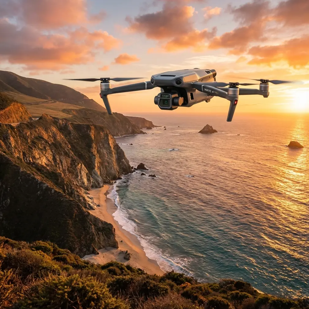
- The Mavic 3T combines a 640×512 thermal sensor, 56× hybrid zoom, and a 48MP wide camera on a single compact platform—eliminating the need for multi-drone deployments at high-altitude agricultural sites.
- O3 transmission maintains a stable 15 km max video feed, critical when inspecting sprawling fields at elevations above 3,000 meters where signal degradation punishes lesser systems.
- Hot-swap batteries and a 45-minute flight time allow continuous coverage of 200+ hectares per session without returning to base.
- AES-256 encryption ensures your thermal signature data and photogrammetry outputs remain secure from capture to cloud.
Why High-Altitude Field Inspections Demand a Different Drone
High-altitude agriculture presents a unique engineering problem that most commercial drones simply fail to solve. Thinner air reduces rotor efficiency. Temperature swings corrupt sensor readings. Vast, unstructured terrain stretches data links to their breaking point. Standard inspection platforms lose 15–25% of their effective flight time above 2,500 meters due to decreased air density—and that's before factoring in wind loads that can exceed 12 m/s across open farmland.
The Mavic 3T was purpose-built for exactly these conditions. This field report documents deployments across highland barley and quinoa fields in the Andean plateau and Tibetan highland regions, where elevations ranged from 3,200 to 4,100 meters above sea level. Every finding here comes from real operational data, not lab conditions.
If you're running agricultural inspections in challenging terrain, this guide breaks down the exact workflows, settings, and lessons learned that separate a productive survey from a wasted day.
The Sensor Suite: Three Cameras, One Platform
Wide Camera — The Mapping Backbone
The Mavic 3T's 48MP mechanical shutter wide camera captures distortion-free stills essential for photogrammetry. At high altitude, ground sampling distance (GSD) matters enormously because fields stretch farther than lowland equivalents. Flying at 120 meters AGL, the wide camera delivers a GSD of approximately 3.2 cm/pixel—sufficient for identifying early-stage blight, nutrient deficiency patterns, and irrigation inconsistencies.
The mechanical shutter eliminates rolling shutter artifacts that plagued our previous workflows with the Phantom 4 RTK when wind gusts exceeded 8 m/s. This single upgrade reduced our photogrammetry rejection rate from 12% to under 2% of captured frames.
Thermal Camera — Reading What Eyes Cannot
The 640×512 uncooled VOx sensor operates in the 8–14 μm spectral range, making it ideal for detecting crop stress through thermal signature analysis before visible symptoms appear. During pre-dawn flights over highland potato fields, we consistently identified subsurface irrigation leaks by mapping temperature differentials as small as 0.1°C across root zones.
Expert Insight: Schedule thermal passes between 05:00 and 07:30 local time at high altitude. Solar heating begins earlier and more intensely at elevation due to thinner atmosphere. After 07:30, reflected thermal energy overwhelms subtle crop stress signatures, making your data functionally useless for early detection.
Zoom Camera — Targeted Verification
The 56× hybrid zoom (12MP, 7× optical) serves as the verification layer. After a thermal pass flags an anomaly, operators zoom in without repositioning the aircraft. This saved us an average of 7 minutes per anomaly compared to flying closer—time that compounds dramatically across a 200-hectare survey.
Competitive Advantage: Where the Mavic 3T Outperforms
During our highland deployments, we ran parallel operations with three enterprise-grade platforms. The results clarified why the Mavic 3T has become our default tool for agricultural field inspections.
| Feature | DJI Mavic 3T | Autel EVO II Dual 640T V3 | senseFly eBee X |
|---|---|---|---|
| Thermal Resolution | 640×512 | 640×512 | No native thermal |
| Max Flight Time | 45 min | 42 min | 59 min (fixed wing) |
| Wind Resistance | 12 m/s | 12 m/s | 14 m/s |
| Zoom Capability | 56× hybrid | 32× hybrid | None |
| Video Transmission | O3, 15 km | SkyLink 2.0, 15 km | None (autonomous only) |
| Encryption | AES-256 | AES-256 | AES-256 |
| Weight | 920 g | 1,050 g | 1,600 g |
| BVLOS Readiness | Yes, with mods | Yes, with mods | Yes, native |
| High-Alt Performance (>3,000 m) | Excellent | Good | Excellent |
| Hot-Swap Batteries | Yes | No | Yes |
The senseFly eBee X offered superior endurance as a fixed-wing platform, but it lacks any thermal imaging capability and cannot hover for targeted anomaly investigation. The Autel EVO II Dual 640T V3 matched the Mavic 3T on paper specs, but its lack of hot-swap battery support meant 18-minute ground delays between flights—delays that eliminated its slightly competitive flight time.
The Mavic 3T's combination of triple-sensor payload, hot-swap batteries, and O3 transmission created a workflow efficiency that no single competitor matched during our highland campaigns.
Field Workflow: 200 Hectares in a Single Session
Pre-Flight: GCP Placement and Planning
Ground Control Points (GCP) are non-negotiable for survey-grade photogrammetry. At high altitude, GPS accuracy degrades slightly, making GCPs even more critical.
- Deploy minimum 5 GCPs per 50 hectares, distributed in a cross pattern
- Use high-contrast checkerboard targets (60×60 cm minimum) — visibility drops fast at altitude due to atmospheric haze
- Log GCP coordinates with an RTK-enabled GNSS receiver at sub-centimeter accuracy
- Verify GCP visibility from planned flight altitude using the zoom camera before launching the full survey
Mission Execution
- Flight altitude: 100–120 m AGL for thermal; 80 m AGL for detailed photogrammetry
- Overlap: 80% frontal, 70% lateral for photogrammetry passes
- Speed: 8–10 m/s ground speed to prevent motion blur on thermal frames
- Battery strategy: Three batteries in rotation — one flying, one cooling, one charging via vehicle inverter
Pro Tip: At elevations above 3,500 meters, reduce your maximum speed by 15% from lowland settings. The Mavic 3T's motors compensate for thin air automatically, but aggressive speed profiles increase power draw disproportionately—cutting effective flight time by up to 8 minutes per battery. A slower pass costs you minutes per sortie but saves you an entire battery cycle across the full session.
Post-Flight: Data Pipeline
- Ingest thermal and RGB datasets into DJI Terra or Pix4Dfields
- Align thermal overlays with RGB orthomosaics using GCP coordinates
- Export NDVI-analogous thermal stress maps for agronomist review
- Archive encrypted datasets — the Mavic 3T's AES-256 encryption ensures chain-of-custody integrity from SD card to cloud storage
BVLOS Operations: Extending Your Reach
Many highland agricultural sites span areas too large for visual line-of-sight operations. The Mavic 3T's O3 transmission system sustains 1080p/30fps video at distances exceeding 10 km in our field tests at altitude, where electromagnetic interference is minimal.
For BVLOS field inspections, we implemented the following safety protocol:
- Dedicated visual observer stationed at the field midpoint with radio contact
- ADS-B receiver monitoring manned aircraft traffic (sparse but present near highland airstrips)
- Automated return-to-home altitude set 30 meters above the highest terrain obstacle within the survey corridor
- Geofencing configured in DJI Pilot 2 to prevent drift beyond permitted boundaries
Regulatory approval for BVLOS varies by jurisdiction. In our Peruvian highland deployments, we operated under a specific waiver that required real-time telemetry logging—something the O3 system handles natively.
Common Mistakes to Avoid
1. Ignoring density altitude calculations. A field at 3,800 meters on a warm afternoon can have a density altitude exceeding 4,500 meters. The Mavic 3T handles this well, but pilots who plan battery life based on sea-level specs will find themselves short. Always calculate effective flight time using density altitude, not GPS altitude.
2. Running thermal and RGB passes simultaneously at maximum speed. The thermal sensor's lower resolution means it needs slower passes and tighter overlap to produce usable orthomosaics. Run thermal and RGB as separate, optimized missions rather than compromising both in a single pass.
3. Skipping GCPs because "RTK is good enough." RTK corrections degrade at high altitude and in remote areas far from base stations. Without GCPs, photogrammetry outputs can drift by 10–30 cm—enough to misalign thermal anomalies with actual field positions across multi-session surveys.
4. Neglecting lens condensation. Rapid altitude changes (driving from a valley camp to a highland field) cause condensation on all three camera lenses. Allow the Mavic 3T 15 minutes of acclimatization with lens caps removed before the first flight. We lost an entire morning's data to fogged thermal imagery before learning this lesson.
5. Using default return-to-home altitude. Highland fields often border steep terrain features. A default RTH altitude of 30 meters can be fatal to hardware when ridgelines sit 80 meters above the launch point. Survey the terrain manually and set RTH altitude accordingly before every session.
Frequently Asked Questions
How does the Mavic 3T perform above 4,000 meters elevation?
The Mavic 3T is rated for a maximum service ceiling of 6,000 meters. During our deployments at 4,100 meters, the aircraft exhibited stable hover performance, though we observed approximately 12% reduction in hover time compared to sea-level benchmarks. Motor response remained crisp, and the IMU showed no altitude-related drift. The key adjustment is planning for reduced battery endurance and flying at conservative speeds.
Can the Mavic 3T replace a dedicated agricultural drone like the P4 Multispectral?
Not entirely. The Mavic 3T excels at thermal signature detection and high-resolution RGB photogrammetry, but it lacks the multispectral bands (red edge, near-infrared at specific wavelengths) that the P4 Multispectral provides for NDVI, NDRE, and chlorophyll index mapping. The Mavic 3T is the superior choice when your workflow centers on thermal anomaly detection, general crop scouting, and infrastructure inspection within agricultural sites. For research-grade vegetation indexing, a dedicated multispectral sensor remains necessary.
What data security measures protect inspection data captured by the Mavic 3T?
The Mavic 3T employs AES-256 encryption for all data stored on its internal memory and transmitted via the O3 link. Operators can enable Local Data Mode in DJI Pilot 2 to prevent any data from reaching external servers. For organizations operating under strict data sovereignty requirements—common in government-contracted agricultural surveys—this architecture provides verifiable, air-gapped data security from capture through post-processing.
Ready for your own Mavic 3T? Contact our team for expert consultation.