Mavic 3T in Mountain Fields: Why Maintenance Training
Mavic 3T in Mountain Fields: Why Maintenance Training Matters More Than Spec Sheets
META: A field-based expert case study on using the DJI Mavic 3T for mountain agriculture and inspection, and why service readiness, thermal workflows, and trained maintenance talent now shape real operational uptime.
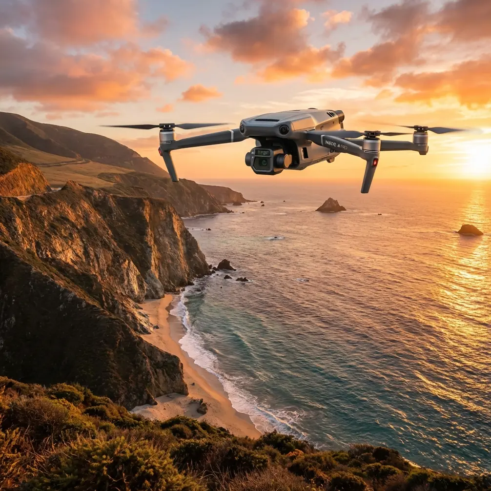
When people evaluate the Mavic 3T for mountain field work, they usually start with the aircraft itself. Thermal payload. Compact airframe. O3 transmission. A workflow that can move from visible-light inspection to heat-based anomaly spotting without dragging a larger platform into difficult terrain.
That is the obvious part.
The less obvious part is what happens after the drone has already proved useful in the field. A thermal mission over steep agricultural plots is not a one-off demo. It becomes a repeated operational cycle: transport, deployment, battery rotation, calibration checks, image review, maintenance, repair, and then another launch window before weather shifts. In mountain environments, that cycle determines whether a Mavic 3T remains a practical tool or turns into a machine that spends too much time waiting for support.
That is why one recent aviation-industry development deserves attention from serious Mavic 3T operators, even though it was not about DJI directly. On March 25, Guangdong Huitian Aviation Technology and Guangzhou Civil Aviation College signed a school-enterprise cooperation agreement and launched the “Huitian Industry College.” The focus was not marketing. It was customized training for electric aviation maintenance personnel, joint practical training platforms, two-way teacher exchange, and co-development of industry standards. The underlying message is larger than the announcement itself: advanced electric aircraft are only as useful as the service ecosystem behind them.
For mountain-field operations with the Mavic 3T, that lesson lands hard.
The real bottleneck is no longer just aircraft capability
The CAAC News report pointed to a growing shortage of specialized maintenance talent as a factor holding back high-quality development in electric aviation. That sounds like a broad industry issue, but it maps directly onto commercial drone work. Small teams operating in remote agricultural terrain already know the pain points.
A drone can have excellent thermal signature detection and stable transmission links, but if a damaged gimbal cable, worn motor, battery health issue, or sensor alignment problem sidelines the unit during a narrow crop-inspection window, capability on paper means nothing. In mountain areas, where access roads are poor and flying conditions change fast, every lost sortie matters.
This is where the Mavic 3T stands apart from many heavier or more cumbersome systems. Its appeal is not just imaging. It is the combination of deployability and mission speed. A farm manager or service provider can reach terraced plots, irrigation channels, hillside orchards, or fragmented crop parcels without needing the logistics footprint of a larger aircraft. Compared with competitors that may offer specialized sensors but demand more setup time or more complex field support, the Mavic 3T often wins because it gets airborne faster and fits the reality of mountain work.
Still, that advantage only holds if the aircraft stays in service.
The Huitian–Guangzhou Civil Aviation College partnership matters because it reflects a maturing truth across the UAV market: training pipelines, practical simulation platforms, and maintenance standards are becoming part of operational performance. Not a side issue. A core one.
A mountain-field case study: where the Mavic 3T earns its place
Consider a mixed-use agricultural zone in hilly terrain. Fields are scattered at different elevations. Some sections are reachable by vehicle; others require walking along narrow ridgelines. The farm operator needs three things from the drone team:
- Identify irrigation irregularities early
- Check for plant stress patterns before they are obvious at ground level
- Produce location-accurate visual records for follow-up treatment
This is a natural fit for the Mavic 3T.
The thermal sensor helps detect surface temperature differences that may indicate water stress, drainage problems, or uneven exposure. The visual camera supports confirmation and documentation. If the operator is building more structured terrain-aware outputs, photogrammetry workflows can be added where conditions permit, especially when supported by GCP placement in accessible control areas. In mountain regions, GCP use is not always convenient, but where accuracy matters for repeatable mapping over small agricultural blocks, even a limited control framework can significantly improve consistency from one survey cycle to the next.
Now add the practical field variables.
You launch from a narrow terrace edge. Wind shear starts building after noon. Cell coverage is patchy. The pilot needs a stable link while moving line of sight between ridges. Here, O3 transmission matters operationally, not cosmetically. A robust transmission system helps preserve command confidence as the aircraft works around terrain complexity, reducing the stop-start hesitancy that slows real inspections. Competitor platforms can advertise impressive sensor stacks, but if field crews trust the link less in broken topography, mission tempo suffers.
Data handling matters too. Agricultural service providers increasingly carry client-sensitive imagery, field boundary records, and inspection history. AES-256-based protection within enterprise workflows is not just an IT checkbox. It is a practical safeguard when devices move between pilots, analysts, and farm managers. Mountain agriculture may sound low-tech from the outside, but many operations now treat crop and land-condition data as commercially sensitive.
Why support infrastructure now influences aircraft selection
The CAAC report described the Huitian program as a full pathway from talent development to practical training and employment. That specific phrase should resonate with drone fleet managers. It points to an end-to-end model, not ad hoc instruction.
For Mavic 3T users, the equivalent challenge is clear: who keeps the fleet mission-ready after six months of hard field use?
Not every buyer asks that question early enough. Yet mountain agriculture is punishing on equipment. Dust, moisture variation, frequent transport, repeated folding and unfolding, improvised takeoff zones, and rushed battery handling all increase wear risk. A compact enterprise drone is easier to carry uphill than many alternatives, but it is not immune to field fatigue.
This is exactly why training systems matter. The Huitian partnership emphasized customized maintenance training, practical platform co-building, and dual teacher exchange. Translated into the drone world, that means organizations need more than pilots. They need technicians who understand inspection routines, fault patterns, battery management discipline, firmware control, sensor care, and return-to-service procedures.
There is also a standards angle. The announcement mentioned joint research on industry standards. That may sound abstract, but standards are what reduce ambiguity during maintenance, handover, and documentation. In a mountain-field Mavic 3T operation, standards answer basic but costly questions:
- How is battery cycle health logged before intensive seasonal work?
- What threshold triggers thermal calibration review?
- When is propeller replacement mandatory rather than discretionary?
- How are minor landing incidents documented and cleared?
- What data backup and encryption procedures apply after each mission?
Without standardization, teams improvise. Improvisation works until peak season.
The Mavic 3T versus the “bigger is better” mindset
There is a persistent assumption in professional UAV operations that tougher terrain demands a larger aircraft. Sometimes that is true. But for many mountain-field inspection tasks, bigger systems introduce their own penalties: more transport burden, more launch-space constraints, more batteries to manage, and more downtime whenever a component issue appears.
The Mavic 3T excels because it balances enterprise sensing with mobility. That balance becomes especially valuable when a crew must inspect multiple separated plots in one day. Walking a compact platform from one hillside sector to another is simply more realistic than relocating a bulkier system with a larger support kit.
Against some competing platforms, the Mavic 3T also has an adoption advantage: operators and technicians can often build proficiency faster because the workflow is less cumbersome. That does not eliminate training needs. It raises the return on training. Every hour invested in operational discipline, battery handling, payload care, and mission planning pays back quickly when the aircraft is easy to redeploy.
And this loops back to the CAAC News story. The shortage of professional maintenance talent in electric aviation is not someone else’s future problem. It is already visible in drone operations whenever teams can fly but cannot sustain fleet health. The companies that treat maintenance training as a strategic asset will keep their aircraft in the air longer and with fewer mission disruptions.
What this means for mountain agriculture teams today
If you are running Mavic 3T missions over orchards, terraces, tea plantations, forestry-edge farms, or steep mixed crops, the lesson is straightforward: stop viewing field success as a pure hardware story.
A durable mountain-field workflow needs five layers working together.
1. Sensor usefulness
Thermal signature analysis must answer a real agronomic or infrastructure question, not just produce interesting heat maps. The Mavic 3T is valuable when thermal findings guide irrigation checks, identify stressed zones, or prioritize on-foot inspections.
2. Terrain-friendly deployment
Compact form factor, quick setup, and stable O3 transmission are not convenience features in mountains. They are mission-preservation features.
3. Repeatable data practices
If you are doing comparative surveys, photogrammetry planning, GCP-supported control, and disciplined naming and archiving practices matter more than flashy screenshots.
4. Secure information handling
AES-256-capable data protections help safeguard client records and land-use intelligence as teams move between remote sites and office systems.
5. Maintenance capacity
This is the neglected layer. The CAAC-reported partnership highlighted practical training platforms and a complete route from education to job readiness. Drone teams need the same mindset internally or through trusted service partners.
The overlooked link between after-sales support and seasonal uptime
One line in the reference report deserves extra attention: the cooperation was designed to reserve core technical capability for continued airworthiness support and after-sales service once products are delivered.
That is an unusually practical statement. It recognizes that product delivery is not the finish line. It is the start of the support burden.
For Mavic 3T users in mountain agriculture, after-sales readiness has direct operational significance. Seasonal windows are narrow. Crops do not wait for repair queues. A unit that misses ten days during a heat-stress period can erase much of the value it was meant to provide. This is why experienced operators increasingly ask not only what the drone can do, but who can keep it flying, how quickly faults can be diagnosed, and whether their teams have enough technical depth to avoid preventable downtime.
If you are evaluating how to structure your own support plan for Mavic 3T field work, it helps to discuss the maintenance side as seriously as the flight side. If you need a practical conversation around that, including mountain inspection workflows and service planning, you can message a specialist here.
Dr. Lisa Wang’s field takeaway
As someone who has watched mountain inspection programs mature from basic visual scouting to thermal-led decision support, I would put it this way: the Mavic 3T is often chosen for what it can see, but its long-term value depends on whether the operator has built a system around what the aircraft needs.
The March 25 cooperation between Huitian and Guangzhou Civil Aviation College is a sign of where the wider industry is heading. It is building maintenance talent before the service gap becomes unmanageable. It is creating practical training environments instead of assuming field competence will emerge on its own. It is treating standards and service continuity as part of product success.
That same discipline belongs in the Mavic 3T conversation.
For mountain-field work, the drone is already good enough to deliver real insight. The next differentiator is organizational maturity: trained people, repeatable service routines, and support structures that keep the aircraft available when terrain, weather, and crop timing make every sortie count.
Plenty of competitors can claim capability. Fewer can fit the realities of steep agricultural operations as cleanly as the Mavic 3T. And even fewer operators are fully prepared for what sustained deployment demands after purchase. That is where the real edge now lives.
Ready for your own Mavic 3T? Contact our team for expert consultation.