Mavic 3T in Low-Light Forest Inspection: What Actually
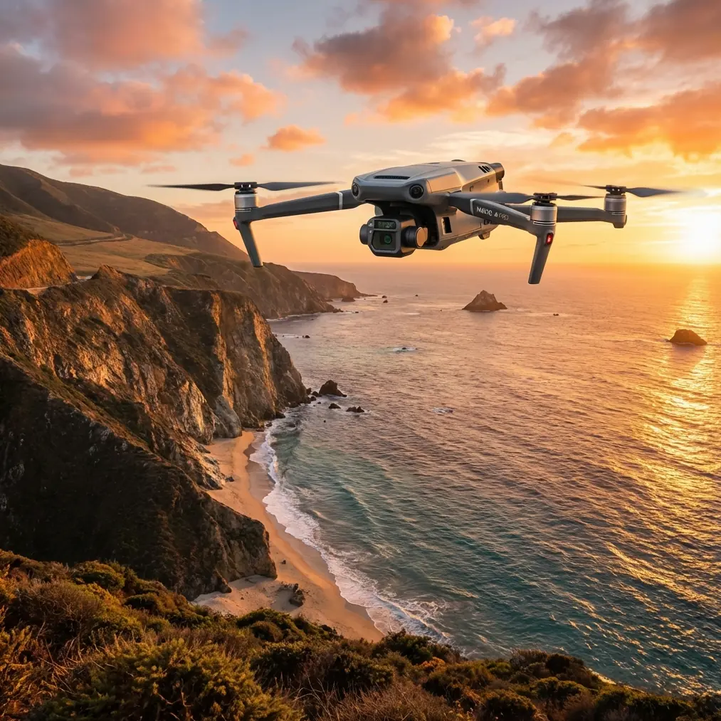
Mavic 3T in Low-Light Forest Inspection: What Actually Matters in the Field
META: Expert technical review of the DJI Mavic 3T for forest inspection in low light, with practical analysis of thermal detection, transmission reliability, workflow design, and why system-level engineering matters.
Forest inspection at dusk or under a dense canopy exposes the difference between a drone that looks good on paper and one that keeps producing usable information when visibility, temperature contrast, and signal stability all get difficult at the same time.
That is where the Mavic 3T earns serious attention.
Most discussions around this aircraft stay too shallow. They repeat the headline features, mention thermal imaging, then move on. That misses the real story. For low-light forest work, the value of the Mavic 3T is not any single sensor in isolation. It is how the aircraft, transmission stack, thermal payload, battery workflow, and remote-control architecture come together to reduce uncertainty when the environment is visually messy and operationally slow.
I have spent enough time around UAV deployment planning to know that forest inspection is rarely a clean-line mission. You are dealing with partial sight lines, temperature interference from ground surfaces, moisture, uneven terrain, and long periods of cautious flying around vertical obstacles. In that setting, the Mavic 3T stands out because it is built as a working tool rather than a camera platform that happens to fly.
Why forests in low light are hard for conventional drones
A daylight inspection drone can perform well over open land and still struggle badly in woodland. The problem is not just darkness. It is layered visual obstruction.
Under a forest canopy, visible-spectrum imaging loses clarity fast. Branch overlap, shadow pooling, and irregular heat retention in trunks and soil all make anomalies harder to isolate. If your objective is spotting stressed trees, identifying warm-blooded wildlife for conservation counts, checking for smoldering hotspots after a controlled burn, or locating people during civilian search support in commercial forestry zones, you need more than good RGB detail. You need reliable thermal signature interpretation and stable control links while flying slowly in signal-unfriendly terrain.
The Mavic 3T is one of the few compact platforms that addresses those needs without forcing the operator into a much heavier airframe category.
The Mavic 3T advantage is systems engineering, not spec-sheet theater
A lot of competitor platforms can claim thermal capability. Fewer deliver a balanced package for mobile inspection teams working in mixed-light forest conditions. The Mavic 3T excels because its useful features are operational, not decorative.
Thermal data is the obvious anchor. In forests at dawn, dusk, or night-adjacent conditions, thermal contrast often tells you more than visible light. A weak heat plume near the forest floor, a warm mechanical asset hidden near vegetation, or an abnormal canopy temperature patch can all be more detectable thermally than optically. That matters when the mission is not cinematic flying but decision-making.
But thermal alone is not enough. A thermal camera without stable transmission becomes frustrating very quickly in wooded terrain. This is where O3 transmission becomes more than a brochure term. In forest inspection, signal robustness affects confidence, aircraft positioning, and whether you can hold a careful viewing angle while studying a thermal anomaly. If the feed is inconsistent, the operator rushes. Rushed flying produces weak evidence.
The Mavic 3T’s transmission architecture makes it more practical than many small thermal drones in cluttered environments. That is a real differentiator.
Low-light work depends on signal integrity as much as optics
People tend to think low-light drone performance begins and ends with the camera payload. In reality, the control and communication chain is just as important.
The provided technical references, while not drone-specific marketing material, point to a deeper engineering principle that absolutely applies here: reliable field systems are built around tolerance to stress, repeatability, and electrical stability. One source describes hose assemblies being validated under aggressive thermal shock, moving rapidly from -65 to 400 and then being tested again for leakage and failure. Another cites endurance under 250,000 pressure pulse cycles and 400,000 bending cycles before failure is acceptable.
Those are aerospace design values for components, not Mavic 3T claims. Still, they reveal the standard of thinking behind serious flight hardware. For forest inspection crews, this matters because drones do not fail only in dramatic crashes. They degrade through connectors, seals, repeated assembly, environmental cycling, and flex stress over time. When you choose a field aircraft, you are indirectly choosing how much hidden engineering discipline sits behind the product ecosystem.
The Mavic 3T feels closer to that “designed for repetition” mindset than many lightweight alternatives. That shows up in practical ways: battery swaps that support quick turnaround, transport-friendly deployment, stable controller integration, and mission repeatability after many field cycles.
Why thermal signature quality matters more than raw detection claims
In forest inspection, “can it detect heat?” is too simple a question.
The harder question is whether the thermal image helps the pilot interpret context. A hotspot on bare ground might be irrelevant. A smaller, partially obscured heat source near root systems or brush can be mission-critical. In woodland work, the thermal signature is often fragmented by leaves, branches, slope, and humidity. So the best aircraft is not just the one that sees heat. It is the one that helps you keep position, revisit the same angle, and compare thermal information against the visible scene without workflow friction.
That is where the Mavic 3T has a practical edge over less integrated rivals. Many competing systems in the compact class either compromise transmission quality, slow down field setup, or feel less coherent when switching between sensor views. In a forest, every extra step drains attention. The operator should be thinking about canopy gaps, terrain rise, and thermal contrast drift, not fighting menu logic.
Hot-swap rhythm and the reality of forestry operations
Forest missions rarely happen in a neat, single-flight window. You may fly one perimeter pass, identify suspicious areas, land, review, relaunch, and then conduct a slower targeted inspection. That is why battery logistics matter so much.
Hot-swap batteries are not a luxury in this kind of workflow. They compress downtime and preserve focus. When teams lose momentum between flights, mission quality often declines. You start skipping verification passes or delaying a second look at a faint thermal signature because the restart burden feels too high.
The Mavic 3T is strong here because it supports a fast operational rhythm. For utility, forestry, and environmental contractors, that has direct value. It means more area assessed within legal daylight margins, more consistent revisit passes, and better use of trained pilots’ time.
Controller architecture matters more than many buyers realize
The second reference document, focused on XMC microcontroller workflows, highlights another useful engineering lesson: embedded systems succeed when the toolchain supports testing, programming, and live-variable observation efficiently. It mentions that small-batch programming can be handled with MemTool and XMC Flasher, and that Infineon’s DAVE environment can generate code through a GUI while trading off some compile and execution efficiency. It also mentions a live-debug approach where variables can be tied to interface controls for real-time observation.
Again, that document is not about the Mavic 3T directly. But it reinforces something experienced UAV teams already understand: controller reliability and software behavior are not afterthoughts. They shape field confidence.
Applied to the Mavic 3T, the takeaway is this: the aircraft’s effectiveness in forest inspection is inseparable from the maturity of its remote-control experience. Low-light flying under canopy edges is not where you want rough firmware behavior, clumsy sensor management, or poor feedback loops. A responsive aircraft-controller pairing reduces pilot workload and helps maintain attention on interpretation, not device babysitting.
That becomes even more relevant if your organization is building repeatable inspection SOPs, managing multiple operators, or preparing for larger-area BVLOS frameworks where permitted by regulation and risk assessment.
Can the Mavic 3T support mapping-style forestry workflows?
Yes, with caveats.
If your forest inspection objective includes photogrammetry, the Mavic 3T can contribute, but buyers need to stay realistic. Thermal missions and mapping missions are related, not identical. For dense forestry, photogrammetry under canopy is inherently limited because optical reconstruction depends on line of sight and texture capture. Even excellent overlap patterns will not magically reveal obscured ground.
Where the Mavic 3T becomes useful is in hybrid workflows. Use visible data for accessible upper-canopy structure and corridor documentation. Use thermal data to flag anomalies that deserve a second pass or ground inspection. If you are tying flights into survey-grade deliverables, GCP strategy still matters. Ground control points improve positional confidence, especially when repeat inspections are used to compare tree stress, erosion around access roads, or infrastructure encroachment over time.
The aircraft is not a substitute for a dedicated large-area mapping platform. It is better understood as a precision inspection drone that can support documentation and localized modeling when the mission plan is designed intelligently.
Security is not a side issue in commercial forestry
Large timber operations, environmental consultancies, and infrastructure managers increasingly care about data handling. Forest inspection missions may capture concession boundaries, utility corridors, protected habitats, or private industrial assets. That is sensitive operational information even in civilian contexts.
This is why features like AES-256 matter. Not because they sound advanced, but because they reduce exposure in transmission and data workflows. If you are flying over managed forest land tied to contracts, permits, or ecological reporting, strong encryption is part of professional practice.
For teams building formal inspection programs, that matters nearly as much as the camera.
Where the Mavic 3T genuinely outperforms competitors
Compared with many compact thermal competitors, the Mavic 3T tends to win in the areas that affect daily use rather than lab-style comparisons.
It is easier to deploy quickly.
It provides a stronger all-in-one workflow.
Its transmission and control experience are more confidence-inspiring in obstructed environments.
Its thermal capability is integrated into a practical inspection platform rather than feeling bolted onto a compromise airframe.
For forest inspection in low light, that combination is decisive.
Some alternatives may offer attractive isolated features. A different platform might emphasize a niche sensor or a modular payload story. But in real forest work, the best drone is usually the one that gets launched more often, flown more precisely, and trusted by operators after dozens of repeat missions. That is where the Mavic 3T separates itself.
Practical advice for operators planning low-light forest missions
Start with mission timing, not just route design. Thermal contrast often improves near sunrise and after sunset transitions, but ground heat retention can mislead you depending on surface type and recent weather.
Fly slower than you think you need to. In wooded areas, thermal clues are easy to miss when translating quickly across layered backgrounds.
Use the visible and thermal views together. Thermal tells you where to look. The optical scene helps explain what you are seeing.
Plan battery sequencing before takeoff. The ability to keep a clean hot-swap rhythm changes how thoroughly you can verify suspect targets.
If you are comparing platforms for a forestry program and want a more technical fit discussion, you can message a Mavic 3T workflow specialist here.
Finally, build your SOP around repeatability. The most valuable forest inspections are rarely the first pass. They are the second and third passes, flown consistently enough that thermal differences actually mean something.
Final assessment
The Mavic 3T is not simply a small drone with a thermal sensor. For low-light forest inspection, it is a tightly integrated field platform that reduces the friction between detection, interpretation, and action.
That distinction matters.
The deeper engineering lessons reflected in the reference materials — resistance to thermal shock, repeat-cycle durability, controlled leakage limits, robust programming and debugging workflows — all point toward the same truth: dependable systems are built for repeated stress, not ideal conditions. Forest inspection is a stress test for UAV operations. The Mavic 3T handles that test better than most aircraft in its class because it is balanced where serious operators need balance most.
Not in marketing terms. In field terms.
Ready for your own Mavic 3T? Contact our team for expert consultation.