Urban Forest Inspection with the Mavic 3T
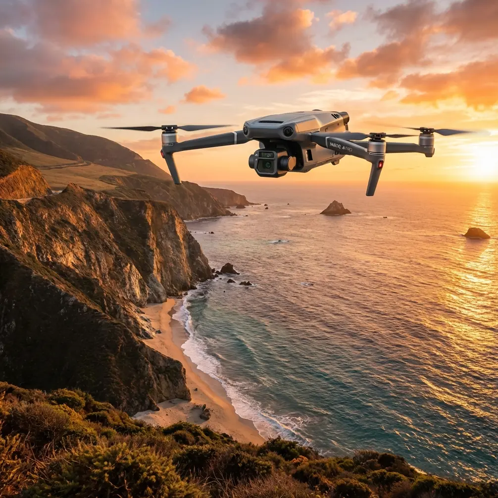
Urban Forest Inspection with the Mavic 3T: What Actually Matters in the Field
META: Practical expert insights on using the Mavic 3T for urban forest inspection, with thermal workflow, sensor interpretation, transmission reliability, and operational tips grounded in real avionics and materials principles.
Urban forest inspection sounds simple until you’re standing at the edge of a green corridor boxed in by towers, power lines, reflective glass, and patchy GNSS conditions. Trees are alive, irregular, and thermally inconsistent. The city around them makes every dataset harder to trust.
That is exactly where the Mavic 3T earns its place.
I’ve used thermal drones around landscaped park belts, roadside canopies, reservoir edges, and institutional campuses where the mission wasn’t cinematic footage or generic mapping. The task was to find stress, document hazards, and do it without wasting battery cycles hovering over noise in the data. In an urban forest environment, the Mavic 3T is most useful when you stop thinking of it as “just a thermal drone” and start treating it like a compact aerial instrument platform whose value depends on display logic, sensor interpretation, and durable electronics.
That may sound abstract, but it isn’t. The oldest aviation design references still point to a truth drone operators relearn every week: if the information shown to the pilot or operator is confusing, delayed, or poorly structured, decisions degrade fast. One of the source references here describes how flight instruments should present changing conditions in a way that matches operator intuition, even down to pointer direction and the use of three distinct colored lights for state awareness. Another stresses that sensors and associated electrical materials need stable characteristics, strong sealing, and reliable insulation under weather exposure.
Those ideas map surprisingly well to the Mavic 3T in real inspection work.
The Urban Forest Problem Isn’t Seeing Trees. It’s Trusting What You See.
In an urban inspection, you’re usually trying to answer a short list of serious questions:
- Which trees show early stress that isn’t obvious in RGB imagery?
- Is a canopy gap caused by disease, irrigation failure, root-zone compaction, or just species variation?
- Are there heat anomalies near utility corridors, paved edges, or drainage structures affecting vegetation?
- Can you collect usable evidence without entering restricted ground areas or disrupting public spaces?
The challenge is that thermal signature alone is never enough. Warm bark can mean sun exposure. Cooler foliage can mean healthy transpiration, or just shade. Roof reflections, parked cars, concrete walls, and HVAC discharge can contaminate a scene instantly.
On one urban woodland survey, a fox moved through a narrow tree line beside a pedestrian path just as we were checking an area flagged for canopy stress. The Mavic 3T’s thermal view picked up the animal cleanly before it entered the denser understory. Operationally, that mattered for two reasons. First, we avoided misclassifying transient heat as a vegetation anomaly. Second, we paused our low-altitude pass rather than pushing through and disturbing wildlife in a public green space. That is one of those moments where sensor fusion is not a luxury. It is the difference between collecting a credible dataset and collecting noise.
Why the Mavic 3T Fits This Environment
The Mavic 3T works well in urban forest inspection because it compresses several critical functions into a platform small enough to deploy quickly but capable enough to produce defensible findings.
Thermal helps identify relative anomalies across canopy sections, trunk zones, irrigation lines, and retained moisture patterns. The visual camera gives context. Zoom helps verify whether a hot patch is deadwood, a nesting cavity, exposed soil, or a utility artifact. O3 transmission matters more than many operators admit, especially when your flight path threads between urban obstructions and tree cover. Stable link performance is not just about convenience. It protects continuity in inspection passes and reduces the temptation to overfly uncertain areas just to “get one more look.”
The mention of AES-256 in the broader Mavic 3T conversation also matters in municipal and commercial work. Urban forestry often intersects with schools, residential compounds, corporate campuses, transport corridors, and sensitive infrastructure edges. Secure transmission and controlled data handling are part of a professional workflow, not an afterthought.
What Old Avionics Logic Teaches Mavic 3T Operators
One of the source references discusses how a flight display should represent conditions in a way that aligns with pilot expectation. It even notes that instrument movement should correspond naturally to how the operator perceives changing flight state. That principle has direct relevance to the Mavic 3T interface and post-processing workflow.
When inspecting urban forest assets, your display hierarchy should be brutally simple:
- Aircraft position and clearance
- Thermal anomaly recognition
- Visual confirmation
- Mission continuity and battery state
If you keep flipping mentally between map, live visual, thermal palette, zoom, and obstacle context without a clear internal order, you miss things. The source also mentions three different colored lights used to indicate distinct states. Whether you think in terms of obstacle alerts, battery thresholds, target classification, or waypoint status, the lesson is the same: state changes must be instantly readable.
For Mavic 3T operators, that means building a repeatable interpretation scheme before takeoff. For example:
- One class of thermal anomaly: likely environmental
- Another: likely vegetation stress
- Another: requires close visual cross-check
This sounds basic. It isn’t. Most weak thermal inspections fail because the operator improvises classification in mid-flight.
Another detail from the aviation reference is the emphasis on response lag and damping. A display that reacts too slowly or too loosely can mislead the operator. In drone terms, if you pan too quickly over mixed canopy and hardscape, thermal transitions can appear more dramatic than they are. Slow your yaw rate. Keep ground speed consistent. Let the sensor settle when crossing from shaded tree crown to sunlit pavement edge. That is how you reduce false positives.
Thermal Signature in Urban Forests: Read Patterns, Not Hotspots
A single warm pixel rarely tells the story. Patterns do.
With the Mavic 3T, the useful thermal work often comes from comparing:
- Adjacent trees of the same species
- Sun-exposed versus shaded crown segments
- Root zones near impermeable surfaces
- Moist versus dry drainage paths
- Canopy temperature shifts over repeated flights
This is where photogrammetry still has a role, even in a thermal-first mission. Build a consistent visual base map. Use GCP-supported datasets where accuracy matters for long-term urban tree asset monitoring, especially if you are correlating thermal anomalies with trunk location, irrigation infrastructure, or previous maintenance records. The Mavic 3T is not a dedicated large-format survey platform, but in corridor parks, civic campuses, and compact woodland patches, it can produce valuable layered outputs when the mission is designed carefully.
A lot of teams skip this and rely on screenshots. That is fine for informal observation. It is weak for trend analysis.
The Less Glamorous Side: Materials, Sealing, and Reliability
The second source reference is not about drones at all. It is a materials handbook section on sealants, potting, insulation, and bonding behavior across metals, glass, ceramics, and nonmetallic surfaces. At first glance, that seems far removed from a Mavic 3T article. It isn’t.
Urban forest inspection is a weather job. You operate in humidity, airborne particulates, irrigation mist, summer heat, and abrupt temperature transitions between air-conditioned vehicles and outdoor launch sites. The source highlights two properties that matter here: durable airtight sealing and stable electrical insulation under exposure to water, atmosphere, and temperature swings.
Why does that matter operationally?
Because the reliability of a compact drone in field conditions depends heavily on how well its internal electronics, connectors, and sensor assemblies resist environmental ingress and electrical instability. Thermal payload consistency is not just a software issue. It is a hardware survivability issue. If your platform lives in the real world, not a showroom, then environmental durability is part of data integrity.
This also affects handling habits. Don’t rush a thermal mission immediately after moving the aircraft from a cool vehicle to hot, damp air. Give the system time to stabilize. Protect battery contacts and storage practices. Inspect seals and external surfaces after operations in fine dust or mist-heavy parks. The materials science behind reliable avionics is what allows a field drone to stay trustworthy over time.
Flight Planning for Urban Forests: A Better Problem-Solution Workflow
Here is the workflow I recommend for Mavic 3T urban forest inspection when the goal is actionable findings, not just attractive imagery.
1. Define the anomaly you care about
Not every mission is “find heat.” Be specific. Are you looking for water stress, decaying limbs, irrigation leakage, heat spill from nearby built structures, or habitat disturbance?
2. Fly the site visually first
A fast visual orbit or corridor pass gives context the thermal feed cannot. Note hardscape, reflective surfaces, dense understory zones, and likely blind spots.
3. Run thermal passes at controlled speed
Consistency matters more than speed. If conditions are mixed, lower your pace. The older avionics idea of controlling display usability through proper damping has a direct parallel here: smooth inputs produce readable outputs.
4. Cross-check every notable thermal signature
Use zoom and visual confirmation. A warm branch union may be structural stress. It may also be direct sun on exposed wood.
5. Add repeatability
Revisit the same area with similar altitude, angle, and timing. Urban canopy thermal data is highly dependent on time of day and surface heating.
6. Secure and structure your data
Where site sensitivity exists, encrypted handling and controlled transfer matter. If your team needs help setting up a clean operational workflow, this direct Mavic 3T planning chat is a practical starting point.
Where BVLOS Fits, and Where It Doesn’t
BVLOS gets discussed constantly, often without enough nuance. In urban forest inspection, the real issue is not whether BVLOS is theoretically useful. It obviously can be for long green corridors, reservoir margins, and distributed municipal assets. The issue is whether your operational environment, permissions, and risk controls support it.
For most city-adjacent forest tasks, the smarter move is often segmented line-of-sight missions with disciplined overlap and standardized capture methods. The Mavic 3T is compact enough that you can reposition quickly rather than forcing a risky or inefficient profile.
Hot-Swap Batteries and the Reality of Mission Continuity
Strictly speaking, the Mavic 3T workflow benefits from efficient battery rotation even if the phrase “hot-swap” is often used loosely in the field. What matters is maintaining mission continuity with minimal downtime between sorties. Urban forestry jobs can involve narrow inspection windows due to public access patterns, irrigation schedules, glare, or thermal timing. If you lose your environmental window because your battery change process is disorganized, the whole dataset may become less comparable.
Set up batteries in sequence. Pre-label missions. Keep takeoff points consistent. Log ambient conditions. Those habits matter more than most pilots expect.
What Good Mavic 3T Forest Inspection Looks Like
A good inspection does not just show that the drone can see warm and cool areas. It explains why the pattern matters.
For example:
- A cluster of roadside trees shows elevated canopy temperature compared with the interior stand, aligning with paved root-zone confinement.
- A recurring cool band near one drainage edge indicates retained moisture and possible irrigation imbalance.
- A warm trunk cavity identified in thermal view is confirmed visually as habitat use rather than disease-related decay progression.
- Repeated flights show one species block diverging thermally from adjacent specimens under similar exposure, justifying arborist follow-up.
That is the level where drone data becomes useful to urban foresters, facility managers, landscape contractors, and environmental consultants.
The Mavic 3T is excellent in this role not because it replaces expert judgment, but because it shortens the distance between suspicion and evidence.
And if you remember the two lessons embedded in the source material, you’ll use it better. First, information has to be presented and interpreted in a way that matches operator decision-making. Second, dependable airborne electronics live or die by sensor stability, sealing, insulation, and environmental resilience. Those are old aviation truths. They still govern modern drone inspection, even in a city park lined with eucalyptus, lamp posts, and concrete.
Urban forest work rewards calm operators. Fly smooth. Compare patterns. Verify every anomaly. Respect wildlife when it appears unexpectedly in the thermal scene. The best Mavic 3T missions are not dramatic. They are disciplined.
Ready for your own Mavic 3T? Contact our team for expert consultation.