Mavic 3T for Mountain Highway Inspection
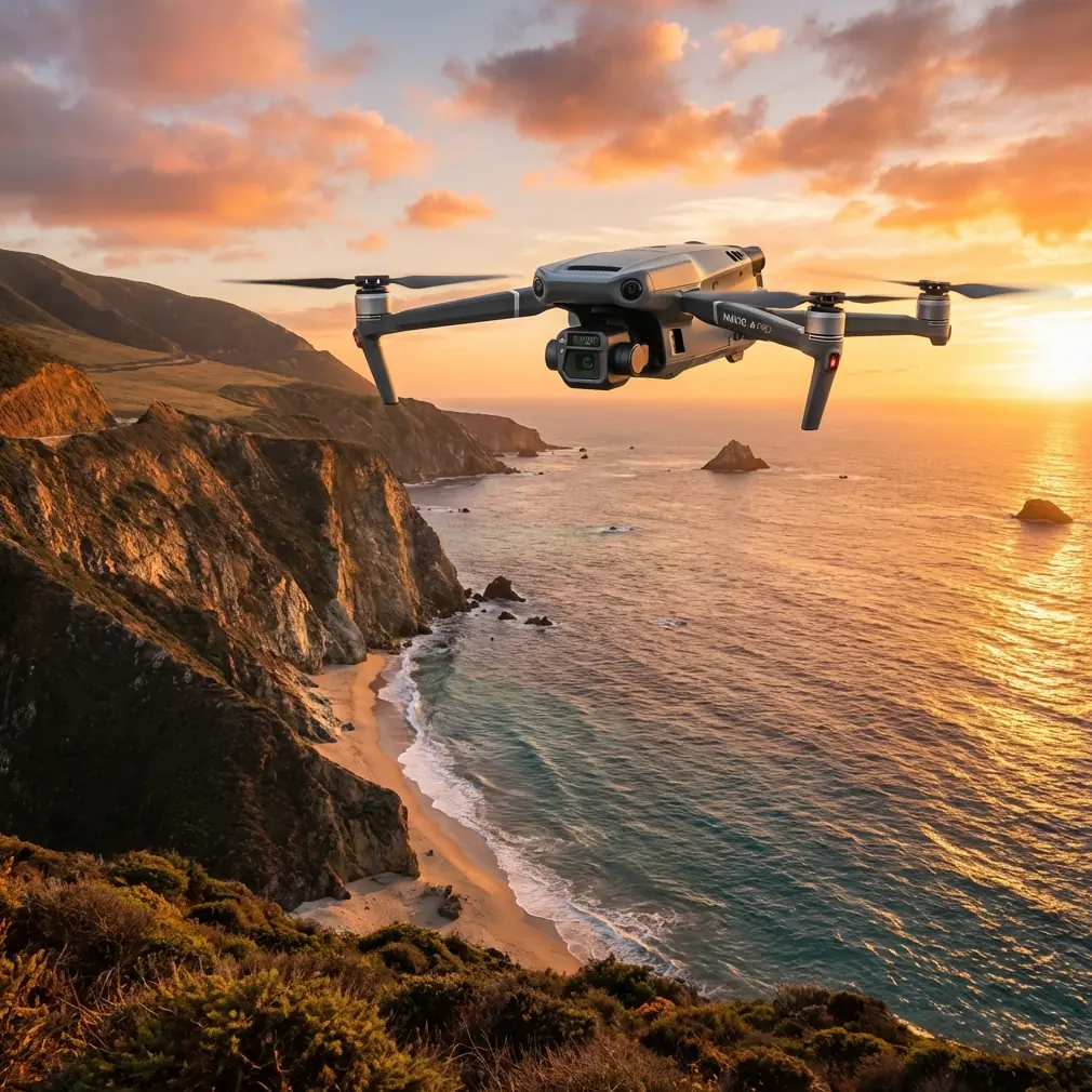
Mavic 3T for Mountain Highway Inspection: What Actually Changes in the Field
META: Expert case study on using the Mavic 3T for mountain highway inspection, with practical guidance on thermal scanning, O3 transmission, AES-256 security, GCP planning, and operational limits.
A mountain highway can look stable from the driver’s seat and still be one storm away from trouble. Rock faces shift. Drainage fails quietly. Expansion joints trap moisture. Retaining walls telegraph distress long before a chunk of slope ends up on the carriageway. The hard part is not knowing that risk exists. The hard part is finding the signal early enough, across long corridors, in mixed light, wind, and broken terrain.
That is where the Mavic 3T earns its place.
I have used larger platforms on road projects, and I still respect them for endurance and payload flexibility. But one recurring problem on mountain routes has never really been about raw aircraft size. It is about speed to deployment. The most useful aircraft is often the one that can be airborne before traffic management becomes the bigger issue. On narrow shoulder sections with inconsistent access, the Mavic 3T changes the rhythm of inspection work because it cuts setup friction without turning the mission into guesswork.
A few years ago, one of the more frustrating assignments I handled involved a winding upland highway after freeze-thaw damage and heavy runoff. We suspected water ingress behind a retaining structure and possible washout zones near culvert exits, but getting repeated visual confirmation from the ground was slow and incomplete. The terrain blocked line of sight, cellular coverage was unreliable, and every extra stop created a new roadside safety concern. We had data, but not a coherent picture.
If I had the Mavic 3T on that job, the workflow would have been cleaner from the first hour.
The reason is not just that it has a thermal sensor. A lot of people stop the discussion there, and that misses the operational value. In mountain highway work, thermal signature analysis becomes useful when paired with fast visual verification and disciplined corridor planning. You are rarely looking for cinematic imagery. You are looking for inconsistencies: trapped moisture cooling differently than surrounding fill, deck areas retaining heat unevenly, drainage paths that do not match the design intent, or stressed electrical components in roadside systems that are supposed to be behaving normally.
The Mavic 3T is strong in exactly that kind of layered observation. The aircraft combines a thermal camera with a wide camera and a tele camera, which matters more than spec sheets make it sound. On a mountain road, you often see a thermal anomaly first, then need to verify whether it is operationally meaningful or just a misleading surface effect. With a multi-sensor workflow, the pilot does not need to break mission flow, reposition unnecessarily, or guess from one data type alone. That saves time, but more importantly it reduces interpretive error.
For highway teams working near steep slopes, culverts, tunnel approaches, and retaining systems, that is a practical advantage, not a marketing bullet.
The transmission link matters too. DJI’s O3 transmission system gives the Mavic 3T a stronger footing in inspection environments where terrain interferes with clean connectivity. Mountain roads are full of signal complications. Ridge lines, cut sections, vegetation, and roadside structures can all interrupt the smooth control experience people assume from open-field flying. A robust video and control link is not just about convenience. It determines whether the pilot can hold a stable inspection position long enough to inspect a crack line, check a drainage outlet, or frame a telephoto reference image without introducing avoidable risk.
That same job category also raises a question many infrastructure clients now ask before they ask about image quality: how is the data protected? The Mavic 3T supports AES-256 encryption, and that matters more than many operators acknowledge. Highway inspection is often tied to public assets, critical corridors, contractor disputes, maintenance planning, and incident response. Thermal scans of structures, roadside power systems, or access-controlled segments are not trivial records. If an agency or engineering firm is building a workflow around remotely captured infrastructure data, security cannot be treated as an afterthought. AES-256 support gives decision-makers a clearer answer when procurement or compliance teams start asking the hard questions.
In mountain operations, battery handling becomes another make-or-break detail. A long corridor inspection can collapse into dead time if aircraft turnaround is clumsy. Hot-swap batteries help keep the mission moving, especially when crews are leapfrogging between lay-bys, bridge pull-offs, and maintenance access points. That does not mean the aircraft suddenly turns a complex corridor into an unlimited operation. It means the crew can preserve momentum. On mountain highways, momentum matters because weather windows are narrow and traffic conditions change fast. Ten lost minutes at the wrong point in the day can erase an entire section of planned coverage.
That is one reason I tend to structure Mavic 3T highway work as a case-based sequence rather than a single broad flight. Segment the route by risk type. Slope instability. Drainage assets. Structures. Surface heat anomalies. Roadside electrical or communications infrastructure. Then assign each segment a primary sensor objective and a fallback capture plan. The Mavic 3T is compact enough that this style of operation remains practical instead of bureaucratic.
For example, if the concern is seepage behind a retaining wall, thermal passes should be scheduled when temperature differentials make moisture behavior easier to detect. Midday is not always your friend. In some mountain settings, early morning or late afternoon reveals more useful contrast. Once a suspicious thermal signature appears, the tele lens becomes the quick check for visible cracking, staining, vegetation growth, or joint movement. If the same area may require a more formal geometry record later, that is where a photogrammetry-minded plan comes in.
Now, the Mavic 3T is not the first aircraft most surveyors reach for when they hear the word photogrammetry. That said, it can still play an important role in a corridor assessment workflow when you use it intelligently. If a mountain highway section shows signs of slope movement or shoulder deformation, the M3T can support targeted mapping passes for context, especially when combined with well-placed GCPs. Ground control points matter here because mountain terrain amplifies error. Elevation change, oblique viewing angles, and inconsistent GNSS quality can all distort your confidence if you rely on imagery alone. A small set of carefully positioned GCPs near critical features can turn a rough visual record into something far more defensible for engineering review.
That distinction is worth dwelling on. Too many operators treat drones as either a survey tool or an inspection tool. On mountain roads, the useful approach is often hybrid. Use thermal and zoom imaging to find the problem. Use targeted photogrammetry with GCP support to define the context and track progression over time. The Mavic 3T is effective because it allows that handoff to happen within a single operational ecosystem instead of forcing the team to treat every anomaly as a separate mobilization.
There is also a cultural factor at work. Highway inspection teams do not always have the luxury of running pristine aviation-style missions in ideal conditions. They work around traffic control, maintenance schedules, weather shifts, and urgent calls from operations managers who want answers before the next storm arrives. The Mavic 3T fits that reality. It is portable enough to deploy from constrained roadside access points, but still capable enough to return data that field engineers can act on.
I would still caution against one common mistake: assuming the aircraft can solve a corridor-scale mission simply because it is easy to launch. Mountain highway work tempts teams to stretch distance and operational complexity. That is where BVLOS conversations tend to surface. In some jurisdictions and project frameworks, BVLOS can expand what is operationally possible. But it also changes the regulatory, risk, and procedural burden significantly. The Mavic 3T can sit inside a broader BVLOS strategy, yet most teams inspecting mountain highways will get better results by first mastering disciplined VLOS segment planning, observation handoff, and repeatable sensor logic. Better short missions beat sloppy long ones.
Another benefit that deserves more attention is communication between pilot and engineer in the field. With the Mavic 3T, the inspection loop tightens. A thermal anomaly can be identified, discussed on site, visually checked, and flagged for follow-up before the team leaves the turnout. That reduces the old pattern where the drone crew captures data, departs, and only later discovers that one more angle would have changed the diagnosis. On narrow mountain schedules, that kind of avoidable return visit is expensive in time, crew exposure, and public disruption.
For teams building or refining this workflow, my advice is simple. Do not start by asking what the aircraft can theoretically detect. Start by asking what failure modes matter on your road. Water ingress behind structures. Blocked drainage paths. Surface delamination. Heat irregularities around electrical cabinets or roadside systems. Settlement indicators near culverts. Then build a repeatable sensor sequence for each one. The Mavic 3T is at its best when it is used to answer a specific engineering question, not when it is sent up to “have a look.”
If you are trying to set up that process, I usually recommend a short field protocol:
First, define the asset class and the defect hypothesis before launch. A retaining wall suspected of moisture intrusion is a different mission from a bridge deck check or a slope netting inspection.
Second, decide whether thermal data is the lead sensor or the confirmation sensor. In some cases, heat pattern is the clue. In others, it is merely supporting evidence.
Third, mark where GCPs will add value rather than dropping them everywhere. On mountain roads, strategic placement beats quantity.
Fourth, keep battery changes frictionless. Hot-swap discipline sounds mundane until a narrow weather window starts closing.
Fifth, document signal-risk zones in advance. O3 transmission is strong, but terrain still wins if you plan carelessly.
Sixth, lock down data handling from day one. AES-256 support helps, but the crew still needs a secure storage and transfer routine.
Those basics sound unglamorous. They are also what separate a useful inspection operation from a collection of pretty files.
The Mavic 3T does not replace engineering judgment, rope access, or detailed ground investigation. It does something more practical. It compresses the time between suspicion and evidence. In mountain highway inspection, that compression is often what keeps a maintenance issue from becoming a closure, or a closure from becoming an incident.
That is why I keep coming back to this aircraft when the job is steep terrain, uncertain drainage behavior, and long stretches of road that cannot be shut down lightly. It is not because it is the biggest platform or the most exotic. It is because the combination of thermal sensing, telephoto verification, O3 transmission resilience, AES-256 data protection, and efficient battery workflow maps unusually well to how real highway inspections unfold in the mountains.
If you want to compare notes on building that workflow around your corridor conditions, you can reach me directly through this quick field contact channel: https://wa.me/example
On paper, the Mavic 3T looks like a compact enterprise drone with a thermal payload. In the field, on a mountain highway, it is better understood as a decision-speed tool. It helps crews find the right problem sooner, verify it with more confidence, and leave the roadside with something closer to an answer than a guess.
Ready for your own Mavic 3T? Contact our team for expert consultation.