Mavic 3T in Windy Highway Inspections: What Actually
Mavic 3T in Windy Highway Inspections: What Actually Changes in the Field
META: Expert technical review of the DJI Mavic 3T for windy highway inspections, covering thermal signature capture, O3 transmission, AES-256 security, battery workflow, and where it fits beside photogrammetry missions.
Highway inspection work has a way of exposing weak aircraft fast.
A drone can look excellent on a calm demo morning, then fall apart the first time it faces crosswinds rolling off an overpass, heat shimmer rising from fresh asphalt, and a long corridor mission that stretches pilot attention as much as battery planning. That gap between brochure performance and field performance is exactly where the Mavic 3T becomes interesting.
I’ve spent enough time around transport asset inspections to know that the challenge usually isn’t getting airborne. The challenge is collecting reliable information when the environment is actively trying to dilute it. Wind pushes framing off target. Passing traffic adds vibration and distraction. Surface temperature variation can mask defects if your thermal interpretation is sloppy. And on linear infrastructure like highways, every inefficiency multiplies because the subject keeps extending away from you.
The Mavic 3T was not built as a heavy mapping platform, and pretending otherwise misses the point. Its real value on highway jobs is that it compresses several inspection tasks into one aircraft that is fast to deploy, stable enough for routine windy-day operations, and flexible enough to capture both visible and thermal evidence without forcing a crew to swap systems at the roadside.
Why the Mavic 3T fits this specific job
The Mavic 3T sits in DJI’s enterprise compact class, and that matters more than many buyers realize. Highway inspections often begin from awkward staging areas: shoulder access points, maintenance pull-offs, bridge approaches, contractor laydown zones. A platform that can be carried in quickly and launched without a long setup sequence wins real operational time. The advantage is not convenience for its own sake. It is reduced exposure of the crew near live traffic and faster movement between inspection points.
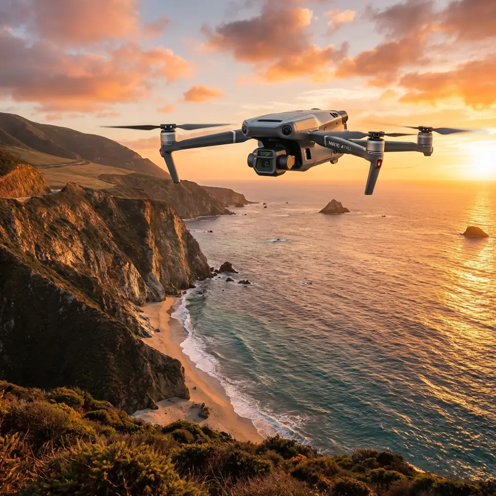
This aircraft’s identity revolves around a multi-sensor package. For highway work, that package changes the inspection conversation. You are no longer choosing between a standard visual pass and a thermal pass on separate sorties if conditions and mission planning allow both in one operation. That matters when wind windows are short.
The Mavic 3T combines a thermal camera with a wide camera and a tele camera. Operationally, that means you can establish context with the wide view, verify or isolate features with zoom, and then evaluate thermal signature without changing aircraft. On a corridor asset such as expansion joints, drainage points, retaining structures, bridge interfaces, electrical cabinets, or pavement patches with suspicious heat retention patterns, that sequence is far more efficient than flying multiple platforms.
Wind changes everything, especially over roads
Wind on highways behaves differently than many pilots expect. Open road corridors can funnel airflow. Elevated sections and embankments create turbulence. Bridges introduce vertical drafts and rotor-like eddies near structural edges. Even when the reported wind speed sounds manageable, the local air over the asset may be messy.
This is where the Mavic 3T’s compact airframe can raise skepticism. Smaller drones are often assumed to be poor choices for windy inspection work. That assumption is partly fair; mass still matters. But in practice, highway inspection is not always about brute-force weather tolerance. It is about how well the aircraft holds a line, how quickly it settles after a gust, and whether the transmission and imaging system let the operator continue making decisions without fighting lag or dropouts.
DJI’s O3 Enterprise transmission is a meaningful part of that story. On a long roadside inspection, signal confidence affects pilot behavior. If the downlink is unstable, pilots shorten useful stand-off distances and spend more time repositioning than inspecting. O3 improves that confidence by delivering a robust feed that stays usable in the kind of mixed environments common around road infrastructure. It does not erase every RF challenge, especially around dense utility corridors or complex concrete structures, but it does support a smoother inspection rhythm.
And then there is AES-256 encryption. People often treat this as a checkbox feature, yet for civil infrastructure clients it has practical weight. Highway inspection footage may include critical assets, traffic management hardware, utility interfaces, and contractor work zones. Secure transmission and data handling are not abstract concerns when public agencies and engineering firms are reviewing imagery. AES-256 helps position the Mavic 3T as a tool that fits professional data governance expectations rather than just image capture.
Thermal is where the Mavic 3T earns its keep
If your inspection work is purely geometric and survey-grade, the Mavic 3E tends to be the better fit. That distinction matters, because too many articles blur the line between the two aircraft.
The Mavic 3T is for jobs where thermal signature is part of the inspection logic.
On highways, thermal does not magically reveal every problem. Used badly, it creates noise. Used well, it gives an inspector another layer of evidence. Think moisture intrusion patterns around bridge decks and joints, uneven heating across electrical roadside cabinets, drainage issues, or early-stage anomalies in paved surfaces where temperature behavior differs from surrounding material. Thermal is not the final diagnosis. It is a fast screening layer that tells your team where to look harder.
That screening role becomes more valuable in wind because you may not get unlimited time on target. A platform that can quickly identify suspect zones and then let the operator move to visible confirmation saves battery and crew time.
A detail many field teams appreciate is the ability to use split-screen or linked interpretation between thermal and visual context. On a windy day, maintaining orientation around repetitive road features can be frustrating. Thermal alone can be hard to interpret when culverts, barriers, lane markings, and patchwork repairs all compress into a narrow corridor scene. Pairing thermal with visible framing reduces ambiguity and improves reporting quality later.
A past problem the Mavic 3T makes easier
A few years ago, one of the recurring headaches on transport inspection jobs was the two-aircraft compromise.
We would bring a capable visual platform for close structural review and a separate thermal system for targeted checks. On paper, that gave the team flexibility. In the field, it created friction. Wind picked up and suddenly one aircraft stayed in the case because we didn’t want to extend roadside setup time. Batteries were split across two ecosystems. Thermal findings were harder to align with visible reference imagery because they came from a separate sortie and sometimes a slightly different angle. By the end of the day, the reporting team had more media but less clarity.
The Mavic 3T doesn’t eliminate every tradeoff, but it removes a lot of that friction. One aircraft, one deployment flow, one synchronized evidence set. That is the sort of improvement that does not look dramatic in a spec table yet changes productivity over a month of infrastructure work.
Battery workflow matters more than most reviews admit
Highway inspection is full of interrupted mission patterns. You launch, inspect a segment, land, relocate vehicles, coordinate with site personnel, then launch again. In that environment, battery turnover is not a side detail.
The phrase “hot-swap batteries” gets used loosely in the drone market. The Mavic 3T is not a true keep-the-aircraft-powered-while-swapping system in the way larger platforms can be. Still, its practical battery workflow is quick enough that crews can maintain momentum without turning every relocation into a reset ritual. For highway work, that reduced dead time matters. Crews are often working under traffic management plans, daylight constraints, and intermittent access windows.
This also ties back to safety in a civilian sense. Less time standing beside an active road while reconfiguring gear is a real operational gain. Fast pack-down and relaunch cycles reduce the total amount of roadside exposure for personnel.
Photogrammetry, GCPs, and knowing where the Mavic 3T stops
Because the reader here is thinking about highway inspections, it is worth being blunt: the Mavic 3T is not the first choice for photogrammetry-heavy deliverables where absolute mapping accuracy is the priority.
Yes, you can document assets and extract useful georeferenced information. Yes, you can support condition assessment workflows. But if your final output depends on tightly controlled photogrammetry, repeated overlap planning, and strong alignment with GCP-based survey control, the thermal-first configuration is not the ideal tool.
That does not make it less useful. It just clarifies its lane.
A practical workflow I’ve seen work well is this: use the Mavic 3T as the rapid-response inspection platform, especially when the mission includes thermal screening or quick corridor assessment in marginal weather. Then bring in a dedicated mapping aircraft for sections that require survey-grade reconstruction tied to GCPs. On larger transport programs, this division of labor is smarter than trying to force one airframe to do everything.
So when someone asks if the Mavic 3T can support photogrammetry on a highway project, my answer is yes, within limits. When they ask whether it should be the cornerstone of a GCP-driven corridor mapping program, my answer is usually no. The better interpretation is that it shortens the path to actionable inspection findings while a separate mapping workflow handles the precision model deliverable.
The zoom camera is underrated for highway assets
A lot of discussion around the Mavic 3T focuses on thermal, but the tele camera deserves more credit in wind-prone road inspections.
Highway environments are full of locations where stand-off distance is not optional. You may need to inspect sign structures, elevated joints, bridge fascia elements, lighting assemblies, cable runs, drainage outlets, or embankment features without moving the aircraft too close to turbulent surfaces or active traffic lanes. Zoom lets the pilot preserve a more stable and safer offset while still collecting detail.
That matters in gusty conditions because every meter you don’t have to creep forward into disturbed air is a meter that improves control margin. For newer enterprise crews especially, the combination of a stable stand-off and optical inspection flexibility can materially improve mission consistency.
Where BVLOS fits, and where caution still wins
BVLOS is one of those terms that attracts more excitement than precision. On long highway corridors, the idea is obviously attractive. The infrastructure itself is linear, repetitive, and often remote. But actual BVLOS operations depend on regulatory approval, risk assessment, procedures, crew competency, and airspace conditions. The aircraft alone does not grant that capability.
What the Mavic 3T does offer is a platform architecture that aligns with corridor-style thinking: dependable transmission, compact deployment, broad sensor utility, and a mission profile suited to frequent repositioning. For organizations building toward compliant BVLOS programs in civil infrastructure, it can play a role. But for most current highway teams, the real near-term benefit is simpler: better VLOS operations with fewer compromises.
The practical ceiling of the Mavic 3T
Every strong field tool earns respect partly by having clear boundaries.
The Mavic 3T is excellent when you need rapid deployment, visual plus thermal inspection, and a platform that behaves professionally in the kind of windy conditions where postponing the mission is inconvenient but flying a fragile setup would be foolish. It is less convincing as a replacement for dedicated survey platforms or for extremely long-duration corridor collection where larger enterprise aircraft still hold the advantage.
The best buyers understand this immediately. They do not ask whether it can do everything. They ask whether it removes the most painful bottlenecks from their current workflow.
On highway jobs, those bottlenecks are usually easy to name:
- too much setup near traffic
- too many separate flights for thermal and visual evidence
- too much uncertainty in wind
- too much post-processing confusion from disconnected datasets
The Mavic 3T addresses those points directly.
If you’re sorting out whether it fits your own inspection program, you can message a drone specialist here and discuss the mission profile rather than just the spec sheet.
Final assessment from an inspection perspective
If I were evaluating the Mavic 3T purely through the lens of windy highway inspection, I would not describe it as a general-purpose drone with a thermal add-on. That undersells what makes it useful. I would describe it as a field inspection aircraft built around decision speed.
That speed shows up in several ways. Quick roadside deployment. Fast movement between visible and thermal confirmation. Confident O3 transmission during linear inspections. Secure data handling with AES-256 where infrastructure clients care about chain of custody and exposure. Efficient battery turnover that keeps the crew moving.
The aircraft’s limitations are also healthy ones because they steer teams toward the right workflows. For photogrammetry-led corridor surveying with GCP discipline, use the right mapping platform. For rapid anomaly detection, asset condition review, and mixed-mode inspection in windy environments, the Mavic 3T makes the work notably cleaner.
That is the difference I keep coming back to. It does not just gather data. It reduces friction at the exact moments when inspection teams usually lose time, confidence, or clarity.
Ready for your own Mavic 3T? Contact our team for expert consultation.