Mavic 3T Highway Inspection in Remote Areas
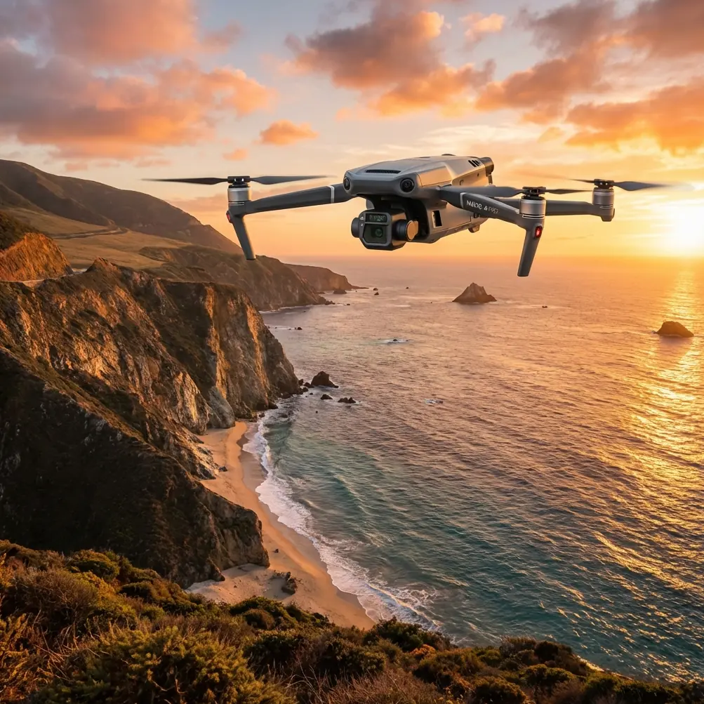
Mavic 3T Highway Inspection in Remote Areas: Field Methods That Actually Hold Up
META: Practical Mavic 3T highway inspection workflow for remote corridors, covering thermal signature capture, O3 transmission limits, AES-256 data handling, GCP strategy, and battery planning.
Remote highway inspection exposes every weakness in an aircraft, a workflow, and a crew. Wind tunnels through cut slopes. Cell coverage drops out. A crack in a culvert headwall can sit kilometers from the nearest turnout. This is where the Mavic 3T stops being a spec-sheet drone and starts proving whether it belongs in a serious inspection program.
If your job is to assess pavement edges, drainage structures, retaining walls, bridge approaches, lighting infrastructure, or roadside thermal anomalies across long rural corridors, the aircraft has to do more than fly smoothly. It needs dependable transmission, clean thermal interpretation, disciplined data security, and a repeatable way to tie imagery back to engineering decisions. The Mavic 3T is strong here, especially when compared with lighter inspection platforms that offer either a thermal payload or mapping-friendly output, but not a coherent field system for both.
This guide is built for that exact use case: inspecting highways in remote areas with the Mavic 3T, under real operational constraints rather than ideal demo conditions.
Why the Mavic 3T suits remote highway work
Highway inspection is awkward because it combines two very different tasks in one day. First, you need broad-area reconnaissance over long stretches of corridor. Then you need close, localized analysis once something suspicious appears. Many drones are tuned for one or the other.
The Mavic 3T bridges that gap well because its value is not just thermal signature detection. It is the way thermal, zoom, flight portability, and secure transmission stack into a field-ready workflow. In remote road networks, the limiting factor is often not camera quality alone. It is whether your team can move fast, launch from irregular shoulders, maintain signal integrity, and document findings in a way that another engineer can verify later.
Two of the details that matter most in these conditions are O3 transmission and AES-256 security.
- O3 transmission matters because remote highways often include terrain masking, vegetation intrusion, and long linear flight paths. Stable link performance gives crews more confidence when inspecting drainage channels, embankment transitions, or cuts where direct positioning is awkward.
- AES-256 matters because road asset data can include critical infrastructure layouts, geolocated defects, and construction staging records. In many organizations, secure handling is not a luxury feature. It is a requirement before inspection flights can even be approved.
Those two points sound administrative until you are 40 minutes into a mission over a remote corridor with patchy connectivity and need both signal confidence and a clean chain of custody for the data.
Start with the inspection objective, not the aircraft mode
A common mistake is launching the Mavic 3T and deciding in the air whether the mission is thermal or visual. For highway work, that wastes time and usually produces uneven datasets.
Instead, define the mission by defect class:
1. Surface and edge distress
Use the visible imaging workflow for shoulder settlement, pavement edge unraveling, barrier impact evidence, sign structure condition, and erosion around drainage inlets.
2. Heat-related anomalies
Use thermal signature review for overloaded electrical cabinets, lighting systems, roadside power hardware, drainage outflow temperature differences, possible moisture retention zones, and heat patterns near bridge expansion assemblies or buried utility crossings.
3. Geometry and change detection
Use photogrammetry where the task is measuring slope creep, ditch deformation, rockfall accumulation, washout progression, or work-zone earth movement.
That third category is where many crews underuse the Mavic 3T. People think of it primarily as a thermal inspection tool, but in remote highway operations, its real productivity comes from combining rapid thermal triage with georeferenced visual documentation. If a thermal irregularity appears around a culvert outlet or a utility run, you can immediately pivot into a structured capture pattern for follow-up analysis.
A practical field workflow for remote corridors
Here is a method that has proven efficient for long, low-density road segments.
Phase 1: Corridor scan
Fly a linear reconnaissance pass at a conservative altitude that gives you enough context on embankments, drainage lines, and adjacent structures. Do not chase detail too early. The goal is to identify targets.
Use thermal first when environmental conditions favor contrast. Early morning often works well for detecting retained moisture, electrical heating issues, or temperature differentials on infrastructure elements. Midday can flatten some signatures and make interpretation less useful.
What you are looking for is not “hot equals defect.” That is too simplistic. You are looking for unexpected thermal behavior relative to nearby comparable assets. A junction box that runs warmer than identical units nearby is meaningful. A wet area that retains a different temperature band after surrounding ground normalizes can matter. A bridge drainage outlet with an unusual thermal plume may deserve a closer look.
Phase 2: Target isolation
Once you identify a suspect area, stop treating the mission like a route survey. Shift into point inspection mode.
This is where the Mavic 3T has an advantage over platforms that require a full aircraft change to move from corridor screening to close analysis. You can tighten the pattern, inspect from multiple angles, and compare thermal and visual observations on site rather than returning later with another system.
For remote highways, that matters because every revisit costs time, battery cycles, and travel coordination.
Phase 3: Structured capture for engineering use
If the anomaly may lead to maintenance action, collect data in a form that others can use. Freehand screenshots are not enough.
For slope movement, drainage failures, culvert settlement, or shoulder erosion, run a structured overlap pattern suitable for photogrammetry. If the site needs measured outputs, add GCPs where practical. Ground control points are not always convenient on active or inaccessible corridors, but when you can place them safely, they improve positional reliability and make the outputs far more defensible in engineering review.
This is one of the biggest differences between a quick drone check and a professional highway inspection deliverable. Thermal helps you find the problem. Photogrammetry and GCP discipline help you prove where it is, how large it is, and whether it is changing over time.
When thermal helps more than the eye
On highways, thermal is often misunderstood as a tool only for powerline work or search tasks. In civil inspection, its strength is comparative diagnosis.
Examples include:
- drainage areas retaining moisture below the visible surface
- electrical cabinets serving lighting or ITS equipment that show abnormal heating
- culvert outflows with unusual temperature contrast
- bridge deck transition zones with inconsistent heat retention
- repaired pavement sections behaving differently from surrounding material
The trick is to interpret thermal signature in context, not isolation. Wind, solar loading, moisture, and material type all change the image. A good operator treats thermal as an indicator layer, then verifies with visual and positional evidence.
This is also where the Mavic 3T tends to outperform simpler thermal drones used by utility crews crossing into road inspection. Those aircraft may detect a hotspot, but they often fall short when the same team needs to document the surrounding geometry clearly enough for an asset manager or consultant engineer.
Transmission reliability is not a luxury on rural roads
The inclusion of O3 transmission is not just a marketing bullet for this kind of work. Long highway corridors are visually deceptive. You may have apparent line of sight, but still deal with terrain folds, vegetation, roadside structures, and electromagnetic clutter near utility crossings.
A stable transmission link affects inspection quality in three direct ways:
Safer positioning near infrastructure You can hold the aircraft in a more deliberate observation point rather than rushing through a pass.
Better anomaly confirmation If you are trying to verify a subtle thermal pattern, a confident link gives you time to compare views rather than relying on a single glance.
Less wasted battery Repositioning after signal hesitation burns time, and time is battery. On remote roads, efficiency is part of risk control.
Competitor platforms sometimes force a tradeoff between portability and confidence in corridor work. The Mavic 3T sits in a useful middle ground: compact enough for rapid roadside deployment, yet robust enough in link performance to support disciplined inspection.
Data security becomes operational very quickly
Remote highway work often involves contractors, DOT teams, utility partners, and consultants sharing datasets. That creates friction around who can collect what, how files are moved, and whether infrastructure imagery is adequately protected.
This is where AES-256 has real operational significance. It helps fit the drone into organizations that would otherwise restrict thermal inspection or geolocated imagery collection. If your workflow includes sensitive infrastructure nodes, secure storage and transmission protocols reduce the burden of workarounds later.
That may not improve image quality, but it absolutely improves deployability. And deployability is what determines whether the aircraft gets assigned to the next corridor project.
Battery planning for long road segments
Remote inspection teams quickly learn that batteries are less about endurance claims and more about rhythm. Highway work involves frequent relocations, repeated climbs for context, and pauses for visual confirmation.
If your operation uses hot-swap batteries in a larger platform, the Mavic 3T will feel different. It is faster to move, but it rewards mission segmentation. Break the corridor into logical blocks based on pull-off access, terrain breaks, and priority assets. Do not try to force one continuous narrative into a single flight series.
A better approach is:
- one reconnaissance block
- one target-validation block
- one structured capture block for any engineering-grade follow-up
This keeps battery usage aligned with data value. It also reduces the temptation to overfly nonessential sections just because the aircraft is already airborne.
Can you use it for BVLOS-style corridor thinking?
Any discussion of BVLOS around highway inspection needs to be handled carefully and strictly within local regulations and approved operational frameworks. Even when you are flying under visual line-of-sight rules, it helps to think like a corridor operator.
That means preplanning observer positions, segmenting the route, identifying likely signal shadows, and deciding in advance which asset classes trigger a closer pass. The Mavic 3T responds well to that kind of disciplined planning because it can switch from broad scanning to high-value verification without forcing a whole new mission architecture.
So even if your mission is not true BVLOS, using BVLOS-style planning logic improves efficiency and documentation quality.
A note on structural thinking: why stiffness matters in inspection data too
One of the more interesting parallels from classical aircraft design comes from structural door engineering. In pressurized aircraft, door structures are not judged only by raw strength. Stiffness is critical, because a door is a moving component that must resist deformation under load and maintain reliable function. Traditional design practice also uses tools like finite element analysis to reveal dangerous stress concentrations clearly, rather than relying on guesswork.
That mindset is surprisingly useful in highway drone inspection.
When you assess a retaining wall, a sign support, a cabinet enclosure, or a culvert inlet, visible damage is only part of the story. You are often trying to detect where the structure may be behaving differently under load, moisture, heat, or settlement. Thermal irregularity can be the field equivalent of a stress map’s warning color. It does not finish the analysis, but it tells you where to look harder.
That is one reason the Mavic 3T is so effective in remote infrastructure work. It helps the field team move from broad observation to focused structural suspicion with very little delay.
Common mistakes that waste Mavic 3T capability on highways
Treating thermal as proof
Thermal is a screening layer. Confirm with visible imagery, context, and where needed, measured follow-up.
Flying too low too early
Start with enough altitude to understand the corridor system. Defects often make more sense when seen in relation to drainage, slope, and adjacent assets.
Skipping GCPs when outputs matter
If the deliverable may feed design, claims review, or change monitoring, controlled positional accuracy matters.
Ignoring secure handling requirements
If the organization has infrastructure data rules, build AES-256 and file governance into the plan from the start.
Using a single battery strategy for every road type
Mountain corridors, open plains, and forested routes consume time differently. Match your battery rhythm to terrain and access.
A sample day in the field
A well-run remote highway inspection day with the Mavic 3T often looks like this:
- pre-mark route segments and turnout launch sites
- review weather and thermal contrast timing
- scan the first corridor block for anomalies
- isolate suspect drainage, electrical, or embankment features
- capture visual and thermal confirmation
- if needed, place GCPs and perform a structured photogrammetry pass
- document findings by segment rather than by flight number
If your team needs help refining that sequence for a specific road network, a quick field-planning chat can save a lot of trial and error; you can message our inspection desk here: https://wa.me/85255379740
Final take
For remote highway inspection, the Mavic 3T is at its best when you stop thinking of it as only a thermal drone. Its real strength is workflow compression. It can scan, verify, document, and secure data within one compact deployment model.
The details that matter are not flashy. O3 transmission supports cleaner corridor operations when signal conditions are imperfect. AES-256 helps the aircraft fit real infrastructure governance. GCP-backed photogrammetry turns observations into measurable outputs. And disciplined thermal use helps crews find issues that standard visual review can miss.
That is why the Mavic 3T stands out against competitors that handle only one side of the job well. On remote highways, the winning platform is rarely the one with the loudest headline feature. It is the one that helps your team return with fewer gaps, fewer revisits, and better evidence.
Ready for your own Mavic 3T? Contact our team for expert consultation.