Mavic 3T for Coastal Solar Farm Inspection
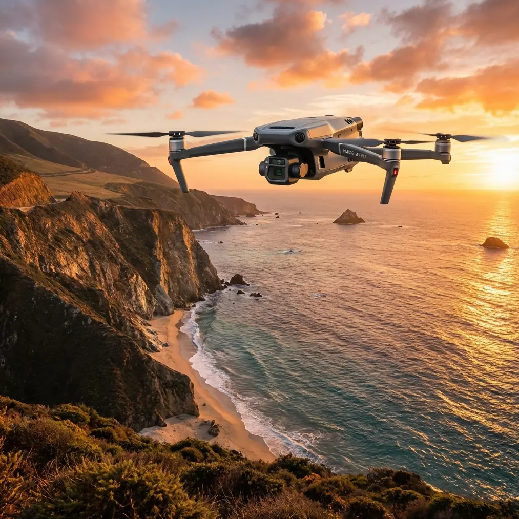
Mavic 3T for Coastal Solar Farm Inspection: A Technical Review from the Field
META: Expert review of the DJI Mavic 3T for coastal solar farm inspection, with thermal workflow insights, flight altitude strategy, vibration stability considerations, and practical data-capture guidance.
Coastal solar farms punish aircraft in subtle ways. Salt haze softens contrast. Onshore winds create constant low-level disturbance. Rows of modules reflect light unpredictably, while thermal anomalies can hide inside a sea of visually identical panels. In that setting, the Mavic 3T is not just a convenient flying camera. It becomes a measurement platform, and that distinction matters.
I approach the Mavic 3T less as a gadget and more as a compact inspection system. For coastal PV sites, the key question is not whether it can produce thermal images. Most thermal drones can do that. The real question is whether it can deliver repeatable, decision-grade results when the environment is actively trying to corrupt your data.
That is where flight discipline, vibration control, image interpretation, and transmission reliability come together.
Why coastal solar inspection is harder than it looks
A solar farm inland and a solar farm near the coast may use the same modules, inverters, and racking geometry. The inspection burden is different. Salt contamination can elevate operating temperatures unevenly. Wind loading changes aircraft behavior during hover and during low-altitude corridor passes. Moisture and airborne particulates affect thermal contrast, especially during the short windows when module temperature differentials are most readable.
On paper, the Mavic 3T is compact and mobile. In practice, for this kind of site, compactness only helps if the aircraft stays stable enough to keep thermal and visual data aligned. A thermal signature from one string only becomes useful when you can trust the exact module position, revisit the same angle, and compare future flights against a stable baseline.
That is why I keep coming back to a principle borrowed from classical rotorcraft dynamics: good inspection results begin with vibration behavior, not with the camera menu.
The hidden lesson from helicopter design that applies to the Mavic 3T
One of the reference materials behind this discussion comes from helicopter vibration analysis. At first glance, that seems far removed from a small multirotor inspecting PV arrays. It is not. The core engineering logic carries over directly.
The source explains that airframe vibration analysis is built around a finite element model and that tools such as NASTRAN are used to calculate natural frequencies and mode shapes. It also emphasizes that engineers must distinguish between global modes and local modes, often using generated mode-shape graphics to understand how different parts of the airframe respond. Operationally, this matters because a structure may look stable overall while still having localized dynamic behavior that degrades sensor output.
For a drone operator, the translation is straightforward. You do not need to run NASTRAN on a Mavic 3T to benefit from the idea. You do need to respect the fact that not all instability is visible to the eye. A drone can hold position well enough for a pilot while still transmitting small, repeated mechanical disturbances into the sensor stack. On a coastal solar mission, those disturbances show up as softer thermal edges, inconsistent overlap in photogrammetry passes, or mismatched hotspot geometry between visual and thermal layers.
The same helicopter source makes another point that deserves more attention in drone operations: seemingly minor factors that are often treated as dynamically unimportant can still have a meaningful effect on low-frequency and even overall modal behavior. In the original context, that includes details such as nonlinear stiffness in secondary materials and assumptions about effective shear area. For us, the practical equivalent is accessories, payload mounting condition, battery fit, landing-gear wear, propeller condition, and even small asymmetries caused by repeated field handling.
In other words, if your Mavic 3T data quality varies from one week to the next, do not only blame weather. Sometimes the issue is structural and cumulative.
What that means for real solar inspections
On coastal projects, I recommend treating the Mavic 3T like a precision survey tool with a vibration-sensitive sensor package. Before thermal capture, verify three things:
- Propeller uniformity and motor smoothness
- Gimbal behavior in crosswind hover
- Repeatable yaw response during low-speed track flight
This may sound basic, but these checks are how you catch the small dynamic issues that ruin a thermal dataset without causing an obvious flight safety problem.
The helicopter reference also discusses breaking a structure into super-elements to better understand how one component affects the whole body’s vibration characteristics. Again, that concept maps cleanly into the field. Think in subsystems: propulsion, arm stiffness, gimbal damping, battery retention, and imaging payload. When one part starts behaving differently, the aircraft’s inspection output changes even if the drone still appears flyable.
For solar farm managers, this has a direct business impact. False hotspot calls waste maintenance time. Missed anomalies delay repairs and reduce yield. Clean-looking maps that are geometrically weak are often worse than no map at all because they create false confidence.
Optimal flight altitude for coastal PV work
If you inspect enough utility-scale arrays, you learn that altitude is less about coverage and more about defect confidence.
For the Mavic 3T in coastal solar inspection, my preferred starting point is 18 to 28 meters above module plane for detailed thermal sweeps, then adjusting based on string spacing, tilt angle, and required revisit speed. That range gives a useful balance: low enough to isolate module-level thermal irregularities, high enough to maintain stable lane geometry and efficient overlap.
Why not fly higher and cover more ground? Because coastal conditions often reduce usable thermal contrast. As altitude increases, you give away detail exactly when you need it most. Tiny hot cells, connector issues, and edge heating become less distinct. Wind also tends to push small multirotors more noticeably during broad-area passes at heights where you may feel operationally comfortable but your image consistency drops.
Why not go much lower? Below that range, especially around tighter row spacing, the aircraft spends more time correcting laterally, perspective distortion increases, and your mission efficiency collapses. You can absolutely descend for targeted follow-up, but not for the primary screening pass.
For visual mapping or photogrammetry support, I usually separate the job from the thermal pass rather than forcing one altitude to do everything. Thermal wants interpretability. Photogrammetry wants geometry. Those are related, not identical.
Thermal interpretation: don’t chase every bright pixel
The Mavic 3T is strong when the operator is disciplined. It is weak when the operator assumes every anomaly is electrical.
In a coastal environment, thermal signatures can be distorted by:
- salt residue patterns
- recent cloud-edge heating shifts
- wetting and drying differences across rows
- reflective contamination
- wind-exposed edge effects
This is where visual context and repeat flight logic matter. If a hotspot appears in a single pass but not in a reverse-angle confirmation, I do not classify it immediately. I log it, cross-check neighboring modules, and review whether the aircraft experienced higher correction activity in that segment.
A stable thermal workflow is not only about emissivity settings or palette choice. It is also about capturing data under consistent aircraft behavior. That is the subtle bridge back to the airframe-dynamics reference. Sensor truth depends on platform behavior.
O3 transmission and operational confidence over long arrays
Large solar farms can stretch farther than people expect, especially when access roads, substation areas, and drainage corridors are included. In coastal zones, where terrain may be flat and visually repetitive, command-and-video confidence becomes central to safe and efficient work.
The Mavic 3T’s O3 transmission is useful here because it supports better operational continuity across long inspection lanes. I value it less for headline range claims and more for what it does to crew behavior: when downlink confidence is solid, pilots fly smoother lines, camera operators make better annotation decisions, and the team is less likely to rush the mission window.
For clients with data-governance concerns, AES-256 matters as well. Solar infrastructure owners increasingly ask how imagery is transmitted, stored, and handed off. On sensitive energy sites, secure handling is not an optional detail. It is part of operational professionalism.
GCPs, photogrammetry, and when the Mavic 3T should not do everything alone
The Mavic 3T can support mapping tasks around a solar site, but experts know where to draw the line. If the deliverable is a thermal-led maintenance map with positional context, the aircraft is effective. If the deliverable is a high-accuracy engineering-grade model for layout verification or drainage redesign, you should build the workflow around GCPs and, depending on tolerance requirements, potentially separate payload strategy and aircraft selection.
That is not a criticism. It is a realistic workflow decision.
For many coastal solar operators, the best use of the Mavic 3T is layered:
- first-pass thermal screening
- visual verification
- targeted revisit of suspect strings
- optional photogrammetry support for maintenance planning
This staged approach reduces field time while preserving confidence in the findings.
Battery workflow matters more on windy coastal sites
People often talk about endurance in abstract terms. Coastal inspection turns endurance into logistics. Wind compensation increases power draw. Repositioning around fencing, drainage areas, and inverter stations adds deadhead time. Midday thermal windows can be narrow.
That is why hot-swap batteries are more than a convenience in this scenario. They protect continuity. If you have to interrupt the mission too long between sections, solar loading and ambient conditions may shift enough to complicate comparisons across the site. A fast battery turnover keeps your thermal dataset temporally coherent.
On larger farms, that coherence is often more valuable than squeezing the longest possible single-flight duration from one pack.
BVLOS discussion, realistically framed
For some utility-scale sites, operators naturally ask about BVLOS because array footprints can be extensive. The Mavic 3T becomes much more operationally interesting when paired with a compliant long-corridor inspection framework. Still, the real-world value depends on local regulations, site risk controls, observer procedures, and the exact mission architecture.
The practical point is this: the aircraft is capable enough to make extended inspection concepts attractive, but the workflow has to be built around lawful civilian operations and disciplined site procedures. Capability alone does not make a mission efficient.
A small design lesson from aircraft interiors that surprisingly fits solar operations
The second reference document is about civil aircraft cabin layout, specifically how designers preserve minimum unobstructed access widths near emergency exits. It even gives a concrete example where an emergency-exit position deviation works out to 5.80%, remaining within a threshold of less than 15%. The document also notes that designers may enlarge spacing, restrict seat recline, or remove a seat to preserve movement around critical areas.
That may sound unrelated to a Mavic 3T at a solar site, but the operational principle is excellent: protect the path around the critical function, even if it costs local efficiency.
For drone inspection teams, the equivalent is route planning around launch zones, battery staging, maintenance carts, and safe crew movement corridors between array blocks. Too many field teams optimize only flight path efficiency and then create a messy ground operation that slows everything down. If your battery swap area, landing zone, and observer positions interfere with each other, your sortie rhythm falls apart. Just as aircraft cabin designers preserve access around exits, drone teams should preserve clean access around the points where operations bottleneck.
Good inspections are not only flown well. They are staged well.
Where the Mavic 3T fits best
For coastal solar farms, the Mavic 3T is at its best when the brief is clear:
- find thermal anomalies early
- confirm them with visual context
- move quickly across large but structured sites
- keep the workflow portable
- preserve enough geospatial reliability to direct technicians efficiently
It is not a substitute for every engineering survey method. It does not erase the need for disciplined timing, weather judgment, or component-level follow-up. But when used properly, it compresses the time between “something may be wrong in that block” and “here is the exact row, string, and module area worth checking.”
That is the real value.
If you are planning a coastal PV workflow and want to compare altitude strategy, overlap settings, or battery rotation logic for your site, you can message our technical team directly here.
The Mavic 3T earns its place on solar projects not because it is small, but because it can be methodical. The operators who get the best results are the ones who think like engineers: understand structural behavior, protect data quality, separate screening from measurement, and build every mission around repeatability.
Coastal environments expose weak habits quickly. The Mavic 3T rewards strong ones.
Ready for your own Mavic 3T? Contact our team for expert consultation.